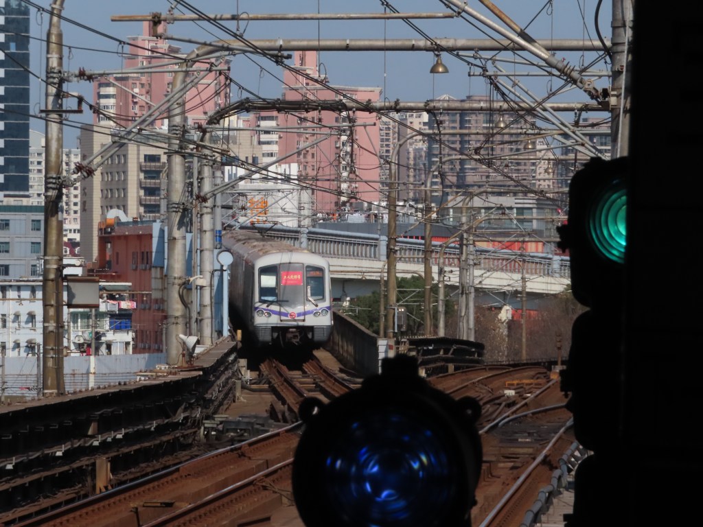
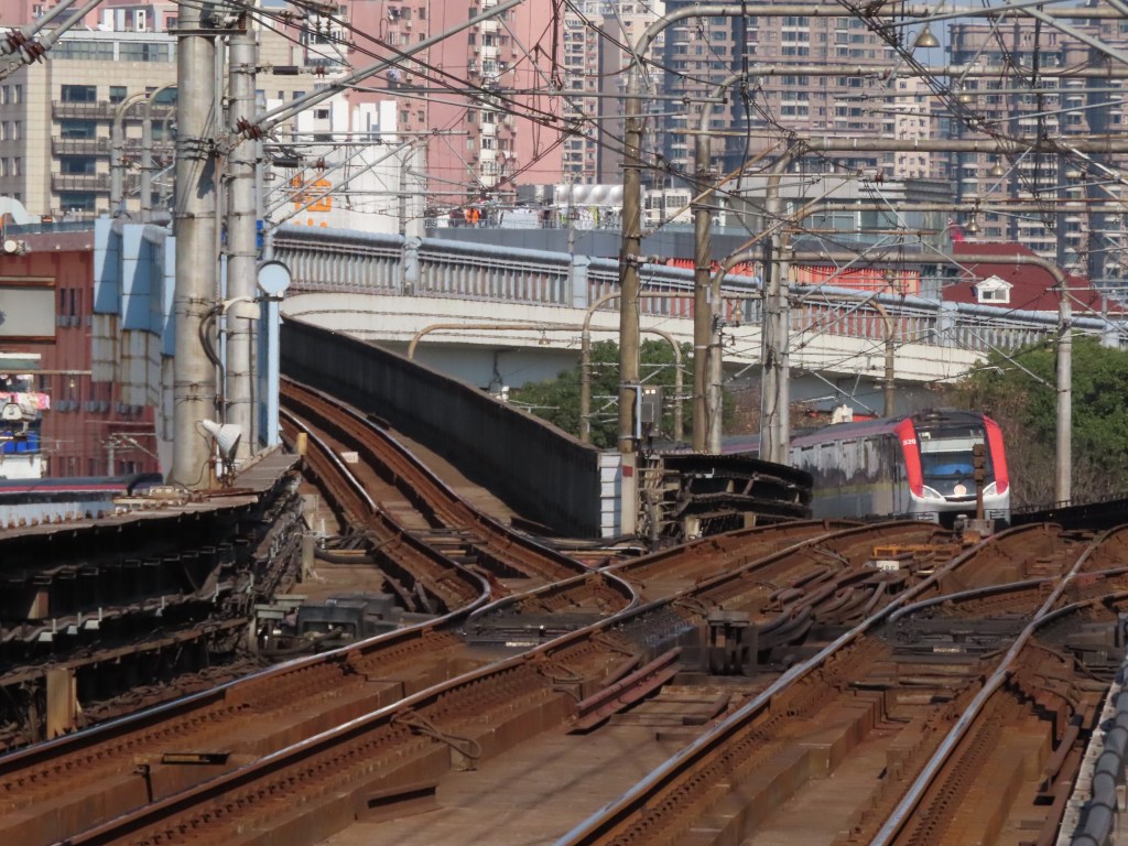
This post will be different from my previous posts for a number of reasons. Most obviously because it is about Shanghai, China, and not New York, but also because the Shanghai Metro is very different from the New York City Subway. Rather than discuss each line in its own post, I am combining them all into this one post. This is done primarily because, since the Shanghai Metro is 91 years younger than the original IRT subway and 110 years younger than oldest continually operating rapid transit station in New York (shoutout to Gates Ave), there is way less history to discuss per line than in New York. Furthermore, as almost every station is an underground island platform with full platform screen doors, there isn’t a lot of internal variation between stations, which means going station by station as I am doing with New York wouldn’t be as interesting. As a result, I am electing to do more of a blurb style here, with a paragraph or two introducing each line and its character (what role it serves, what is interesting about it, etc.) and then only discuss the interesting stations on each line in the following few paragraphs.
The Shanghai Metro is much better organized than New York, partly because it was largely planned as a coherent system rather than three competing systems that got Frankenstein-ed together into one. The lines are entirely physically separated with no interlining except for one shared section between Lines 3 and 4. Therefore there is none of the “line means the physical infrastructure and service means the named trains that operate” business that is necessary for clarity in New York.
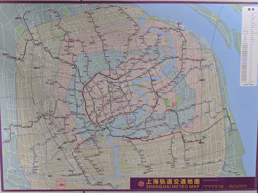
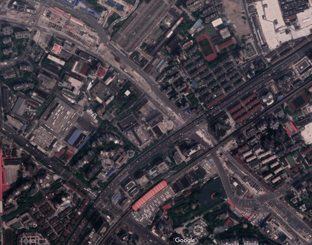
Much of the system, especially in the central city, operates like a grid, with the lines operating radially in the outskirts. There are obvious similarities to the Soviet metro ethos (no surprise there) with a circle line looping the central business district and distinct physically separated lines. However Chinese metros are distinctly their own meta, with conventions not present in Soviet systems and lacking some key Soviet characteristics, such as the Soviet triangle, where three radial lines meet in the city center at three interchange stations. Stations in Shanghai tend to be around 1 km (0.6 miles, or 13 Manhattan street blocks) apart. Like all radial systems, suburb to suburb trips are very inconvenient, as often the first interchange on a radial line with another line is when it crosses the loop line. However as the Shanghai Metro has grown to the longest metro system in the world, new lines outside of the loop have opened in order to ease the poor connectivity of the outskirts.
Shanghai also has no express service (except for one line), which makes long distance trips (and there are some long trips. Shanghai is home to the longest rapid transit line in the world) annoyingly long. Additionally, many lines simply don’t intersect, and without almost any interlining or reverse branching, the number of one seat rides across the system is pathetically small, leading to nearly every trip requiring at least one and possibly two transfers. With headways usually around 2.5 minutes transfers are not as unbearable as they are in New York, but we shouldn’t be too keen on de-interlining fully in New York, as one-seat rides are a wonderful aspect of our system.
I divide the Shanghai Metro lines into eras, with Lines 1-5 being the original set. Lines 1 and 2 are the oldest and have the most history. Lines 3 and 4 are the only two that interline, are elevated in the city center, and neither really cross the city center. Line 5 was the first “extension” line in the system and the prototype for the others. Lines 6-11 are the golden age of the Shanghai Metro and are the most consistent with the design ethos of the system (and are consequently the most boring). Lines 12 and 13 are siblings with a twist on the standard metro design, forming an X shape across Shanghai instead of conforming to grid lines. Lines 14, 15, and 18 are the new generation of automated metro lines tasked with relieving crowding on the original system. Lines 16 is its own, almost entirely unique thing, and Line 17 shares characteristics with Lines 5, 16, and the Pujiang MRT.

Line 1
Line 1 is (shockingly) the first line opened in the Shanghai Metro. Ironically, it is also the line that least adheres to the overall ethos of the system. When you look at the Shanghai Metro Map, a trend appears, especially inside the loop line of Line 4. The lines in the Central Business District of Shanghai are arranged in a grid, with pretty clear north-south (11, 7, 12, 13, 8, 10) and east-west (9, 10, 14, 2, 13/12) lines and transfer stations at nearly every single line intersection, with very few non-transfer stations. However, Line 1 functions overall as a diagonal line, neither clearly east-west or clearly north-south, throwing a wrench into this otherwise well organized system. Or, rather, this well organized system was built around the wrench, seeing as Line 1, was, if you remember, the first line built as part of the Shanghai Metro.
Line 1 starts in the south at Xinzhuang, and the Xinzhuang to Jinjiang Action Park section of the line sits at ground level adjacent to the Shanghai-Kunming Railway. This section has four stations, and was opened as the second phase of Line 1 in December of 1996. Line 1’s southern terminus of Xinzhuang is an interchange with Line 5. This station has an interesting layout, and will be discussed more in the Line 5 section.
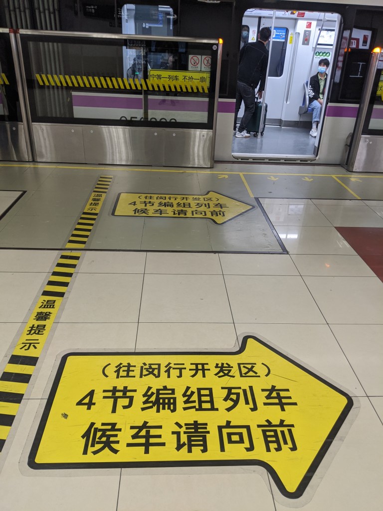
The next station on Line 1, Waihuan Lu, is largely unremarkable in and of itself, but provides an interesting window into the language issues that the Shanghai Metro encounters. The Shanghai Metro is entirely bilingual (and sometimes trilingual (!) but we’ll get to that much later), with stations names, wayfinding, and announcements all in both Mandarin and English. Station names almost all consist of [Street name] + [Lu], (the Mandarin word for road). When translated into English, the [Street name] part is usually only transliterated, not translated. For example Lianhua Lu, the next station after Waihuan Lu on Line 1, is written in English as “Lianhua Road,” even though Lianhua means lotus flower in English. Sometimes, however, it is more useful to translate the name of the station into English, even if the English name bears no phonetic resemblance to the Mandarin name. For example, the People’s Square station, on Lines 1, 2, and 8, is renmin guangchang 人民广场 in Mandarin. Rather than transliterate this name and preserve the sounds but lose the meaning in English, the phonetic similarity is sacrificed to preserve the more important semantic meaning, and the station is therefore called “People’s Square” in English.
Back to Waihuan Lu station. Waihuan Lu literally means Outer Ring Road, and is a reference to the orbital highway of the same name, located near the station. It is interesting that at this station it was chosen to preserve the phonetic sound, going so far as to not even translate “Lu” into “Road,” rather than preserving the semantic meaning of “Outer Ring Road”. This station’s tiling also makes it look a bit like a bathroom.
The first section of Metro to open in Shanghai, opening in April of 1995, was between Shanghai South Station and Shanghai (North, although the “north” isn’t used) Station. There is a connection to the original depot for Line 1, Meilong Depot, just south of the Shanghai South Railway Station station (yes that was a funny sentence to type). The yard leads daylight first, almost immediately south of the station, and the revenue tracks daylight just 200 meters further south adjacent to the depot. This depot is primarily used for parking and maintenance of Line 1 trains, which is to be expected, but it is also responsible for the advanced maintenance of Line 2 trains.
Caobao Lu was constructed in the early 1980s as a test of subway construction methods. This makes the Line 1 platform of Caobao Lu the oldest metro station in Shanghai, as the test station was later incorporated into Line 1. One of the downsides of this is that the station has the narrowest platform in the system at 6.6 meters (21.6 feet) wide.
A few stations along and we reach Xujiahui station, shared with lines 9 and 11. Xujiahui is one of the busiest stations in Shanghai, as it is surrounded by dozens of high rise office towers and malls. It is also the station with the most exits, at 19, although it does not have the highest numbered exit. That belongs to a station further along Line 1.
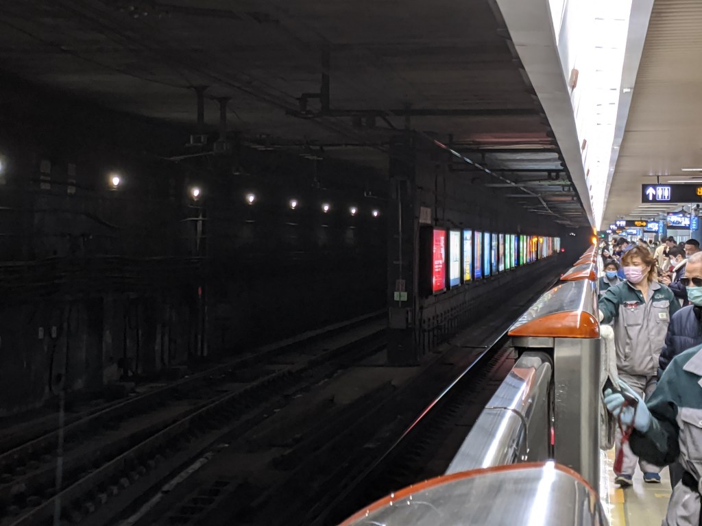
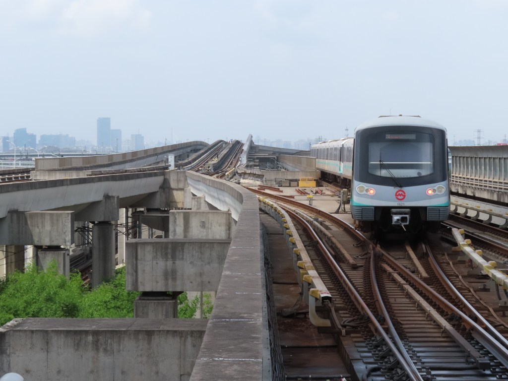
And here we are at that station further along Line 1. People’s Square is the busiest station in the Shanghai Metro, with 600,000 daily passengers. For reference, in 2019, the last year before COVID, Times Square, New York’s busiest station, handled 178,000 people per day. People’s Square is also the station with the highest numbered exit, at 20, although it skips both Exit 4 and Exit 13. Both are likely skipped for superstitious reasons. In Chinese, the number 4, si 四, sounds like death, si 死, and so is an unlucky number. 13 is considered an unlucky number in many cultures, although I found no concrete reason as to why. However by avoiding these two numbers, People’s Square has fewer exist than Xujiahui, despite having a higher numbered exit.
People’s Square is shared with Line 2 and Line 8. The Line 1 and Line 8 platforms are parallel, and south of the station, the two lines have a track connection. This is one of the rare instances in which two Shanghai Metro Lines have a track connection outside of shared depots. Another is also in this station, but we will discuss that in the Line 2 portion of the blog.
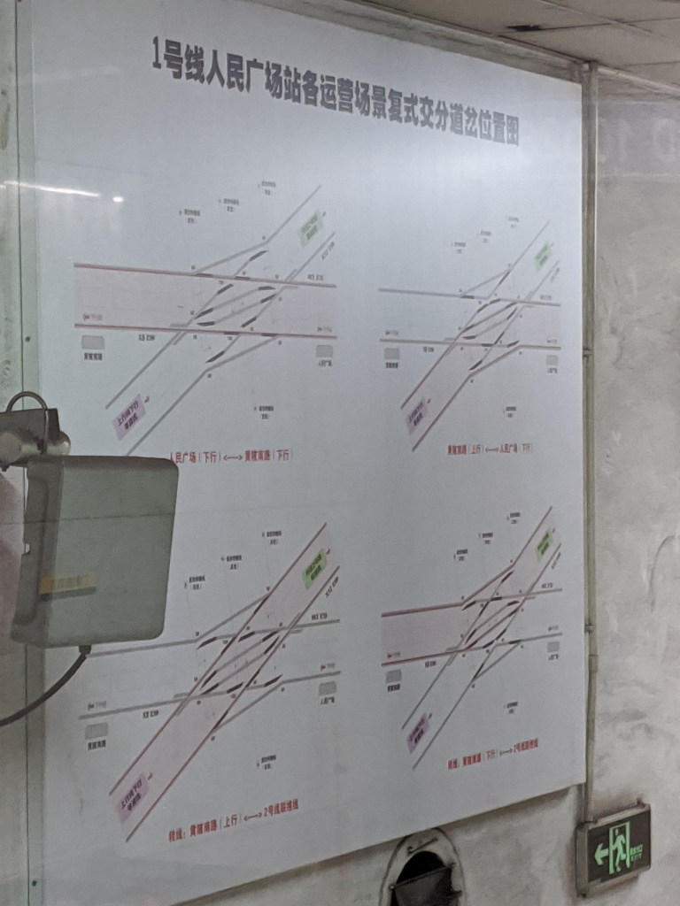
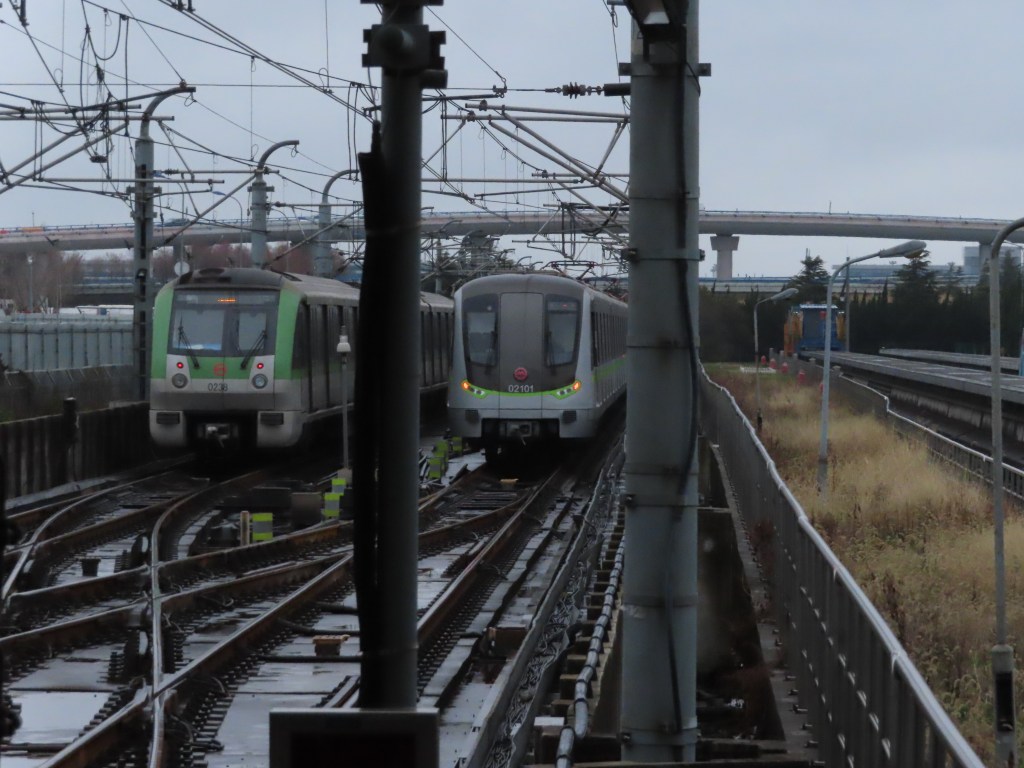
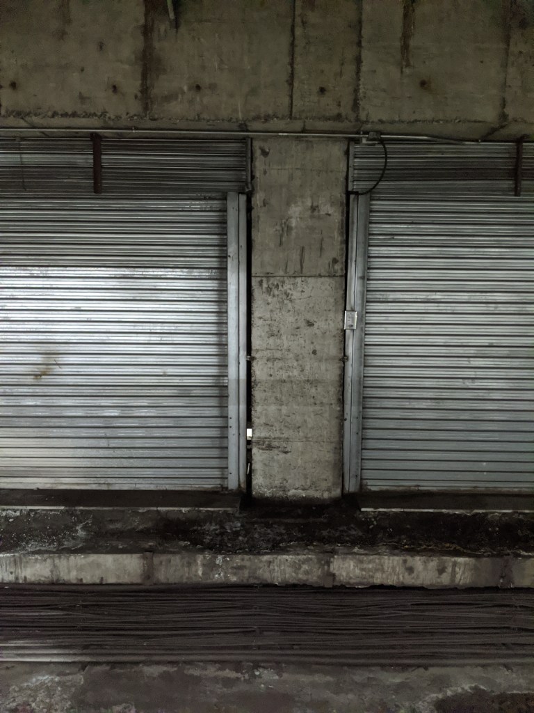
Just past the southbound platform on Line 1 is this diagram, showing the various positions of a switch. Not being fluent in Chinese, and this diagram being behind a floor to ceiling plexiglass wall means I have very little idea of what exactly is being shown here. Other than this, both the Line 2 and Line 8 platforms at this station are more interesting, so be on the lookout for those later.
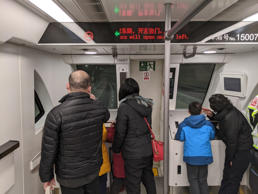
Shanghai Station was the original northern terminus of Line 1. It is still used to short turn some Line 1 trains, which leaves nearly 17 km (10.56 miles, nearly the entire length of Manhattan) and 11 stations north of here with reduced service. Despite Lines 3 and 4 also serving this station, due to the two metro stations being on opposite sides of the railway station, there is no in-system transfer between the two, much like at Penn Station between the IRT Seventh Ave/Broadway and IND 8th Ave Lines.
The Shanghai Circus World station was the first station on Line 1 to be equipped with platform screen doors. Line 1 was built without them, although with provisions for them to be installed in the future. There was no company in China capable of installing platform screen doors when the Metro was being built. Now, excluding Line 2, all underground stations in Shanghai are equipped with full platform screen doors, whereas Line 2 only has half height doors. The line north of Shanghai Circus World is elevated, and was constructed simultaneously with the North-South Elevated Highway. The metro line is under the highway but over the surface street, making for a very unique semi-elevated feel along this stretch of the line.
When the line was extended north from Shanghai Station, trains were intended to short turn at Pengpu Xincun. Xincun means New Town by the way, and for some reason this is never translated into English, although I think it would make more sense to do so. There is a pocket track north of the station where trains would be able to turn around, however due to an incident in 2004 where two trains clipped each other, one of which was in this pocket track, the plan to short turn trains at this station was shelved indefinitely.
Fujin Road is the northern terminus of Line 1. It has three tracks and two platforms. The northbound trains terminate on the easternmost track, and there is a side platform on the right hand side for passengers exiting the station. The middle track is unused, but it shares an island platform with the southbound track. There are provisions for the line to be extended further north, although I don’t think this is being planned. The tracks continue, allowing trains to access the depot.
Line 2
Line 2 is the primary East-West line in the Shanghai Metro, and the busiest by passenger numbers. Its western terminus is a station called (confusingly) East Xujing, and its eastern terminus is Pudong International Airport. Line 2 is, I believe, the line with the most yards/depots servicing it, with 3 main yards and one advanced maintenance depot (no points for figuring out which one that is).
There isn’t much to say about East Xujing, and while there is quite a bit to say about the Hongqiao Railway Station and Hongqiao Airport Terminal 2 stations, we’ll cover those in later lines. We will start our Line 2 exploration at Songhong Lu, which opened as the second western terminus of the line. The original western terminus was Zhongshan Park, but when the line was first extended west from Zhongshan Park it ended here at Songhong Lu. West of Songhong Lu is the yard leads to the Beidi Lu depot, which also serves Line 13 trains. Some trains still short turn at this station using those tracks. To the west of the yard leads, the mainline tracks swerve south and then west directly underneath the runways of Hongqiao Airport.
As mentioned above, People’s Square station is the busiest station on the entire metro system. It is quite large too, with the platforms of Line 1 and Line 2 arranged in an L shape (although and L shape turned 90* to the right). The mezzanine level has a swooping curved wall connecting the western end of the Line 2 platform and the southern end of the Line 1 platform. This swoop is not just to be fancy, as there is actually a track connection between the two original lines of the Metro here, and the connecting track follows the swooping wall. It is by using this connecting track that Line 2 trains can enter the Line 1 tracks and then access the Line 1 Meilong depot for maintenance. There is also a siding on the eastbound platform of Line 2 at this station, which is visible from both ends of the platform.

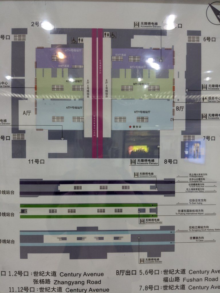
Century Avenue was the first four-line transfer station in all of China, and still is (but not for long, or maybe already not anymore depending on what you count) the only four-line transfer station in Shanghai. Lines 2, 4, and 9 are parallel to each other under Century Avenue and Line 6 is perpendicular across the top of the other three lines. Lines 2 and 9 are both on the same level underground, and Line 4 is one level further down.
The Century Park station apparently used to have nature-themed murals on the station walls, but these have since been replaced by light up advertisements, a significant downgrade if you ask me.
Longyang Lu was the original eastern terminus of Line 2, and thusly has a connection to the Longyang Lu depot east of the station. A fact about the name Lonyang Lu. Long 龙 means dragon and yang 阳 is the same yang of yin 阴 and yang 阳. Yang 阳 is the masculine (or positive) energy, and can be used to mean anything from sunlight to the north side of a river to something being carved in relief. However, when you put the two characters together into Longyang 龙阳, it is a colloquial (and generally positive) term for a male homosexual. I just think that is funny.
With the opening of Line 18, Longyang Lu will become the second four-line transfer station after Century Avenue. If you count the Shanghai Maglev, Longyang Lu already is a four-line transfer station and will actually become a five-line transfer station with the opening of Line 18. I, however, don’t count the Maglev as part of the Metro, even though it appears on the map, because it doesn’t have integrated fares with the Metro.
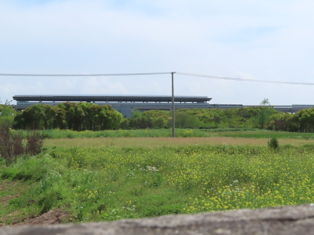
Zhangjiang Hi-Tech Park is one of the most interesting stations on the Metro, although you wouldn’t know it from platform level. It is the next stop east of Longyang Lu, and in between the two stations the train briefly daylights before plunging back underground. This is where the tracks lead to the Longyang Lu yard, but it also where the tracks led to the original, elevated, Zhangjiang Hi-Tech Park station. While the current station is an unremarkable underground affair, the original station was an (admittedly also unremarkable) elevated affair. When the line was extended past this station, it was decided that underground was better for the extension, and so the original elevated station was abandoned, but not demolished. The original station now houses offices and serves as training grounds for Metro staff. As you exit the current underground station, you emerge underneath the now empty shell of the original station. In addition, this station is home to the Zhangjiang tram line, a pneumatic-tired, monorail tram system that transports people around the neighborhood.


When Line 2 was originally extended east of Guanglan Lu, all of the following stations to the airport were half as long as a standard metro train, and were served by a disconnected semi-shuttle extension of Line 2. It was this station where that change happened, and passengers had to transfer between trains on their way to the airport. In 2016, the remaining stations were extended and now full length Line 2 trains can run through to the airport. However similar to Songhong Lu, some Line 2 trains do still short turn here. There is a third platform that facilitates that service pattern.
At Huaxia Dong Lu, a side platform station, at the northern end of the station, the two tracks widen slightly, and a gap appears between them. Huaxia Dong Lu sits at the end of a curve in the line, so the tracks appear to be beginning that curve within the station. I’m not entirely sure why this happens, but my best guess is that when the stations east of Guanglan Lu were extended, they extended Huaxia Dong Lu into the tunnel where the tracks were curving and simply left the gap. The gap is visible both from the platforms and on the station diagram.


The Chuansha depot is the third depot immediately connected to Line 2 and the fourth used by Line 2 trains. It is accessed by Line 2 trains east of Yuandong Avenue station.
Pudong International Airport is the last stop on Line 2. The station has two side platforms, and tail tracks that extend past the station to allow for Line 2 trains to turn around.
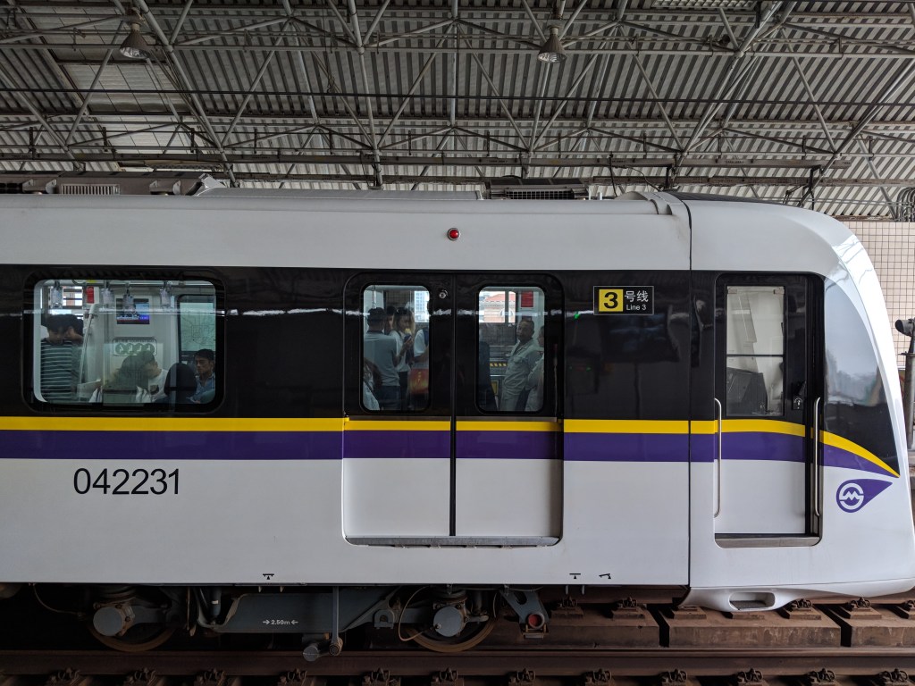
Line 3
Line 3 is an (almost) entirely elevated line, and the first elevated line in the Shanghai Metro. It follows the routes of two historic railways, the Shanghai New Line and the Songhu Railway.
The Shanghai New Line was opened as a branch of the Shanghai-Hangzhou Railway in 1916 in order to allow trains from the Shanghai-Hangzhou Railway to continue from Shanghai South Railway Station, their original terminus, to Shanghai North Railway Station (now simply called Shanghai Railway Station), the terminus of the Shanghai-Nanjing Railway. When the line was constructed, the land it passed through was relatively rural, however as the surrounding area urbanized, partially as a result of the railway being constructed, the frequent grade crossings turned the road network into gridlock, and the Shanghai government began looking for a solution. Metro Line 3 was opened in December of 2000, on an entirely elevated structure making construction one third the cost and two or three times faster than underground lines. However, this low cost and speed of construction was largely due to the right-of-way already existing, and therefore demolition of buildings was entirely eliminated. It is telling that no other elevated lines were built through the city center after Line 3.
The story of the Songhu Railway is much longer and far more interesting than the Shanghai New Line. It actually replaced a much older railway called the Wusong railway. The city of Shanghai is located near the mouth of the Yangtze River, however the commericial heart of the city is actually about 14 miles upriver along a tributary of the Yangtze called the Huangpu (Huangpu means Yellow River but this is not the Yellow River). A problem for the foreign businessmen in Shanghai in the late 19th century was that the Huangpu was too silty for big oceangoing vessels to reach the commercial heart of Shanghai, and often goods had to be ported overland or along canals from the ocean wharfs to Shanghai. Wusong was an area along the same side of the Huangpu river as Shanghai where the Huangpu met the Yangtze, and was therefore ideal as a wharf for oceangoing trade vessels. The idea behind the Wusong Railway was that it would allow for the transport of goods from the wharf to the foreign concessions in Shanghai.
The Wusong Railway was at the center of a much bigger debate going on in China during the 19th century. Following the successes of the first commercial British Railways such as the Manchester and Liverpool, and Stockton and Darlington, British businessmen overseas began pushing for the adoption of railroad technology in other countries. The Chinese government was largely opposed to foreign technology, especially when it was controlled by foreign businessmen, and therefore prevented railway construction in China. However this negative attitude toward foreign controlled railways by the Chinese government was inconvenient to the rich white businessmen who, doing what they do best, ignored the wants and needs of other people and did whatever they wanted anyway in order to increase their own profits as much as possible. A consortium of British, American, and Danish companies and businessmen began purchasing land for the railway they wanted built. Despite the protests of Chinese locals and officials, the construction of the railway continued. The government in Shanghai tried multiple times to slow or stop construction, and then tried to purchase the line, however this all failed. The line opened in 1876 as the first modern railway in China and the first railway in China for passenger use.
The line opened in July of 1876, but in October, the Qing government agreed to purchase the line for 285,000 taels of silver, payed in three installments over the course of a year (Currency conversion over long periods of time using currency no longer used is basically impossible, but this was a lot of money). Because of how profitable the line was for passengers, foreign businessmen in Shanghai expected the Qing government to continue to operate the line, and convert it to freight, as had been the intention of the businessmen in the first place. However when ownership and operation of the line was passed to the Qing government in October, 1877, they immediately had the line demolished.
Now we reach the Songhu Railway line. In 1897, just 20 years after the Wusong Railway was demolished, the government approved the rebuilding of the old line into a suburban branch line of the Shanghai-Nanjing Railway. This version of the line lasted until 1997, when it was removed for the construction of the Shanghai Metro Line 3. A note about Chinese railway name conventions: most place names in China have two characters in their name, and so railway lines will often be named by creating a portmanteau of the two city names, using one character from each. For example, the Beijing-Guangzhou Railway line is called the Jingguang line in Chinese. The other option for railway lines to be named after a city’s nickname or abbreviation, which is the case in Shanghai. The one character abbreviation for Shanghai is Hu, which was the old name of the city when it was just a fishing village, named after a bamboo fishing tool created by the locals which they called hu. Therefore the Songhu Railway line is short for Wusong-Shanghai (Hu) railway line. Almost no trace of these original railway lines exist today.
The Shanghai New Line portion of Line 3 (from Shanghai South Station to Shanghai Station) follows the Inner Ring Road of Shanghai, and elevated expressway that rings the central part of the city. At some places the two are only a few blocks apart, and the Inner Ring Road is visible on the western side of the transit line. This section of track is shared with Line 4.
Much like at Shanghai South Station, the Line 3 (shared with Line 4) and Line 1 platforms of Shanghai Station are on opposite sides of the station, however at Shanghai Station there is no in-system transfer between the two lines, which there is at Shanghai South Station.
At Changjiang Nan Lu station some Line 3 trains short turn. This is unfortunate because Line 3 shares track with Line 4 along the Shanghai New Line section of its route, restricting the total capacity of both lines. With some trains short turning here, the stations north of here (8 to be exact) see headways (the time interval between two trains) of around 7 minutes, which is fairly standard in New York but practically unheard of in Shanghai. This makes commuting on Line 3 especially frustrating for the people coming from or going to the northern areas of the city only served by Line 3.
The second to last station is Tieli Lu, which is the only underground station on Line 3. While the station is below ground, the ceiling was designed to include glass, which allows in natural light, giving this below ground station a not-quite-underground feel. This station is also located in front of the Bao Steel Group (the Chinese State-owned iron and steel conglomeration) Research Institute, which makes the station name, which translates to “Iron Power” feel particularly apt.
The final station on Line 3 is Jiangyang Bei Lu, or North Jiangyang Road, which is the furthest north point in the Shanghai Metro System (for now). This station is somewhat atypical, first because it sits at ground level, rather than elevated or below ground, and second because while it has two side platforms, only one is in use. This means that the terminal has the capacity for all Line 3 trains to terminate here, and yet some still short turn at Changjiang Nan Lu instead. Jiangyang Bei Lu is also adjacent to the Jiangyang Bei Lu depot, where both Line 3 and Line 4 trains are serviced. I bet this depot has the widest range of rolling stock (i.e. types of trains) serviced in a single depot, as Line 3 and 4 each have their own exclusive rolling stock along with a fleet of trains shared between the two lines. Perhaps Meilong Depot, which if you remember services both Line 1 and Line 2 trains, services the same number of rolling stock types, as Lines 1 and 2 have three different types of rolling stock, all of which are shared by both lines.
Line 4
Line 4 is Shanghai’s circle line which encircles the Central Business District, mirroring the Inner Ring Road. Along with Lines 1 and 2 which form the primary North-South and East-West routes respectively, Line 4 roughly creates the shape of the Shen 申 character. This is relevant because just a few paragraphs ago when we discussed the nicknames and abbreviations of Chinese cities and provinces. If you remember, I said that hu 沪 was the abbreviation for Shanghai, however it is not the only one, just the most common and most formal one. Shen 申 is also a nickname for the city of Shanghai, seen in the soccer team Shanghai Shenhua 上海申花 (which, near as I can figure, roughly means The Shanghai Shanghai Flowers. Reminds me of the LA baseball team whose name, when translated entirely into English, means The The Angels Angles). Anyway, having three of your main metro lines roughly create the shape of your city’s nickname character is obviously very symbolically important.
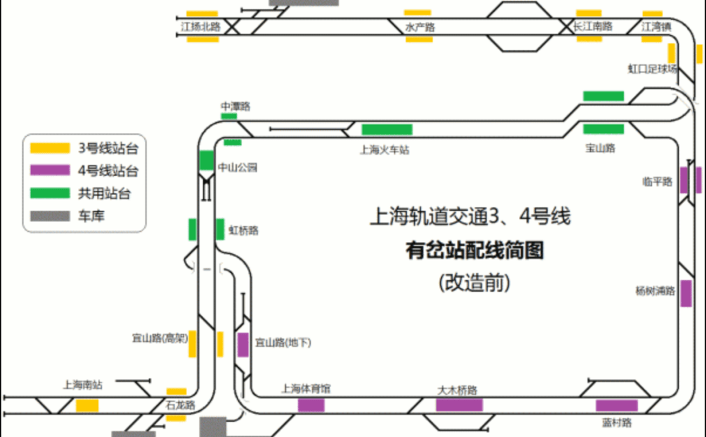
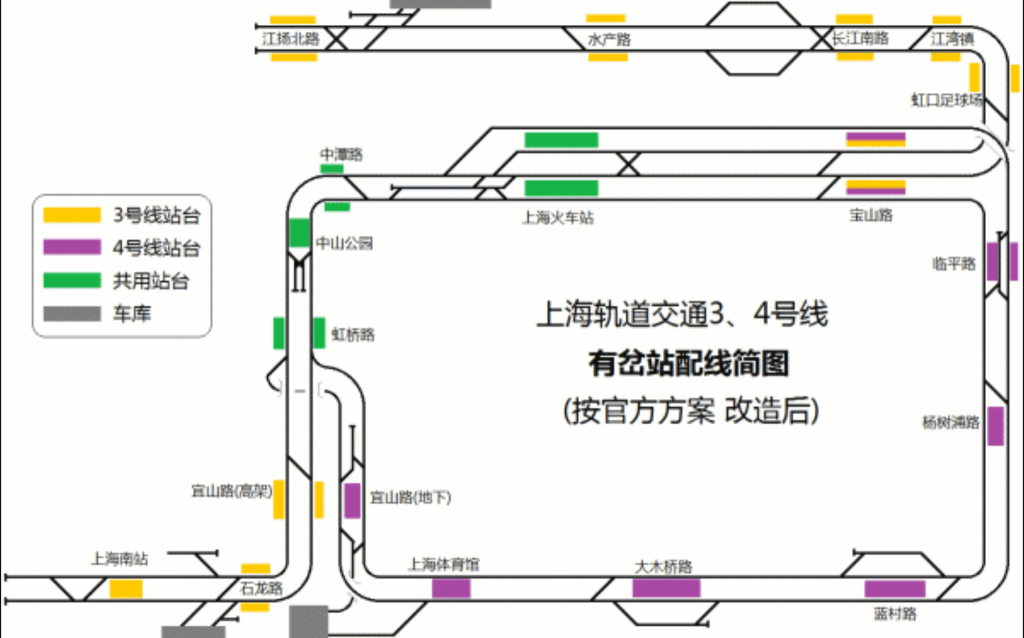
Line 4 shares track for about a third of its route with Line 3, meaning both Lines 3 and 4 have longer intervals between trains on the non-shared sections of track than the other lines. Anyone familiar with New York’s struggle with interlining will be familiar with this concept. Because each section of track has a total capacity of how many trains can use it at a time (measured in trains per hour, or tph), which is limited by things like the signaling system, the speed limit, the number of stations, and the number of switches, when two services (i.e. named routes of a rail system like the (F) train or Line 4) share one section of track, each service can only run half as many trains as the total capacity of the shared section of track. As mentioned above, this means the sections of Line 3 and 4 that don’t share track are each left with less service than they otherwise would have. Shanghai doesn’t have nearly the same level of interlining as New York so this problem is limited, if still present.
There was a plan to quad-track a portion of the shared Line 3/4 track in order to reduce the amount of interlining, however this never came to fruition.
Because Line 4 is a circle, it doesn’t have a set start and end point like most other metro Lines. It instead has inner (clockwise) and outer (counter-clockwise) loops. While there is no formal terminus of Line 4 there is an informal terminus at Yishan Lu, so that is where we will start. Yishan Lu allows for a transfer with Line 3, but the two lines don’t share track here. The interlining portion of the route is one stop north (clockwise) at Hongqiao Lu. Yishan Lu is the informal terminus because this is where the Puhuitang Depot is located, which stores Line 4 trains. This depot allows for trains to enter and exit Line 4 from both directions, however Line 4 trains will usually start and end their days at Yishan Lu.
Line 4 is the first line without a short turning service. All Line 4 trains make all stops, looping around and around and around, however this wasn’t always the case. Linping Lu used to be one end of a short turning service, and this has three tracks and two platforms. There is one side platform and an island platform, although only the outer side of the island platform is in service, and the middle track and inner side of the island platform sees no service. The short turning Line 4 service was cancelled after less than a month of operation in 2006.
The station after Century Avenue is Pudian Lu, not to be confused with Pudian Lu on Line 6. The two stations are named for the same street and their closest entrances are located only 260 meters (slightly more than one furlong) from each other, however there is no in-system connection between the two, nor is there and out-of-system transfer (what the Chinese call a virtual transfer). This is the only place where two stations share a name but are still two distinct stations. What is even crazier (your mileage on whether or not metro station naming convention oddities are crazy may vary) is that the following station after Century Avenue and the Pudians Lu (that is the proper pluralization, it’s like Attorneys General), both of which are served by Lines 4 and 6, is Lancun Lu, a transfer station between Line 4 and Line 6. Thus these two lines have three stations in a row with the same names, but only two of them are actual transfers. Shanghai is usually quite good about giving stations unique, unconfusing (non-confusing?) station names, however they seem not to care in this particular instance as the station names haven’t changed since 2007 when Line 6 opened. Incidentally, Lancun Lu was the other end of the very short lived short-turn Line 4 service, although I imagine that service went the long way around Line 4 rather than just serving the five stations in between Linping Lu and Lancun Lu on the eastern side of the loop.
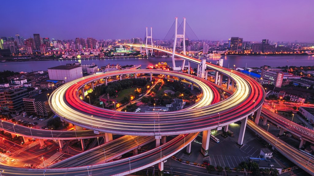
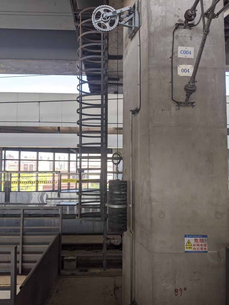
The Nanpu Bridge station is a double stacked side platform station. Think IND Central Park West Line stations, where the platforms and tracks are located one above the other. Nanpu Bridge (the actual bridge itself) is very cool and since this is my blog I make the rules and I’m gonna talk about a bridge now because I want to. The western approach to the Nanpu Bridge is constrained for space by 1) lots of buildings and 2) the fact the the expressway it is a part of, the Inner Ring Road, runs very closely parallel to the river that the bridge is crossing. The main span has a height of 46 meters (2.29 chains), which needs to be brought down to the level of the expressway with very limited space. The solution was a spiral ramp with a radius of about 120 meters (24 rods). The spiral ramp looks incredibly cool, as someone who appreciates big infrastructure, and is also quite fun to ride around.
Back to trains. We are almost all the way around the Line 4 loop. The last two stations before Yishan Lu can be translated into English the same way, although they have been intentionally differentiated. These two stations are Shanghai Stadium and Shanghai Indoor Stadium (in the clockwise order). These two stations are only one character apart in Chinese, with the Shanghai Stadium name in Chinese being shanghai tiyu chang 上海体育场 and the Shanghai Indoor Stadium name being shanghai tiyu guan 上海体育馆. Chang 场 means field and guan 馆 means “a place for guests” or “embassy” or “shop” or more broadly anything indoors, like museum (bowu guan 博物馆). These two stations are part of a larger sports complex, with the Line 11 Shanghai Swimming Center also in the vicinity.

Line 5
Line 5 is an example of a somewhat common type of line in Shanghai, which I call the “extension.” Lines 5, 16 (sort of), 17, and the Pujiang MRT all fit the bill, along with the Chongming Island Line which is currently being planned. Line 5 it is essentially a southern extension of Line 1. Line 5 was constructed with funds provided by the Minhang District government, the first and only line to be constructed by a district government rather than the city. When first built, it ran south of Xinzhuang all the way to the Minhang Development Zone station. It uses slightly smaller cars (called C-Type) and shorter overall trains than most of the other lines in the network. Line 5 has recently undergone an expansion with a new branch continuing south to Fengxiang New City. This new extension uses 6 car trains as opposed to the 4 car trains of the original Minhang Branch.
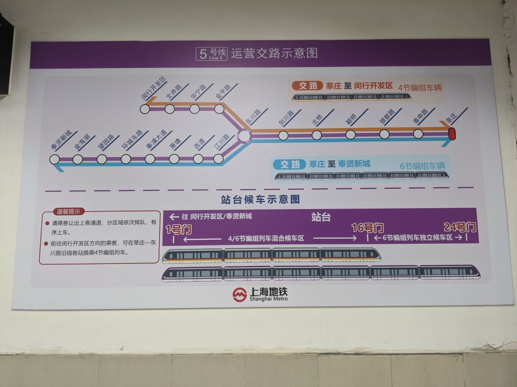
Dongchuan Lu is the last station before the line branches split. Because the new Fengxiang Branch has longer trains, the stations north of Dongchuan Lu had to be extended to accommodate the new trains. When the extension was built, the new tracks were constructed on the outside of the original side platforms turning them into island platforms. Therefore, the Fengxiang Branch serves the outer tracks and the Minhang Development Zone Branch serves the inner tracks. Line 23 is a line currently being planned that will take over the Minhang Branch line, and Line 5 will at that point only consist of the new branch to Fengxiang New City.
The entire Minhang Branch of Line 5 will be replaced by Line 23, which will be entirely underground. I imagine then that the elevated structure of Line 5’s Minhang Branch will be demolished, and it will be interesting to see what happens at Dongchuan Lu after Line 23 is constructed. The current station layout has two island platforms and four tracks, but this will be overbuilt when Line 23 takes over the Minhang Branch.
The southern extension of Line 5 to Fengxiang crosses the Huangpu River on a new structure called the Minpu 2nd Bridge. The metro line and highway were constructed in conjunction with each other, and therefore resemble the northern end of Line 1 which was built elevated, but under a highway. Unlike Line 1, when the metro was being tested along the new bridge, locals complained about noise, and so operation of Line 5 was restricted to a maddeningly slow 20 km/h (12.4 mph) between Dongchuan Lu and Xidu station, a total length of 2 km and including one other station.
The Xiaotang station name has an interesting history, but it has nothing to do with trains. The station is named Xiaotang 萧塘, where Xiao 萧 is a surname commonly found in the area and tang 塘 means embankment or pond. However, when Chinese characters were being simplified in both the first and second simplifications, in the 1950s and 1970s respectively, the surname Xiao 萧 was set to be simplified to Xiao 肖. The station here uses the old version of the Xiao character 萧 in its name.
Currently Fengxiang New City is the southern terminus of the new branch, however there will be a one station extension south from Fengxiang New City to Pingzhuang Highway, including a new depot for Line 5 trains.
Line 6
Line 6 was constructed with the same smaller size of train as Line 5. This caused immediate problems, as the line was expected to carry 105,000 passengers per day, and in the first week of opening carried and average of 150,000 passengers per day. Furthermore, development along the line happened at a much quicker pace than expected when the line was announced, and so the design was already inadequate by the time it opened. Unfortunately the only way to increase capacity on the line is to run more trains, which the government did by expanding one of the lines depots, however there is a physical limit to the number of trains able to run on a given section of track at any time. Because the tunnels and stations of Line 6 were built to the loading gauge of the C-Type metro trains on Line 6 instead of the A-Type metro trains used on full size lines, there is no possibility of running bigger or longer trains on Line 6. On March 8, 2019, Line 6 carried 520,000 people, a single-line record in Shanghai, and almost 5 times more people than the line was designed for.
The northern terminus of Line 6, Gangcheng Lu, is now shared with Line 10, but we will discuss that later.
Jufeng Lu is the northern terminus for the short-turning Line 6 trains. (This doesn’t seem like a very interesting fact right now but I promise it is relevant for later).

Minsheng Lu has a third middle track that starts just before the station and ends just after the station. I’m not entirely sure what it’s intended purpose is, because I used to commute on this section of Line 6 fairly regularly, and I have never once seen a train stored on that middle track.
Line 6 stops on the upper level of Century Avenue, and makes that station infinitely more complicated to navigate. Lines 2, 4, and 9 all run parallel underneath Century Avenue, and roughly at the same depth underground. Above these three lines is the mezzanine of Century Avenue, and half a level above that, Line 6 runs perpendicular across all three lines. Because Line 6 is not a full level above the mezzanine, the mezzanine level is split into two halves. Line 6 also, for some reason, has two side platforms at one of the busiest stations on the metro, meaning if you are transferring to Line 6 from one of the other three lines and you haven’t gotten in the right end of the train at your origin station, you have to navigate the layout of Line 6 to find the correct platform for whichever direction you are going. This isn’t much of a secret, just a rant I had to get out because I always have to go through Century Avenue and I still to this day have no idea whether Mezzanine A or Mezzanine B is the right side for when I want to go home.
As mentioned above, Line 4 and Line 6 both stop at a Pudian Lu station, just a few hundred meters apart, without any potential to transfer. However the real problems start at Lancun Lu, one stop south on both lines. This station is also terribly laid out, as even though the platforms are parallel to each other, there is very little connection between the two. The exits, although numbered as if they were all one station, are actually exclusive to one line or the other, with exits 1 and 2 serving Line 4 and exit 3 serving Line 6. If you enter through the wrong exit, good luck getting to the train you want.
The Shanghai Children’s Medical Center Station, or Shanghai ertong yixue zhongxin zhan 上海儿童医学中心站 has the longest name of any station in the Shanghai Metro system. Gaoqing Lu is the other end of the short-turn Line 6 service. Shangnan Lu was planned to have a transfer with Line 8, however Line 8 was realigned and the basement shell which was meant to serve Line 8 was repurposed to allow passengers to transfer between the two side platforms of the Line 6 station.
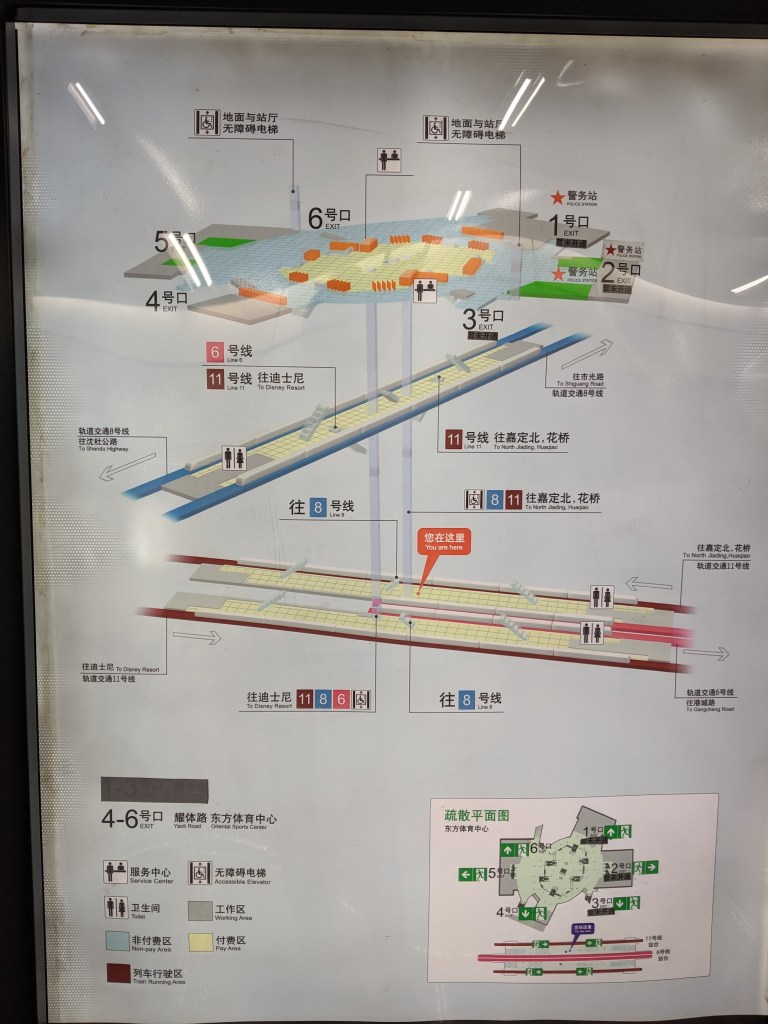
Oriental Sports Center is the southern terminus of Line 6. Transfers are available to Line 8 and Line 11 here. Lines 6 and 11 share two island platforms, with the Line 6 trains serving the inner two tracks and the Line 11 trains serving the outer two tracks. This station was the first cross-platform interchange on the Shanghai Metro. Because the Line 11 trains are so much longer than the Line 6 trains, there is a significant portion of the Line 11 platforms that appear to be standard side platforms, and only about half of the platform is set up for cross platform transfers.
Line 7
Line 7 serves two distinct functions within the Shanghai Metro system. Its L-shaped route allows it to function as a north-south line through the western side of the city center, and also as an east-west route between the two sides of the river, south of the Line 4 loop.
The northern terminus is Meilan Lake, which much like Jiangyang Bei Lu on Line 3 only has one platform in regular use. Qihua Lu, five stations south of Meilan Lake, is the northern terminus of the short-turn Line 7 service. Line 15 was supposed to connect to Line 7 here, but was instead connected to Line 7 one station further north at Gucun Park.
Yanggao Nan Lu has two island platforms, three tracks, and a fourth storage track with no platform. The station is set up to allow trains to short turn here, but I think all trains continue on towards the southern terminus rather than short turn here.
Line 7 is a part of the Longyang Road station complex. The station has a connection to Longyang Depot, where some trains are stored along with Line 2 trains. Line 7 is the northernmost platform of the four parallel stations (including the Maglev station).
The southern terminus is Huamu Lu, which serves the site of the 2010 World Expo. It’s location is a bit awkward as it juts out north of the Longyang Lu station complex. It also doesn’t have any tail tracks for turning trains around, which limits capacity as trains have to enter the station slowly so as not to run into the buffer and wall at the end of the track. There is also no storage space for terminating trains, meaning all trains that enter Huamu Lu have to turn around almost immediately so as not to take up precious space in the station.
Line 8
Line 8, like Line 6 uses C-Type cars rather than A-Type. Also like Line 6, this causes major crowding issues on Line 8. Line 8 was originally projected to have between 400,000 and 5000,000 daily riders, necessitating the larger A-Type trains, however this projection was downgraded to 200,000 per day, warranting the smaller C-Type trains. I have no idea why C-Type cars were selected for Line 8, as it passes through a pretty major corridor in the Central Business District of Shanghai. Like Line 7, Line 8 is another one of those “Platonic Ideal” Metro lines, and also doesn’t have much in the way of interesting features, aside from a few notable outliers. In fact the first 14 stations have nothing interesting going on, other than a missed connection between Line 8 and Line 4. Missed connections with Line 4 only happen two other times. There is also a short-turn Line 8 service that starts from Yanji Zhong Lu.
The first thing of note on Line 8 is People’s Square, where the Line 8 platforms were built parallel to the Line 1 platforms. As mentioned in Line 1 and Line 2, both Line 2 and Line 8 have track connections to Line 1 at this station. However not only does Line 8 have a track connection to Line 1, it also has a shared platform. There is an island platform built between the northbound Line 1 track and the southbound Line 8 track, however it is only accessible from the Line 8 side. Standing on the main Line 1 island platform and looking towards the northbound track, you can clearly see a number of sliding metal doors at regular intervals along the opposite wall. These doors are where platform screen doors would be installed if the platform was opened to Line 1 trains, however it is only open to Line 8 trains. Southbound Line 8 trains open their doors on both sides, to access the main Line 8 island platform and also the exit-only southbound side platform. I imagine this platform was closed on the Line 1 side for passenger safety issues, however I think it would be quite useful if it was reinstated.
The short-turn service terminates at the Oriental Sports Center station, although all of the interesting stuff is on the Line 6/Line 11 level.
The southern terminus of the line is Shendu Highway. This station has a main island platform, as well as a side platform exclusively for the northbound trains to pick up passengers. There was a planned southern extension of Line 8 that never materialized as a full-fledged metro line, but instead became what is known as the Pujiang Mass Rapid Transit, or Pujiang MRT for short.
Pujiang MRT
The southern extension to Line 8 was constructed instead as a separate automated line. This line is just 6 stations, and while the novelty is cool, an extension to the metro line probably would have been better, as currently passengers have to make an inconvenient transfer at Shendu Highway if they want to continue into the city. The Pujiang MRT also has an additional side platform at Shendu Highway, this time exclusively for dropping off passengers.
Line 9
Line 9 is one of the longest lines in the Shanghai Metro, clocking in at 64 km, or 40 miles. For reference, the (A) train from Far Rockaway-Mott Ave to Inwood-207th St, the longest service in New York, is 31 miles. However Line 9 was planned to be even longer, stretching from Fengjing to Chongming Island. The western end was cut back from Fengjing to Songjiang, and the eastern end was changed to Cao Lu, with a new line altogether planned to serve Chongming Island, sort of how the Pujiang MRT took over what was supposed to be a Line 8 extension.
Line 9 starts in the west at Songjiang South Station, but originally started a few stations north at Songjiang New Town. When the first phase of Line 9 opened, it was entirely separate from the existing metro network and passengers had to use a shuttle bus to reach the existing network.
Songjiang is also served by two tram lines that interchange with Line 9 at various stations on the western end of the line.

Sheshan is an elevated island station that serves as the western terminus for the short-turn Line 9 service. Sheshan 佘山 means She mountain, which is ironic as Shanghai is mostly formed from deposited sediment of the Yangtze river and therefore has almost no elevation above sea level. Sheshan itself is only 97 meters (106.8 yards) above sea level.
Zhongchun station has an island platform served by the eastbound Line 9 trains, and unused middle track on the other side of said island platform, and a westbound side platform. This station provides access to the Jiuting Depot. Guilin Lu has the same layout as Zhongchun Lu, however this was because before Line 9 was extended further east and connected with the rest of the metro, Guilin Lu was the eastern terminus of Line 9. Once Yishan Lu, one station east, opened, Guilin Lu was no longer used as the terminus.
Madang Lu has a third middle track and two side platforms. Yanggao Zhong Lu served as the eastern terminus for Line 9 before the final eastern extension was opened. Line 6 and Line 9 have two separate stations with the similar names, with the Line 6 Jinqiao Lu station and Line 9 Jinqiao station (and yes, those are the same Jinqiao 金桥, meaning Golden Bridge).
The stations on the newest extension of Line 9 are further apart than normal. This section of Line 9 parallels Line 6, and Lune 9 stations are roughly twice as far apart as the Line 6 stations.
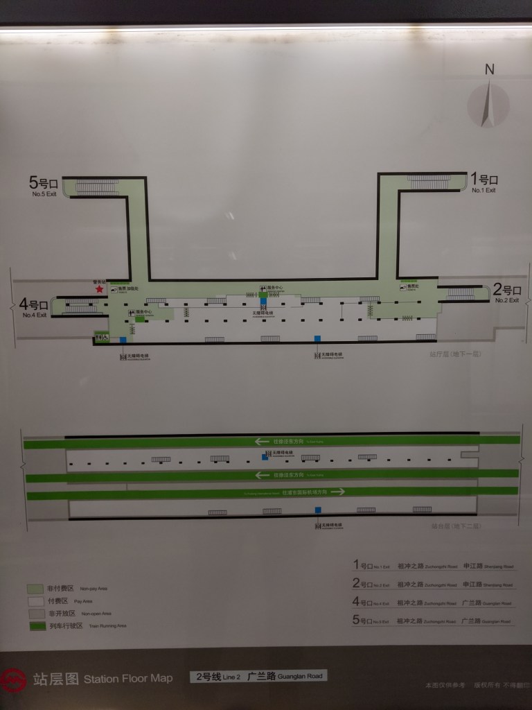
Line 10
Line 10 was the first line in all of China to be capable of automatic train operation, although from when it opened to the time of writing, drivers were still used on board. Currently drivers are being phased out in favor of automatic operation. Line 10 is the only line to have numbered station codes to help with navigation.
Line 10 has two branches in the west, one of which is called the branch line and the other of which is called the mainline. The branch line doesn’t have much in the way of sights to see or discuss, but it is where the original depot is located.
The mainline of Line 10 starts at Hongqiao Railway Station with an island platform. The directions of travel on the tracks are reversed, with left-hand running, unlike the rest of the system. The reason for this becomes apparent at Hongqiao Terminal 2 station, one stop east. Line 2 and 10 share this station, and the east bound (towards the city) tracks share a large island platform. Because Line 10 is south of Line 2, and Line 2 was built first, the Line 10 directions have to be swapped in order to have both Line 2 and Line 10 eastbound trains adjacent to each other. This means that passengers entering the metro from the airport can use this island platform to take them into the city without having to choose which line they need. Both lines also have island platforms allowing for cross-platform transfers between directions. This swapped pattern remains for Hongqiao Airport Terminal 1 as well, and an underground flyover sorts out the directions for the Shanghai Zoo station.
One stop east of Shanghai Zoo is Longxi Lu, where the main and branch lines of Line 10 meet. Both west-bound trains share a side platform, there is a middle storage track, and the two east-bound trains share an island platform, with the merge of the two tracks happening east of the station. Songyuan Lu also has a middle storage track, and two side platforms, as does Sichuan Lu.
Sanmen Lu has a space reserved for what used to be Line 17, which was then renamed to Line 20. However this planned line has been shelved and likely won’t be constructed, leaving the space reserved unused.
Xinjiangwancheng was the original eastern terminus of Line 10, and it still serves as the terminus for trains from the branch line. It has two island platforms and three tracks, and terminating trains use the middle track and open doors on both sides when in the station.
The new extension of Line 10 takes it into Pudong and has the aforementioned cross-platform transfer with Line 6 at Gangcheng Lu. This is the Shanghai Metro’s only elevated cross platform transfer between terminating Line 6 trains and northbound Line 10 trains. I personally think a solution similar to Hongqiao Terminal 2 should have been implemented, with terminating Line 6 trains and southbound Line 10 trains sharing a platform, as this would provide a convenient transfer for passengers going from northern Pudong (the district east of the Huangpu River) and Puxi (The district west of the Huangpu River). This would have involved constructing an elevated flying crossover, but 1) I think it would have been worth for convenience and 2) that would have looked cool as hell.
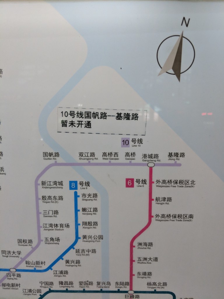
The new terminus station is Jilong Lu, and in addition to the new stations, a new depot was built for Line 10 trains adjacent to the Line 6 depot that already existed.
Line 11
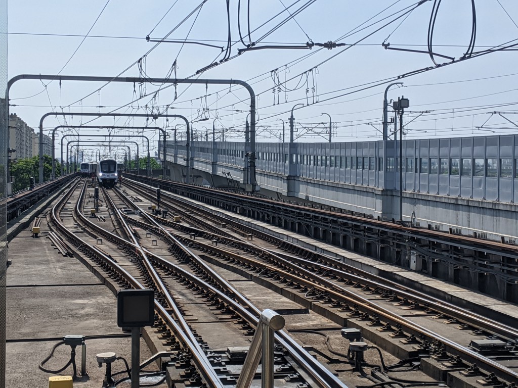
Clocking in at 82 km (50 miles), Line 11 is the longest rapid transit line in the world. The one caveat to that is that Line 11 has two branches, and so the longest any one Line 11 train could go is 73 km (45 miles). Line 11 is also the first inter-provincial line in the Shanghai Metro, as the Huaqiao Branch goes over the border into Jiangsu Province. Line 11, much like Line 9, was actually planned to be much longer, going from Jiading, one of its current northern termini to Lingang New City, in the far southeastern corner of Shanghai, which would give it a route length of 120 km (74.5 miles). In reality the line to Lingang New City was taken over by Line 16.
The branch to Huaqiao is considered the branch, and Jiading the mainline, so we will start in Huaqiao. This station will soon be a transfer station with the Suzhou Metro S1 line, allowing passengers to take the train from Shanghai to Suzhou, the next city to the west. Imagine if you could take the subway to Trenton, NJ and transfer to the Philadelphia Subway. This branch also serves the Shanghai Circuit racetrack, which has access to the Circuit depot. Line 11, like Line 2, also has a higher number of depots than most lines, with three.
The Jiading Branch starts at Jiading Bei, which has direct access to the Jiading Depot. Jiading New Town is where the two branches meet, and this station has the same layout as Line 10’s Longxi Lu, with northbound trains sharing a side platform, and southbound trains serving both sides of an island platform. Nanxiang station has the same layout, although the middle track serving the island platform is not in use. Zhenru also has this three track layout, although the island platform serves northbound trains rather than southbound trains.
Yunjin Lu has a middle storage track. This station also has adjustable platform screen doors to allow the air pushed in front of the trains to act as ventilation in the station during the summer. As mentioned in Line 6, Line 11 trains stop on the outside of Line 6 trains at the Oriental Sports Center, allowing for cross platform transfers to take place. The following station, Sanlin, has two island platforms and three tracks, allowing some Line 11 trains to short turn here.
Pusan Lu also has a middle storage track. In between Pusan Lu and the following station Yuqiao is an unopened station called Yanyu Lu. The station shell was constructed when the rest of the line was, but it was not opened with the other stations and instead left in reserve in case it was needed.
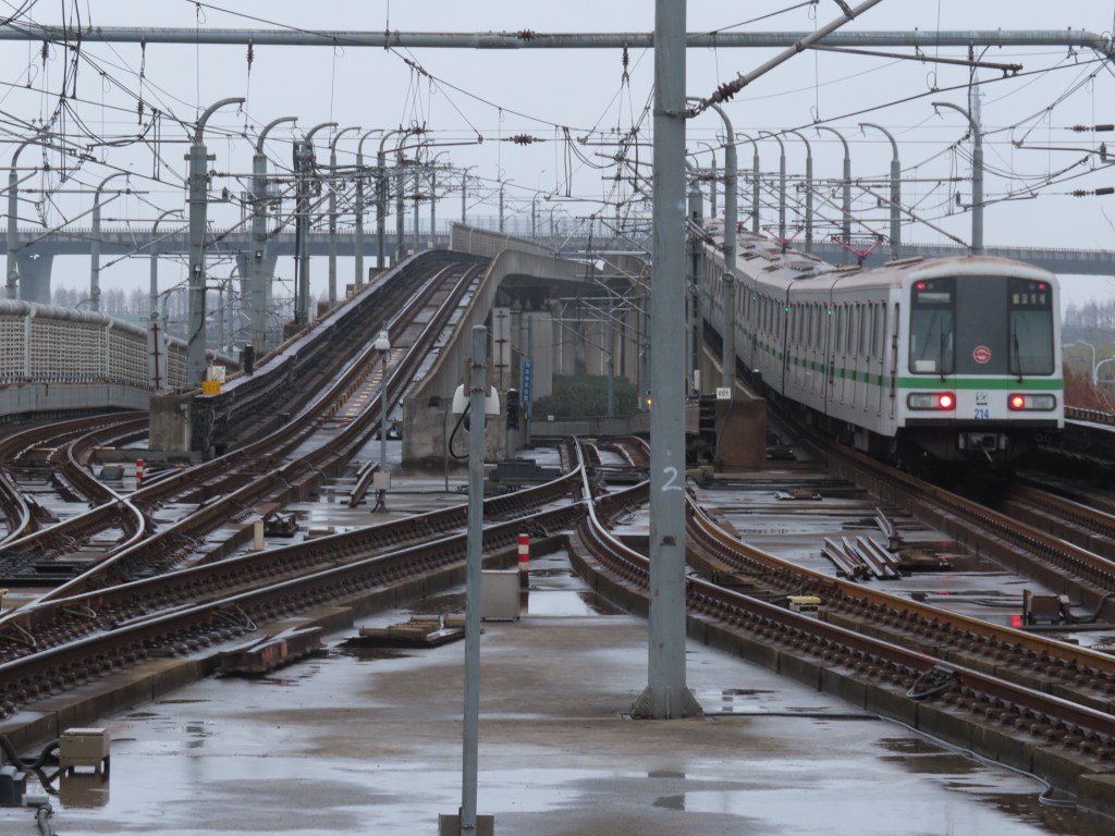
The station after Yuqiao is Luoshan Lu, which is quite a spectacular station. The station is elevated, with Line 11 trains on the lower level and Line 16 trains on the upper level. West of the Line 11 platform, two yard leads head to the massive three-line Chuanyang River Depot, which is shared between Lines 11, 13, and 16. East of the station are two tail tracks, which I don’t believe are in use, as the short-turn service short turns at Sanlin a few stations back west.

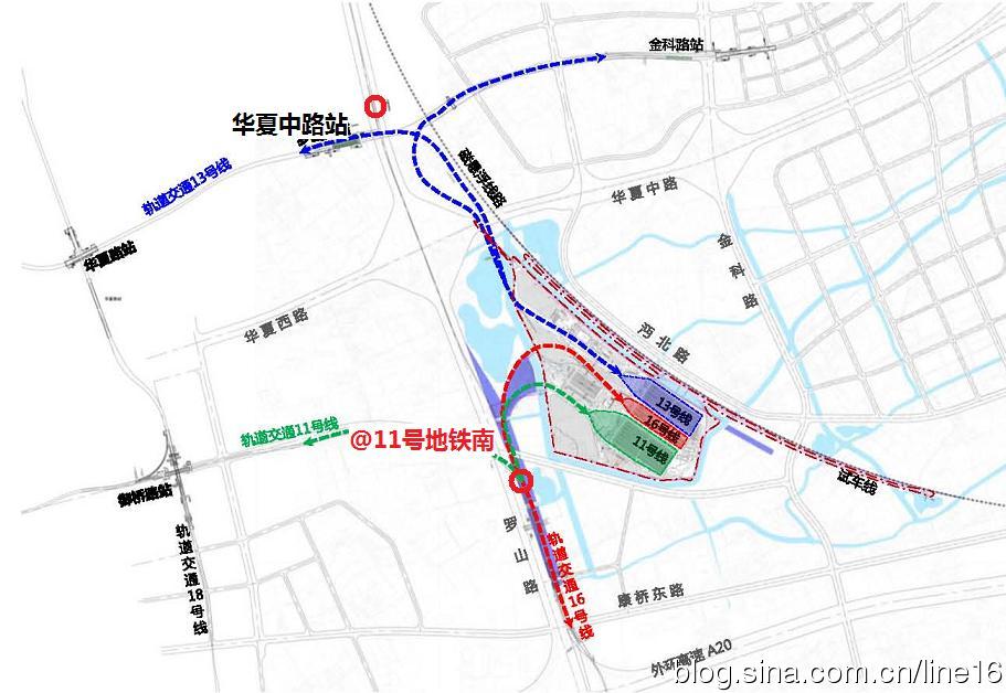
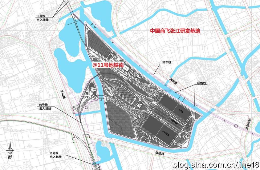
These are two maps of the Chuanyang River depot complex.
The following station, Xiyuan Lu, is adjacent to Line 16, but Line 16 does not stop here.

The final station of Line 11 is Disney Resort, which has quite a few Disney themed decorations. Some Line 11 trains are also wrapped in Disney themed liveries.
Line 12
Lines 12 and 13 form sort of an X shape across the center of Shanghai. Line 12 is southeast-northwest and Line 13 is northeast-southwest. Line 12 not only has the most interchange with other lines in the entire system, with 19 across 15 stations, Line 12 also has the most interchange stations in a row, at 12.
When Shaanxi Nan Lu was opened in 1995 it was originally only served by Line 1. Line 10 opened in the area in 2010, creating an out-of-system virtual transfer between the two. The eastern end of the Line 10 station was in line with the western end of the Line 1 station. In 2015 the Line 12 station opened, connecting the two stations in-system for the first time in a zig-zag shape.
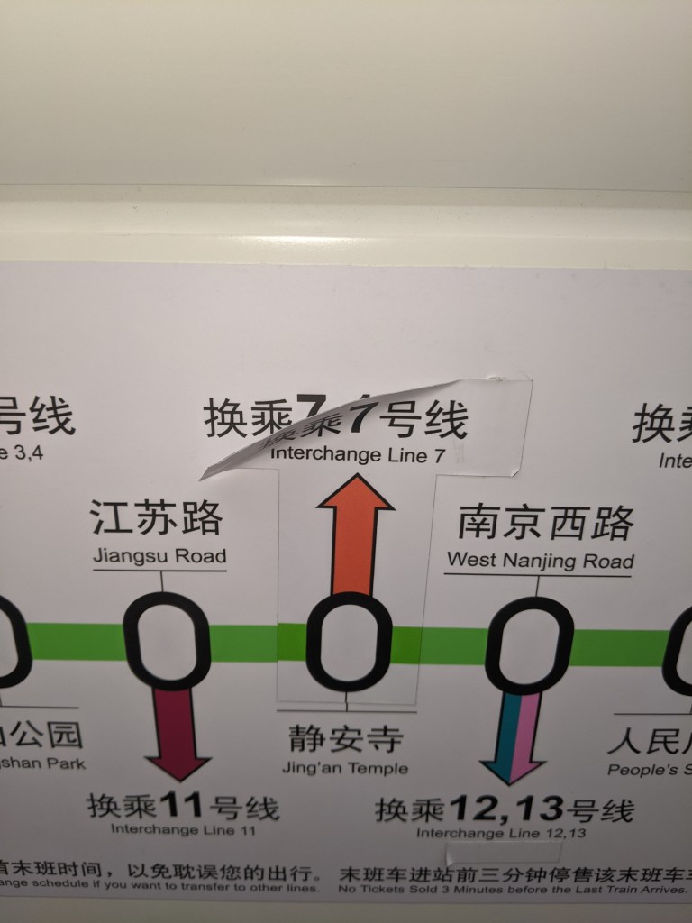
A similar story exists with Nanjing Xi Lu, where Lune 2 originally served the station in 1999. Both Lines 12 and 13 opened in 2015, and initially the three stations were planned to be connected via underground passages. However, to the the density of the surface buildings, historical buildings nearby, and the overall difficulty in construction meant that the connecting passages were not built, and instead an out-of-system virtual transfer was implemented between Lines 12 and 13 with Line 2. There is an in-system interchange between Lines 12 and 13 one stop north on Line 12 and two stops north on Line 13 at Hanzhong Lu.
Jufeng Lu, as you may remember, was the northern terminus of the Line 6 short-turn service. Well, it is also the northern terminus of the Line 12 short turn service. This is, I believe, the only station in Shanghai with two short-turn services terminating at the same station.
The final station is Jinhai Lu, shared with Line 9. The tracks lead immediately beyond the station into the massive Jinqiao Depot, which currently serves Line 9 and 12 trains, but will also serve Line 14 trains when that line opens.
Line 13
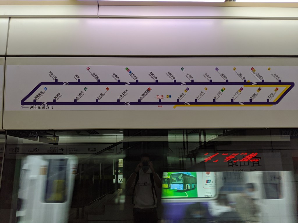
Line 13’s current western terminus is Jinyun Lu, although there is a western extension planned that will add five new stations. The first section of Line 13 opened in 2012 between Jinyun Lu and Jinshajiang Lu where an interchange with Lines 3 and 4 is possible. This line was then extended to Changshou Lu before a much longer extension to Shibo Avenue. Huaihai Zhong Lu on the second extension is Shanghai’s deepest station. There is also a missed connection with Line 1 here.

I told a little fib just now. The first section of Line 13 to open was actually a three stop section between Madang Lu and Shibo Dadao, which opened in 2010, two years before any other portion of the line. These three stations were opened to transport people around the 2010 Shanghai Expo, and operated in a shuttle pattern with one train per track. It was not called Line 13 at the time, instead it was the Dedicated Expo Line. The trainsets were borrowed from Line 9, although I have no idea how they got into the new line as there is no connection as far as I know between this section of Line 13 and the existing network. It was closed after the expo and was recaptured for the Line 13 project once construction reached Madang Lu. Shibo Dadao and Huaxia Zhong Lu each have a third track that is not in use. Line 13 does not have a short-turn service, although this might change with the western extension.
Line 14
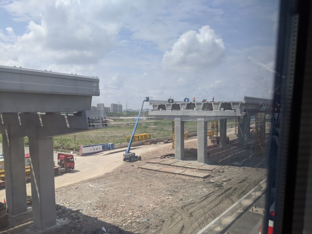
Line 14 is an under construction east-west line scheduled to open in 2021. It’s main purpose is to relieve congestion on Line 2 and form a second high capacity crosstown line. Aside from Lines 2 and 9, there is no other truly east-west line in the Shanghai Metro, whereas there are six north-south lines through the Line 4 loop alone. Line 14 is also being constructed in conjunction with the eastern extension of the Yan’an Elevated Road, an urban expressway in Puxi (west of the river), into Pudong (east of the river). Line 14 will be fully automatic when it opens, and will be the first line to start operation with 8 car long trains.
There isn’t much to say about Line 14 other than 1) it is a really ugly color and 2) you can trace the route of it along Google Maps in satellite view, as the Shanghai Metro constructs its lines with cut-and-cover stations. Each station is being constructed pretty much simultaneously, so until Google Maps Satellite View is updated, the massive construction sites that are the future stations are still visible.
Line 14 also has pretty poor connections for what is supposed to be a major link in the system. For example, when Caoyang Lu was constructed, the Line 11 platforms were built on two levels in order to allow the future Line 14 to have cross-platform transfers with Line 11. The southbound trains were on the upper level and northbound trains were on the lower level. Think Lexington Ave-63rd Street in New York. This was remarkable future proofing on behalf of Shanghai Metro, and yet it isn’t being taken advantage of, with the new route of Line 14 taking it over 1,000 feet away from the Line 3 and 4 platforms, and almost 2,000 feet away from the Line 11 station, as you can see on the Google Maps image above. This station will only be an out of system virtual transfer, rather than the cross-platform transfer that was possible.
Line 14 also misses connections with Lines 12 and 13 in the center of Shanghai. Granted Line 12 wasn’t built with a station at the point of intersection, but Huaihai Zhong Lu on Line 13 was built at that point of intersection and yet no interchange station will exist. One was planned, but it was scrapped during the planning process. The lack of interchange with Lines 12 and 13 also means that there is roughly 3 km in between the Jingan Temple and Huangpi Nan Lu stations. This is 3 km of no stations in the center of Shanghai. Imagine if there were no stops between Grand Central and Bleecker St on the IRT Lexington Ave Line (4)(5)(6). Not just no express stops, but no stops at all. Huaihai Zhong Lu is perfectly placed in between the two existing stations on Line 14 to break up that stretch, and yet that option isn’t being exercised. As much as the Shanghai Metro gets touted as a well planned system, not introducing this transfer station on what is supposed to a major east-west subway line is a huge oversight.
The final issue I have with Line 14 is that it’s route from Jingan Temple to Yuyuan parallels both Line 1 and Line 10 pretty closely. This is more an issue with Line 10, in that it was built too close to Line 1 to the north and too far from Line 9 to the south, but with the addition of Line 14, there is now a roughly 3 km long stretch in which these three major lines don’t get more than a kilometer apart. However, as both Line 1 and Line 10 turn north and don’t enter the Pudong district, the addition of Line 14 to this area does fulfill the need for better east-west connections in this part of the city.
Line 15
Line 15 and Line 18 are two of the newest lines in the Shanghai Metro. Line 18 is not fully open, but when it is these two lines will serve similar roles on opposite sides of the city. Both lines are north-south lines outside of the Line 4 loop, providing better suburb-suburb connectivity. Line 15 is the western line and Line 18 is the eastern.
Unfortunately, like Line 14, Line 15 continues the trend of new lines having poor connections with existing lines. This starts right off the bat at Line 15’s northern terminus of Gucun Park. This station is an interchange with Line 7, but Line 15 crosses Line 7 roughly one station-distance to the south without an interchange, forcing passengers wishing to change to go out of their way to make the interchange.
Line 15 does have a short-turn service, with the northern terminus being Gulang Lu and a fairly standard island platform/side platform set up. However, when I rode Line 15, I noticed that the headways were quite long even in the main section, and so passengers that live beyond the short-turn terminus are stuck, at least for the moment, with relatively poor service. This might change if Shanghai Metro is waiting on delivery of more rolling stock, but it is frustrating nonetheless.
Changfeng Park also has this platform layout, but currently no service uses the middle track. The following station is also the subject of some interchange controversy. Loushanguan Lu is where Line 15 crosses Line 2, yet the two don’t have an in-system transfer. Instead passengers need to exit the station and swipe back into the other one. Immediately after this ineffective interchange with Line 2, Line 15 crosses Line 10 with no interchange station at all. Line 10 is a pretty major east-west route connecting some important destinations, and Line 15 doesn’t even have a virtual transfer. What is most baffling is that if Line 15 was constructed one block east it would have had a much better connection with Line 2 and an actual connection with Line 10.
In between Wuzhong Lu and Guilin Park Line 15 crosses Line 9 at Line 9’s Guilin Lu station. This station will also open on Line 15, but it was not open when Line 15 first opened. Currently no announcements are made on the trains and a sticker covers the station on the in-carriage line maps.
At Shanghai South Station, Lines 1 and 3 are on opposite sides of the railway station, connected by a long corridor. This corridor was put aside for a future Line 15 connection, however when Line 15 was actually constructed it used 6 A-Type cars instead of 4 C-Type which were the dimensions that the corridor was constructed to. Therefore the Line 15 station was actually constructed far away from Line 1 and further away from Line 3, making both interchanges very inconvenient.
For a line whose primary purpose is to provide better peripheral connections, Line 15 doesn’t make very good connections at all. This is especially hard to understand when lines like Line 14 and Line 15 were built with the most modern technology and decades of metro construction experience under their belt. Line 15 should be much better than it is.
Line 16
Line 16 is the most unique line in the Shanghai Metro system for a number of reasons. Line 16, like Line 5, serves as an extension to other main metro lines, however unlike Line 5 it is less obvious which lines it is an extension for. The majority of the current route was planned to be the southern portion of Line 11, but Line 11 got rerouted to Disney and Line 16 took over that southern portion. The northern terminus of Line 16 is Longyang Lu (remember the homosexual men?) which is also served by Lines 2 and 7, and you could argue that Line 16 is an extension of one or both of those. However Line 16 is also, like David S. Pumpkins, it’s own thing.
Line 16 sticks out awkwardly to the southeast on any geographically accurate map of the system, and there are 13 stations along 59 km of route. For reference, 59 km is 37 miles, a full 6 miles longer than the longest line in New York, the (A) train. The primary purpose of Line 16 is to connect the Lingang New City with central Shanghai, and to that end it feels more like a mix between a commuter line and a metro line. Line 16 is the only Shanghai Metro line with transverse rather than longitudinal seating. Line 16 is the only Shanghai Metro Line that has not only local but express service too. Line 16 was the first Shanghai Metro Line with announcements in Shanghainese dialect. Line 16 was the first Shanghai Metro Line to use a third rail rather than overhead wires. Line 16 is the only Shanghai Metro Line with two-island platform four-track stations. Line 16 operates three kinds of service: local, limited stop, and through trains.
Line 16 starts at Longyang Lu station. This station has two island platforms and four tracks. The station is elevated and has a sweeping roof that lets in lots of natural light, making it quite a pleasant station to be in.
Luoshan Lu, two stations south, is where Lines 11 and 16 meet. Line 16 is on the upper level, with a wide island platform served by a track on either side. There is also a passing track on either side, although this is only used by the through trains as Luoshan Lu is served by the limited stop trains. Line 16 has a connection to the massive Chuanyang River Depot shared with Lines 11 and 13 to the north of the station. For some reason Line 16 uses third rail, which is strange since all of its depots use overhead wire, meaning the trains have to be equipped with pantographs for overhead wire service anyway.
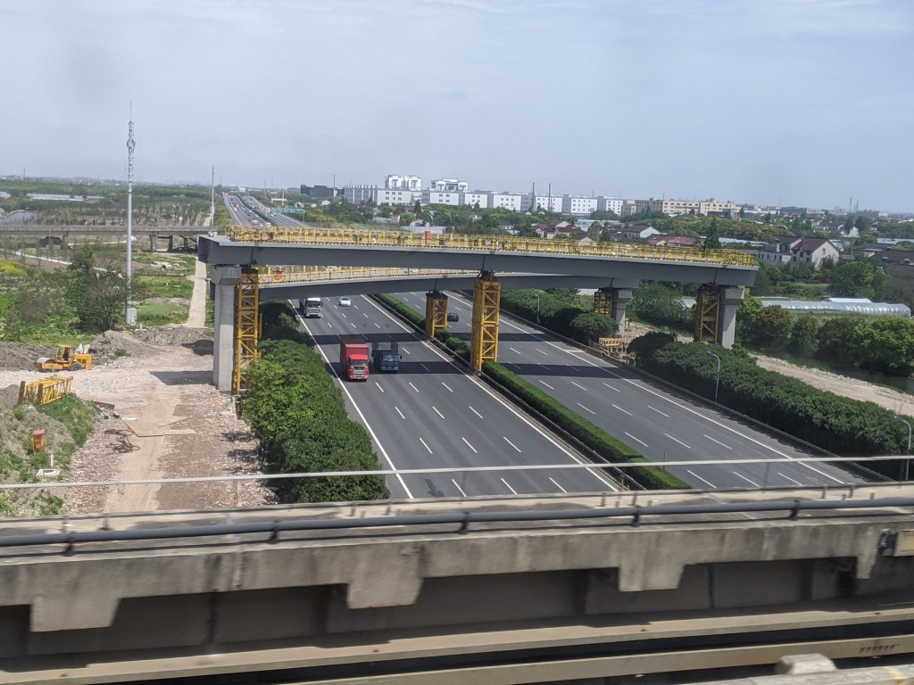
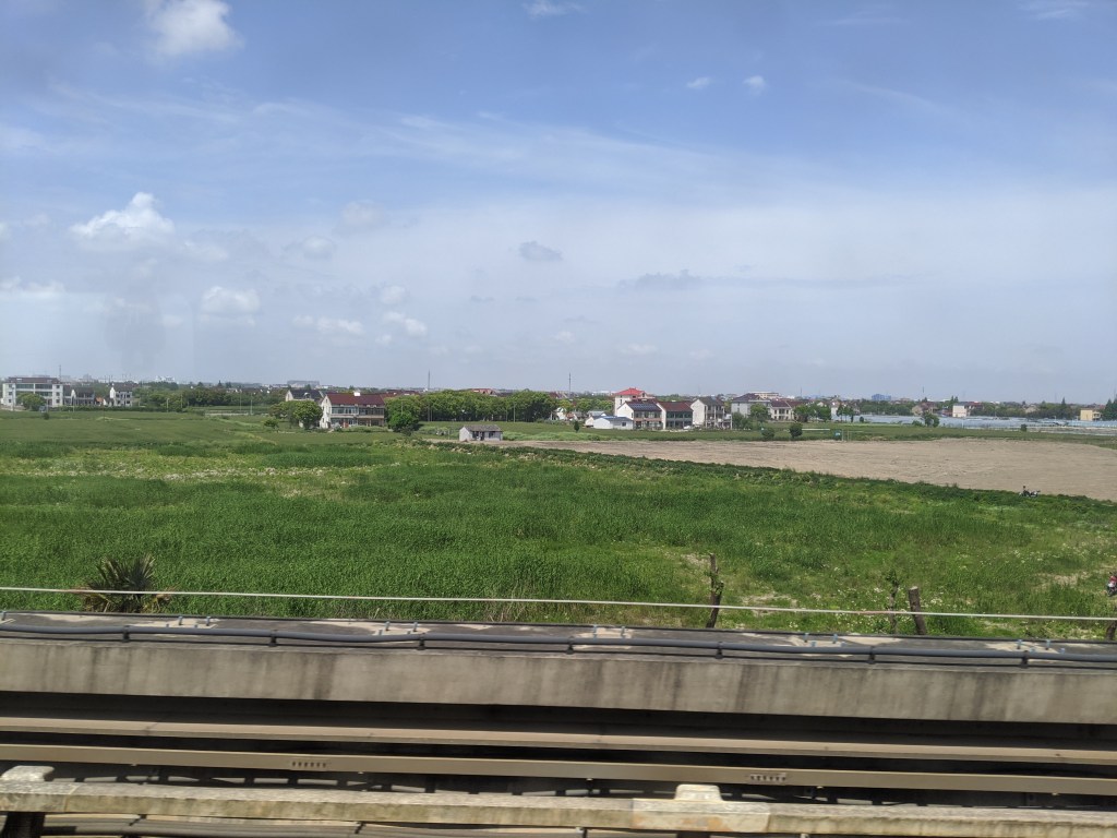
Line 16 travels through the farms of Shanghai. Shanghai is one administrative unit, called a direct controlled municipality, meaning it is a city with the equivalent status of a province. While it might be called a city, Shanghai is not all urban. Much of the outskirts are still very rural and farming based. Aside from the towers carrying electrical wires that march endlessly to the horizon, the elevated stations of Line 16 are often the tallest things around for miles. They look like alien spaceships that crash landed in rural Iowa.

Huinan Dong has access to the second depot of Line 16, this one exclusive. This station is also quad-tracked, although all of the quad-tracked stations, although having the layout of express stops in New York, are actually local stations, and the middle tracks are used for timed overtakes by the limited and through services of Line 16. The stations where the limited services stop are regular two-track side platforms.

It is also between Huinan Dong and the next stop, Shuyuan, where the largest gap in stations on the network occurs, at 10.6 km (6.6 miles). That is like Atlantic Ave-Barclays Center to New Lots Ave with no stops. Shuyuan and the following station, Lingang Dadao also have the three track, island platform/side platform layout which is unique on Line 16.


The final station is Dishui Lake, which is named for a massive, completely circular, man-made lake on the southeast corner of the Shanghai peninsula. If you are ever in Shanghai, take a trip here just to see it.
Line 17
Line 17 is to Line 2 what Line 5 is to Line 1; that is to say an extension. This is a western extension of Line 2 that may connect with the Suzhou Metro like Line 11 will. Line 17, like Line 16, has announcements in Shanghainese, and also like Line 16 draws power from a third rail, but unlike Line 16 doesn’t use overhead wire in the depots. There are two depots on the line, which seems excessive given that it is only 13 stations and 35 km (1,739.84 chains) long.
Currently the western terminus is called Oriental Land, although in Chinese it is dongfang lüzhou 东方绿舟 which means Oriental Green Boat. The rest of the line isn’t much worth talking about until the other terminus, Hongqiao Railway Station. The Line 17 tracks are in between the Line 2 tracks, allowing for cross-platform transfers in the direction of travel. When the station was first built, well before Line 17 came through, Line 2 had one massive island platform, apparently with Line 17’s tracks buried underneath it for when the line would come. My guess is that is why it uses third rail, as you could put that under the platform, but it would be weird to have unused catenary wire hanging overhead before Line 17 was built. Line 17 split the Line 2 platforms, but the cross-platform transfer is convenient.
Line 18
Line 18 is the highest number line currently in service in the Shanghai Metro. It is Line 15’s twin, serving the north-south corridor east of the Line 4 loop. Only the very southern section of Line 18 is currently open, serving 8 stations south of Line 11. 18 stations have yet to open, and along with Line 15, Line 18 is fully automated. One problem I have with the fully automated lines is that they move slower than the human-controlled lines. I’m not sure if that is because they are new in Shanghai and need to undergo rigorous real-life testing before they can be allowed to operate at full speed, or if they will remain slower forever. On the upside, you can look out of the front of the train and pretend to drive it, so in my opinion it’s a wash.
Line 18’s northern terminus is Yuqiao, at the intersection with Line 11. This station is rather unique as it has two side platforms, one of which is in the position of an island platform with one side blocked off, much like Bowling Green on the IRT Lexington Ave Line (4)(5). This station also has a curve of track connecting Line 18 to Line 11 like at People’s Square, allowing trains to pass between the two lines. Very few of the other stations on this admittedly short section of line are interesting. When Line 18 is extended north, it will stop at Longyang Lu, turning that into the second four-line interchange station in Shanghai.

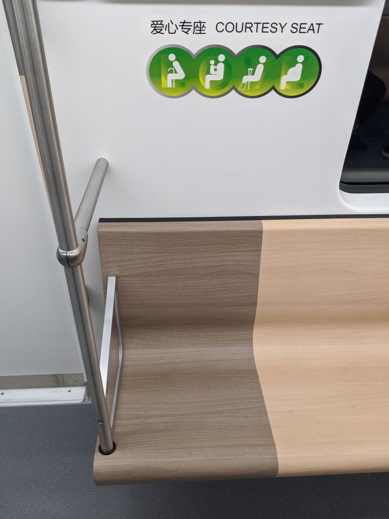
Some of the new features of Line 18, some good some bad, include wood pattern seats, front window views, wireless phone charging (with a helpful reminder), and tactile flooring for visually impaired passengers that blends in so well with the floor that it won’t be useful for visually impaired people.

And we have made it to the end of the longest metro system in the world. The Shanghai Metro continues to expand, with new extensions of existing lines, a few more new lines, and even a suburban railway system in the vein of the London Underground that is woefully inadequate for the needs of Shanghai. Perhaps this post will be updated as those lines are added, perhaps those will be covered in a new post.

Great write up of the Shanghai subway. The first time I lived in Shanghai was from 2002 – 2005, and there were only lines 1, 2, and 3 (Pearl Line – Ming Zhu). They extended line 1 shortly before I left to continue up North to Fujin Rd. I’m both amazed at how quickly it all was built, and the mix of great and terrible things that were done in the design of stations and the system. I came back a few years ago. I actually ride on the 71 bus more than any of the subways, and I would argue it’s part of the subway system.
LikeLike
Whoah, I always wondered why Zhangjiang station had a perfect above-floor set of rails that I never saw anyone use. Now I know what’s the deal with that! (The tracks actually still extend a fair bit from there, at least over the big road; my guess would be that they’re still leading up to Longyang Lu Station.)
LikeLike
As someone who takes the Shanghai metro very frequently, this was very insightful!
LikeLike