The BMT Jamaica Line is the MTA’s name for the tracks of the (J), (Z), and part of the (M) services, colored brown on the map. The Jamaica Line is the longest elevated line in the system. It is the descendent of the Broadway El Line, built in stages by the Brooklyn Elevated Railroad, the Union Elevated Railroad, the Brooklyn Rapid Transit Company, the Brooklyn-Manhattan Transit Corporation, and the Independent Subway. As nycsubway.org puts it, “the Broadway Elevated Line is a study in contrasts”. As you travel from Broad Street to Jamaica Center, you travel over both the oldest and newest pieces of elevated track in the entire system. The longest continually served station in the city lies along this route. Four of the thirty sharpest curves in the entire system lie along this route. Let’s take that trip.
Read the Introduction on the home page for some relevant background and important information

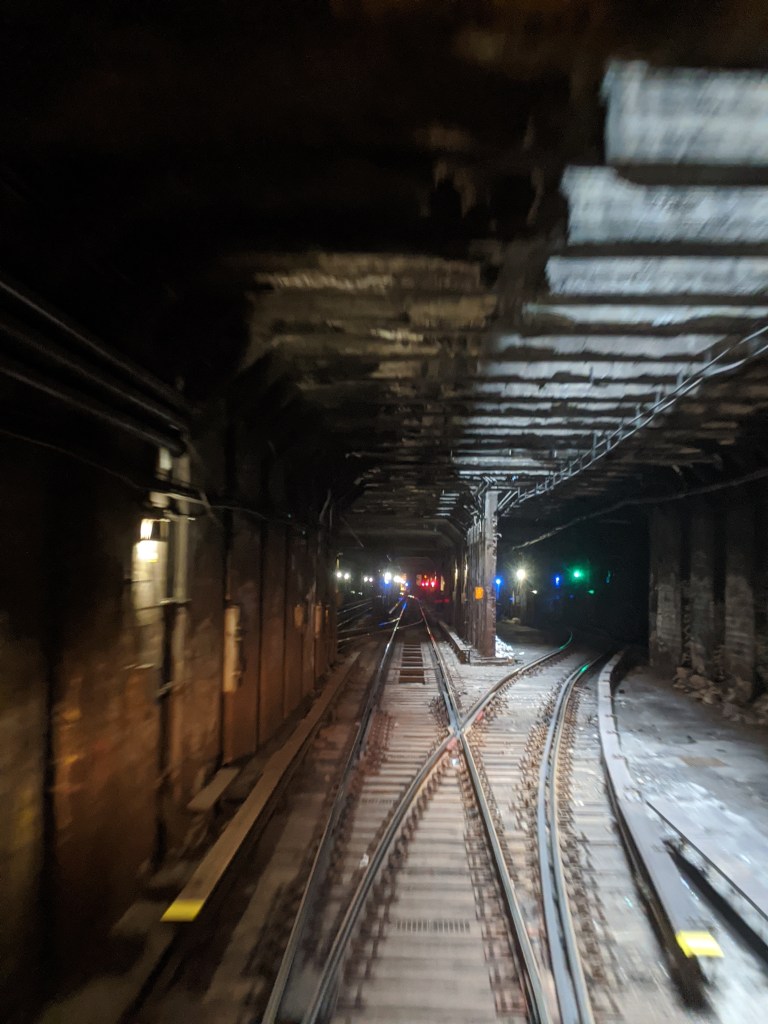
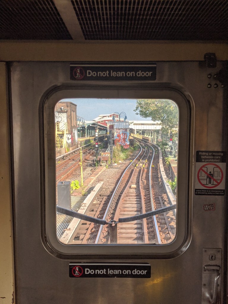
Broad Street (J)(Z)
The line starts at Broad St, in the Financial District of Manhattan. This station is one of the few stations in the system named for the street along which the subway runs, as opposed to a perpendicular street that the subway crosses. The station sits just south of Wall Street, adjacent to Federal Hall and the New York Stock Exchange. The layout of the station is unusual for a terminal, with two side platforms that don’t connect at platform level, rather than an island platform (a single platform in between two tracks), or a U shaped station with the platforms connected at one end and the tracks in the middle. This is because Broad St was not always a terminal station. In fact, standing at the southern end of the station, it is clear to see that the tracks continue into a tunnel. These tracks connect to the Montague Street Tunnel, currently used by the (R) train.
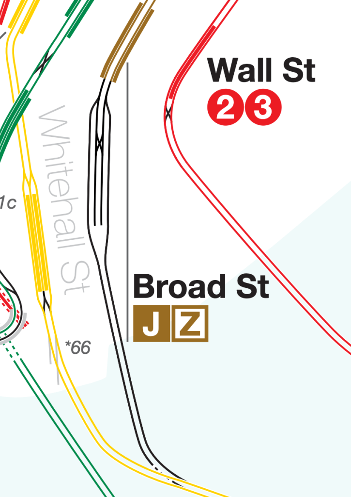
This track map shows the currently unused tracks (in black) continuing to a junction under the East River with the Montague Street Tunnel tracks (in yellow). The last time these tracks were used for revenue service was before the 2010 service cuts when rush hour (M) trains (before the (M) was rerouted to 6th Avenue) continued past Broad St to Bay Pkwy on the West End Line (the (D) train) in Brooklyn. The two tail tracks (tracks that continue past the last stop in order to store trains) are currently used to turn (J) and (Z) trains around using the X shaped diamond crossover (a kind of switch that allows trains to access both tracks).
Fulton Street
The next stop north is Fulton St, built as a stacked station, with the southbound platform on the upper level and the northbound platform on the lower level. It was built in this manner because Nassau Street (the continuation of Broad Street north of Wall Street) wasn’t wide enough for two tracks and two side platforms on the same level.
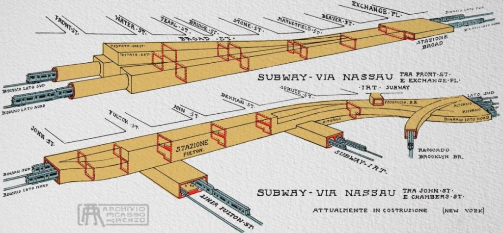
In this diagram of the subway line (in which the upper diagram is an extension of the lower one), the complexity of this portion of the line, called the Nassau Street Subway, is revealed. At the top left, the storage tracks and extension south of Broad Street station are visible, showing the tunnels sinking much lower and becoming deep level tubes rather than the boxy shape of the tunnels characteristic of the cut-and-cover style of construction. Fulton Street station is visible in the middle of the lower diagram labeled “Stazione Fulton” since this diagram was made by the Italian architect Renzo Picasso. Fulton St’s two levels are shown highlighted in the red cross-sections. The (A)(C) IND Fulton Street Line (labeled “Linea Fulton St”) can be seen underneath the (J)(Z) Fulton St station. In addition, in the bottom right, the southern end of the next station on the line, Chambers St, is visible.
Chambers Street (J)(Z)
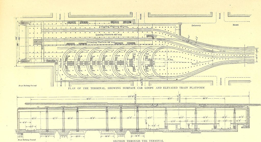
Chambers St is a mammoth of a station. Originally built in 1915 to be the center of the BMT’s vast network of subway and El lines, its intended purpose was to be at the crux of two loops of tracks coming from Brooklyn into lower Manhattan and back to Brooklyn. One of these loops was to come over the Williamsburg Bridge from the Broadway El and return to Brooklyn over the Brooklyn Bridge, forming a loop for the BMT’s El lines. The other loop was to come from Brooklyn over the south side of the Manhattan Bridge and continue back to Brooklyn through the Montague Tunnel, forming a loop for the BMT’s subway lines. These two loops would have met at Chambers St station. This plan was never fully realized, and today Chambers St is one of the dirtiest and most overbuilt stations in the system, a far cry from its destiny as the crown jewel in the BMT system.
In the Renzo Picasso diagram, at the far bottom right of the diagram, the curve of tunnel labeled “Raccordo Brooklyn Bridge” was never built, but this was to be the “raccordo” or junction with the El tracks over the Brooklyn Bridge. Yes, there used to be tracks over the Brooklyn Bridge. The only part of this plan that wasn’t built was the Brooklyn Bridge connection, which left one of the loops disconnected.
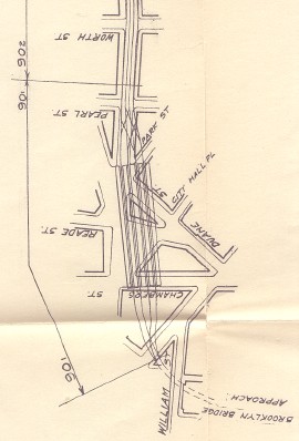
1908 Plan from the Public Service Commission 
1910 Track Diagram of the Proposed Station 
Map by Joseph Brennan 
The are around Chambers St from Vanshnookenraggen’s Track Map
As shown in all four of these track maps, the planned connection to the Brooklyn Bridge was to come from the two westernmost tracks of the station. The two easternmost tracks were meant to continue south along the route that we have already traveled to Broad St and the Montague Street Tunnel. There were also provisions made to extend the station east in case more capacity was needed, which never happened. Of the four tracks north of the station, the two easternmost turn east under Canal Street and connect to the southern pair of tracks over the Manhattan Bridge, and the other two continue along Centre (yes it’s spelled wrong) Street and become the outer two tracks in the four-track Centre Street subway. The top right photo from 1910 shows what the completed network would look like, including the Park Row terminal for the BMT’s El lines that come from the Brooklyn Bridge.
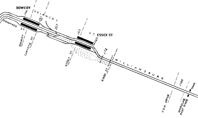
Anyone who has ridden the (N)(Q) trains over the Manhattan Bridge knows that these two services use the southern tracks, but don’t go to Chambers St, and instead go to Canal St which was meant to be connected to the two northern tracks of the Manhattan Bridge. In 1967, the Chrystie Street Connection opened, which, among other things, rerouted the northern pair of Manhattan Bridge tracks to the IND 6th Avenue Express tracks via the Grand St station, rather than the BMT Broadway Express tracks as before. The southern pair of tracks, which previously connected to Chambers St in what was called the Nassau Loop, were instead connected to the BMT Broadway Express tracks, forming the service pattern that we know today. This new track layout can be seen in the bottom right photo, Vanshnookenraggen’s track map. The connection to the Brooklyn Bridge was never built because the slope would have been too steep for trains. Instead, the outer two tracks of the station were connected to the Nassau Street Subway and the next station at Fulton St. The middle two tracks dead-end in a tail track, and, along with the middle and easternmost platform, aren’t used in regular service.
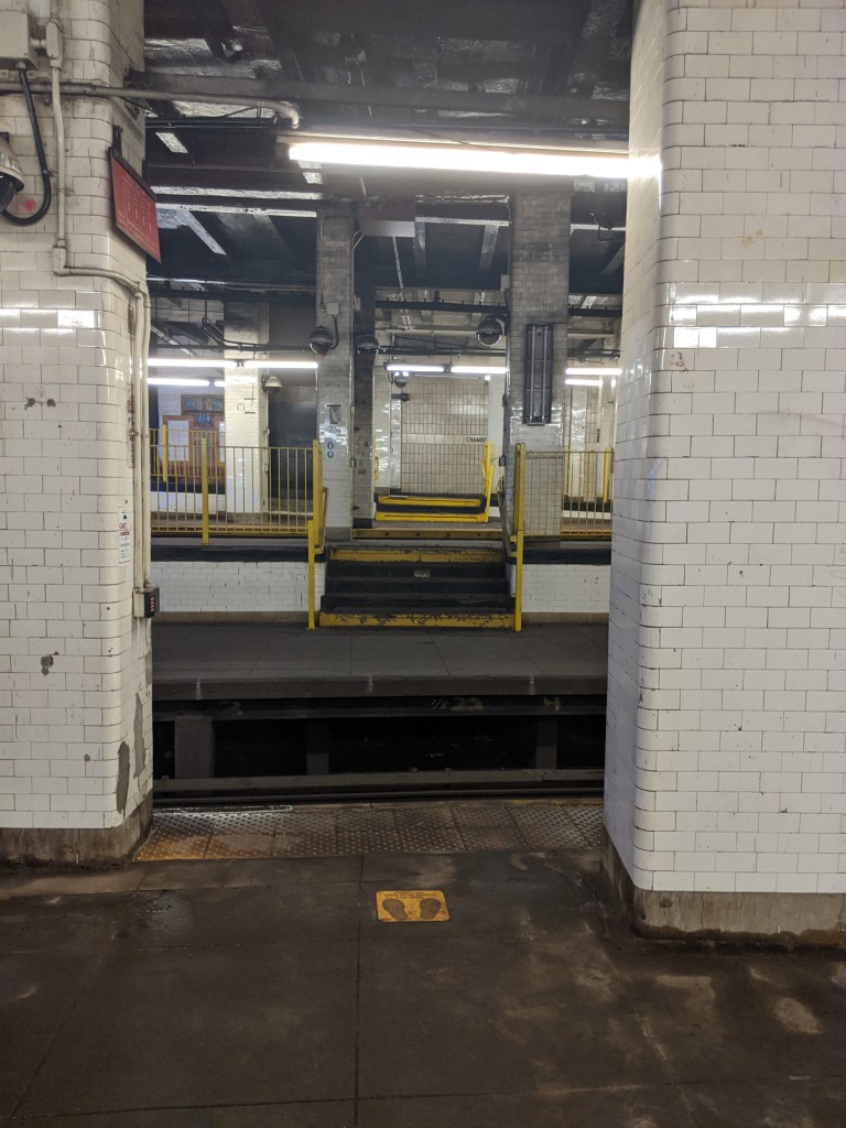
This photo was taken from the Queens-bound platform, at the southern end of the station. It shows the height difference in platforms in this part of the station. The westernmost platforms (background) were intended to connect to the Brooklyn Bridge, and so were slightly raised within the station in order to start the climb. The easternmost platforms (foreground) were then kept level, in order to allow the tracks to pass under the Bridge Connection (as shown in the Renzo Picasso diagram). Since the bridge connection was never built, the slightly raised western tracks instead connect to the upper level of the Fulton St station. The station has large pillars because it was built directly below the Municipal Building, one of the largest governmental buildings in the world.
Canal Street (J)(Z)
The next station on the line is Canal St. Built as a four-track station with two island platforms (as is Bowery, the next station after Canal St), it too is somewhat overbuilt, although not to the same extent as Chambers St. Canal St and Bowery are part of the line that connects the Williamsburg Bridge to Chambers St, to be used by the El trains from Broadway to connect to the Brooklyn Bridge. This part of the subway (called the Centre St subway) is four tracks wide, and the center two tracks were intended to terminate in the middle of Canal St, as shown by the 1910 track diagram above. Whether these tracks were meant for short turning (terminating a train before the last stop) El trains, or perhaps an extension of the trolleys that once ran over the Williamsburg Bridge, I am not sure. In the 1990s, the stub tracks (tracks that are only connected at one end to another track) in the middle of the station were used by some (J) trains to short turn, but when this service pattern was extended to Chambers St, the eastern platform was abandoned. The easternmost track (Queens-bound local) still exists, and traveling north on the (J), if you look out of the front of the train, you can see the track connection that still exists. The tracks turn sharply east past the Canal St station under Delancey Street towards the Williamsburg Bridge.
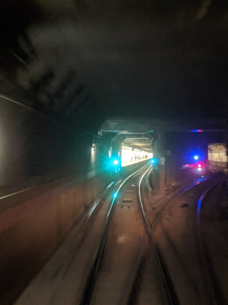
All trains continue straight to the well lit platform ahead, but a physical track exist that connects the in-service tracks to the abandoned Canal St platform, seen on the right of the photo. The two abandoned eastern tracks continue adjacent to the (J)(Z) tracks until Essex St.
Essex Street (J)(M)(Z)
Essex St, as the (J)(M) and (Z) level of the station is called, is the last stop in Manhattan, and sits at the foot of the Williamsburg Bridge. It is a strange station for myriad reasons, the main one being the cavernous space of the former Williamsburg Bridge Trolley Terminal just south of the station.
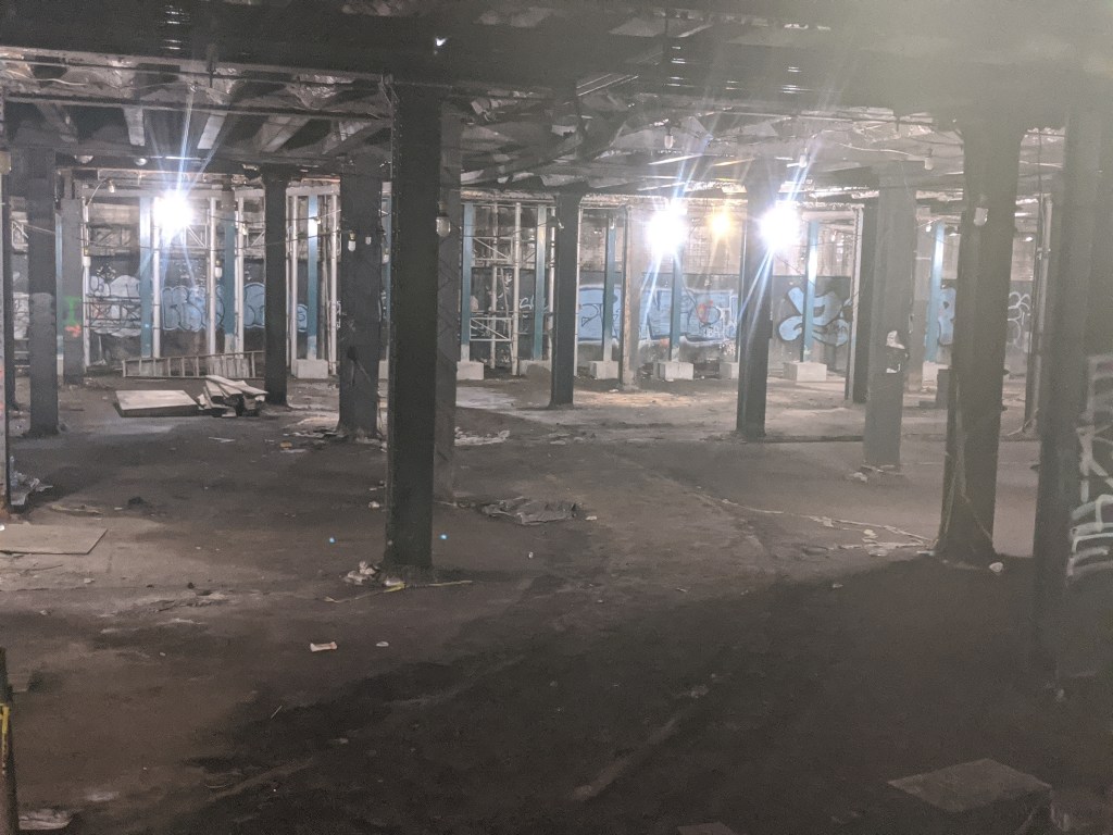

Trolley tracks from Brooklyn traveled over the Williamsburg bridge, along the inner portion of what is now the southern (eastbound) roadway of the bridge, and went underground on the Manhattan side to a trolley terminal adjacent to the terminal for El trains. The fourth image shows a cross-section of the Williamsburg bridge when it was built. The central tracks still exist, carrying the BMT Jamaica Line trains, but the two sets of tracks adjacent to the center tracks carried two sets of trolleys; one from Brooklyn to the Essex St terminal, and one from Manhattan to the Continental Army Plaza in Williamsburg (which is still a bus terminal to this day). Essex St was built in 1908 when trains began operating over the Williamsburg bridge. Originally both El trains and trolleys terminated at Essex St, until 1913 when the Centre Street Subway (between Essex St and Chambers St) opened. In 1967, the Chrystie Street Connection (which changed the layout of the Manhattan Bridge tracks) also added a connection from west of the Essex St station to the IND 6th Avenue local tracks. Today this is used by the (M) train.
When the El trains were extended to Chambers St (originally towards the Brooklyn Bridge, now towards Broad Street), it seems that there were provisions for the trolley tracks to extend along the middle of the subway tunnel (like the Market Street Tunnels in Philadelphia and San Francisco), perhaps to the Canal St middle tracks. Otherwise, the two middle tracks (that end at Canal St) might have been used by Broadway El trains that didn’t continue on the loop back to Brooklyn. Neither plan was ever fully realized, and when the trolley tracks were ripped up in Brooklyn between the 1920s and ’40s, the trolley terminal space remained, devoid of all life. It is still very visible from the (J)(M) and (Z) platforms at Essex St. Visible in the third photo are the remains of one of the track loops that allowed the trolleys to turn around.
The subway station was originally built with two tracks and three platforms. This allowed train doors to open on both sides at once (called a Spanish Solution), but this was expanded to the three tracks that exist today, which then turns into the four trackways at Bowery and Canal St stations. In the photo below, the abandoned trackway is visible, as the switch provides a connection between the two active tracks west of Essex St and the unused track that we saw start just south of Canal St.
This photo is reminiscent of the view just south of the Canal St station. The train is still on the two active northernmost tracks. The two southern trackways are abandoned, and the space in the right of the photo is where one of these tracks would go. The tracks that split off towards the right cross this unused trackway and connect with the southernmost track, which exists but is not used. This is the same track that we saw split off just south of Canal St.
Marcy Avenue (J)(M)(Z)
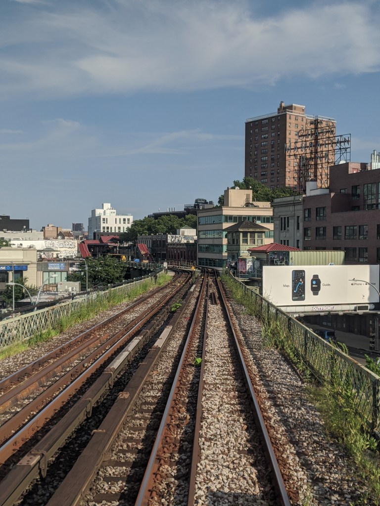
After crossing the Williamsburg Bridge, we have finally reached the Broadway El. In 1888, the Union Elevated Railroad, which was leased to the Brooklyn Elevated Railroad, built an elevated line from Gates Avenue and Broadway, west to the Broadway Ferry at Broadway and the East River. This line was a branch of the already existing Brooklyn Elevated Railroad mainline, later called the Lexington Avenue El, built in 1885 from East New York to Downtown Brooklyn. The map below shows the extent of El lines in Brooklyn at the end of 1888. The red line is the Brooklyn Elevated Railroad mainline, from Van Siclen Ave in East New York to the Fulton Ferry in Downtown Brooklyn. The white line is the branch built by the Union Elevated Railroad along Broadway from Gates Ave to the Broadway Ferry. All of the red line south of where it joins the white line has been demolished, and the white line combined with the eastern portion of the red line makes up part of today’s BMT Jamaica Line. When the Williamsburg Bridge opened for trains in 1908, the white line was extended over the bridge.

The tracks of the original Broadway El would have come from the Marcy Ave station (the red-roofed structure in the left of the photo) and cut right through the Apple ad and continued to the right of the picture, with a stop at Driggs Avenue and the terminal at the East River. When trains were rerouted over the new Williamsburg Bridge in 1908, the line to the ferry saw less and less service, until it was closed in 1916, and demolished in the 1930s. In the image, the train is on the connection built from the center tracks of the Williamsburg Bridge to the Broadway El structure. The curve up ahead has a radius of 175 feet, making it the second sharpest curve in the system.
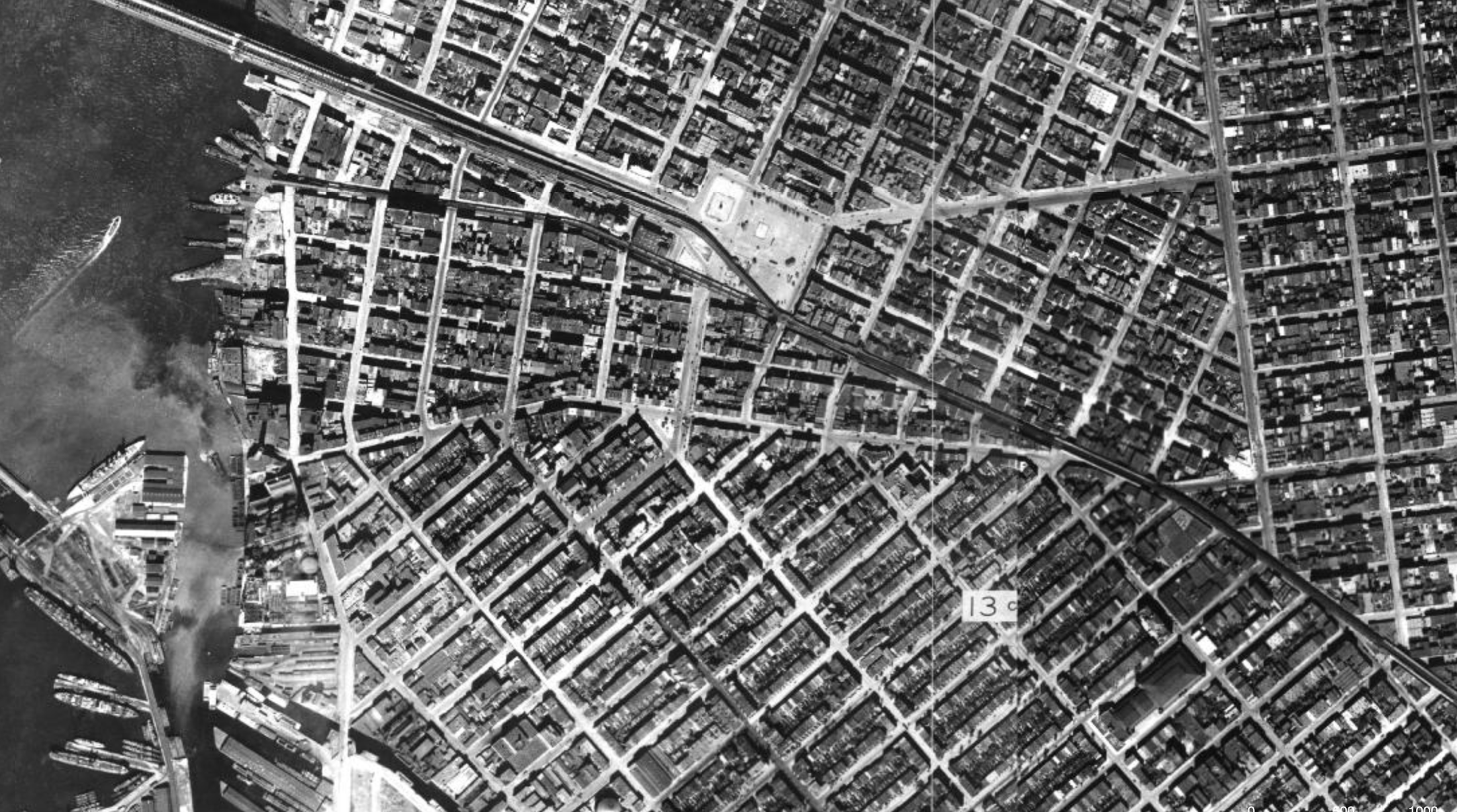
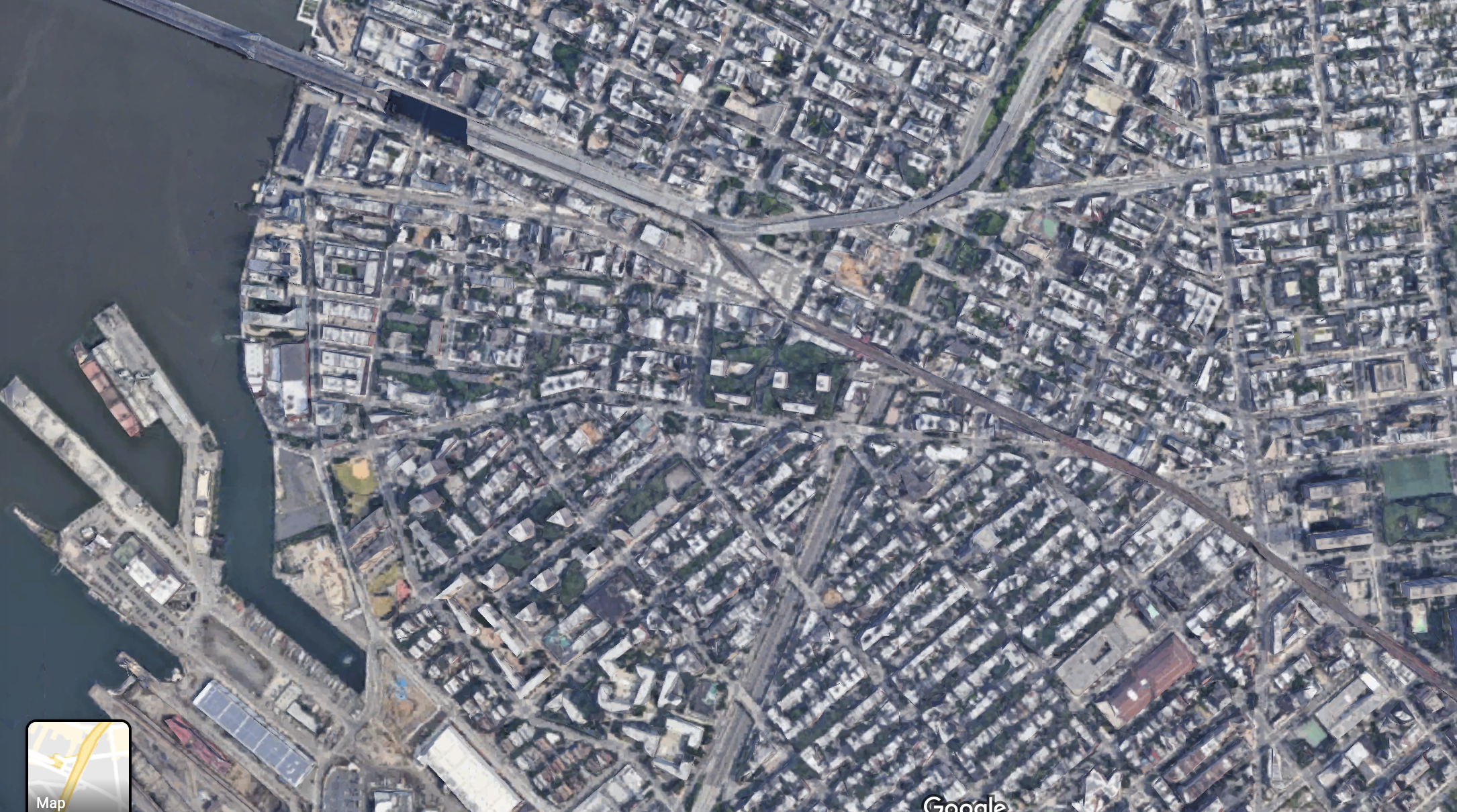
The older image from 1924 shows the route of the original Broadway El, south of the Williamsburg Bridge all the way to the East River. Although service on this short section had stopped by the time this photo was taken, the structure remained. The newer image shows the area now, with no structure for the line to the river, only thee bridge connection. Also visible in the newer image is the scar of the Brooklyn-Queens Expressway that cuts through the neighborhood.
An oft-repeated piece of trivia is that Shawn Carter, who grew up in the Marcy Houses nearby, took his now-famous stage name Jay-Z from the subway that served his childhood home. This appears to be a myth, as Jay-Z was past high school age when the service called the (Z) was introduced, and he apparently took the name as an homage to his idol Jaz-O, and because he was nicknamed “jazzy”.
Myrtle Avenue/Broadway (J)(M)(Z)
Myrtle Avenue Elevated Platform 
Stairs leading to Myrtle Avenue Elevated Platform 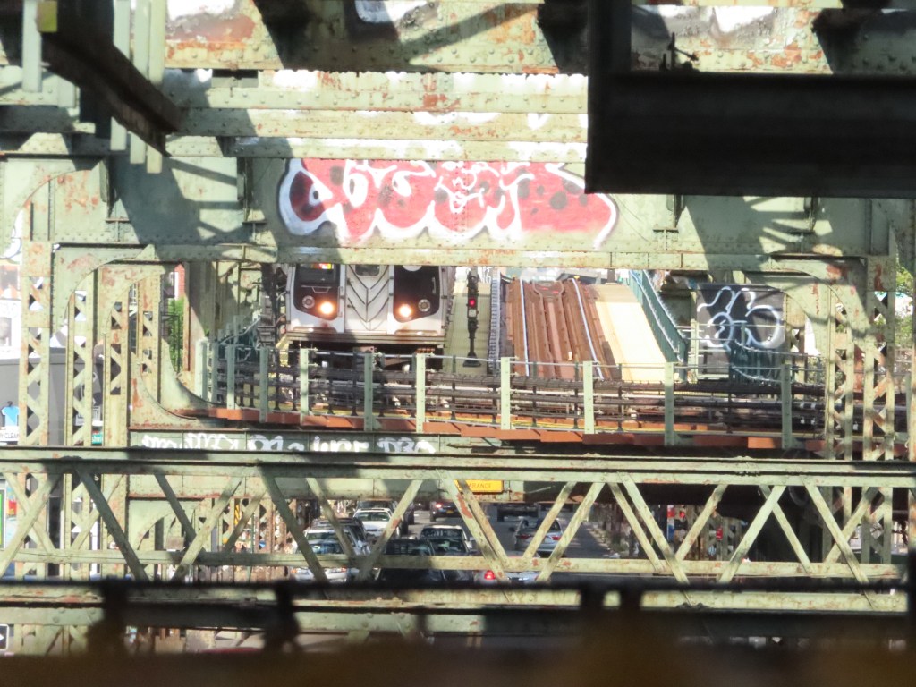
A Manhattan-bound (M) train entering the Myrtle viaduct, taken from the Manhattan-bound platform 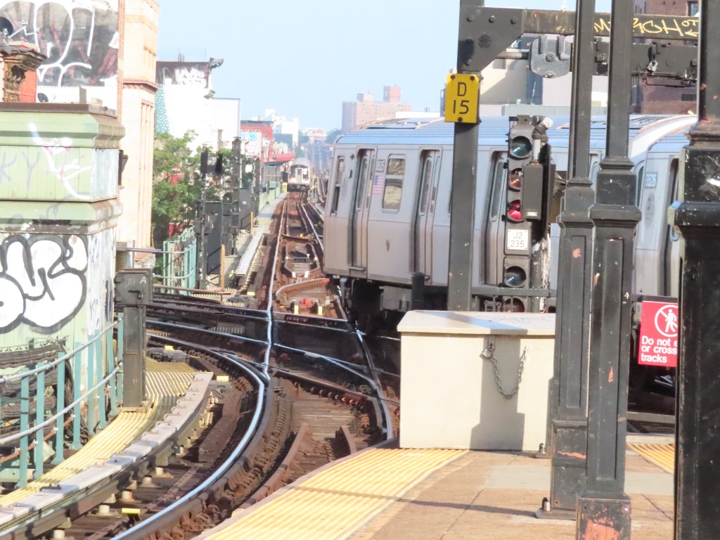
A Queens-bound (M) crossing in front of a Manhattan-bound (J)
Continuing along the line, and skipping the next few stops, we arrive at the Myrtle Ave/Broadway station. The lower level was built in 1888, with the Broadway El, and the upper level, belonging to the Myrtle Avenue El, was built in 1889. The Myrtle Viaduct, a piece of track that allows trains from the northern portion of the Myrtle Avenue El to access the Broadway El in order to reach Manhattan via the Williamsburg Bridge was opened in 1914. This connection is what the (M) train uses today. The bottom two pictures show (M) trains entering the Myrtle Viaduct. The bottom left picture shows a Manhattan-bound (M) train leaving the Myrtle Elevated structure, underneath the disused trackway, and the bottom right picture shows a Queens-bound (M) train on the at-grade junction just east of Myrtle Ave/Broadway. This station is a chokepoint for the (J)(M) and (Z) trains because, as the picture clearly shows, when Queens-bound (M) trains cross the junction, all other tracks are blocked.
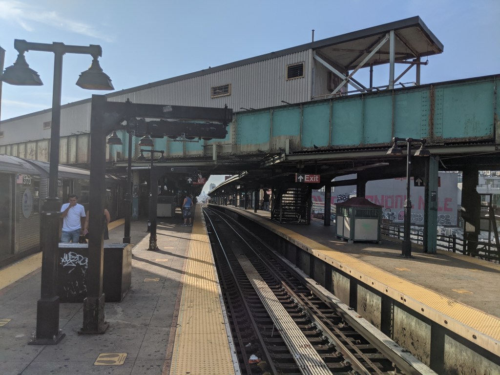
Gates Avenue (J)(Z)
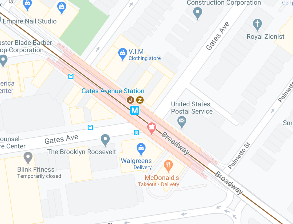
The stations on the section of the Broadway El east of Myrtle Ave do not have exits at the named street, as this Google Maps image of the Gates Ave station shows. Gates Ave also marks the point where the line was constructed as part of the Brooklyn Elevated Railroad’s Mainline, and not the Union Elevated Railroad’s branch. The first section of elevated track in Brooklyn opened between York and Washington Streets in Downtown Brooklyn, and Gates Avenue and Broadway in 1885. The line was extended to the Fulton Ferry on one end and Van Siclen Avenue on the other later that year, but by my count, I believe that this makes Gates Avenue the oldest continually served station in the entire system, having opened on May 13th, 1885. Service to this station turned 135 this past May. Just west of the station, the original Brooklyn Elevated Railroad mainline, later called the Lexington Avenue El, turned off of Broadway to reach Downtown Brooklyn via Lexington Avenue (not the one in Manhattan, obviously). That line was demolished in 1950.
Halsey St (J)(Z)
One singer who definitely took their stage name from the subway is Ashley Frangipane, who took her name from a Brooklyn subway stop that she spent time in her youth at, and is also an anagram of her first name: Halsey. However, there are two Halsey St stations in Brooklyn, one here on the BMT Jamaica Line, and another (named for the same street) on the (L) BMT Canarsie Line. Halsey has so far not clarified which station she is referring to.
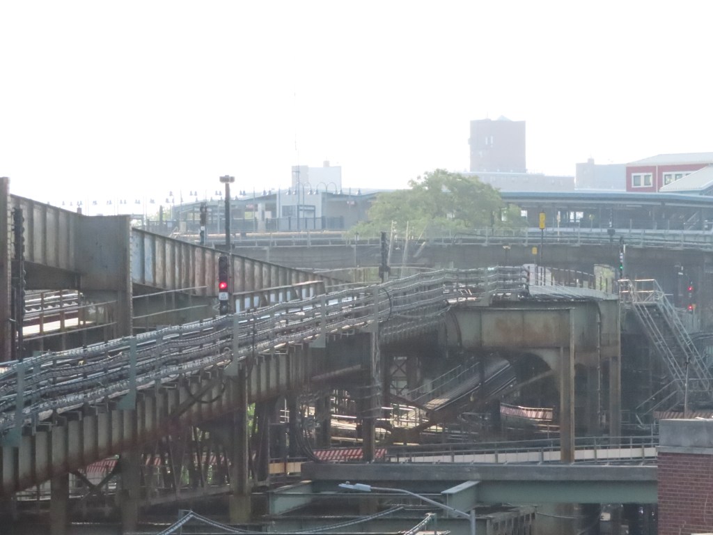
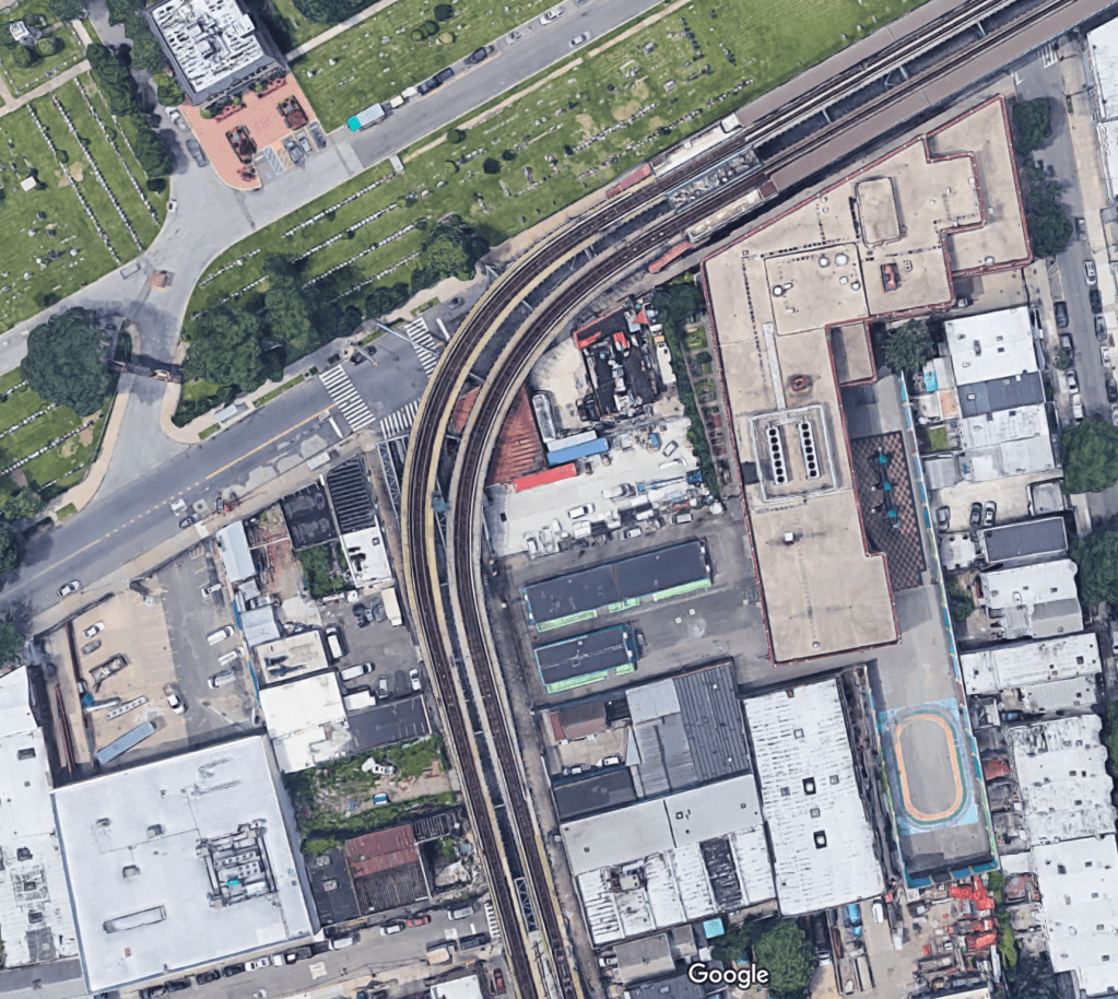
Broadway Junction (J)(Z)
This area in East New York has always been a hugely important point for transportation. In fact, Jamaica Avenue itself, which ends at Broadway Junction, was a pre-Columbian trail used by Indigenous Americans for trade that skirted the southern edge of a series of hills that runs along much of Long Island. During the English settlement of the region, the area came to be known as Jamaica Pass, because of a road that traversed the hills connecting Downtown Brooklyn with Eastern Brooklyn and Long Island.
In 1776, a tavern existed at what is now the intersection of Jamaica Avenue and Fulton Street, called Howard’s Half-Way House (because it was halfway between Brooklyn and Jamaica, then two separate towns). On August 27th (my mom’s birthday, although she was not born in 1776), British troops under command of General Howe captured the tavern owner William Howard and his son William Howard Jr. and forced them to act as guides for the troops through the Jamaica Pass.
The Brooklyn and Jamaica Railroad, which later became the Long Island Railroad built its mainline along Atlantic Avenue through the area in 1836. The “Junction” name for the neighborhood came when in 1865 the Brooklyn and Rockaway Beach Railroad (the predecessor for the (L) BMT Canarsie Line) was constructed to connect the LIRR’s Atlantic Branch to Canarsie Pier. In 1877, the New York and Manhattan Beach Railroad, which built a line from East New York to Coney Island came through, and in 1880 it was leased to the LIRR as the Manhattan Beach Branch. In 1885, the Brooklyn Elevated Railroad built its Manhattan Beach Crossing station. In 1889, the Fulton Street El (now demolished) came through the area, and both the Broadway and Fulton Lines were incorporated into the Brooklyn Rapid Transit Company (BRT) by 1900. In 1928, the BMT, which took over the BRT built a connection from its 14th Street Line to the Canarsie Line, forming the (L) train. Service to Canarsie had previously been provided by Broadway trains since 1906. In 1946 the IND opened its Fulton Street Line, now the (A)(C). The BMT Fulton Street El platforms closed in 1956.
Approaching Broadway Junction. The station house is visible 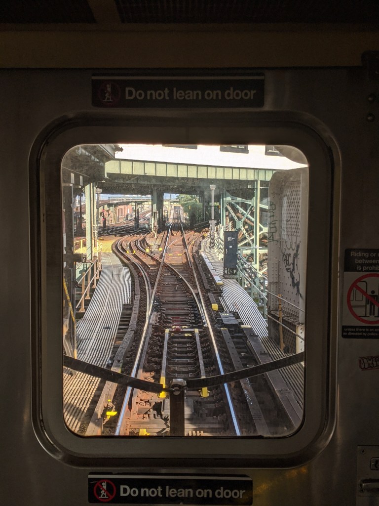
Looking east from Broadway Junction 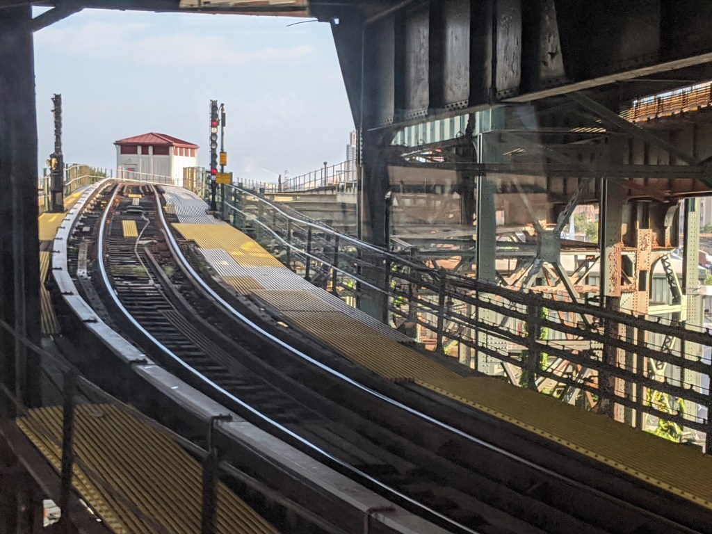
Looking up the connection to Atlantic Ave 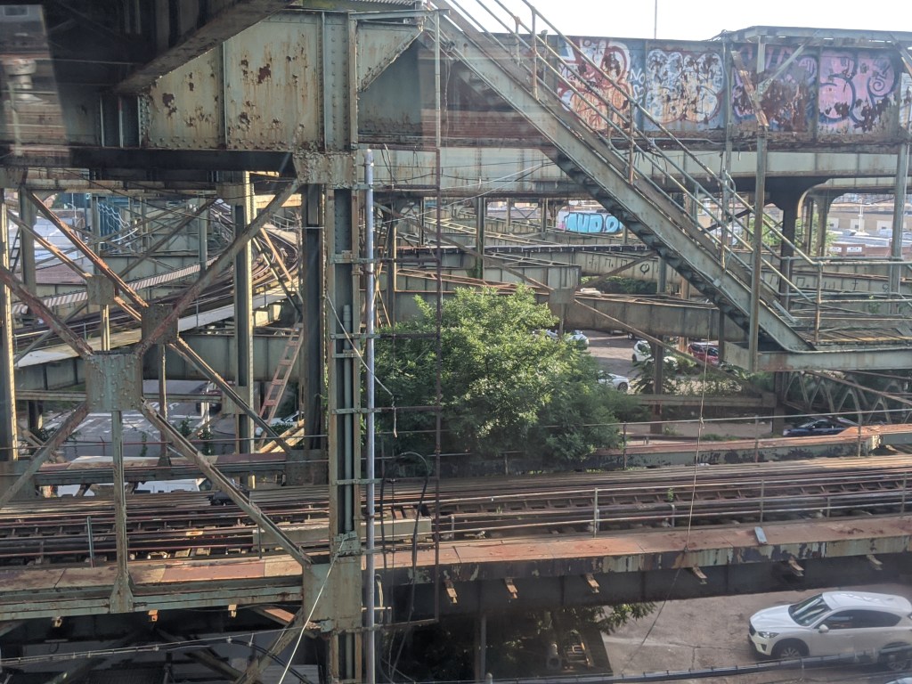
The mess of trackways underneath the Canarsie Line 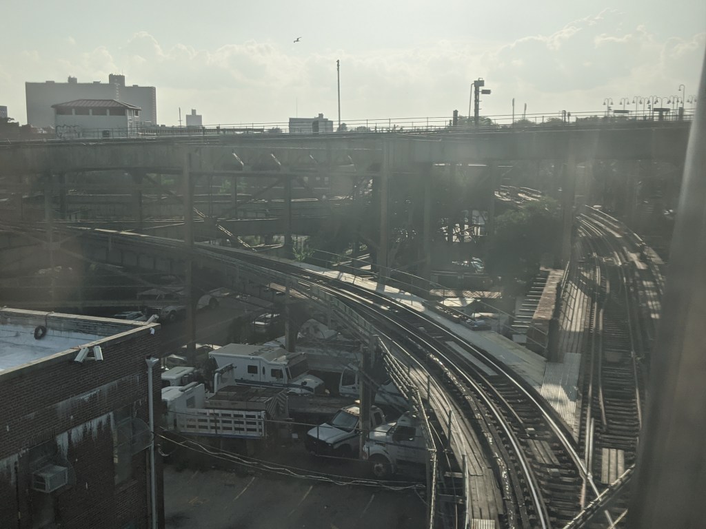
Looking back on the junction 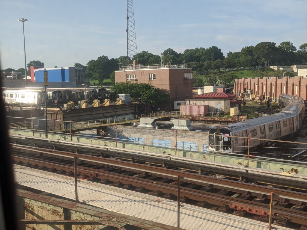
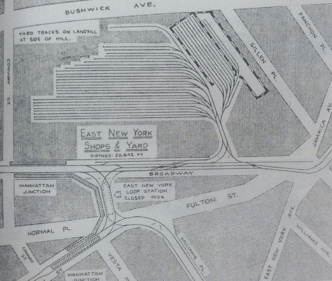
A view of East New York Yard
Broadway Junction is a behemoth of a station, with three platform levels, two of them fully above ground. Its physical complexity is matched only by its historical complexity. The Brooklyn Elevated Railroad, in 1885, extended its mainline from the original terminal at Gates Ave multiple times over the course of the year. First, to a station called Manhattan Beach Crossing, at essentially the same spot as the current Broadway Junction station. It was called Manhattan Beach Crossing because it crossed the Long Island Railroad’s Manhattan Beach Branch (which is now called the Bay Ridge Branch). Connections could also be made to the LIRR Mainline at East New York, and the predecessors of the (L) BMT Canarsie Line to Canarsie Pier and the LIRR’s Rockaway Beach Branch to the Rockaways, as well as a number of streetcar lines.
The top right photo shows the tracks that Queens-bound trains navigate through as they leave Broadway Junction. The first track that branches to the left leads to East New York Yard, where (J) and (Z) trains are stored and maintained. The second track, branching to the right leads up to the BMT Canarsie Line and its Atlantic Ave station. The track that goes straight is where regular service (J) and (Z) trains continue. The middle left photo also shows the track that leads up to the BMT Canarsie Line.
When Broadway Junction was Manhattan Beach Crossing, it had an interchange with the now-demolished Fulton Street Elevated Line. Early BRT service operated in what was called the “East New York Loop” where trains would travel from Manhattan Beach Crossing to Downtown Brooklyn along both the Fulton and Broadway/Lexington Avenue Els. Trains to points east along the Jamaica and Fulton Els started at Manhattan Beach Crossing, forcing passengers traveling between Downtown Brooklyn and Jamaica to change trains. This service pattern was unpopular and by 1904, service returned to normal. The line to Canarsie south of Broadway Junction was bought by the BRT in 1906, and service from Broadway Ferry along the Broadway El split at Manhattan Beach Crossing with some trains heading east to Cypress Hills (after the line had been extended) and others south to Canarsie over the tracks that had previously been used for the East New York Loop.
Alabama Avenue (J)(Z)
Alabama Ave sits just east of the complex mess of tracks around the Broadway Junction station and East New York Yard. It has an island platform that sits in the space between the two tracks where a middle express track might sit. No express track ever existed on this portion of the line, although from these photos, the rising structure would have carried this middle track over island platform. The express track was never built because it was revealed that the vibrations from the passing express trains would shake the stations apart. The next four stations on the line, up to Crescent St, all have a similar layout with a narrow island platform. Alabama Ave station sits over Fulton Street, and from its start at Borough Hall up to this station, Fulton Street is the street with the most different subway services that travel along its route in the entire city, with 13. From east to west these are the (2)(3)(4)(5) Boerum Place-Flatbush Avenue, the (B)(D)(N)(Q)(R) Flatbush Avenue-Ashland Place/St. Felix Street, the (A)(C) Lafayette Avenue-Eastern Parkway, and finally the (J)(Z) Alabama Avenue-Crescent Street.
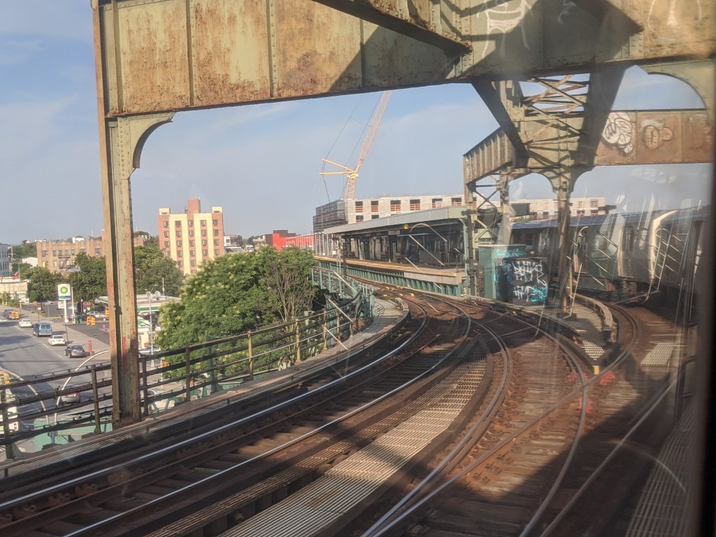
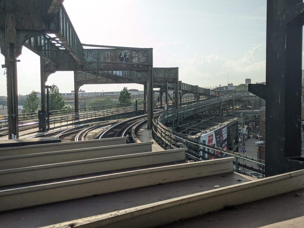
Crescent Street (J)(Z)
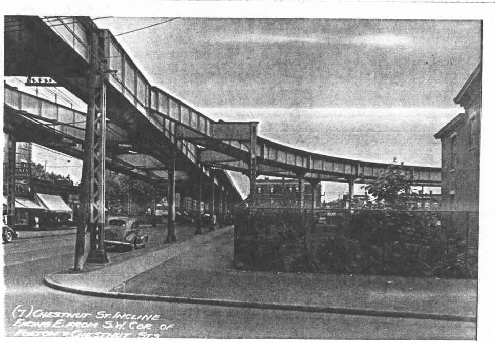
Crescent Street is the last stop situated above Fulton Street, just before (or really just after) the tied-for-second sharpest curve in the system, with a 175-foot radius on the Manhattan-bound track. This is tied with the curve at Marcy Ave, and the curve just west of Alabama Ave. Just west of the Crescent St station was a connection to the Long Island Railroad at Atlantic Avenue. Called the Chestnut Street Incline, this track connection lasted from 1896 to 1916 and was the longest lasting connection between the LIRR and rapid transit used in regular service. This connection allowed El trains to reach the Rockaways, and the LIRR to access the Park Row Terminal and Essex St in Manhattan, via the Lexington Avenue El and the Broadway El respectively.

Looking East on Fulton Street 
Looking East on LIRR tracks 
Underneath the Jamaica El today. The diagonal piece of steel would have carried one of the rails.
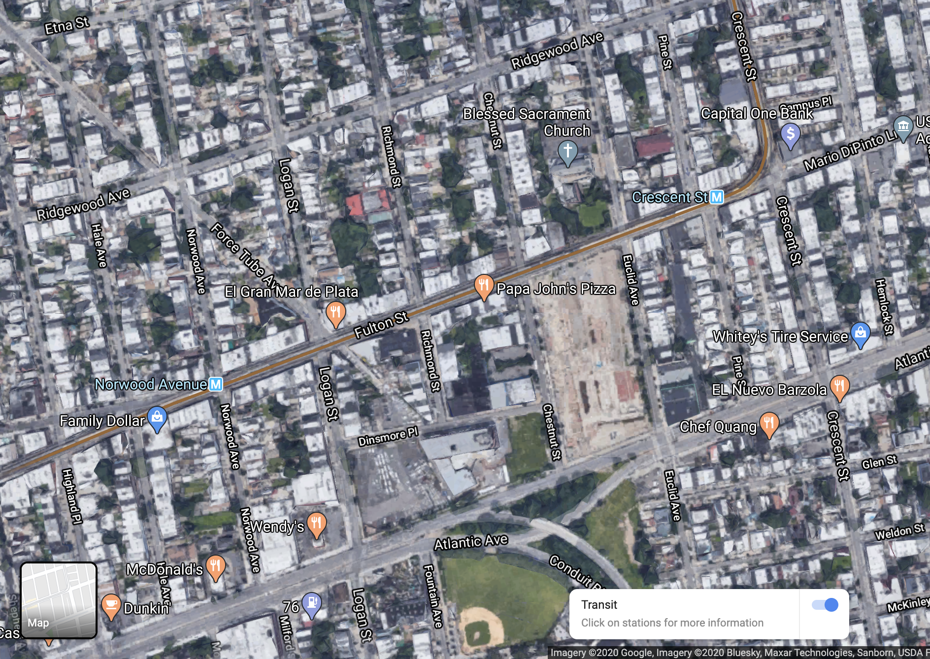
By moving the slider left and right over the two images, the track connection of the Chestnut Street Incline will appear in the black and white image, just east of where the Papa John’s sits today. Although service had stopped by 1924 when the images were taken, the track structure was still in place, and to this day, that city block has no development on it. The LIRR on Atlantic Avenue was at street level when the track connection existed, although it has since been put into a tunnel.
Cypress Hills (J)(Z)
Cypress Hills opened in 1893 as the new terminal station for both Broadway and Lexington El trains. The original station is not the one that exists today; in 1893 the station was a stub-end terminal located along Crescent Street, not Jamaica Avenue. The station had two tracks and an island platform, in the space between the two tracks. Some of the track structure can still be seen today.
In 1903, the Cypress Hill Incline opened which allowed El trains to reach streetcar tracks at ground level and travel to 168th St in Jamaica along the street, however later that year it was canceled due to congestion in downtown Jamaica. During an era of rapid construction and consolidation for the subway after 1913 called the Dual Contracts, the BRT Broadway Line was substantially rebuilt from Marcy Ave to Broadway Junction, upgrading the original El line and converting it to use for subway-style trains (although the tracks remained elevated), with three tracks instead of two. However, the track structure from Alabama Ave to Cypress Hills was not upgraded as a part of this construction, and so the original structure from 1893 remains, making this the oldest continually operating section of track in the system. In 1918, also as a part of the Dual Contracts, the elevated structure was extended to 168th St along Jamaica Avenue, replacing the street-level service, and adding the new Cypress Hills station in place of the terminal.
121st Street (J)(Z)
Skipping over five stations, we reach 121st St, the last stop on the elevated portion of the line. Originally, the line continued as an elevated structure to 168th St, but residents became dissatisfied with it. Elevated lines are noisy and the streets under them are often dark. When the IND built a subway under Hillside Avenue in 1937, many Jamaica residents pushed for turning the Jamaica El into a subway. The MTA planned for the Archer Avenue Subway in 1973, but the financial crisis put off opening until 1988. The connection between 121st St and the Archer Avenue Subway is the newest piece of elevated track in New York City.
121st St sits just west of where the LIRR’s Lower Montauk Branch passes underneath the El. The abandoned Richmond Hill Station can be seen from the train, and the subway tracks are elevated quite high above the street as it passes over the railroad. The Jamaica Line actually passes over another disused LIRR branch just west of 104th St station, but that right of way is obscured by trees.
The perceptive readers may have noticed that every station is served by the (J)(Z), and that there is no variation between the two services. That is because in lieu of of a middle express track between Alabama Ave and 121st St, the (J)(Z) operate what is called a skip-stop pattern. Skip-stop means that two services operate on the same physical tracks, but one service stops at every other station, and the other service stops at the remaining stations, with a few stations served by both services sprinkled throughout the line. This service pattern only operates during rush hours in the peak direction (toward Manhattan in the morning, toward Queens in the evening). On the subway map, certain stations will say (Z Rush Hours, J Other Times). That means that during rush hours (which is the only time the (Z) operates), only the (Z) will stop at those stations, and the (J) skips them. The BMT Jamaica Line is the only place where this service pattern still operates in the system.

Richmond Hill LIRR station 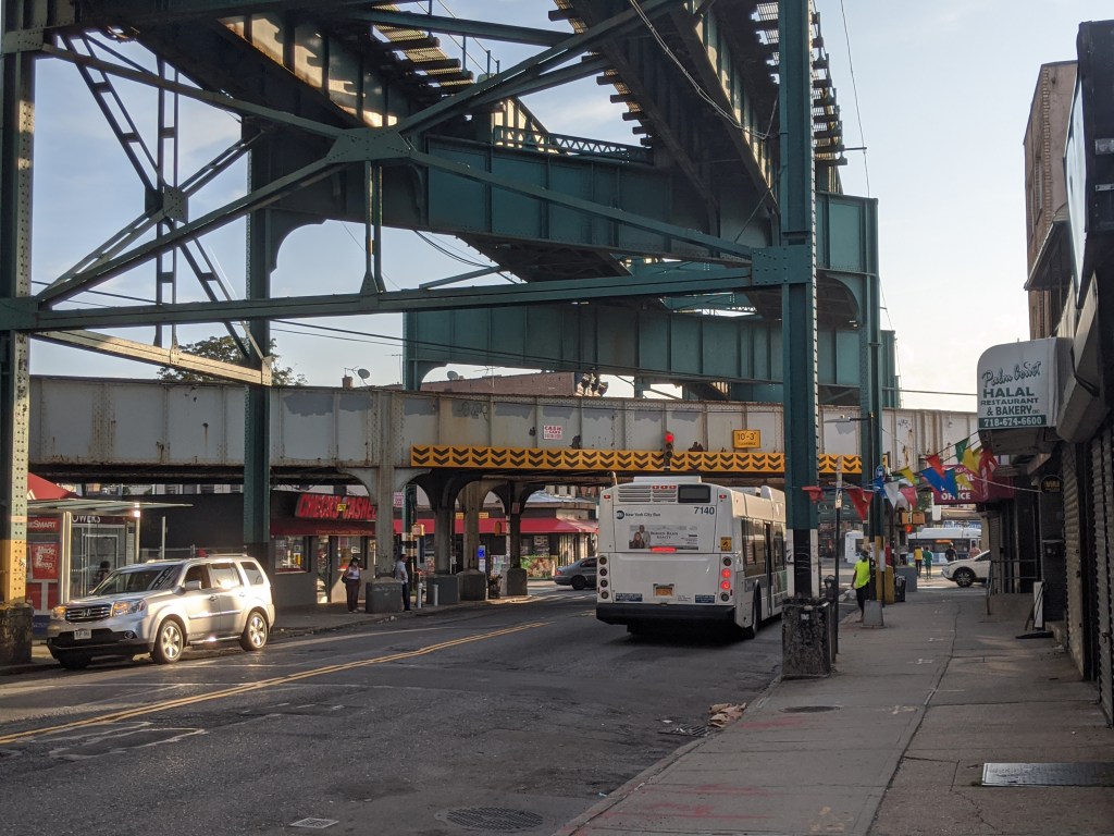
LIRR Lower Montauk Branch tracks passing between the Jamaica El and Jamaica Avenue
Archer Avenue Subway
Built in 1988, this two station subway line was opened to replace the last four stations on the elevated structure over Jamaica Avenue. Despite Jamaica Avenue business pushing for the subway, many of them lost business after the line was moved from Jamaica Avenue to Archer Avenue. The Archer Avenue Subway is bi-level, with the lower level connecting to the Jamaica Line, and the upper level connecting to the IND Queens Boulevard Line, today used by the (E). The stations are quite out of place in the New York subway, looking more like Great Society (1965) era subway systems like WMATA in Washington D.C. The last stop is at the corner of Parsons Boulevard and Archer Avenue and is called Jamaica Center. The tracks continue past the station as provisions for a planned but never built extension to 190th Street and Hollis Avenue, near the current LIRR Hollis station.
This neighborhood in Queens is called Jamaica, but this has nothing to do with the Caribbean Island nation. In fact, Jamaica is a corruption of the word for beaver in the Munsee language, part of the Eastern Algonquian language family and spoken by the Indigenous Lenape people that inhabited western Long Island. “Yameco” is roughly the English transliteration of the Munsee word for beaver. However, the “y” sound in Dutch is written with a J, and when the English took control of the region, they kept the spelling of the name, and the pronunciation slowly drifted from Yameco to Jamaica.

_(14760357355).jpg)
Leo, your expository writing is excellent – a pleasure to read. This country boy is going to have to read and reread the content however. Your images are very helpful. Hope you and the family have a great Labor Day weekend. And do watch out for the “broken down train from Brooklyn” though I suppose a new and better sound system fixed that. Big Papa.
LikeLike