The BMT Canarsie Line is the MTA name for the (L) service, colored grey on the map. The Canarsie Line was built in four distinct sections, with the oldest being 1865 and the newest being 1931. The (L) has some of the most beautiful mosaics in the station tiling in the system. The (L) is one of only two non-shuttle services to not share tracks with any other service (the other being the (7)). Because of this fact, the (L) was the first line in the system to be fully automated, and fully automated service on the line commenced in 2012, although trains are still manned by two personnel. Because of the automation, the (L) can achieve a frequency of 24 trains per hour per direction (tph/pd), or a train every 2.5 minutes (the headway). This is comparatively high as most services don’t crack 10 tph, and the lines they run on can usually only handle 20 tph in regular service. The (L) takes you on a trip through some of the most unusual pieces of subway history. Let’s take that trip.
Read the Introduction on the home page for some relevant background and important information
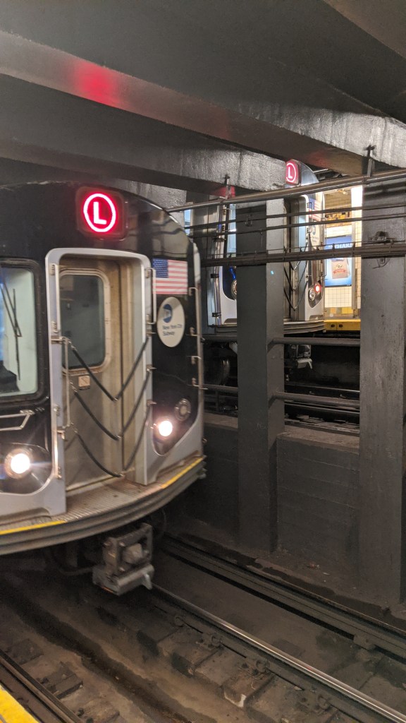
8th Ave (L)
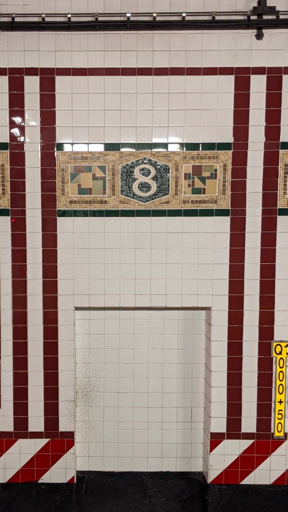
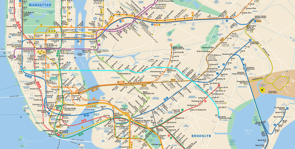
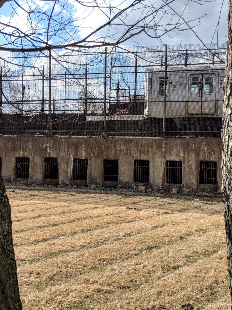
We start our trip along the (L) at its Manhattan terminal, 8th Avenue. This station is the newest on (L), built in 1931 when the (A)(C)(E) IND 8th Avenue Line opened. The original western terminal was 6th Ave, opened in 1924. The 8th Avenue Line was built by the city-owned and operated IND, whose stations are distinct from the two private companies’ because they are less decorated and more utilitarian in their appearance. The other (L) stations, which were primarily built by the private company, the BMT, are distinct from 8th Ave because 8th Ave was built not to mimic the style of BMT stations, but to mimic the style of IND stations. The station underwent a renovation in 1999, during which the iconic Canarsie Line mosaic style was installed on the station walls. The red and white striped “no-clearance” bands that are colloquially known in the MTA as the “blood and bones,” which shows where it is unsafe for workers to stand in the trackbed is, in this station, a part of tiling, rather than a thin sheet of metal installed on top of the tiling as is the norm in the rest of the system.
This station is also iconic for its art installation, called “Life Underground,” by Tom Otterness. This includes dozens of cartoonish bronze statues arranged in various poses around the station.
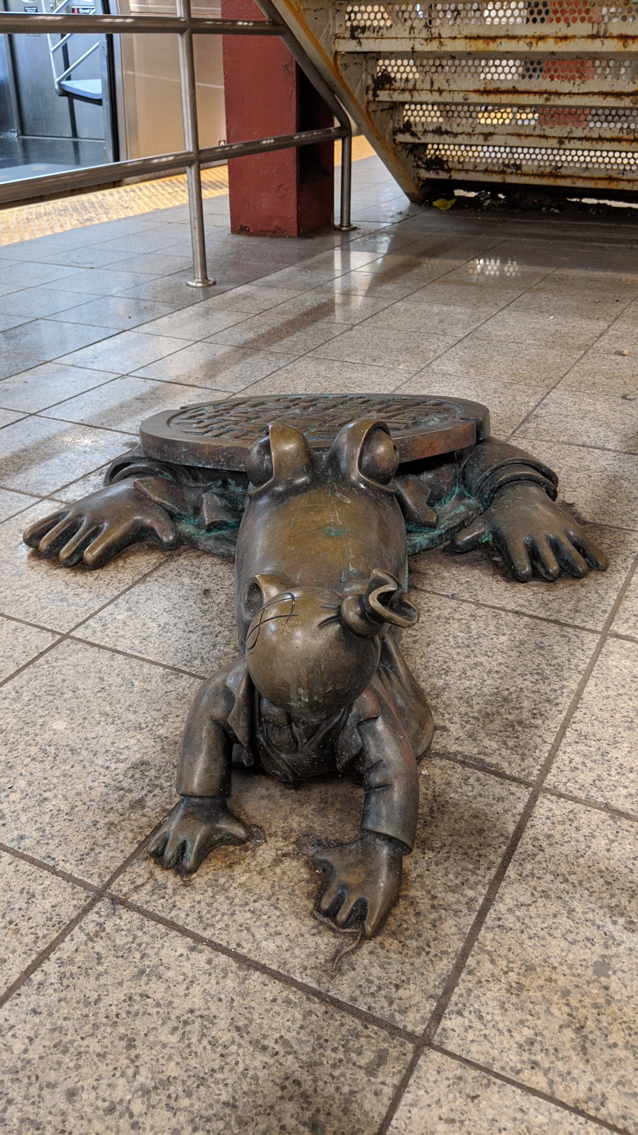
Apparently alligators do live in the sewers 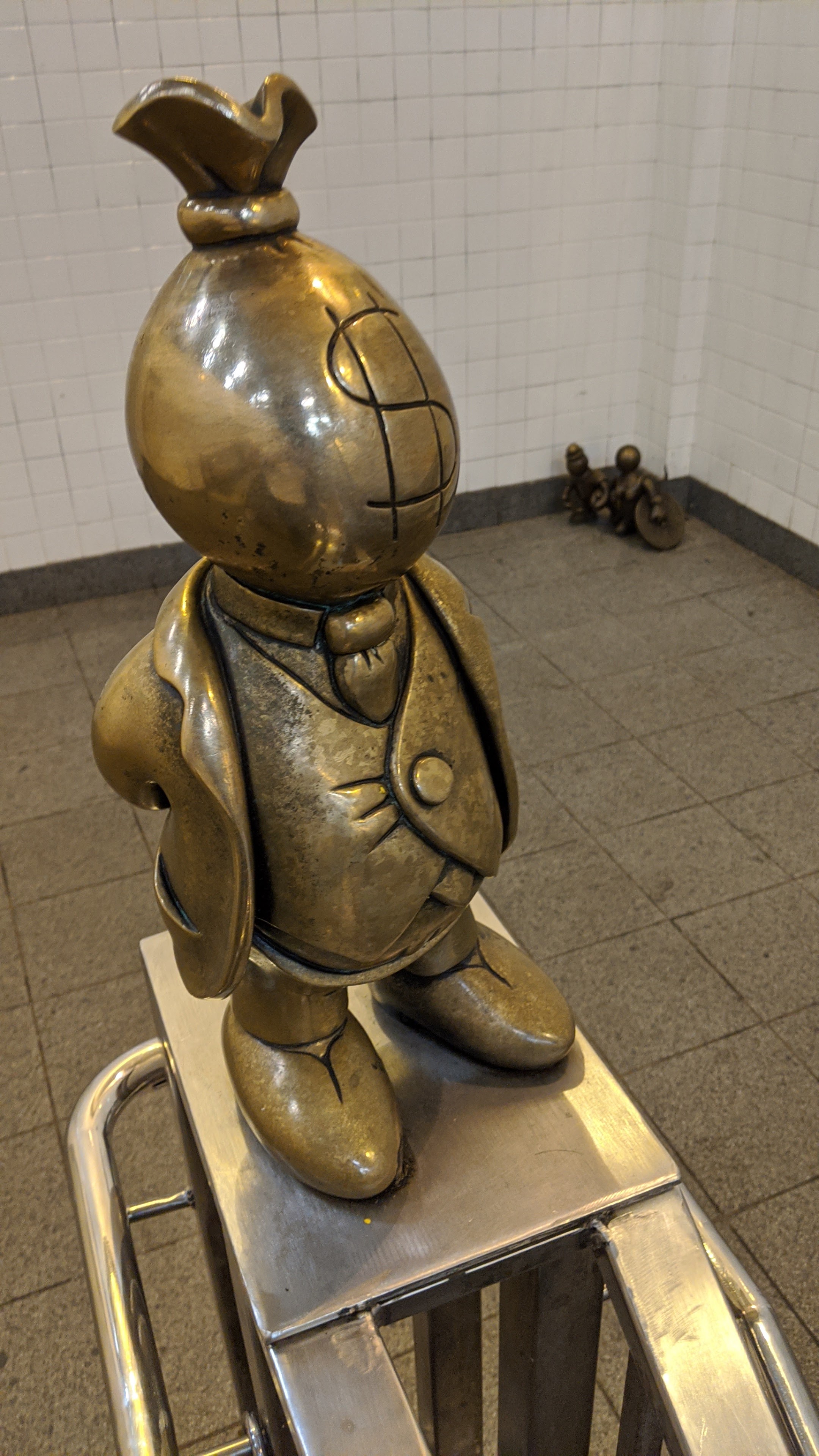
Mr. Moneybags, inspired by Thomas Nast’s depictions of Boss Tweed 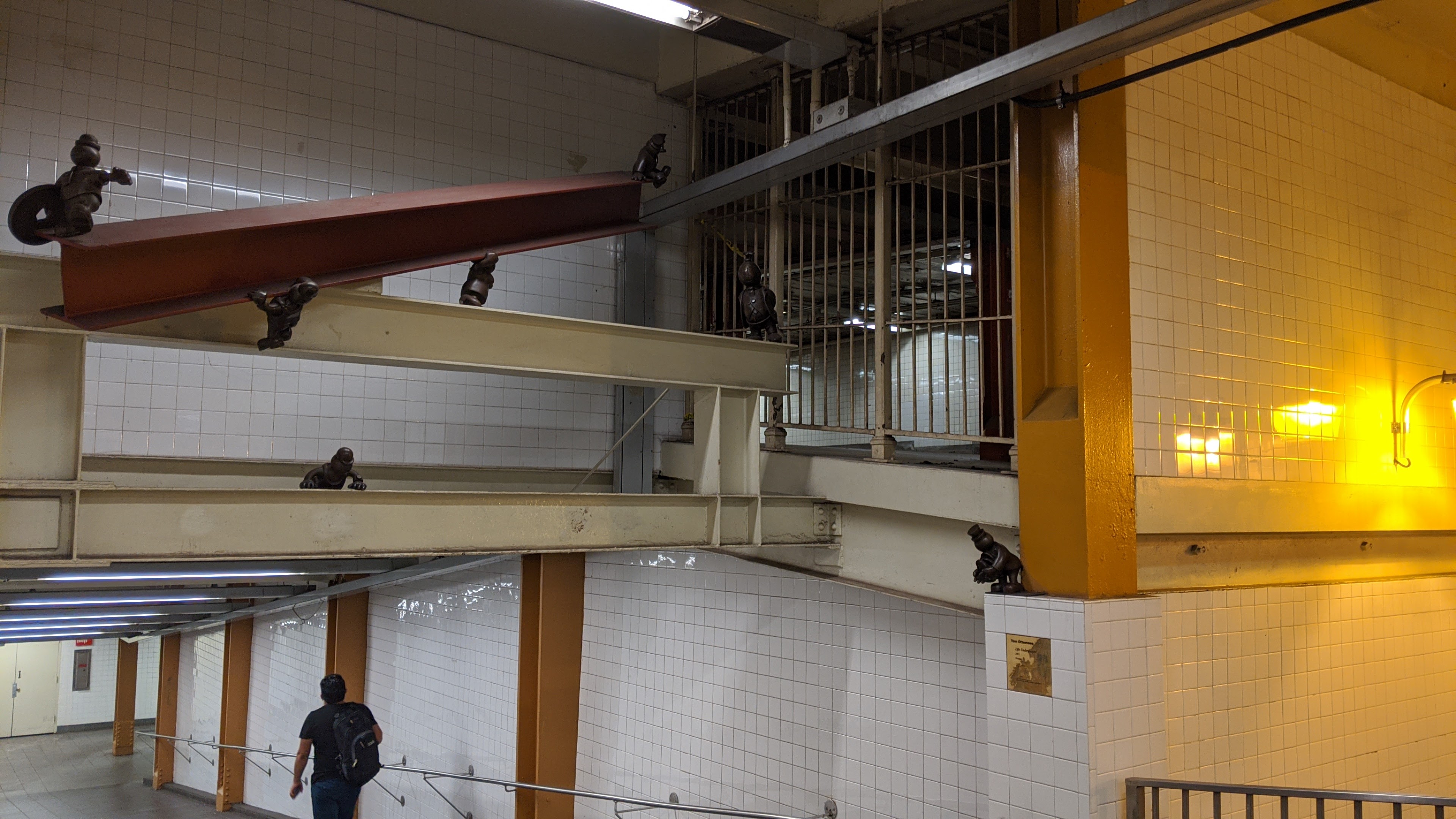
Workers moving an I-beam, with what appears to be an abandoned mezzanine behind them 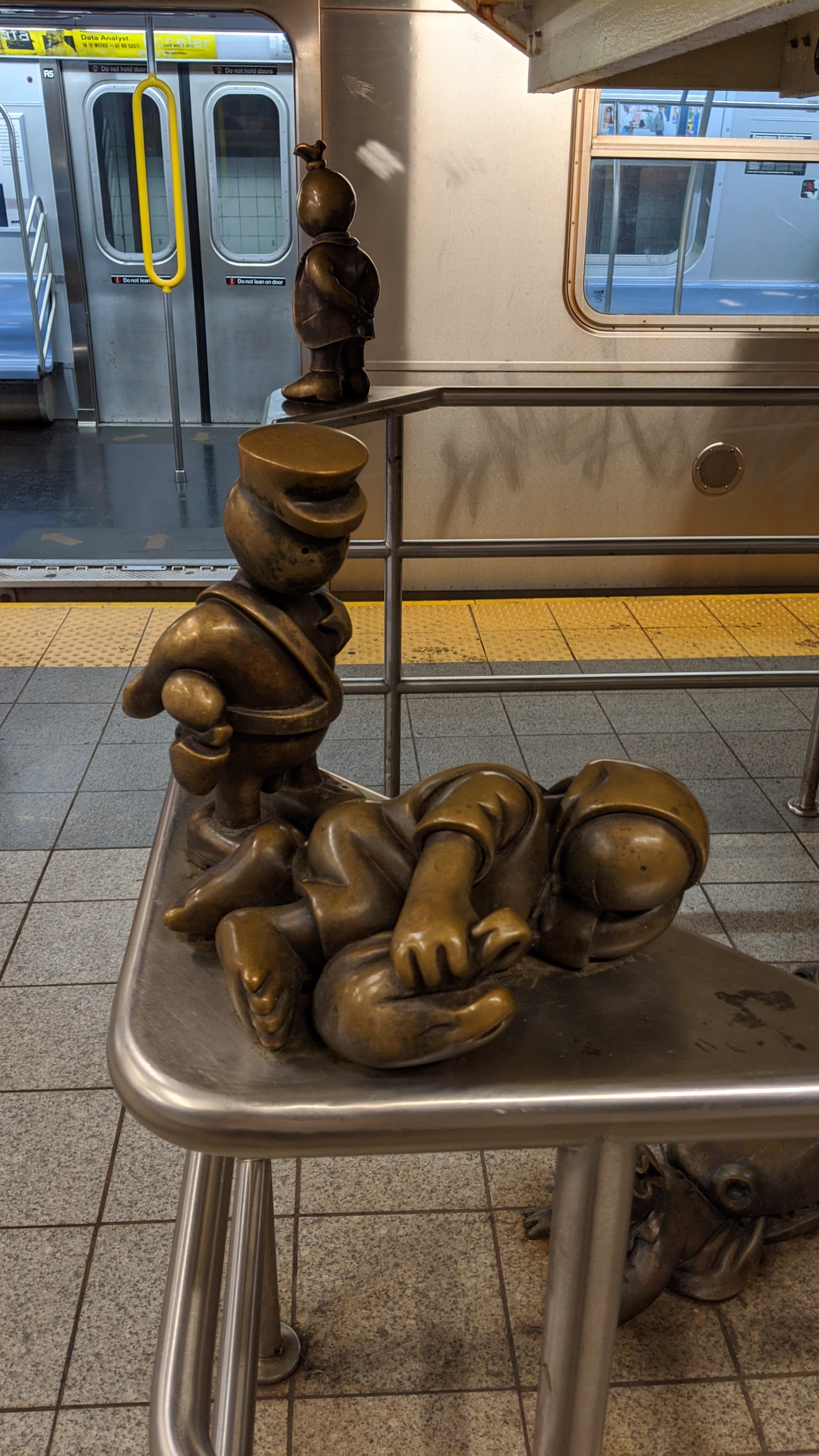
Policing homelessness
6th Ave to Grand St (L)
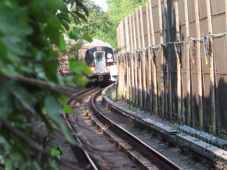
The next fourteen stations are somewhat boring. The two interesting things along this section are first, I believe that the section from Bedford Ave to Jefferson St is the squiggliest (that’s the technical term) part of the system. Anyone who has ridden the (L) can attest to this. In just a two-mile stretch of track, the (L) takes 4 curves, one of which is among the sharpest in the system, clocking in at a radius of just 254 feet.
The quick succession of curves and their sharpness has to do with how subways are built. Most subway lines are built along the paths of surface streets. This reduces the cost of construction, as streets are publicly owned, whereas if a subway passed underneath someones private property, the subway company would have to negotiate the purchase of that land. The more private property along the route, the more money needs to be spent on non-construction costs. Building along streets also saves the cost of demolition of the property. The downside of building along a street is that the curves when the subway switches from one street to another become very tight, to minimize the number of private lots the subway passes underneath.
The (L) path here in Williamsburg and Bushwick is also necessitated by the street layout demo geography (where people live and why) of the area. The (L) path in Williamsburg and Bushwick borders an industrial area where few people live. The point of the construction of the (L) in 1924 was to move residents out of crowded Manhattan tenements, so lines were built to provide quick access to the jobs in Manhattan from residential areas outside of the city core. In order to serve the needs of the residents, while staying under the streets as much as possible, this zig-zag route is the best solution.
The second interesting fact about this portion of the (L) is that the underground stations along the (L), from 8th Ave to Bushwick Ave-Aberdeen St all have unique mosaics that depict the station name.
6th Ave Mosaic. Image by Leo Shirky 
Union Sq Mosaic. Image by Leo Shirky 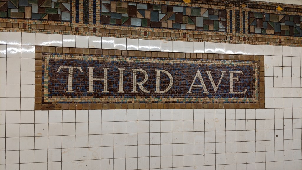
Third Ave Mosaic. Image by Leo Shirky 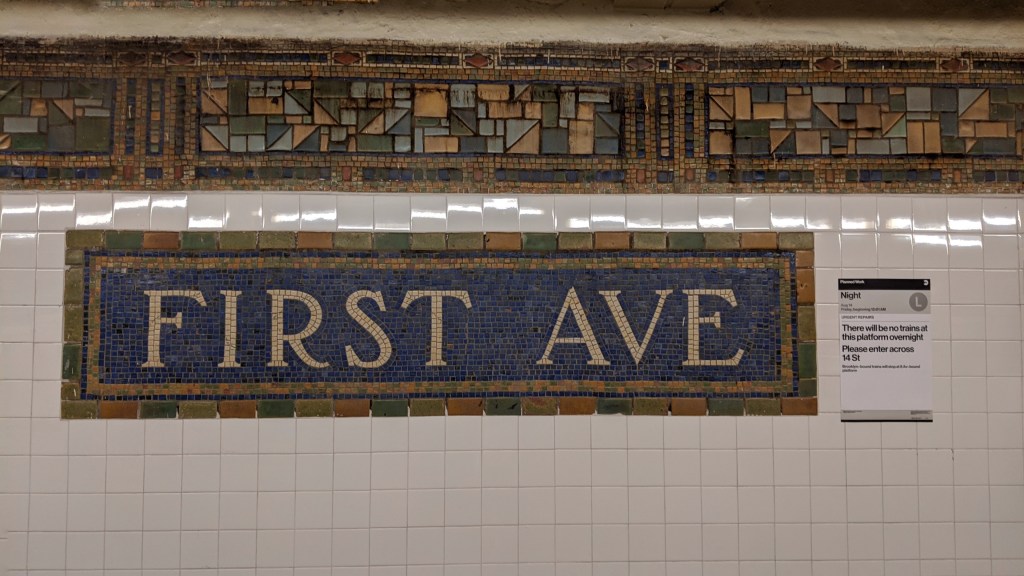
First Ave Mosaic. Image by Leo Shirky 
Bedford Ave Mosaic. Image by Leo Shirky 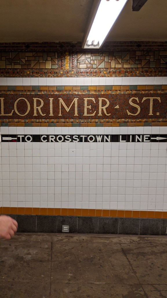
Lorimer St Mosaic. Note the IND style “To Crosstown Line” that was added when the (G) was built. Image by Leo Shirky 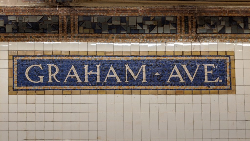
Graham Ave Mosaic. Image by Leo Shirky 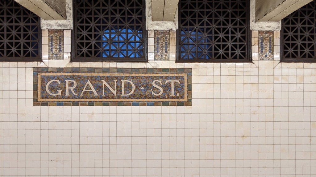
Grand St Mosiac. Image by Leo Shirky
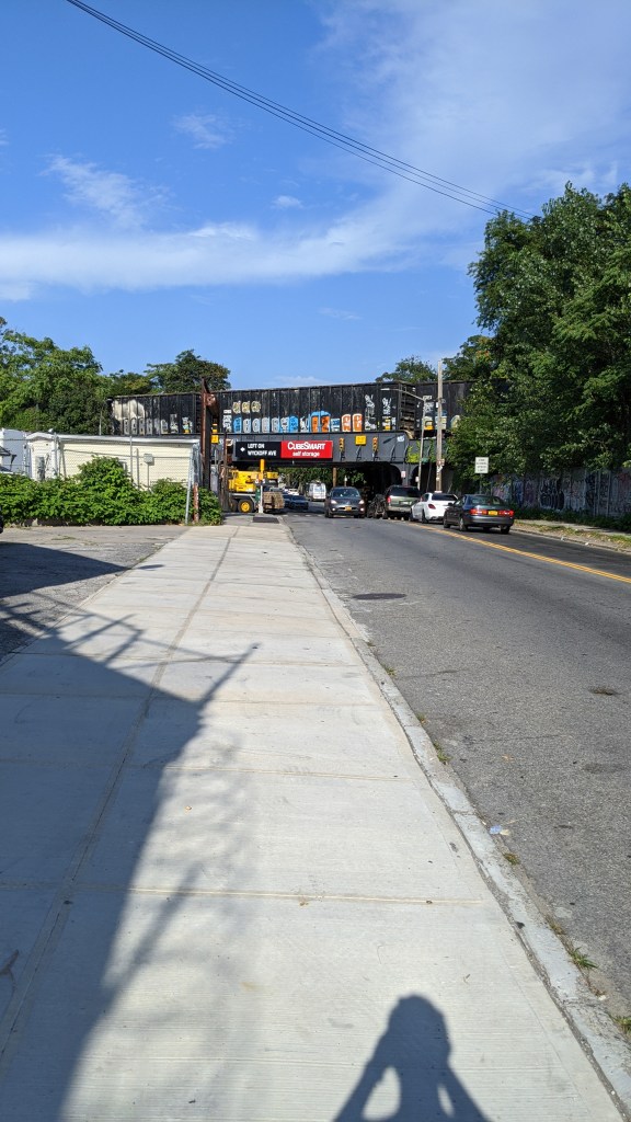
Montrose Ave (L)
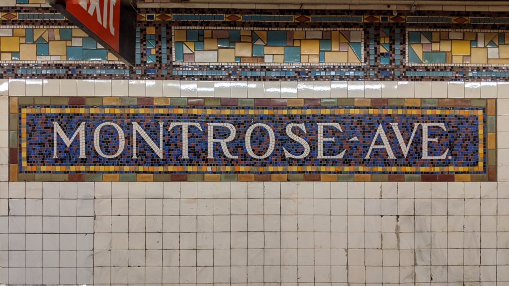
In addition to being one of the most beautiful mosaics on the line, Montrose Ave is also special because it was the original eastern terminal of the line. What we now know of as the (L) was originally built in 4 distinct sections. Our journey along the (L) is going in almost reverse chronological order, with our first section being 8th Ave, which was the most recent addition to the line. The second section on our journey, and the second section to be built, was 6th Ave to Montrose Ave. This line was called the BMT 14th Street-Eastern Line when it was constructed, and it was entirely isolated from every other line in the system. Because of its isolation, the subway cars couldn’t be delivered to a regular storage yard, as the BMT 14th Street-Eastern Line had no storage yard. Cars were instead delivered to the nearby LIRR Bushwick Yard (which still exists in some freight capacity), and were moved into the subway via a temporary ramp that was constructed in the road surface and into the subway tunnel.
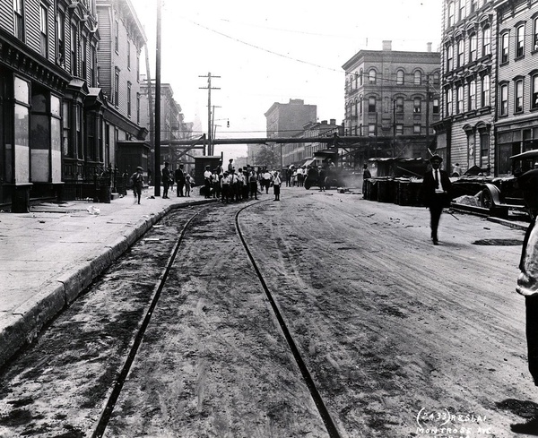
Looking West on Montrose Avenue 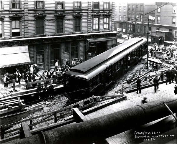
The corner of Bushwick Avenue and Montrose Avenue 
Inside the tunnel under Bushwick Avenue
These three photos were taken on the day of the deliveries (June 18, 1924). The first picture shows the temporary track laid in Montrose Avenue, which connected the LIRR yard to Bushwick Avenue where the ramp was. The pipeline visible in the background is a temporary gas line that was moved during constriction, running along Bushwick Avenue. The second picture shows a BMT car turning onto Bushwick Avenue from Montrose Avenue. The entrance to the tunnel is visible in the bottom left. The third picture is taken from inside what would become Montrose Ave station, with a BMT car on the ramp. The ramp was in place of where the Manhattan-bound platform sits today. When the cars were delivered, the platform had not been put in place as passenger service wouldn’t start until September 21 of 1924.
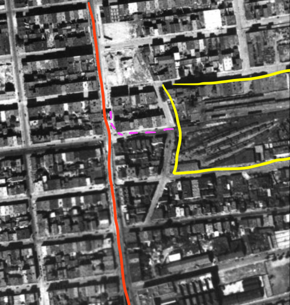
Annotated 1924 aerial view of the area in question 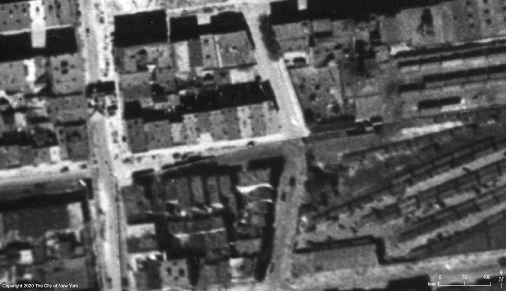
Closeup 1924 aerial view. Note the dark shape on Bushwick Ave to the left of the photo. 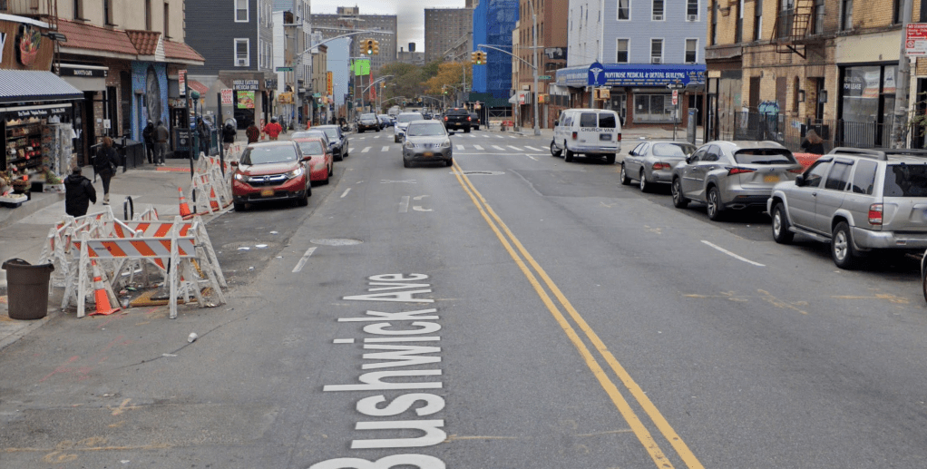
A modern view of the area from Google Maps
These three photos situate the process in geographic space. The first is an annotated screenshot from the aerial photos taken of New York City in 1924. The date that appears on the map is July 1st, 1924, making it about two weeks after the car delivery took place. The red line through the photo shows Bushwick Avenue. The subway tunnel ended about halfway down the length of the road in this image. The yellow outlines the LIRR Bushwick yard from which the cars were delivered, and the dotted pink line shows the path of the temporary track. Because of the camera quality in 1924, and the fact that these photos were taken from aircraft, the level of detail at street level is amazing, but it is not quite high enough to determine for certain if the darkened box in the middle of Bushwick Avenue (more visible in the next photo) is the portal to the subway tunnel that the cars were delivered through.
The last photo is a screenshot from Google Maps of Bushwick Avenue where the temporary tunnel existed. As I walked this portion of the route, I noticed that where the construction is in the photo (in front of the Grocery), the sidewalk and side of the street dip down noticeably. That would have been about the spot where the ramp for the car deliveries was placed almost 100 years ago. I have no idea if the divot is a remnant of that construction, or if it is unrelated, but it serves as a useful place marker for this unique moment in subway history.

Hand-drawn diagram of the street level from the February 1963 edition of the Electric Railroader’s Association 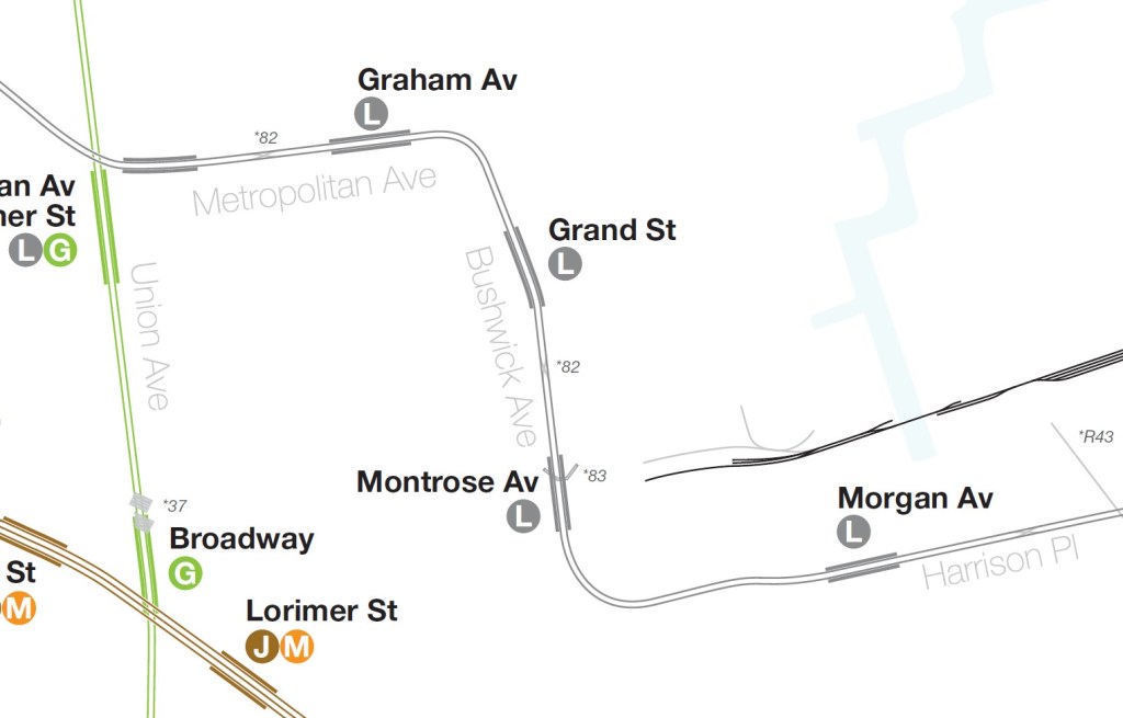
A screenshot from Vanshnookenraggen’s track map
These two diagrams show the track layout during and after the operation. On the top, from the Electric Railroaders’ Assoiciation February 1963 edition, a hand drawn diagram of the LIRR Bushwick Yard, the temporary track connection and the subway tunnel. On the bottom, the diagram shows where the tunnel opening was in relation to the existing Montrose Avenue subway station, and the remnants of the LIRR Bushwick Yard.
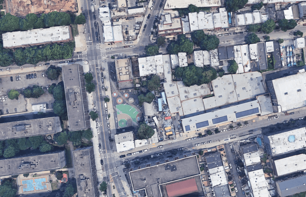
In the playground at the corner of Bushwick Avenue and McKibbin Street, where the (L) turns east from the Montrose Ave station towards Morgan Ave, there are train tracks painted on the ground above where the (L) tunnel is located.
Morgan Ave to Myrtle Ave (L)
The stations between Montrose Ave and Broadway Junction were the third of four sections of the (L) to be built. This section was opened on July 4th, 1928, and linked the original subway portion, opened in 1924, with the elevated portion south of Broadway Junction that had been operating for much longer. The history of the earliest portion of the line will be discussed later in this post.
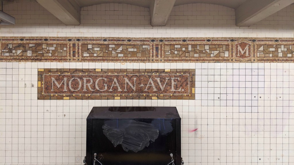
Morgan Ave Mosaic. Image by Leo Shirky 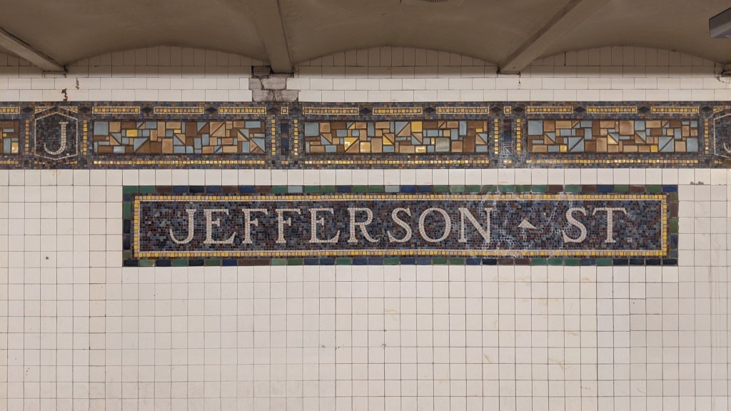
Jefferson St Mosaic. Image by Leo Shirky 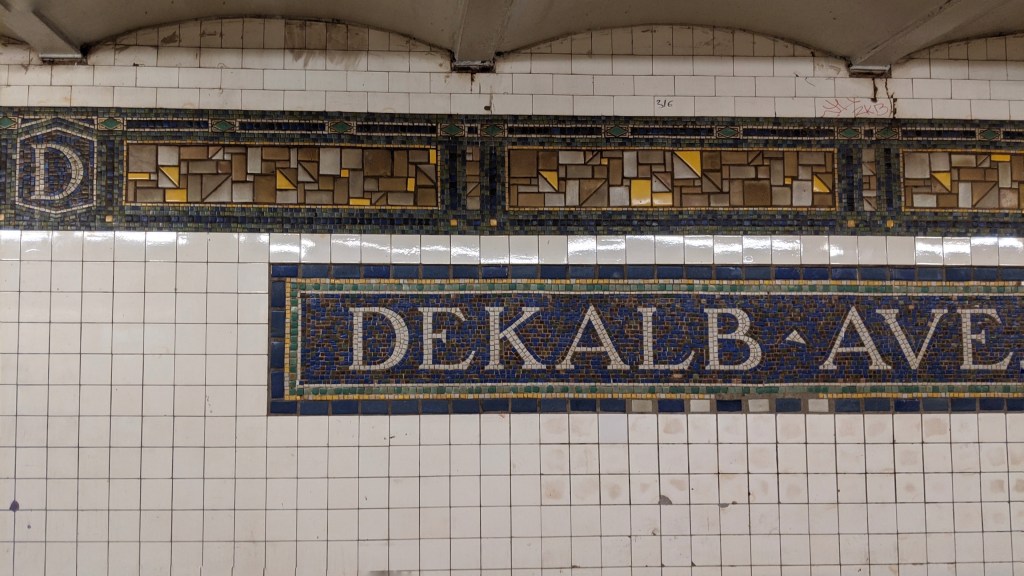
DeKalb Ave Mosaic. Image by Leo Shirky 
Myrtle Ave Mosaic. Image by Leo Shirky
Halsey St (L)
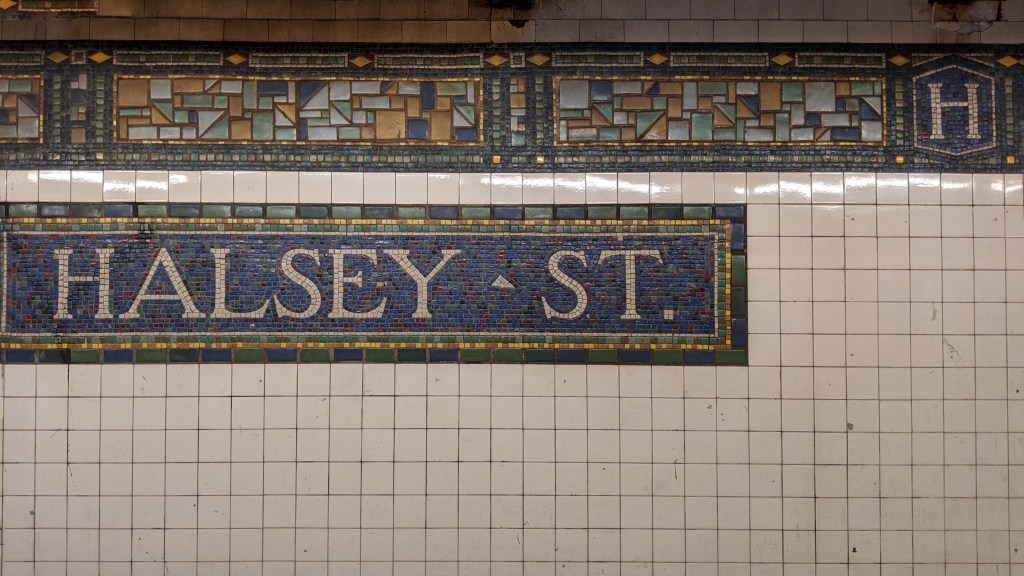
There is no subway service in the system that travels through more than three boroughs. Most travel through three with Manhattan as the middle of the two, some travel between an outer borough and Manhattan only, the (G) travels trough two outer boroughs only, the (A) travels through two outer boroughs before Manhattan, and shuttles remain entirely in one borough, but no service is weirder in its borough-traversing than the (L), and Halsey St is why.
The border between Brooklyn and Queens is a weird one in many ways. It is the only land border between city boroughs, and because of that, many of the neighborhoods along it don’t feel physically separated from each other by a borough line. Often the only tangible evidence is that the addresses change (Queens has a weird method of addresses that I don’t understand), and the street names sometimes change. Because the border isn’t in the water, it has to use regular streets as the boundary of the boroughs, and from Gates Avenue (just west of Myrtle Avenue) to Eldert Street (just east of Halsey Street), the border runs along Wyckoff Avenue, which is also the street that the (L) train runs under. This means that in the Halsey St station, the entire Manhattan-bound and eastern half of the Canarsie-bound platforms are in Queens. This also means that between Halsey St and Myrtle Ave, just one station back towards Manhattan, the Manhattan-bound track is in Queens, while the Canarsie-bound track is in Brooklyn. The border zigzags to the south one block and continues east parallel to the path of the (L) train and into a cemetery, while the (L) turns south a few blocks east of the Halsey St station, crossing back into Brooklyn before its next stop at Wilson Ave.
Ashley Frangipane took her stage name from a Brooklyn subway stop where she spent time hanging out which is also an anagram of her first name: Halsey. However, there are two Halsey St stations in Brooklyn, one here on the (L) BMT Canarsie Line, and another (named for the same street) on the (J)(Z) BMT Broadway Line. Halsey has not specified which station she took her name from.
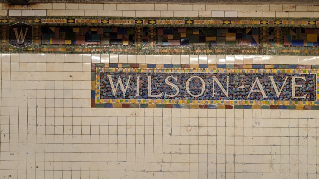
Wilson Ave (L)
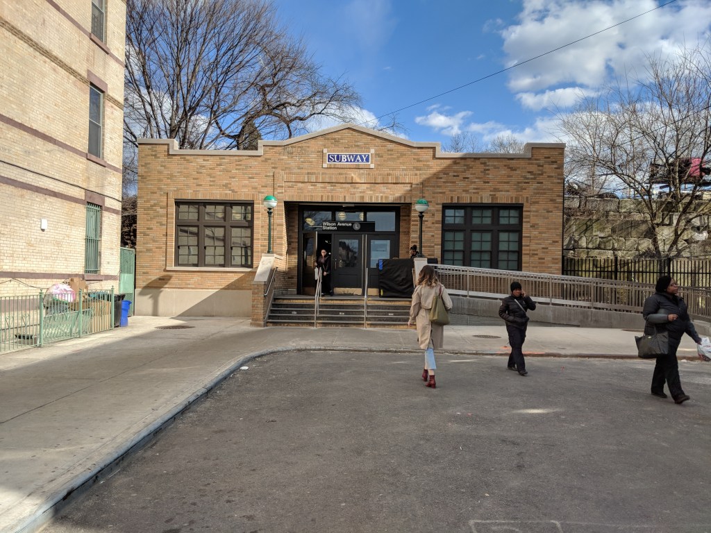
Wilson Ave Station Entrance from the street. Image by Leo Shirky 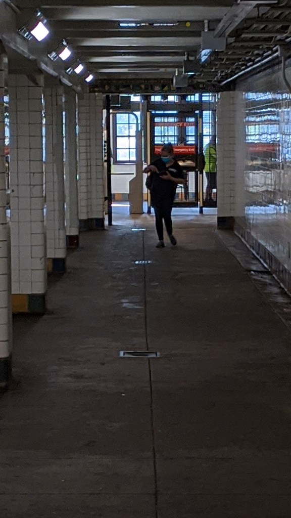
Wilson Ave Station Entrance from the Manhattan-bound platform. Image by Leo Shirky
I feel comfortable saying that Wilson is Avenue is the most unusual station in the system. It sits at the eastern end of Wilson Ave, on a narrow strip of land in between the Most Holy Trinity Cemetery and the freight-only Bay Ridge Branch of the Long Island Railroad. The station sits at street level as the first two photos show, although neither platform feels like it’s at street level. The second photo shows the hallway from the Manhattan-bound lower platform to the exit. There are no stairs to leave the station, and then length of the tunnel is due to the LIRR Bay Ridge Branch being just above.
A Canarsie-bound train enters the Upper Level of Wilson Ave, taken from the platform. Image by Leo Shirky 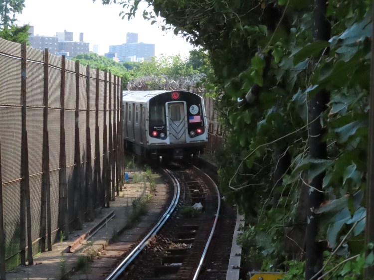
A Canarsie-bound train leaves the Upper Level of Wilson Ave, taken from the platform. Image by Leo Shirky
Due to the narrowness of the land that the subway line runs along here, the tracks and platform sit one on top of the other, rather than next to each other. In these two photos, showing a train entering and leaving the upper-level platform, the two fences on either side of the track show just how narrow a space the subway has. The fence on the side with the foliage is separating the subway and the LIRR Bay Ridge Branch (which is at the level of the upper platform), and the fence on the opposite side separates the subway from the Most Holy Trinity Cemetery. Because it sits on the upper level, the Canarsie-bound platform feels like an elevated, open-air station, with stairs leading down to the street level Manhattan-bound platform.
A Manhattan-bound train enters the lower level of Wilson Ave, taken from the platform. Image by Leo Shirky 
A Manhattan-bound train enters the lower level of Wilson Ave, taken through the metal grates on the cemetery side. Image by Leo Shirky
The next two photos show a train entering the lower level platform from two different angles. The first of the two is taken from the platform, and although this track is at street level, the photo clearly shows that the train is in a tunnel. Just above the roof of the tunnel is the Canarsie-bound track, and to the left of the train, the slanted holes in the roof and side of the tunnels are letting in daylight. Those holes show the ground level of the cemetery, which is just past the far wall of the tunnel. Even though the lower level platform appears to be an underground station, it is actually built into what used to be a slight hill from where Wilson Avenue ends (at track level) to where the cemetery starts (almost at the top of the tunnel). The right-hand photo shows a Manhattan-bound train entering the lower level of Wilson Ave, taken from the perspective of those holes in the top corner of the tunnel.
A Canarsie-bound train leaves the Upper Level of Wilson Ave, taken from the cemetery. Image by Leo Shirky 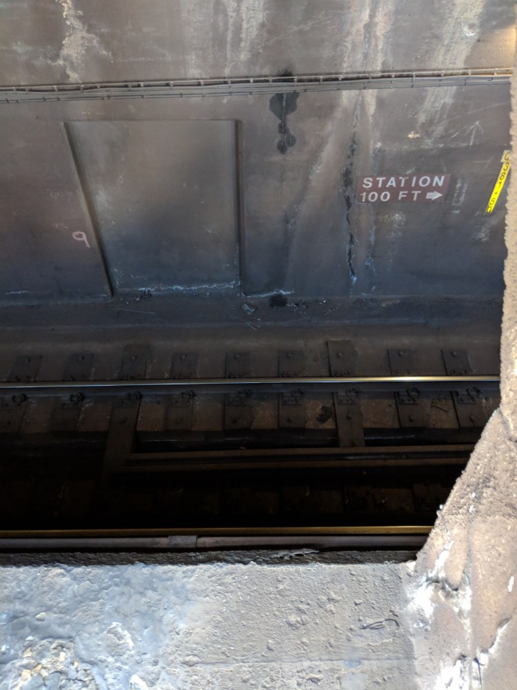
The lower trackway when viewed through the metal grates in the cemetery. Image by Leo Shirky 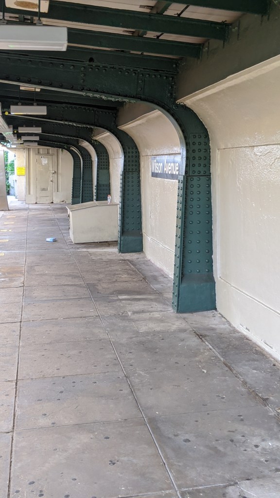
The upper-level platform with a) the standard station signage and b) the upper part of the U shaped steel supports. Image by Leo Shirky 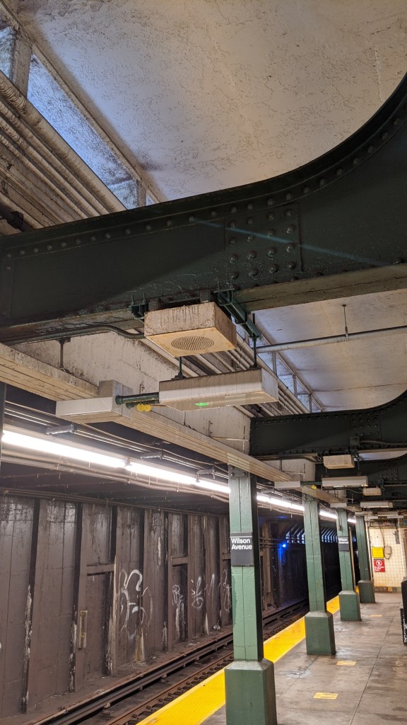
The lower level platform with a) the metal grates that lead to the cemetery, b) the lower part of the U shaped steel supports, and c) some light from the upper trackway. Image by Leo Shirky
The top two photos show the subway tracks from inside the cemetery. The leftmost photo is a Canarsie-bound train leaving the upper level, elevated slightly above ground level in the cemetery. The red sign on the wall says “Station 100 Ft ->,” referring to Wilson Ave being to the right of the photo. Just below the train, metal grates can be seen inlaid into holes in the concrete wall, and these holes are the same as the ones visible from the lower level platforms in the station. The right hand photo shows the equivalent “Station 100 Ft ->” sign for the lower level of the station, which was taken through the metal grates from the cemetery. The following two photos show the top and bottom halves of the continuous, sideways U shaped steel supports that extend across both platform levels. Additionally, daylight can be seen in the right hand photo, which was taken from the lower level “underground” station. This daylight is coming through holes just below the upper platform at track level.
The LIRR Bay Ridge Branch crossing Cooper Avenue. Image by Leo Shirky 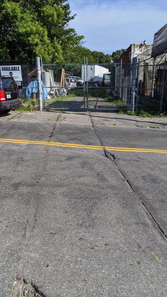
The former LIRR Evergreen Branch crossing Cooper Avenue. Image by Leo Shirky
Finally, the last two photos show evidence of the railroads in the area. The left-hand photo shows the LIRR Bay Ridge Branch crossing over the corner of Wyckoff and Cooper Avenues, just northwest of the Wilson Ave station. The other photo shows the abandoned tracks of what used to be called the LIRR Evergreen Branch. This was a short stretch of track that originally operated as part of an excursion railway from a ferry landing in Greenpoint at the East River to Coney Island, as a way for New Yorkers to reach the beach. This portion of the line was built by the New York and Manhattan Beach Railroad after it leased the Brooklyn and Rockaway Beach Railroad (which built the southern portion of the (L)), from East New York (in the vicinity of the current Broadway Junction station) to Jefferson Street, just south of Wyckoff Avenue. The photo shows the abandoned tracks crossing Cooper Avenue, just south of Wyckoff Avenue. This line paralleled much of the route used by the (L) train today, running less than a block south of the current path of the (L). West of Jefferson Street, the line continued to Greenpoint on tracks built by the Glendale and East River Railroad and opened from Greenpoint to East New York on May 16th, 1878.
A map of the Evergreen Branch, created by the LTV Squad
Trains stopped running all the way to Greenpoint in 1885, but trains still ran between the junction at the Bay Ridge Branch near Wilson Ave and the LIRR Bushwick Yard, which was the site of the 1924 BMT car delivery, until 1894. Much of the route is still visible from Google Maps, due to a number of empty lots that haven’t been built on.
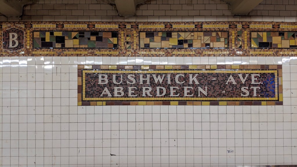
Bushwick Ave/Aberdeen St (L)
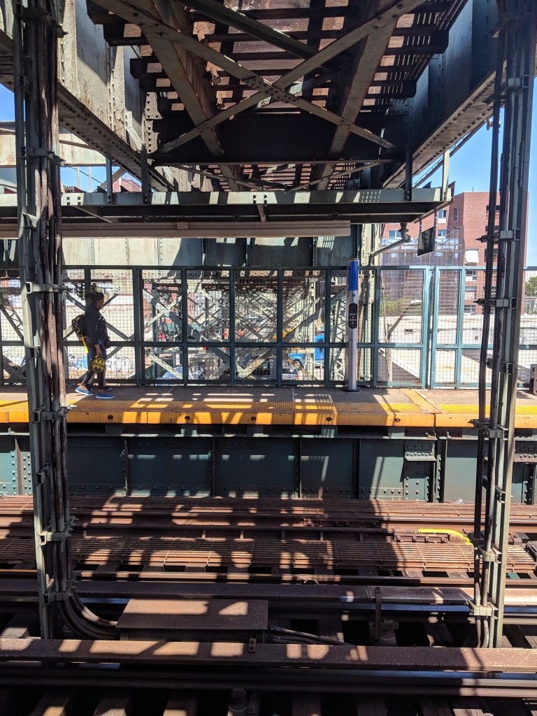
Bushwick/Aberdeen is not built in line with a street. Because the next station in the direction of Manhattan is the bi-level Wilson Ave, the platforms at the northern end of Bushwick/Aberdeen are on slightly different levels, as the Manhattan-bound track starts to descend to the lower level, and the Canarsie-bound track ascends to the upper level. In this image, the height difference is clear at this end of the station, although the platforms at the other end are at the same level.
Broadway Junction (L)
The tracks of (L) rise sharply after Bushwick/Aberdeen, going from underground to the upper level of Broadway Junction, one of the highest platforms in the system, in just 1,300 feet. Broadway Junction is one of the most complex stations in the city, both physically and historically. It is a colossus of a structure, with two full levels elevated above the street, and a tangled web of tracks that connect these two lines and a storage yard. The platforms used by the (L) were built in 1928 and were the last of the stations that strung together the 1924 subway (6th Ave to Montrose Ave) and the 1865 Brooklyn and Rockaway Beach Railroad. The (L) platforms are some of the highest in the system, built over the already elevated (J)(Z) BMT Jamaica Line tracks. There is a side platform used by Canarsie-bound trains, and an island platform in between the two tracks, but used only by the Manhattan-bound trains.
Manhattan-bound (L) entering the tunnel. Image by Leo Shirky 
Looking at a (Z) train on the Jamaica-bound platform of the lower level, with the track connection visible. Image by Leo Shirky 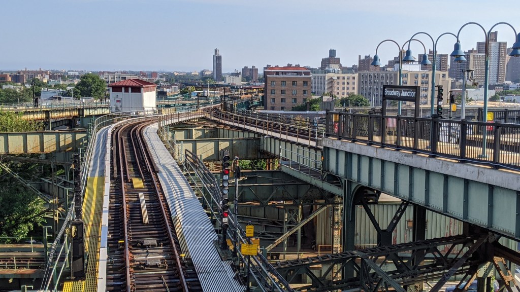
Looking at the eastbound track connection from the upper level. Image by Leo Shirky 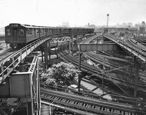
A historical photo looking south from the upper level platform towards Atlantic Ave. Image by Leo Shirky 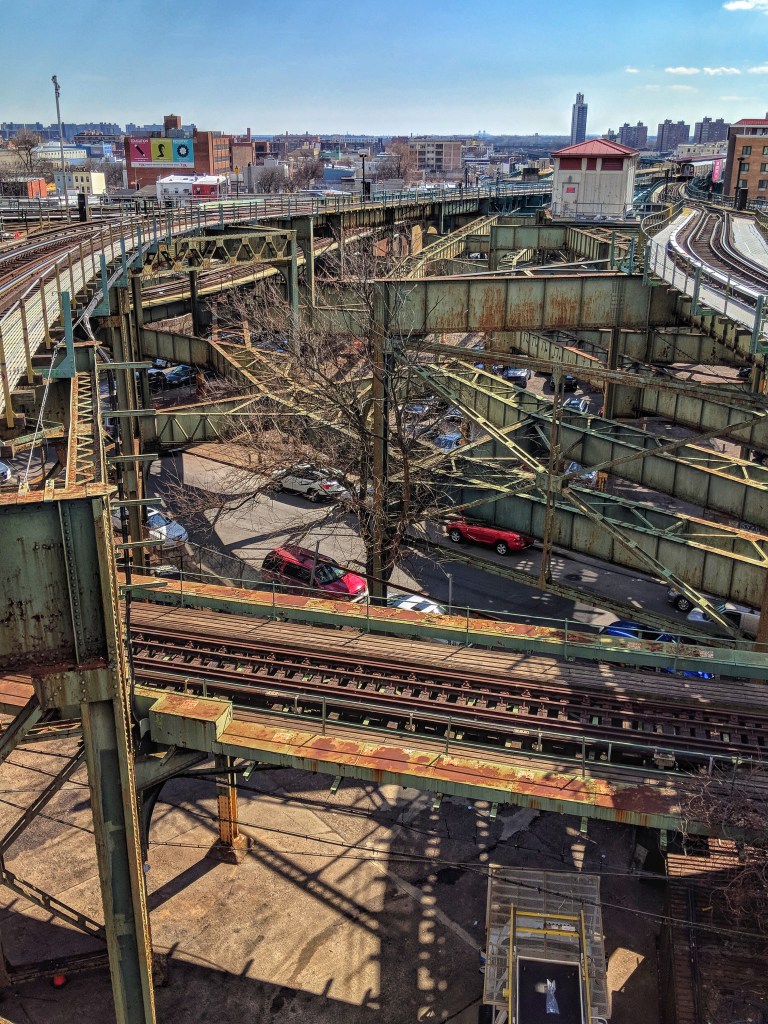
A historical photo looking south from the upper level platform towards Atlantic Ave. Image by Leo Shirky 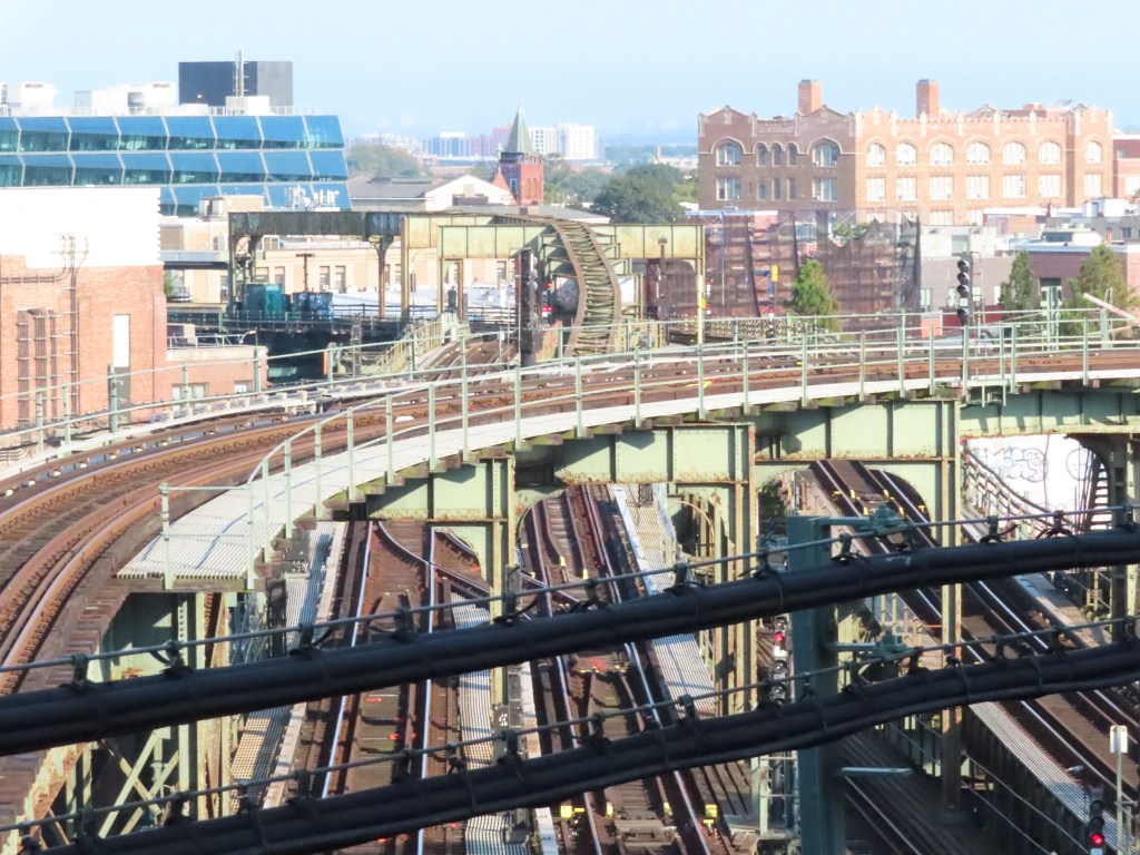
Westbound track connection crossing the BMT Jamaica Line tracks. Image by Leo Shirky
Currently, a track connection exists between the (J)(Z) BMT Jamaica Line and the (L) BMT Canarsie Line. The eastbound connecting track is what travels under the split island platform on the upper level, and the westbound track crosses the (J)(Z) tracks east of the station, before taking a sharp turn west and down to the (J)(Z) platforms. The tracks visible in the historical photo, and the abandoned trackways in the photo below show where the Fulton Street El used to run through this complex junction.
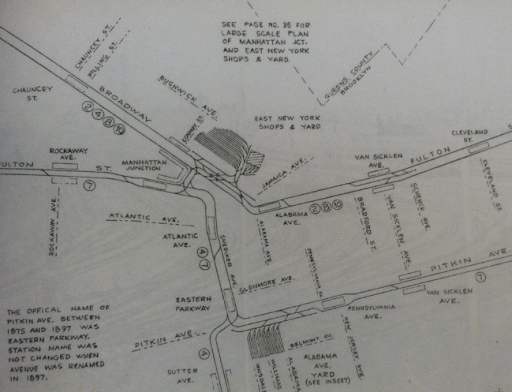
The earliest portion of what became the (L) was opened in 1865 by the Brooklyn and Rockaway Railroad. This was a street-level steam railroad that ran from the LIRR’s East New York station to Canarsie Pier, at Schenck Street, Canarsie Road, and East 96th Street. Passengers would then catch a ferry to the Rockaways. In 1906, the Canarsie Railroad was chartered by the streetcar and elevated railroad operator, the Brooklyn Rapid Transit Company (BRT), to buy the Brooklyn and Rockaway Railroad’s line. After purchasing the line, the BRT elevated and electrified the line north of New Lots Ave with a third rail, and electrified the southern half with trolley wire. It was a common practice at this point in time to run El trains on streetcar tracks with trolley poles, especially in less dense parts of the city. The northern part of the line was extended to connect with the BRT’s Fulton Street El at Glenmore and Snediker Avenues and through this connection, also to the BRT Broadway El. Service to Canarsie was provided by trains from the Broadway El, and so trains to Canarsie would travel from a now-demolished station at Broadway and the East River, or when the Williamsburg Bridge opened to trains in 1908, from Essex St and Manhattan, along what is now the tracks of the (J)(Z) trains until Broadway Junction (called Manhattan Crossing until 1913) and onto the Canarsie Line.
In 1913, a period of rapid expansion and consolidation of transit lines, called the Dual Contracts, was undertaken by the city. This required the Broadway Junction station to be rebuilt to remove what was called the “East New York Loop”. The Fulton St El would no longer stop at Broadway Junction, and instead, the Atlantic Ave station would be expanded to handle trains from the Broadway El to Canarsie and trains on the Fulton St El.
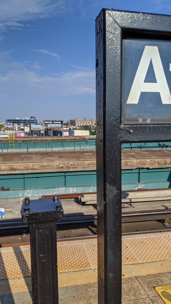
Atlantic Ave (L)
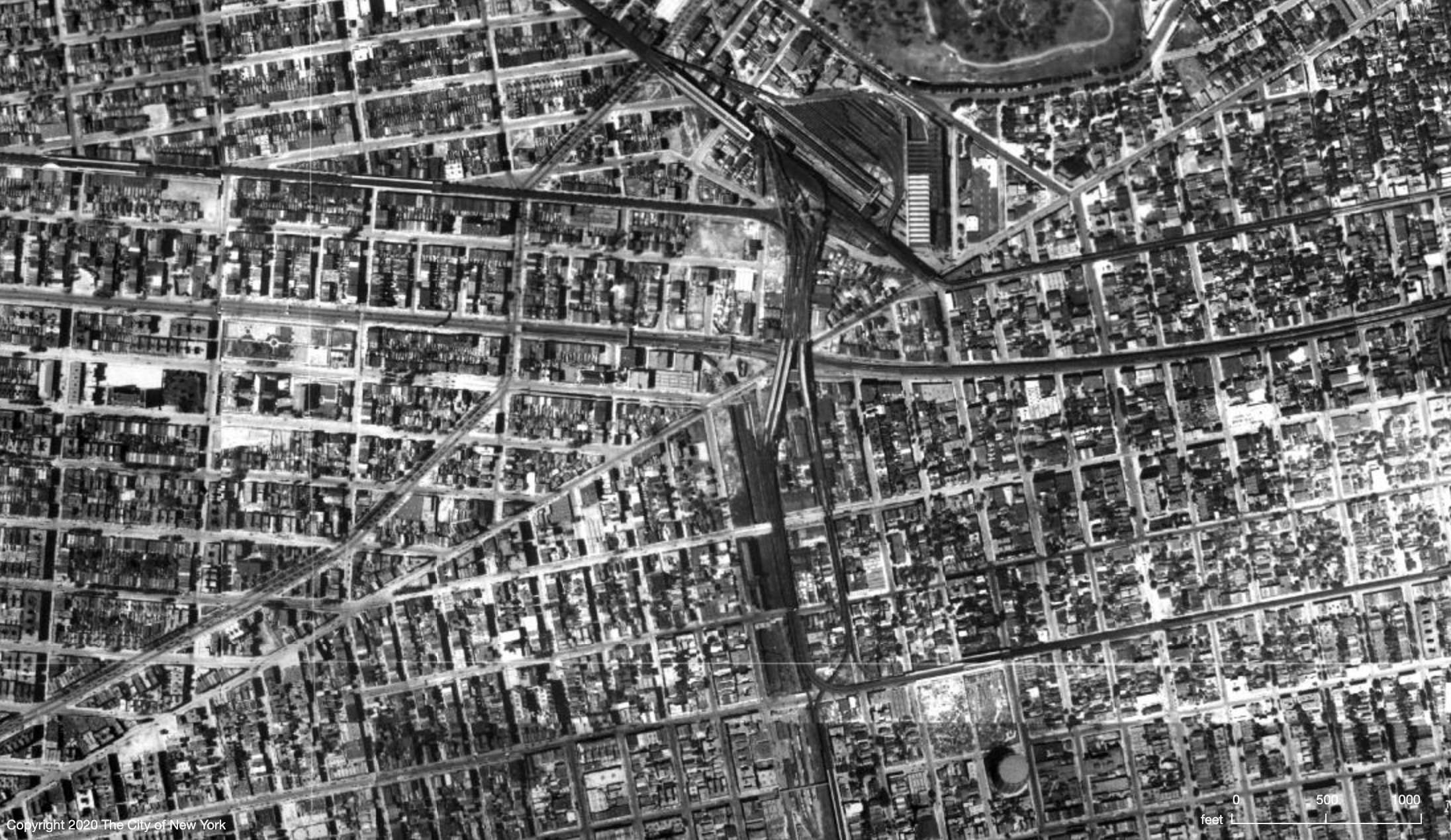
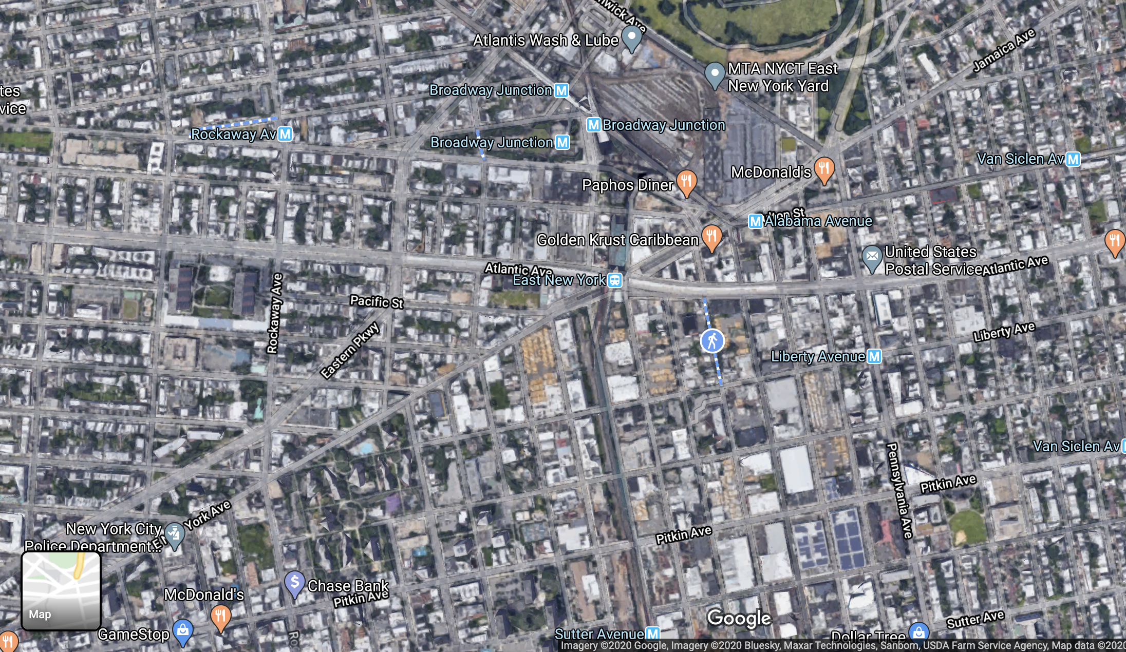
Atlantic Ave, when it was opened in 1889 by the Fulton Elevated Railroad, was a simple island platform with two tracks, served by the Fulton St El, situated over Snediker Ave. In 1906, when the Canarsie Line was elevated south of East New York, its tracks were connected to the Fulton Street El tracks one stop south of Atlantic Ave, at the Glenmore Ave station. Trains using the Canarsie Line came from the Broadway El and used the tracks that had been used for the “East New York Loop” service.
In 1916, the new Atlantic Ave and Broadway Junction stations were opened after the Dual Contracts were signed, and Broadway El trains going to Canarsie used new tracks (visible in the 1924 aerial photo) to reach the Atlantic Ave station that had also been rebuilt. After 1916, it had three island platforms and 6 tracks. From west to east those tracks were: southbound Canarsie Line, Southbound Fulton St El, Middle Express Fulton St El, Northbound Fulton St El, Northbound Canarsie Line, Northbound Fulton St El to Broadway El connection. The two western platforms were new, and built at an angle to the original eastern platform. Today, the three platforms remain, but only the westernmost is still in use by the (L).
Track map of the East New York Loop, 1906-1916 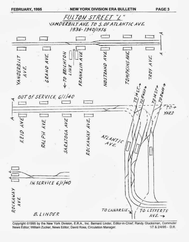
Track map of Atlantic Ave and Fulton St El, 1936-1956 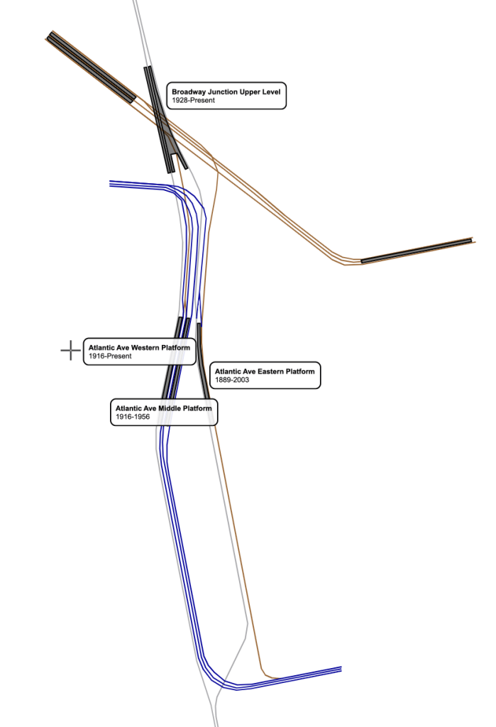
My own track map of the area, 1928-1956. Blue: BMT Fulton St El, Brown: BMT Jamaica Line, Grey: BMT Canarsie Line
To the south, the six tracks continued, with the four westernmost above Van Sinderen Avenue, and the two easternmost (and original) tracks above Snediker Avenue. South of the station, there was a junction where Fulton St El trains turned east onto Pitkin Ave, and Canarsie Line trains merged together over Van Sinderen Ave, also visible in the bottom of the 1924 aerial image. In 1928, the upper level of Broadway Junction opened, allowing Broadway El trains to stop serving Canarsie, and instead having 14th Street-Eastern Line trains serve Canarsie full time. In 1956, the Fulton St El was abandoned and only Canarsie Line trains served the station. In 2003, the track layout was changed to move the northbound Canarsie track from the easternmost platform to the westernmost platform, allowing the two eastern platforms to be abandoned.
Looking east from the active platform at the two abandoned platforms of Atlantic Ave. Image by Leo Shirky 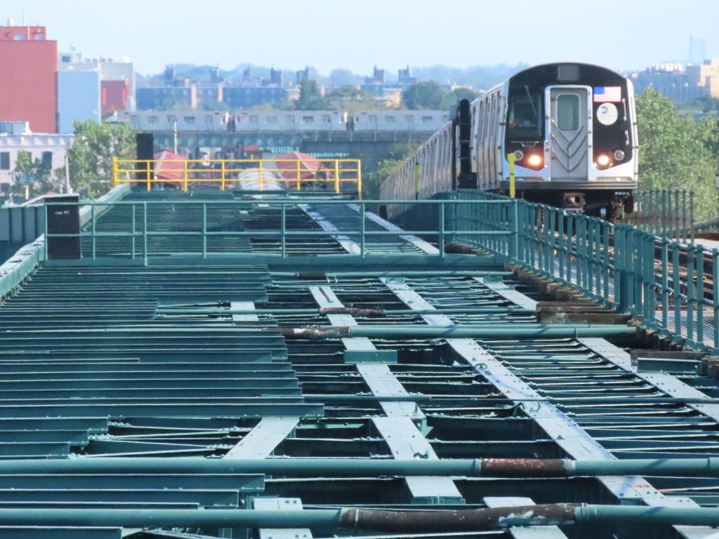
Looking south along the Canarsie Line as a Manhattan-bound train approaches Atlantic Ave, adjacent to the abandoned Fulton St El trackway as a (3) passes along the IRT New Lots Line in the background. Image by Leo Shirky
Sutter Ave (L)
Sutter Ave sits just south of where the Fulton St El turned east along Pitkin Ave. Because of this, trains entering and leaving the station to the north do a little wiggle (again, the technical term) as they move from the two westernmost tracks of four trackways to the center two. Looking north from the platform, you can also see the remaining steel structure that once carried Fulton St El trains.
The other amazing thing about Sutter Ave is the stairs. The stairs from the mezzanine and fare gate to platform level of Sutter Ave are situated at the far southern end of the platform and have a landing at just the right height so that your eye line is level with the tracks. Trains pass your face maybe three feet away, behind a metal fence so it’s safe, but it is hands down one of the coolest views in the system.
Livonia Ave (L)
Livonia Ave is another strange station because the platforms are situated directly underneath the (3) IRT New Lots Line. The (L) station was built in 1906 by the BRT, and the (3) was built in 1920 as part of the Dual Contracts. The (3) train has a station a block west of the (L) tracks, but no free transfer between the two stations exists yet.
Eastbound (3) track passing over Livonia Ave Station 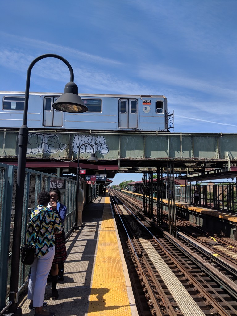
Eastbound (3) train passing over Livonia Ave Station 
Westbound (3) train passes over a Canarsie-bound (L) train, taken from Sutter Ave 
Westbound (3) train passes over a Canarsie-bound (L) train, taken from Livonia Ave 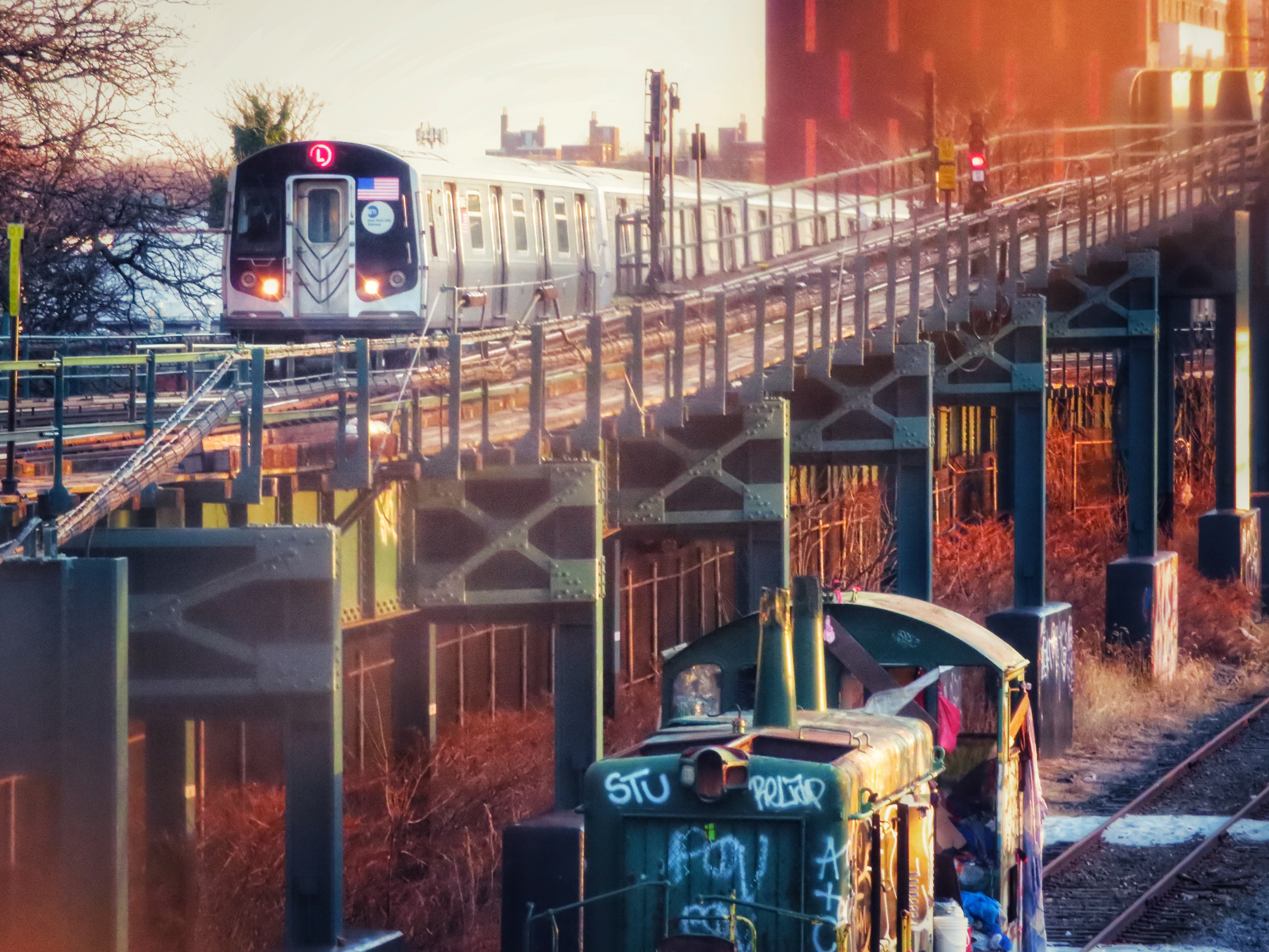
A Manhattan-bound (L) train passes the Linden Shops Yard Lead and an abandoned locomotive on the Bay Ridge Branch 
Looking south along the LIRR Bay Ridge Branch from the pedestrian overpass at the Linden Shops Yard Lead and the abandoned locomotive
The (L) sits adjacent to the LIRR Bay Ridge Branch from Wilson Ave to New Lots Ave. Before 1906, the LIRR used the Brooklyn and Rockaway Railroad tracks to reach its mainline in East New York. When the BRT elevated the line to New Lots Ave, the LIRR built a new line just to the west of the original. An abandoned locomotive sits on the Bay Ridge Branch here. I believe it is a New York and Atlantic Railway locomotive, but I’m not sure. The New York and Atlantic Railway is the freight division of the Long Island Railroad.
Livonia Ave is one of just four places in the system where A and B division (numbers and letters) tracks meet, and also where one of only two connections between the New York City Subway and the national railroad network. Both the (L) and the (3) have track connections to the Linden Shops, where switches and other track infrastructure is built. The shops also have a track connection to the LIRRs Bay Ridge Branch, meaning trains can move between the LIRR and the subway, although no trains do, and the connection to the subway has no third rail.
East 105th Street (L)
East 105th Street station has a very narrow platform, visible in the photo. It was also the site of the only level crossing (where a road crosses a track) in the system until 1973 when the crossing was removed as part of the area around the station was redeveloped into the Flatlands Industrial Park.
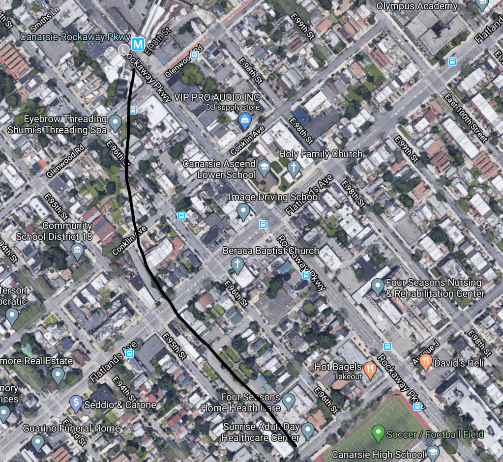
Canarsie-Rockaway Parkway (L)
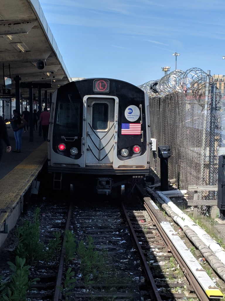
Rockaway Parkway is the last stop on this train. In 1916, when the line was electrified further south than New Lots Ave, it stopped at Rockaway Parkway, and the tracks that continued to Canarsie Pier were completely turned into a streetcar line by 1920. This service was stopped in 1942, but the B42 bus follows a similar route, albeit on streets and not the private right-of-way of the railroad. The right-of-way is still somewhat visible from Google Maps, showing where the tracks curved south to reach the pier.
Canarsie, or Canarsee, was the Dutch name (exonym) for the Indigenous Lenape people who inhabited the western part of Long Island and southern Manhattan, which comes from the Indigenous name for the land they inhabited. We don’t know what the Canarsee called themselves (their endonym) because it was common for European settlers to refer to the Indigenous peoples not by their endonym, but by their name for the land. It was the Canarsee people who “sold” the Island of Manhattan to the Dutch settlers, although the concept of ownership was something alien to the Canarsee and the Dutch failed to realize that owning land was not something that translated across cultures. Today, Canarsie is a neighborhood in southeast Brooklyn and a name that reminds us today of the people that lived before us.

This is great!
The abandoned mezzanine at 8th Ave/14th street is a disused connection to the 7th Ave/14th street station on the IRT. I don’t believe it was in use before the 1999 renovation, and it was severed from the 8th Avenue station by the need to add an ADA-compliant ramp down to the L platform elevators.
LikeLike
This is great!
The mezzanine at 8th Avenue used to provide a connection to the next station east, 14th Street on the 7th Avenue Line. Disused for many years (I forget how many) it was severed from the station during the 1999 renovation to make room for the ADA ramp.
LikeLike
You say there were no trains using the connection from the LIRR Bay Ridge Branch to the Linden Shops. There aren’t any scheduled trains, no, but I am aware of a few special movements that used this interchange.
One was when the LIRR caboose #60 was displayed in the Transit Museum in 2009. April 4th of that year they brought it from Riverhead to the crossover, then the South Brooklyn Railroad (the MTA’s freight arm, now mostly unused with the 1985 removal of the tracks on McDonald Ave, but they still exist on paper and own two locomotives) picked it up at the interchange, ran it over the Williamsburg Bridge, down to the Montague Street Tunnel and to the yard at 37th Street, Then with a new crew they ran back up to 207 Street Yard for prep (had to reinforce the floor, install plexiglass panels on the end platforms, and install locks on things not meant to be accessed by the public, like the toilet!), and back to the Transit Museum at Court Street. (Apparently the Christie Street connection, tracks BJ1-2, were unavailable that day due to track work, or they coulda just gone straight up the 6th Ave line.) Details at this link: https://railroad.net/viewtopic.php?f=63&t=60671
Another was the time that Metro North borrowed one of the MTA’s GE 50-tonner freight/work locomotives for switching duties in Grand Central while their switcher was being repaired. When it was sent back down to the MTA, the engineer assigned to it was supposed to tow it with LIRR locomotives, but ran it under its own power instead, towing the LIRR units with it; he said he couldn’t believe the acceleration in that little beast. I can’t find the post now.
Here’s an amusing story about delivering R143 subway cars by that interchange: https://railroad.net/viewtopic.php?p=493534#p493534
LikeLike