
Brooklyn
(4)(5) IRT Eastern Pkwy Line
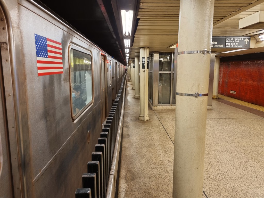
Atlantic Ave-Barclays Center (2)(3)(4)(5)
The Interborough Rapid Transit (IRT) Atlantic Ave station was the southern terminus of the first ever extension to the New York City Subway. This extension, called Contract 2, was one of the most important events in the history of the subway. The history of Contract 2 is messy, as plans were redrawn in the middle of construction, and there were numerous expansions and extensions planned, some of which never came to fruition. Contract 2 set the stage for how the rest of the subways history would play out.
The history of subway lines in New York is complicated as a rule, but I am usually quite good at untangling the historical mess and figuring out what happened. However, this short section of track, from Borough Hall to Atlantic Ave, has defeated me. In all of the books and websites dedicated to the history of the New York City subway, not one that I have so far read is clear about the timeline of the plans for the Contract 2 subway. I will do my best to describe the line as it exists now, and provide the historical information that I know to be correct, and then, before we reach Borough Hall, I will lay out every piece of information I have ever read about this line, and let you attempt to form a coherent narrative out of it, because I sure couldn’t.
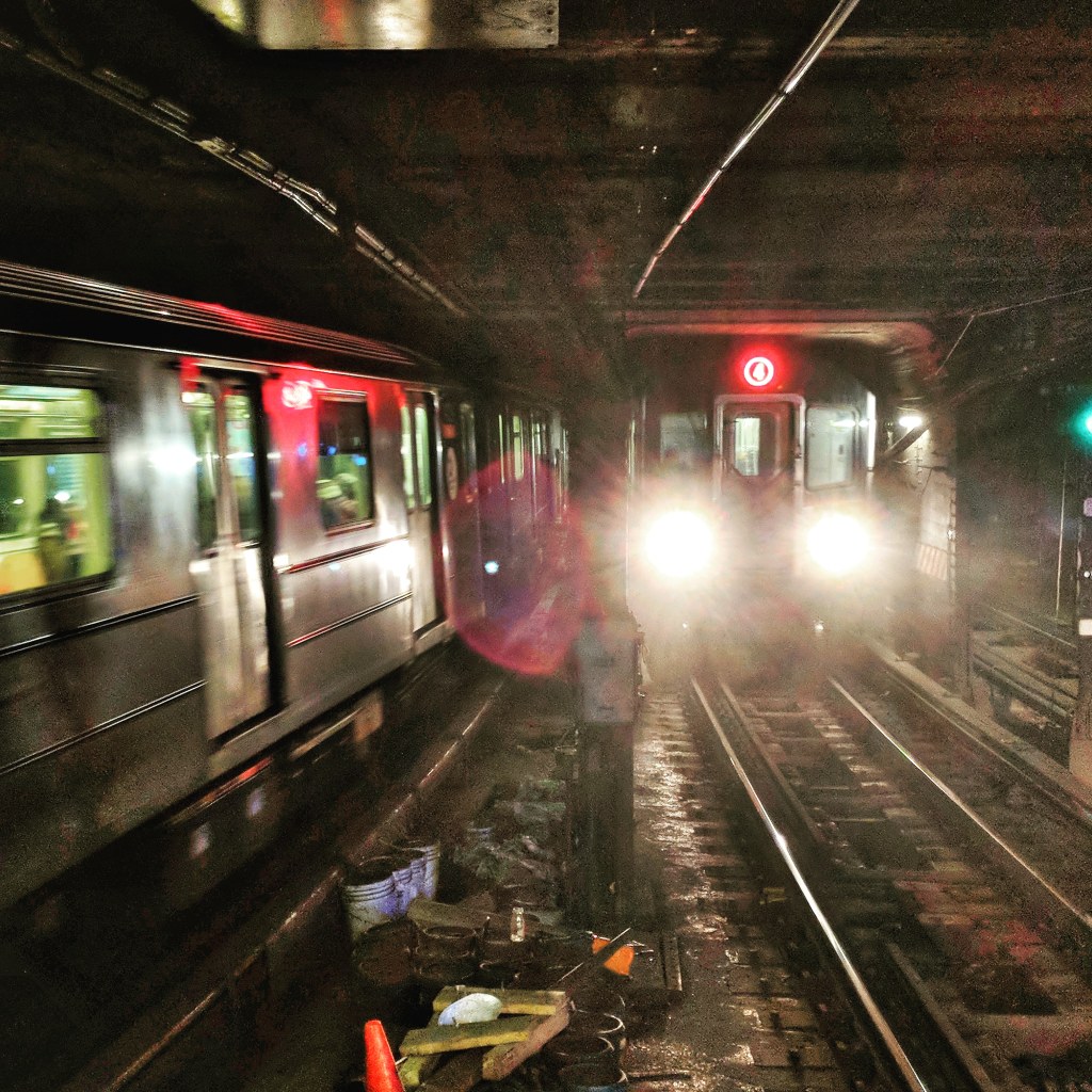
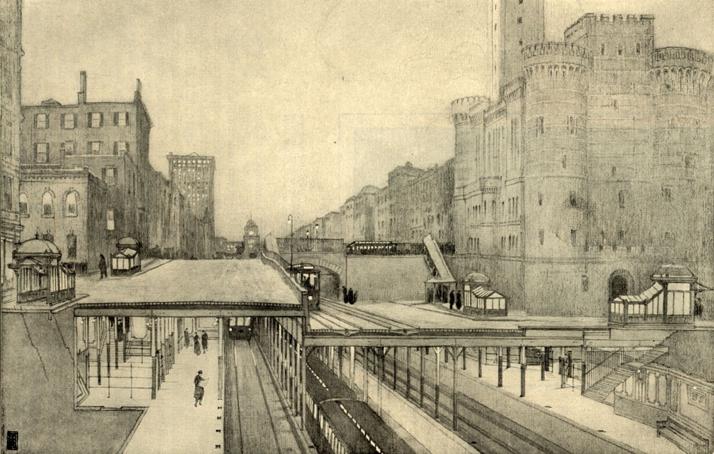
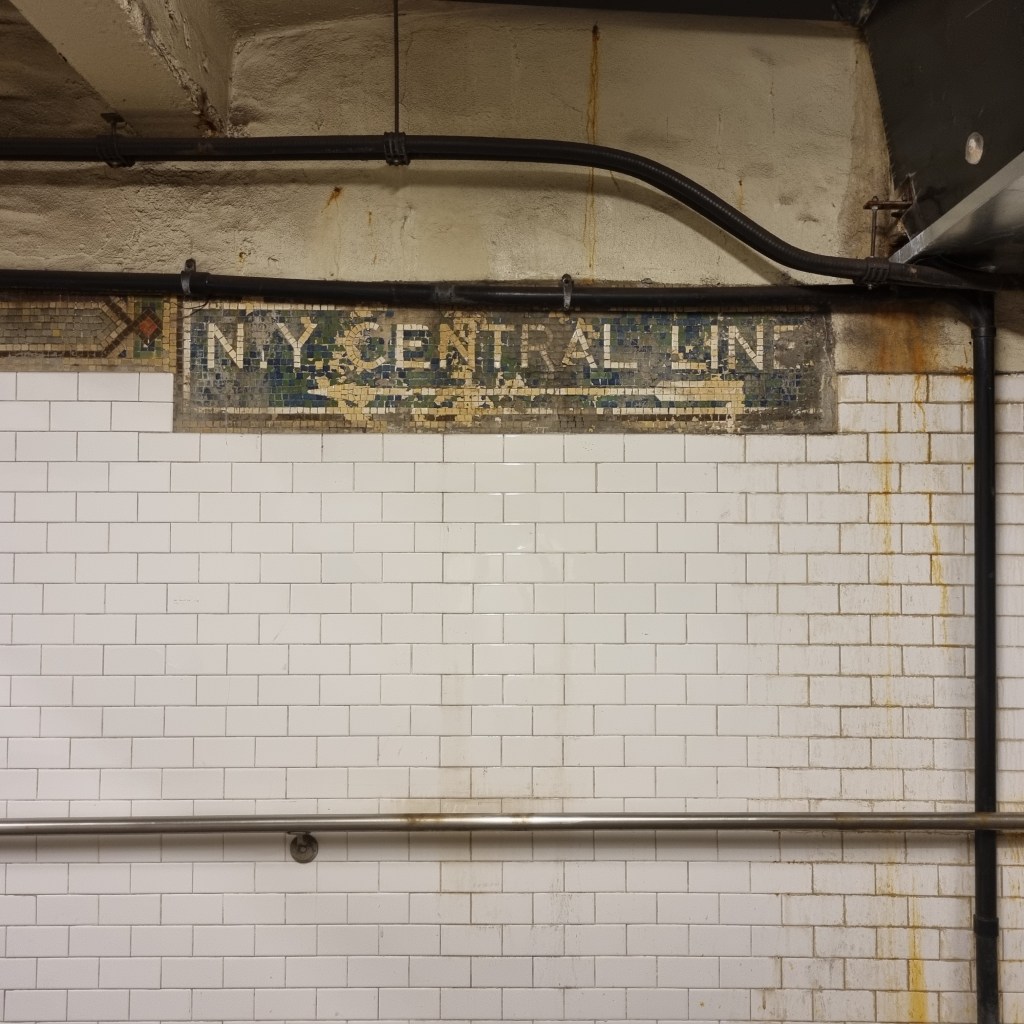
Atlantic Ave-Barclays Center is one of three express stations in the system where the express and local tracks don’t share an island platform. This was the first place this layout was used, with the express tracks sharing the middle island platform, and the local tracks each having their own side platform. The other two stations are both 34th St-Penn Station, on the IRT Broadway-7th Ave Line and the IND 8th Ave Line. Because this station interchanges with the LIRR terminal, limiting overcrowding by preventing cross-platform transfers like the justification for the same layout at 34th St-Penn Station, might have been part of the reason for not having shared island platforms between the express and local tracks here. Nevins St, one station north is a normal express stop with two island platforms, each between the local and express tracks, and therefore allows for cross platform transfers that are prevented at Atlantic Ave.
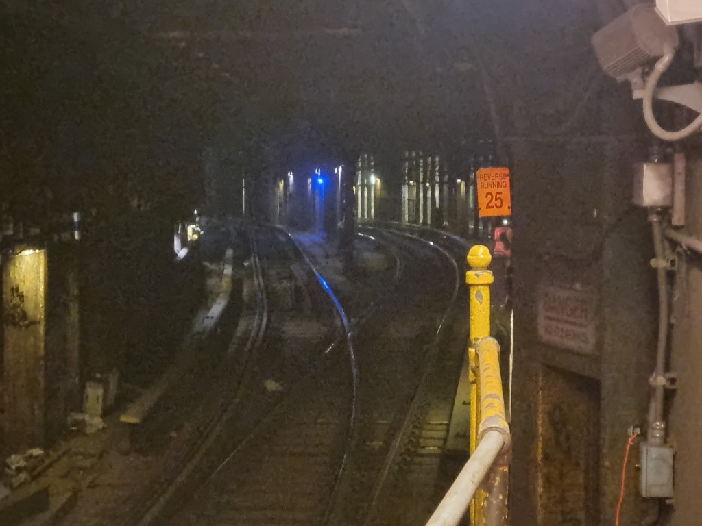
North of Atlantic Ave, just barely visible on the northbound local and express platforms is the provision for a connection to the LIRR. As you might remember from the BMT Jamaica Line post, the LIRR has a history of planned inter-operation with the various subway and elevated companies in New York. The LIRR had plans to extend its line in Brooklyn into Manhattan, and when the IRT built a station literally next door to the LIRRs Brooklyn terminal, there seemed no better chance for them to get their wish. The two stations were not explicitly designed for integration, as if they had been, no IRT station would have been built, and the IRT simply would have connected their tracks to the existing LIRR station. However, provisions existed for a connection to be built, with eastbound LIRR trains serving the IRT station and then connecting to the LIRR line, and westbound LIRR trains serving the existing LIRR station and using a connection north of the IRT station to join the IRT line. It is this provision that is somewhat visible from the IRT platforms.

Nevins St (2)(3)(4)(5)
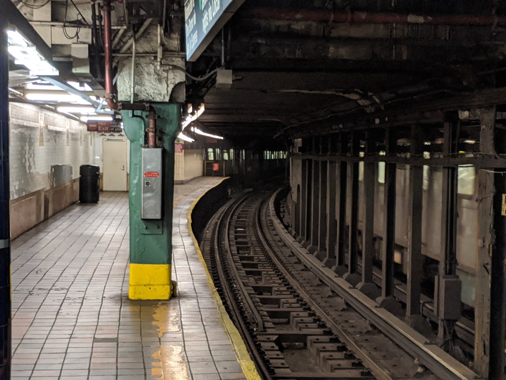
Nevins St is one of the stations with the most wasted potential in the system. Much like Chambers St for the BMT, Nevins St was planned to be the beating heart of the IRT empire. In reality, it is a simple express station, too close Atlantic Ave to be useful much on its own, and primarily designed for serving as the last cross platform interchange station on the IRT Eastern Pkwy Line before Manhattan. But the IRT had big plans for Brooklyn. Contract 2 was the last contract before the Dual Contract period, in which the city negotiated with both the Interborough Rapid Transit (IRT) and the Brooklyn Rapid Transit (BRT) companies. However, before the BRT was brought into the negotiations, the IRT had its own plans for an Eastern Pkwy Line, a Lafayette Ave Line, and a 4th Ave Line. All of these would have branched out from Nevins St.
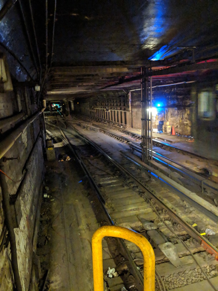
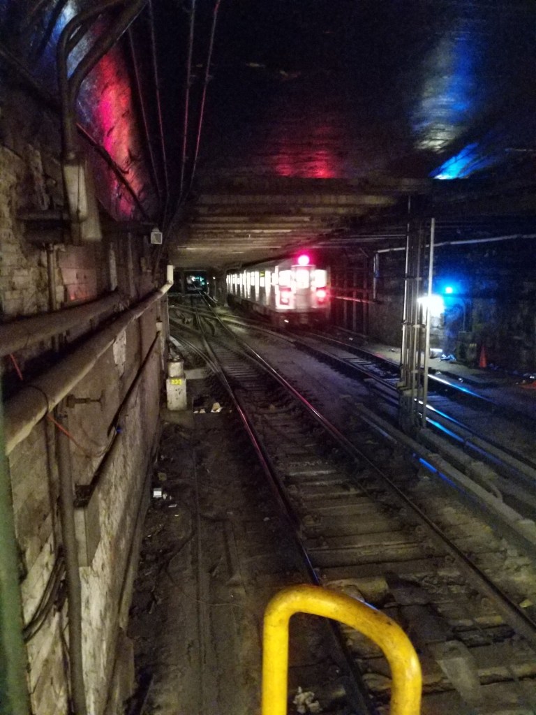
Nevins St was built with a one-track, one-platform lower level, with the lower level platform below the upper level southbound island platform, and the lower level track below the upper level southbound express track. To the north of the station, this lower level track connected with the southbound local track east of Hoyt St. There was also a provision for the lower level to connect to the Manhattan Bridge, which was under construction at the time. This line was originally planned to connect with the IRT 3rd Ave Elevated Line in Manhattan, although when the BRT eventually built its subway over the Manhattan Bridge, that plan evaporated. On the upper, in service, level at Nevins St on the northbound local track, there is a section of wall that could be knocked through had this Manhattan Bridge Line come to fruition.
South of Nevins St, there was the provision for a branch line along Lafayette Ave. Provisions for this line exist both on the upper level northbound local track and on the unused lower level track. The lower level line would also continue along Flatbush Avenue, ascending to reach the level of the four track main line. It would have merged with the upper level southbound local track, and then a line would have branched off, turning south under 4th Ave. For northbound trains along the would-be IRT 4th Ave Line, they would have been on a lower level, turning north onto Flatbush Avenue below the existing tracks, and ascending to the main level in between the Atlantic Ave and Nevins St stations. The ramp where this would have happened is gone now, as in 1963 the tracks in between Atlantic Ave and Nevins St were rebuilt. There are five tracks here, with the center one being unused in regular service. Before 1963, this track was the northbound express track, the current northbound express track was the northbound local track, and the current northbound local track would have been the IRT 4th Ave Line northbound local ramp. I believe that the provisions for the IRT 4th Ave Line were destroyed when the BRT built the 4th Ave Line.

This plan, had it come to fruition, would have given the IRT a massive advantage in Brooklyn over the BRT, which at this point only operated Elevated lines. However, with each of Contracts 3 and 4 going to one of the two companies, and the BRT being granted the 4th Ave Line as part of Contract 4, the IRT’s plans for Brooklyn expansion were dashed, and only the IRT Eastern Pkwy and IRT Nostrand Ave Lines were ever completed. It is also probably good that at least the IRT 4th Ave Line was never built, as there were only provisions for two tracks which would have been woefully inadequate for passengers volumes, at least in modern times.
Borough Hall (4)(5)
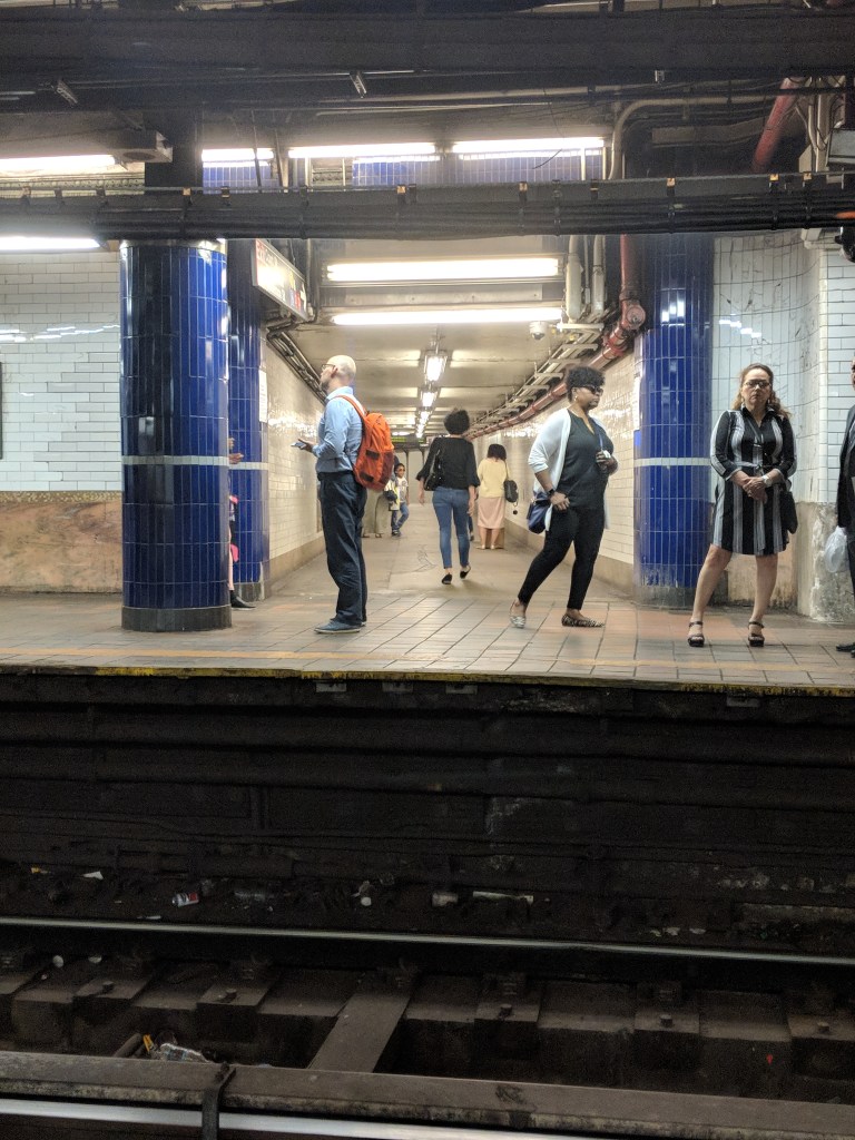
The IRT Lexington Ave (4)(5) station at Borough Hall has one of my favorite spots in the whole system. As you may recall from the IRT Broadway-7th Ave Line post, the (2) and (3) train platforms at Borough Hall are stacked on top of one another. The Manhattan-bound track, which is the local track from the IRT Eastern Pkwy Line, is at the same level as the (4) and (5) platforms, while the Brooklyn-bound platform is below. The Manhattan-bound local track diverges from the express tracks immediately east of the (4)(5) Borough Hall station. When I say immediately, I mean immediately. At the eastern end of the Manhattan-bound platform (back of the train), you can stare down the tunnel underneath Fulton St and watch as Manhattan-bound (4)(5) trains enter Borough Hall station from the IRT Eastern Pkwy Line express tracks on your right hand side, and watch the Manhattan-bound (2)(3) trains enter their platform at Borough Hall from the IRT Eastern Pkwy local track on your left hand side. When both a local and an express enter the station, they come barreling towards you down the tunnel, diverging at the last second and giving you an amazing view of both trains. Well, it’s an amazing view if your definition of amazing view is one that involves multiple subway trains only a few feet from your face. Borough Hall also has overpasses which provide great views of the trains passing below.
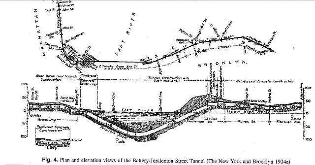
The Joralemon Street Tunnel was the first tunnel to connect Brooklyn and Manhattan. It was originally called the Brooklyn-Battery Tunnel, which nowadays refers to the road tunnel built to the south. The assistant engineer for the subway tunnel was one Clifford Millburn Holland. The name Holland and the word Tunnel in the same sentence has another more famous association in the greater New York area. A road tunnel underneath the Hudson River bears his name, as he was the first chief engineer on the project that is now known as the Holland Tunnel. A little known fact, (to me at least, as I’m sure the Clifford Millburn Holland stans are already aware of this), is that Holland also served as the engineer-in-charge of the Clark St (2)(3), Montague St (R), 14th St (L), and 60th St (N)(R)(W) tunnels. Too bad he’s now only known for the road tunnel instead of his many subway projects.
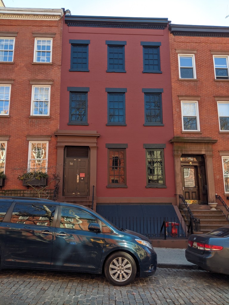
When the Joralemon Street Tunnel was being constructed, the IRT bought the house at 58 Joralemon Street, gutted it, and converted it into a ventilation shaft and emergency exit. The windows are now blacked out and the front door doesn’t work, but the structure and façade of the house was left intact.
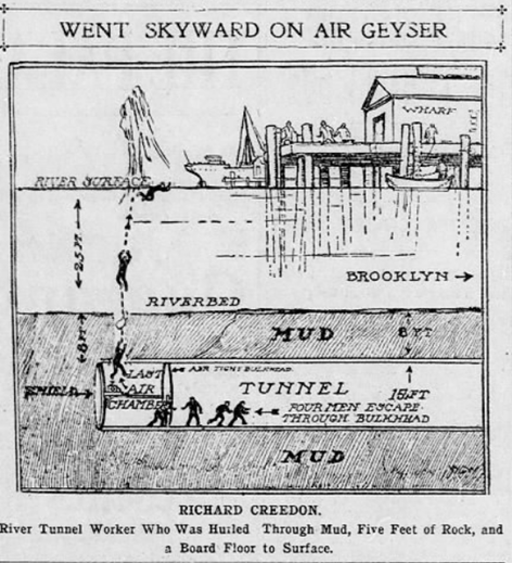
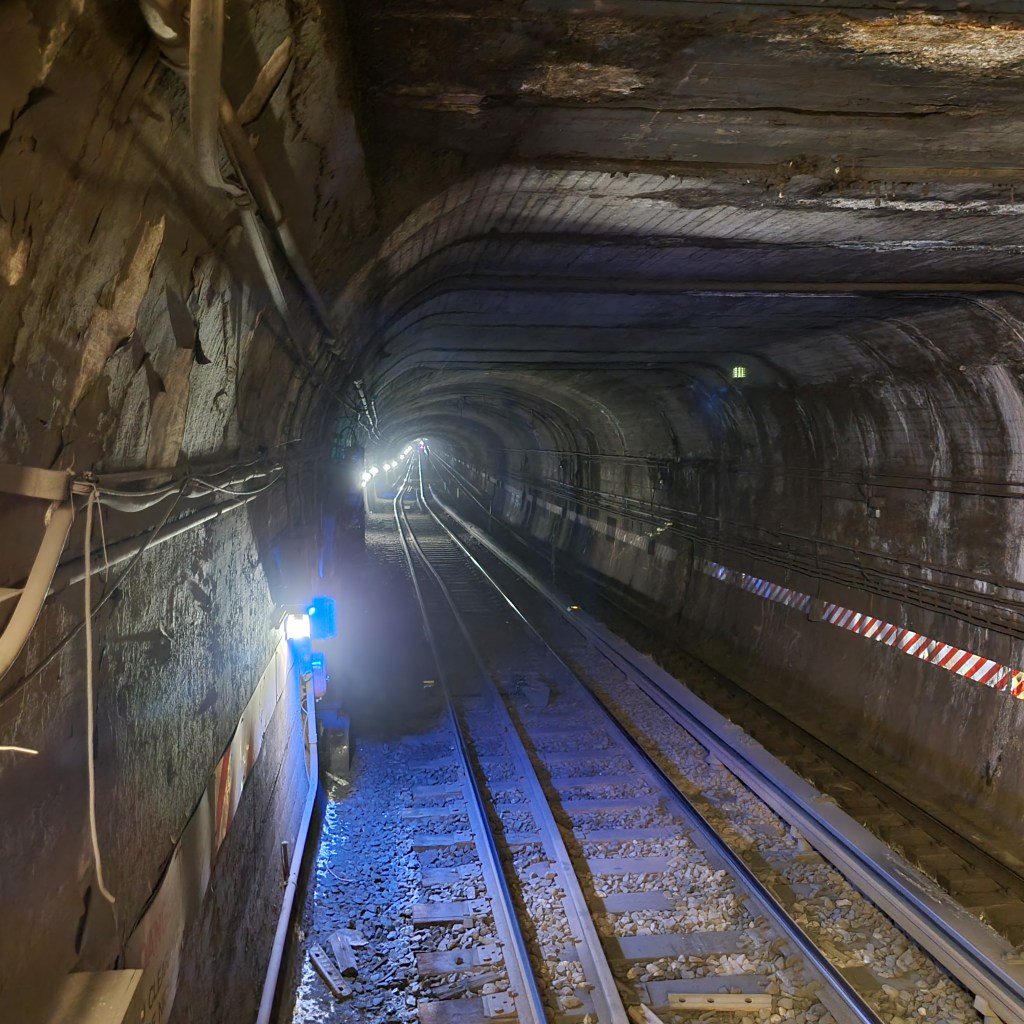
The construction of underwater tunnels was incredibly dangerous. Tunnels were constructed with a pressurized chamber in which laborers worked to carve out the tunnel, as steel rings were placed behind them to support the tunnel. The pressure was so great that workers could only work for a few hours at a time to avoid negative health effects. On March 27, 1905, during the construction of the Joralemon Street Tunnel, one Richard Creeden experienced one of the working hazards of the job. A fissure appeared in the roof of the tunnel, and as he rushed to fill it with sand and sawdust, as was the procedure, the escaping air from the high pressure chamber pushed his body into the roof of the tunnel. The pressure grew and grew until he was blown straight through the roof of the tunnel, through 17 feet of river bed, 10 feet of water, and into the air. Miraculously he survived, and no one in the tunnel was killed in the ensuing flood. However, many workers were not as lucky. Blowouts and floods killed many of the workers who built the underwater tunnels in New York.
Migraine-Inducing History
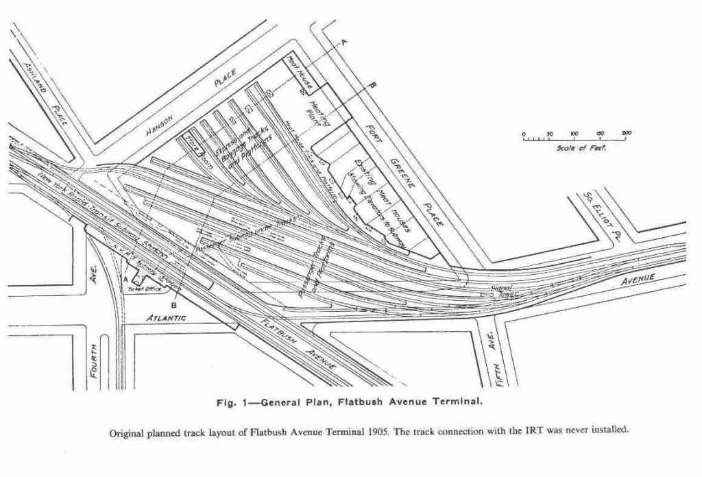
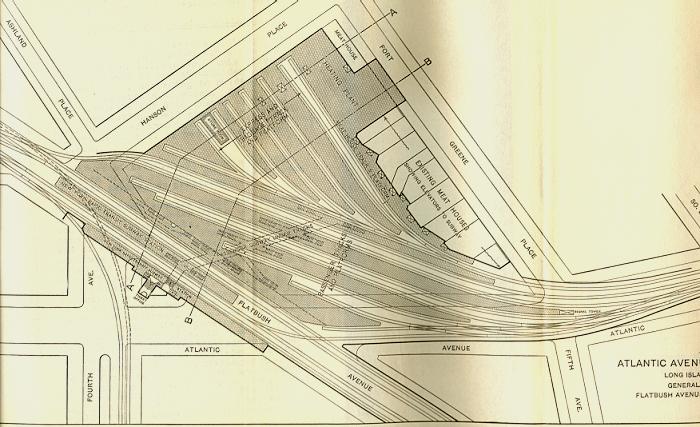
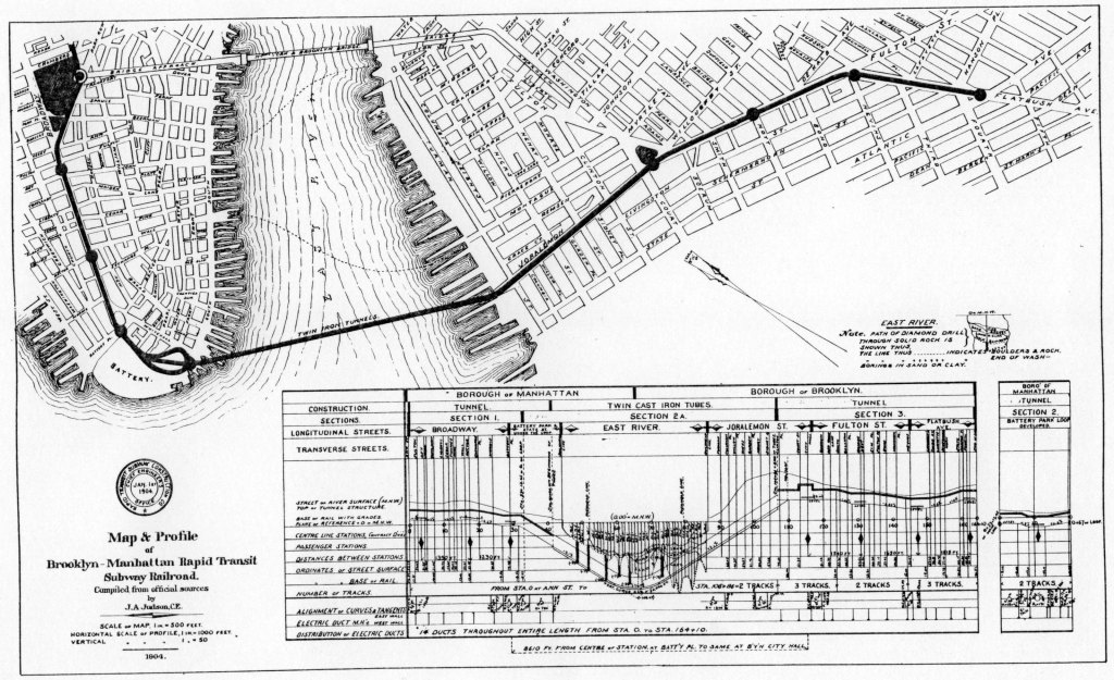
Now to untangle the history of the planning of this less than a mile stretch of subway. The Borough Hall station opened in January of 1908, and was the first subway station outside of Manhattan. There are two tracks and two side platforms at this station. The line was planned to continue east under Fulton Street as a two-track subway, and when it turned southeast under Flatbush Avenue, widen to three tracks, with Nevins St being a three-track local station with two side platforms. This three track line would continue towards the at-the-time terminus at Atlantic Ave, although eventually the line would continue deeper into Brooklyn. Got it? This is where things start to get confusing.
When Atlantic Ave opened on May 1, 1908, it may have been a two-track terminus with an island platform and two side platforms. I have only found this claim on Wikipedia, and it is not cited. This layout is confusing however, because if the line had just become a three-track line one station north, where would this third track go? Perhaps when the line was extended, the IRT planned to remove the middle island platform and install the third track? That doesn’t make any sense, as Atlantic Ave has a transfer with the LIRR, and the IRT would want to take full advantage of those connecting passengers with an express stop.
By the way, this platform-on-both-sides layout is called the Spanish Solution, and allows loading and unloading to occur on different sides of the train. For reference, most IRT elevated terminals (such as Van Cortlandt Park-252nd St, Woodlawn, Wakefield-241st St, and Pelham Bay Park) were organized in this way, although the side platforms have since been closed. The name “Spanish Solution” apparently comes from its common use in the Madrid and Barcelona Metros, however the earliest subway in either of those cities was opened in 1919, 11 years after Atlantic Ave was opened.
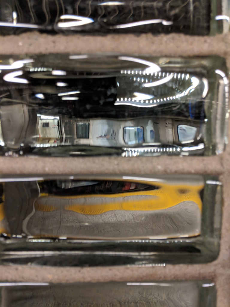
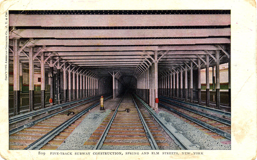
Perhaps Atlantic Ave was never operated as a Spanish Solution station. What is true is that during the construction of the line, plans were changed, and instead of being a two-track line under Fulton Street and a three-track line under Flatbush Avenue, the line would be widened to a four-track line under Fulton Street and five-track line under Flatbush Avenue. The two new tracks were added to the outside of the existing two/three tracks. The fifth trackway only exists because the original three trackways had already been built under the middle of Flatbush Avenue. That is why at Nevins St, there is a gap in between the two express tracks, and why there is an unused storage track in between Nevins St and Atlantic Ave. It is during the widening of the Nevins St station that the lower level platform was added. This was quite the expense, as the station shell had already been carved out, and it had to underpinned the new platform. It is clear that the IRT were serious about their expansion plans in Brooklyn.

Atlantic Ave was widened, with the two new outer tracks being added on either side of the original two tracks and their island platform. Unlike at the two Penn Station subway stations, it seems that Atlantic Ave’s unorthodox express station layout is due more to an accident than planning. While this seems like the story wraps up in a nice bow, with plans being changed halfway through to widen the line and Wikipedia simply being wrong about the original layout of Atlantic Ave when it opened, I am actually left with many many more unanswered questions.
Where does the Hoyt St station fit into this? Was it a planned local station on the original two-track line or was it added when the line was widened to four tracks? It opened in 1908 with the rest of the stations, so it seems like it was planned, but there is no mention of it being rebuilt to fit the new wider line. Nevins St had to be partially reconstructed for the widening, so why not Hoyt St?
Why was the original plan was to widen the line to three tracks under Flatbush Avenue only to return to a two-track island platform (and possibly two side platforms) station at Atlantic Ave? What did Atlantic Ave look like when it first opened? Was it a Spanish Solution style layout, or had the outer tracks been added before it opened? If the outer tracks had been added before it opened, which I think is likelier, how did those local trains turn around? Did they have to cross all five tracks at grade in between Atlantic Ave and Nevins St? The extension to the IRT Eastern Pkwy Line didn’t open until 1920, a full twelve years after Atlantic Ave, so that is a long time to have such an inconvenient terminal layout.
And I haven’t even mentioned the fact that the IRT Broadway-7th Ave Line tracks that now connect to the IRT Eastern Pkwy Line local tracks didn’t even reach Borough Hall until 1919, so for eleven years the three stations east of Borough Hall were all being served exclusively by the express trains from the original subway line. Why would you build both express and local tracks for this three-station segment that only has one local station? If anyone has clear answers to these queries, please let me know, I am going crazy trying to figure it out.
Manhattan
(4)(5)(6) IRT Lexington Ave Line
Bowling Green (4)(5)
Bowling Green opened in 1905, before the tunnel to Brooklyn was finished. It was originally constructed with just a single island platform, and all trains continued to the original South Ferry station, and used the outer loop platforms. The inner loop track existed, however it was a storage track. It was only in 1918 when the IRT Broadway-7th Ave Line was constructed down the west side and connected to the outer loop tracks that IRT Lexington Ave Line trains started serving the inner loop, at which point a platform was constructed. Currently, some (5) trains use the South Ferry loop to short-turn on weekday evenings and weekends, although no trains stop there.
After the Joralemon Street Tunnel opened, the volume of passengers coming from Brooklyn was too high to warrant terminating rush hour trains at South Ferry, and so a short, two-car platform and track was built on the west side of the Bowling Green station to allow for a rush hour shuttle service between Bowling Green and South Ferry. This is no longer in service, although the shuttle platform can be seen from the in service platforms. In 1978, the northbound side platform was opened in order to relieve congestion in the station. The middle island platform is now only served by southbound trains.
The island platform has a fence on one side, preventing northbound trains from opening their doors. 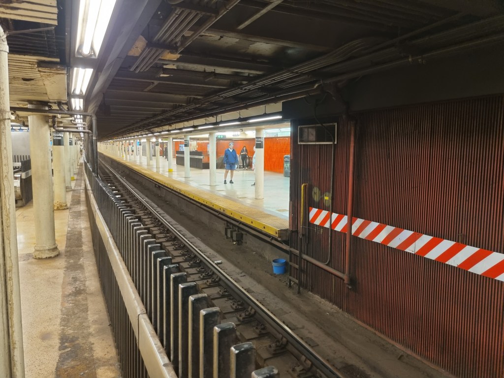
The northbound side platform is slightly offset from the island platform.
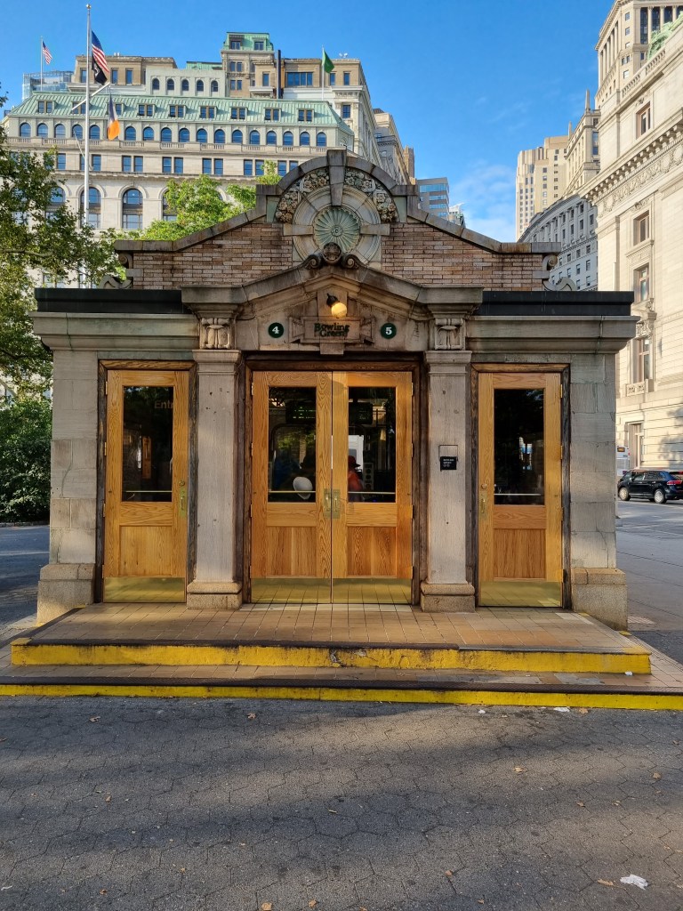
The station house for Bowling Green is very cute. 
I’ve always thought this station should be called Bowling Orange, due to the tile color.
The station is named after the Bowling Green, which is the city’s oldest park. It had been a public space since 1638, when it served as a cattle market, and was converted to a park with a bowling green in 1733. A bowling green is a patch of grass kept for the purpose of playing bowls. Bowls is a game like modern bowling, although is played on grass, and the goal is more akin to Bocce, where the player must bowl a ball as close to another ball as possible, rather than knocking over pins. In 1770, a statue of King George was erected in the park, which as you can possibly imagine did not last long after the Declaration of Independence was signed. In fact it only lasted five days, and was pulled down by Washington’s troops after the Declaration was read aloud to them at the site of what is now City Hall.
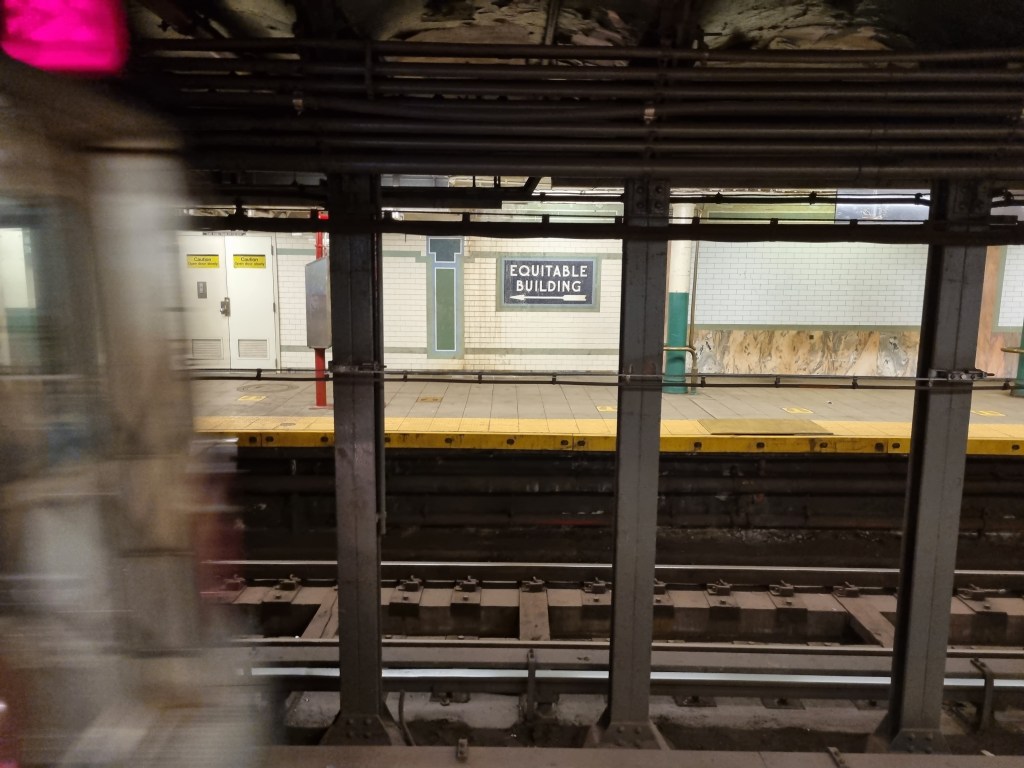
Wall St (4)(5)
The Wall St station has a connection to the Equitable Building, with signs inside the stations directing passengers to the building. When it opened in 1915, the Equitable Building was the largest office building in the world by floor area, and directly contributed to the 1916 Zoning Resolution, the first city-wide zoning code in the country. This new zoning code was designed to prevent skyscrapers from blocking light and air from reaching the street. The main way this was achieved was through setbacks; for every X feet in vertical height, the building had to be Y feet in horizontal height further back from the street. These regulations led to the iconic setback style of skyscraper seen all throughout the city.
Brooklyn Bridge-City Hall (4)(5)(6)
Brooklyn Bridge-City Hall, much like Union Square and 96th St (on the IRT Broadway-7th Ave Line) has two abandoned outer 5-car platforms that used to exclusively serve local trains, when local trains were only 5 cars long. As interesting as the Brooklyn Bridge station is, it is overshadowed in the world of subway secrets by its southern neighbor, City Hall.
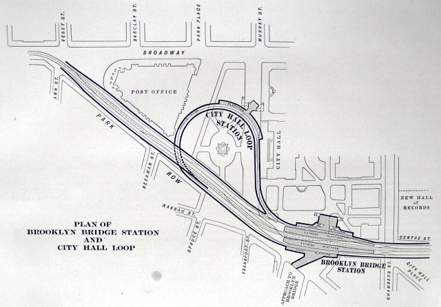
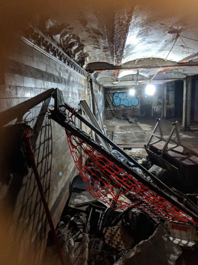
Photo via nycsubway.org 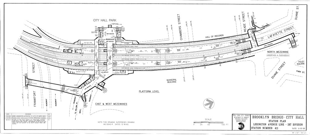
Photo definitely not found here but when I searched Google for the image this was the only place that came up.
The original subway line terminated here at Brooklyn Bridge, with the express trains turning back on tail tracks that extended south past the station. These tail tracks were incorporated into the southern extension of the line. The local trains terminated at the City Hall loop station, which is perhaps the best known abandoned station in the city. The City Hall station was to be the crown jewel in the original subway, and was designed to be unique from the rest of the stations. It features skylights, impressive tiling, an arched ceiling, and a single curved track and platform. The station closed in 1945, due to its proximity to the Brooklyn Bridge station, and as local trains were lengthened from 5 to 10 cars, extending the platform of the City Hall loop was impractical. (6) trains still pass through the station every day as they travel from the southbound local track at Brooklyn Bridge to the northbound local track at Brooklyn Bridge. If you stay on a southbound (6) train after Brooklyn Bridge, you can see the station for yourself, although you might get kicked off before the train leaves.
North of Brooklyn Bridge is the abandoned Worth St station, which closed in 1962 after the Brooklyn Bridge platforms were lengthened to the north. The first collision in subway history occurred when the train operator of a southbound local train did not heed a caution signal at Spring St, and collided into the back of another local train stopped at Worth St. No one was killed, but six people were injured by shattered glass.
Spring St (6)
Spring St was built with five tracks, instead of the usual four. There is an extra track in between the two express tracks, although this fifth track only starts and ends just north and south of the station, so its usefulness has never been clear to me. Not to mention that the actual track was removed shortly after the line opened, and so it is now just an unused space.
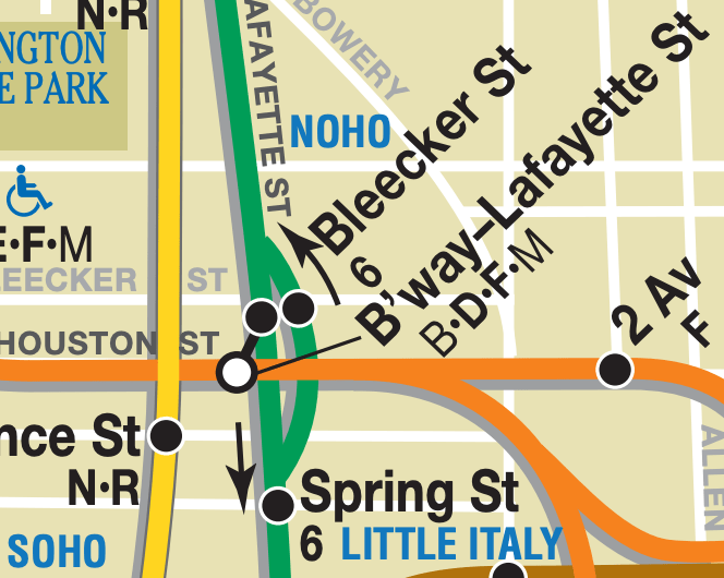
Bleecker St (6)
Many of the local stations south of Union Sq were built with staggered platforms, after platform extensions were added to increase capacity on the subway. At Bleecker St, for example, the northbound track extended from Bleecker Street north to about W 3rd Street, but the southbound platform extended from Bleecker Street south to about Houston Street. The only entrances to the station were at Bleecker Street, and brought passengers down to the rear of the train, in both directions.
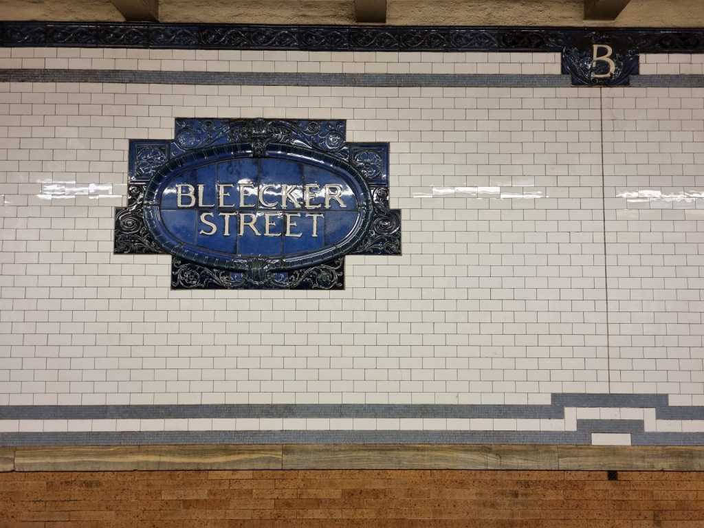
This caused problems when the IND 6th Ave Line was built underneath Houston Street. The IND’s Broadway-Lafayette St station provided a transfer to the IRT’s Bleecker St station, but only to the southbound side, where the IRT platform extended south to Houston Street. Because the northbound IRT platform’s southern end was a full block north of the IND, there was no connection between the IND and the northbound IRT platform. This led to subway maps having a bulge in the line in order to show the one-directional transfer between the two lines.
This was rectified in 2012 when the northbound IRT platform was extended south to line up with the southbound platform and provide a connection with the IND line. The northern end of the northbound Bleecker St platform was closed and walled off, although you can see it from passing train windows.
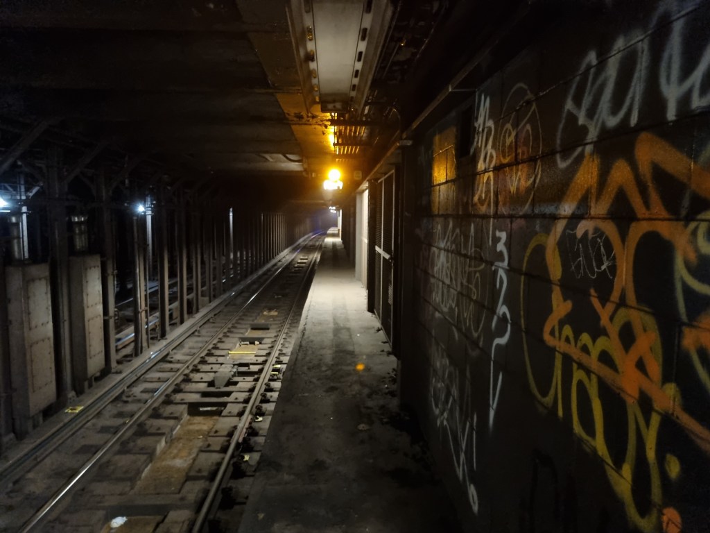
Looking north from the north end of the northbound platform at Bleecker St. The platform clearly used to extend much further north 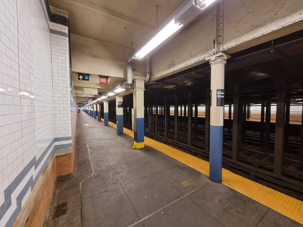
The divide between the original station and the southern extension on the northbound platform is visible through a number of clues. 1) The columns change from cylindrical to I-shaped (that’s a capital i, however the font is sans-serif however so the point is lost). 2) The wall indents by about 30 cm (0.33 yards) for no apparent reason. 3) The ceiling lowers slightly 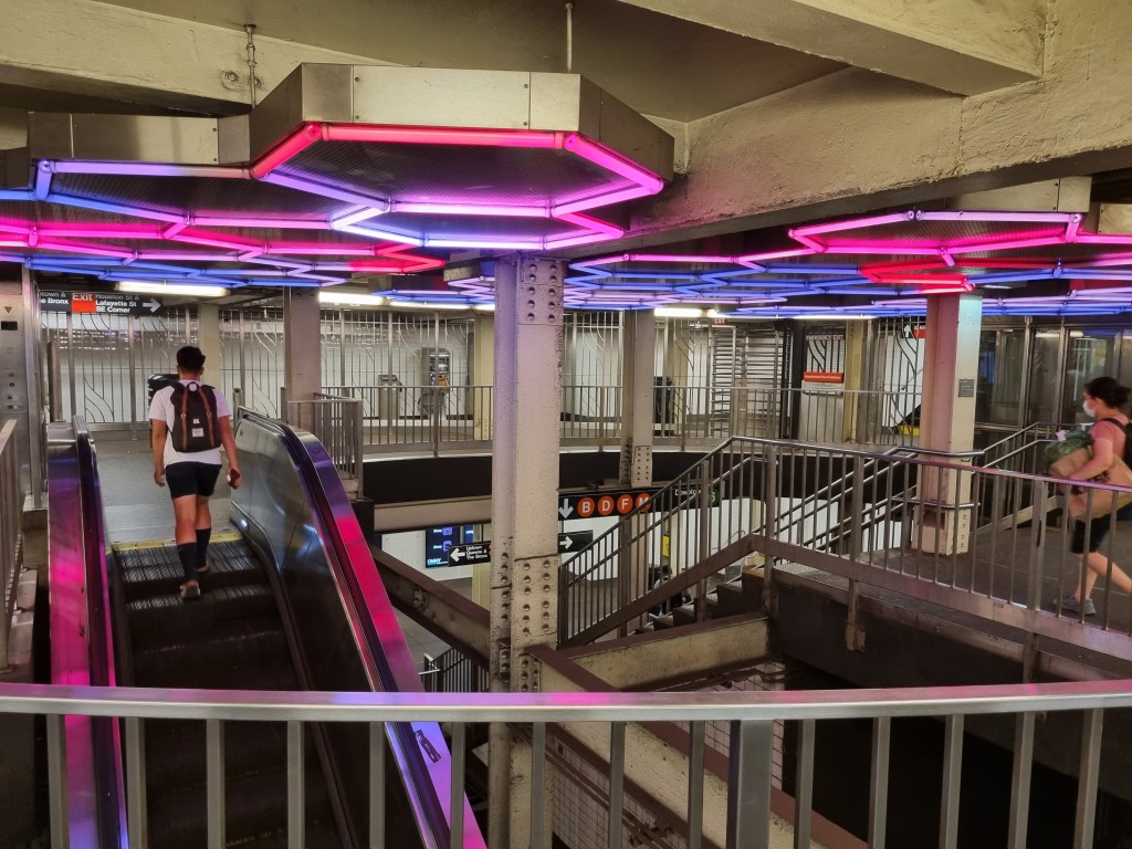
The new transfer between the northbound IRT Lexington Ave Local (6) and the IND 6th Ave Line (B)(D)(F)(M) has this rather cool hexagonal lighting installation
Astor Pl (6)
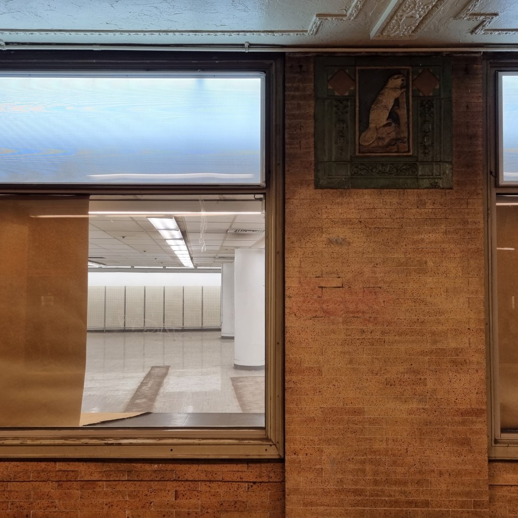
Not much to say about this station except that 1) the street is named after John Jacob Astor, the first multi-millionaire businessman in the United States and 2) there used to be K-Mart at the platform level which has now been abandoned.
The station is decorated with beavers, whose fur John Jacob Astor traded, and which led him to be worth almost a full percent of the US GDP at the time of his death. He would be worth almost $700,000,000 today.
Union Sq (4)(5)(6)
The Union Sq platforms are very curvy (that’s the engineering term), as the subway line zig-zags from underneath 4th Avenue to underneath Park Avenue. The screech of the train wheels on the curved rails make standing at platform level unbearable for more than a few minutes. Due to the sharp curves, this station uses platform gap fillers to bring the edge of the platform closer to the middle doors of the train on the sharpest part of the curves. Similarly to 72nd St on the IRT Broadway-7th Ave Line, there are two out of service “pocket tracks” in between the express and local tracks before the station. These would be a place for a train to wait during busy rush hours if another train was still in the station, however they became useless the moment local trains were extended beyond 5 cars. All throughout the Union Sq Station, bright red frames outline pieces of the original stations, turning the whole station into a museum of itself.

Platform gap fillers at Union Sq. 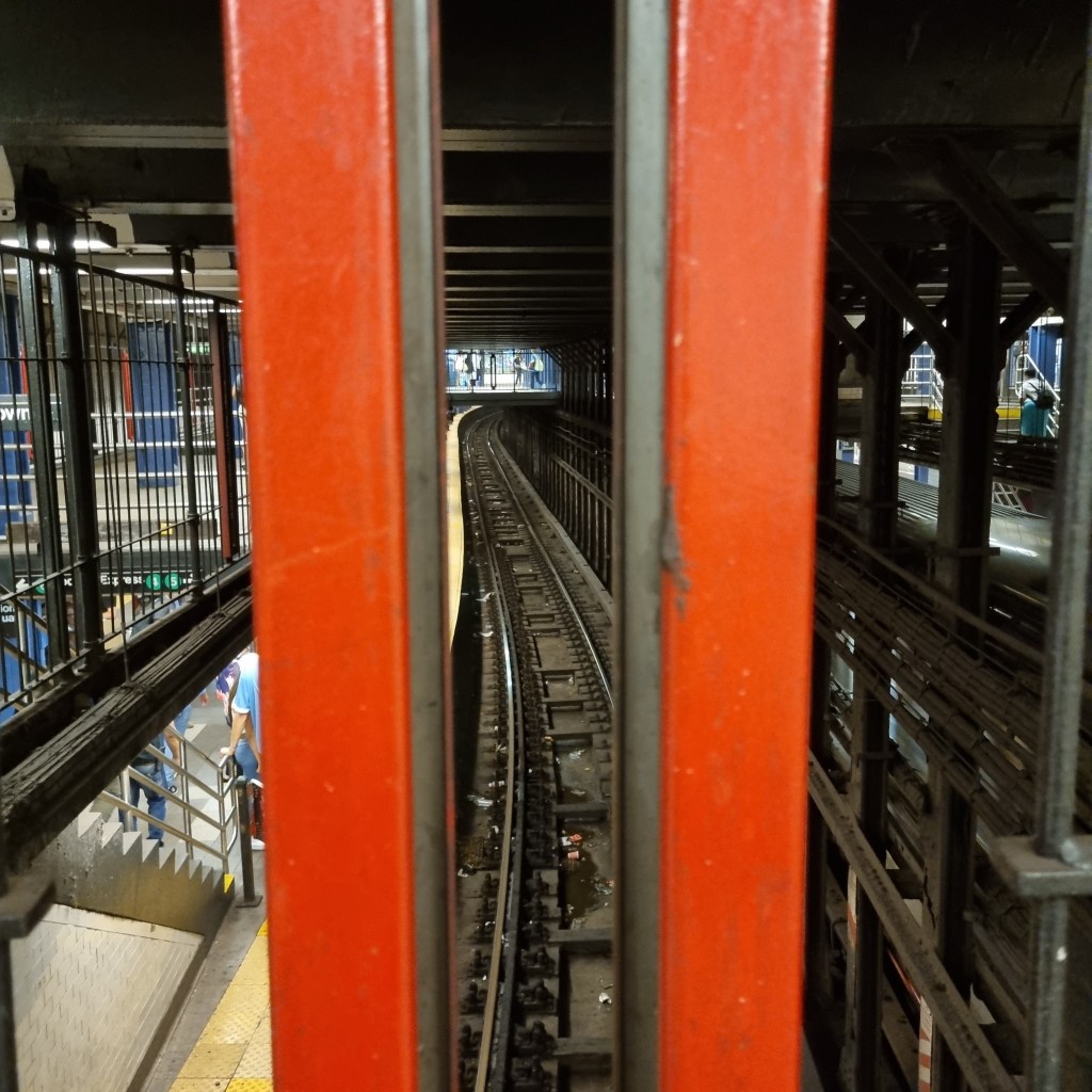
Union Sq has a number of walkways over the tracks. Looking along one of the express tracks, the swervy nature of the station is apparent. 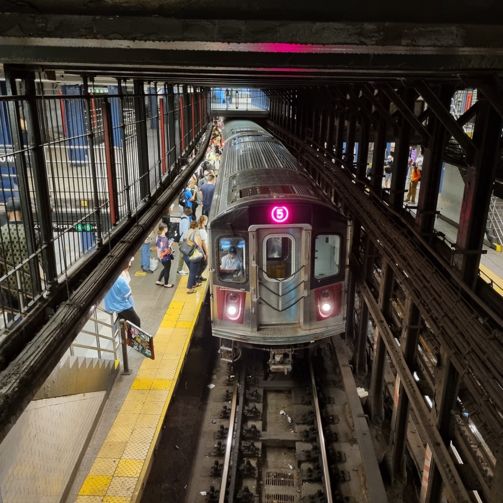
The overhead walkways provide some excellent photo spots. 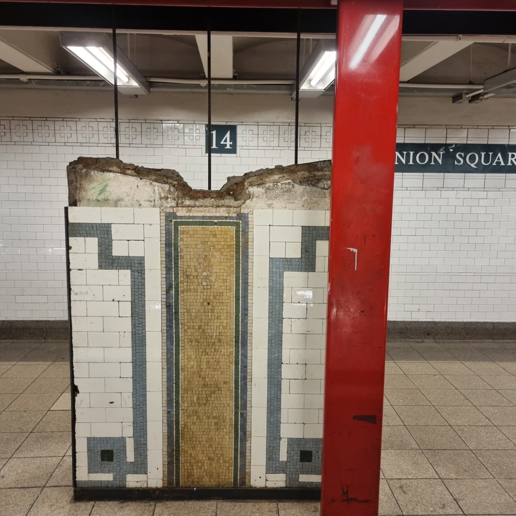
Anywhere you see red metal in the station, it is denoting some aspect of the original station. For example, this is a section of what used to be the wall.
The abandoned 18th St station is just north of Union Sq. This station, like Worth St, was closed when platform lengthening projects at other stations, in this case 14th St-Union Sq and 23rd St, brought those entrances too close to the 18th St station.
33rd St (6)
33rd St is an interesting station. The IRT Lexington Ave Line is the only trunk line of the five major north-south subway trunk lines to not have an express stop at 34th Street. 33rd St is rather deep, when compared to the other cut and cover stations built as part of the original subway. Also, at the northern end of the station, the express tracks are at a lower elevation than the local tracks, allowing passengers standing on the platform to see clear over the tops of the express trains as they pass through the station. All three of these oddities are because of one thing: The Murray Hill Tunnel.
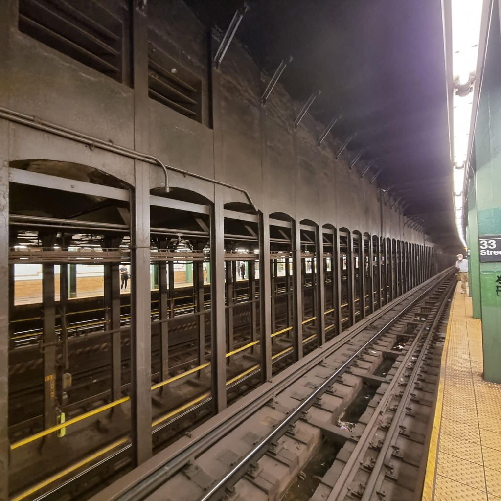
Looking south along the 33rd St station from the southbound platform. The height difference between the express and local tracks is very apparent. 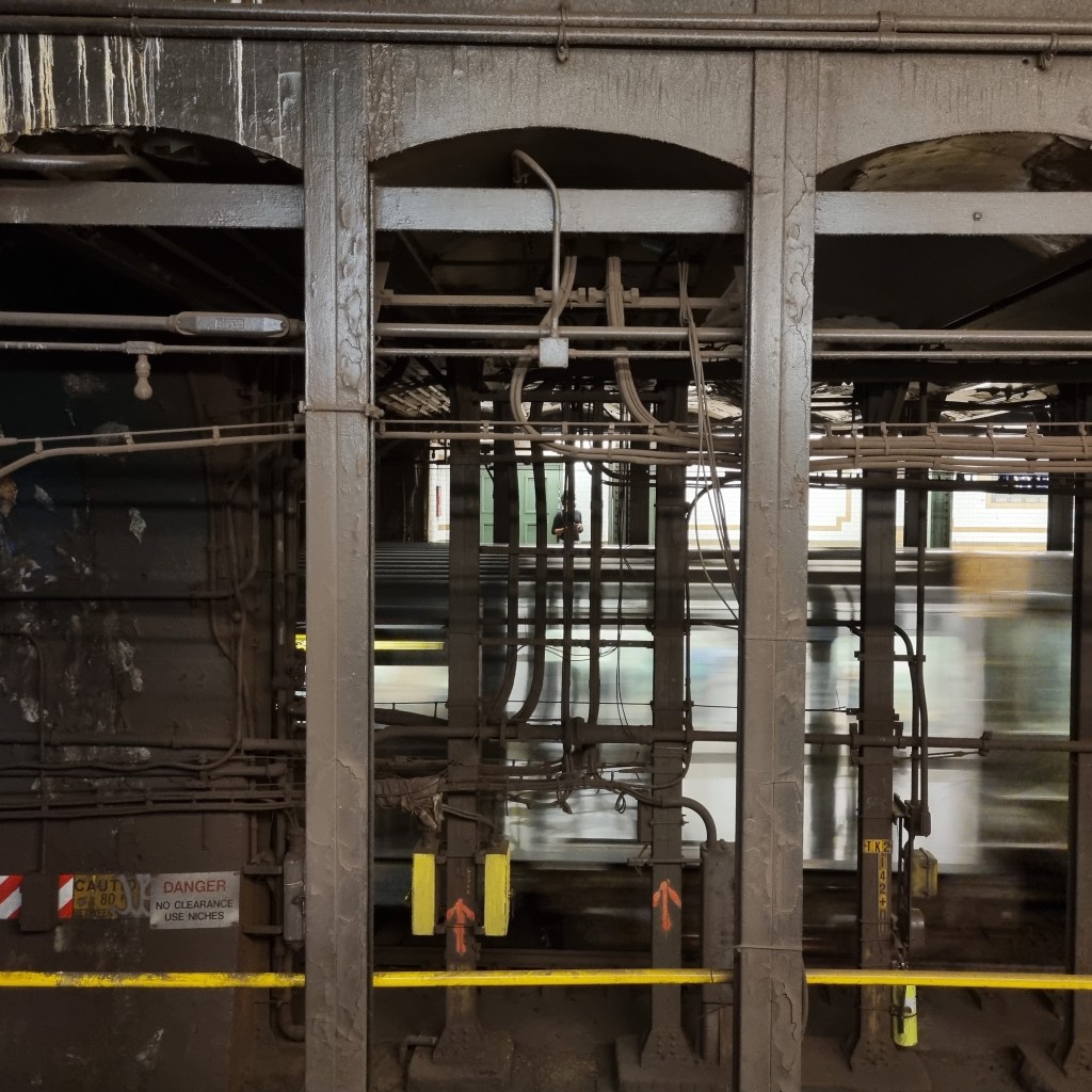
Looking across the 33rd St station at a passenger waiting on the northbound platform. A northbound express train rushes past, at a lower elevation than the local tracks.
The Murray Hill Tunnel opened in 1834, carrying the tracks of the New York & Harlem Railroad (NY&H). The NY&H is a fascinating tale on its own, and I’ll give a brief overview here. It was chartered in 1831 to provided service between New York City (at that time just Manhattan below 14th St or thereabouts and the then separate village of Harlem. The NY&H was one of the first railroads in the United States, and the first street railroad in the world. It ran from Park Row, near City Hall, up Centre Street, east on Broome Street, then north along the Bowery to 14th Street, then along what was then called 4th Avenue and is now called Park Avenue all the way to Harlem. By 1852 it had reached all the way to Chatham, NY 116 miles as-the-crow-flies from it’s southern end at City Hall. In 1871, Grand Central Depot opened at 42nd St, a precursor to today’s Grand Central Terminal. Intercity trains terminated at the depot, and the streetcar continued south of 42nd St. This essentially split what used to be a single railroad line in two, with the mainline railroad taking over the tracks along 4th Avenue north of 42nd St, and the streetcar line using Madison Avenue north of 42nd Street.
In 1834 the railroad built an open cut (a tunnel without a roof) through Murray Hill in order to avoid the steep grades otherwise needed to climb it. In 1850 this open cut was covered, creating the tunnel that exists today. 70 years after the open cut was created and the subway was coming through, the subway tunnel had to find a way around the Murray Hill Tunnel. The solution was two deep tunnels on either side of and slightly below the Murray Hill Tunnel, constructed with a tunneling shield rather than the traditional cut-and-cover. Looking north from the 33rd St platforms, you can see these two tunnels; they have rounded roofs and no support columns, and are separated into northbound and southbound tracks in each tunnel.
In order for the 33rd St station to have a level platform, the local tracks have to rise up quite quickly from their level in the tunnels to the station, however the express tracks, which skip this stop, remain at a much smoother grade, which is why there is such a drastic height difference at the north end of the station.
42nd St-Grand Central (4)(5)(6)
The original subway turned west under 42nd Street towards the west side. The original Grand Central subway station is now the Shuttle platforms, as when in 1918, the H-system was built, the short jog of track across 42nd Street was turned into the Shuttle, and the original subway was split into an east and west side line. The IRT Lexington Ave Line does not actually run underneath Lexington Avenue until north of 42nd St. The new Grand Central station was built diagonally underneath the street grid in order to bring the eastern portion of the original subway south of 42nd St from underneath Park Avenue to underneath Lexington Avenue. The signal tower that controls the entire IRT Lexington Ave Line is located south of the platforms.
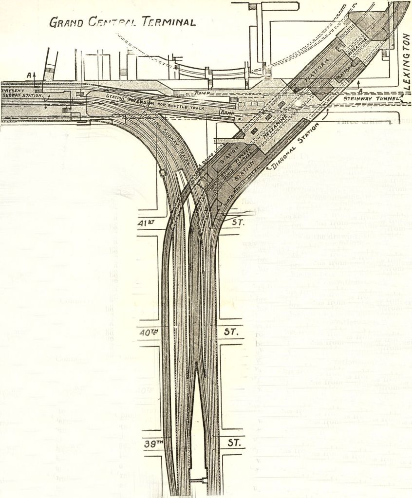
Rather than destroy the original subway tunnels, new ones were built in between and below the originals in order to reach the new Grand Central station. The express tracks split from each of their respective local tracks in between 39th and 40th Streets, and merge into a new tunnel in between the original two. The new express tracks pass under the original northbound tunnel. The northbound local only leaves the original tunnel at 41st St, and actually descends slightly to reach the level of the Diagonal Station. The southbound local track passes underneath all of the original tunnels, and merges into the original southbound tunnel between 38th and 39th Streets.
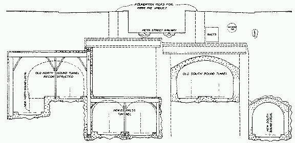
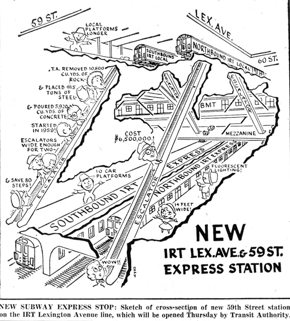
59th St (4)(5)(6)
Between just north of Grand Central until just south of 103rd St, the IRT Lexington Ave Line is built with two levels. The local tracks are on the upper level, and the express tracks are on the lower level. As you might remember from the BMT Broadway Line post, at 59th St, the BMT subway is in between the two levels of the IRT subway. The 59th St station was converted to an express stop in order to facilitate a transfer between the two systems.
86th St (4)(5)(6)
Like 59th St, this express station has two levels, with locals on the top and expresses on the bottom. 86th St is one of only two express stations in the system where there is no possibility to transfer between northbound and southbound trains. The other is Bergen St on the IND Culver Line, not coincidentally another bi-level express station.
116th St (6)
103rd St and 110th St local stations are both four tracks wide; the local and express tracks are on the same level, but the IRT Lexington Ave Line returns to the two-over two-under layout at 116th St.
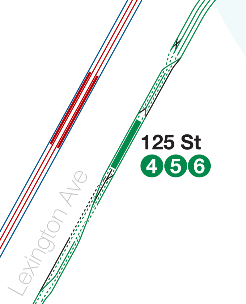
125th St (4)(5)(6)
125th St is also a bi-level station, however it is split into northbound (upper level) and southbound (lower level) rather than express/local. The track layout in and around the station is rather confusing. The interlocking (a series of switches) allows both local and express trains from the IRT Lexington Ave Line to reach either the IRT Pelham or IRT Jerome Ave Lines.
The Bronx
(4) IRT Jerome Ave Line
138th St (4)(5)
138th St was originally called Mott Haven Ave, hence the “MH” tiles in the station. It used to have a connection to the 138th St station on the New York Central Railroads Hudson and Harlem Divisions (todays Metro-North Hudson and Harlem Lines), but that station was demolished in 1973.
149th St-Grand Concourse (4)
There are signs in the 149th St station that point to a never-built 149th St station on the New York Central Railroad.
167th St (4)
The El structure widens in between 161st St and 167th St stations, with the north and southbound local tracks widening, creating a gap between them and the middle express track. These gaps used to provide a connection to the IRT 9th Ave El and its 155th St terminal. The 9th Ave El was the worlds first elevated railroad, beginning with steam engines on April 20, 1871, making it about three months younger than a the German Empire. Much of the 9th Ave El was demolished in 1940, 22 years after the end of the German Empire, however the line from 155th St north to the connection with the IRT Jerome Ave Line remained, and was serviced by the Polo Ground Shuttle. The Polo Grounds was a stadium located in northern Manhattan, and was the home of the New York Giants baseball team. When the team left for San Francisco in 1958, the remainder of the 9th Ave El was demolished and the Polo Grounds Shuttle discontinued.

There are a number of remnants of the IRT 9th Ave El in the Bronx. The line crossed the Harlem River on the now-demolished Putnam Bridge. The bridge was built to serve the Putnam Division of the New York Central Railroad, which ran north from 155th St, through the Bronx north to Mahopac and Brewster in Putnam County in between the Hudson and Harlem lines of Metro-North. It was converted to Elevated use in 1918 when the Putnam Division was cut back to a station called Sedgwick Ave, on the Bronx side of the Harlem River. A short tunnel was built from the bridge, east underneath 162nd St, between Sedgwick and Anderson Avenues, and then on an El structure over Jerome Ave, through the space now taken up by Yankee Stadium (the original Yankee Stadium was on the south side of 161st St), and joined the Jerome Ave Line at River Avenue between 164th and 166th Streets.
There were two stations on the 9th Ave El in the Bronx, one at Sedgewick Ave providing a transfer with the Putnam Division, and one between Anderson and Jerome Avenues, just past the tunnel. Both are abandoned, but with the station structures relatively intact.
Woodlawn (4)
The Woodlawn station is not actually located in the neighborhood of Woodlawn; rather it is situated in Norwood. It was named for Woodlawn Road, the old name of Bainbridge Ave. The name is now primarily associated with Woodlawn Cemetery, the main entrance of which is a short walk north of the station. The layout of Woodlawn is very similar to other IRT Elevated terminals, with a middle platform for boarding, and two side platforms for alighting (the Spanish Solution strikes again). Nowadays the side platforms have been abandoned and all passengers use the middle platform.
(5) IRT Dyre Ave Line
E 180th St (2)(5)
The IRT Dyre Ave Line is the descendant of the much longer New York, Westchester, & Boston Railroad (NYW&B). This was a commuter rail line that started construction in 1909, and served White Plains and Port Chester, New York from a terminal on the Harlem River in the south Bronx. The line was initially built to a high standard, with gentle curves, smooth grades, high platforms, and concrete and marble station buildings. No public road was crossed at grade on the entirety of the route since its inception, avoiding the need for costly (in time and money) grade separation projects, although this contributed to an eye-wateringly high initial construction cost-per-mile of $1.2 million ($34 million in todays money), which was incredibly high for the time.
Service on the NYW&B ended in 1937, and the portion of the line within the city limits was purchased by the city. The IRT initially ran a shuttle between 180th St and Dyre Ave, before the Dyre Ave Line was connected to the IRT White Plains Line at 180th St and through subway service was initiated in 1957. Interestingly, because the city’s takeover of the BMT and IRT in 1940 required all new lines to be a part of the city owned Independent (IND) system, the line was internally referred to as the IND Dyre Ave Line, despite not having any connection to the rest of the IND system. Once the connection to the IRT White Plains Line was built, the line was transferred to an IRT designation.
Some stained glass (I think) decorations in E 180th St
The NYW&B station at E 180th St was opened before the subway E 180th St, on the IRT White Plains Rd Line, and housed the headquarters for the railroad. The old headquarters building still exists, as does the original station, although the station has been abandoned. It sits directly adjacent to the IRT White Plains Line E 180th St station. The NYW&B line used to continue south of the station, and connect with the New Haven Railroad’s Harlem River and Port Chester branch, although new apartment buildings have been put in that right-of-way. Passengers still enter the E 180th St station through the old NYW&B entrance.
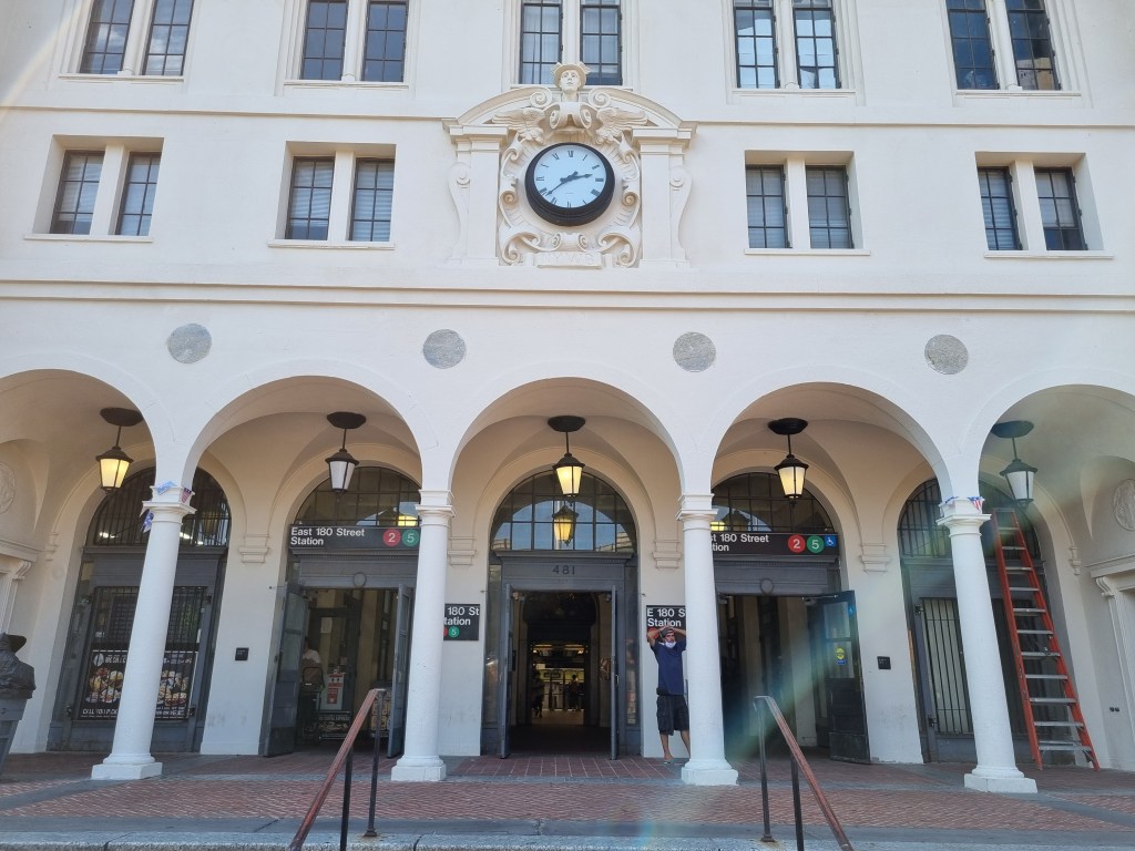
The former NYW&B Headquarters building, now the E 180th St station entrance 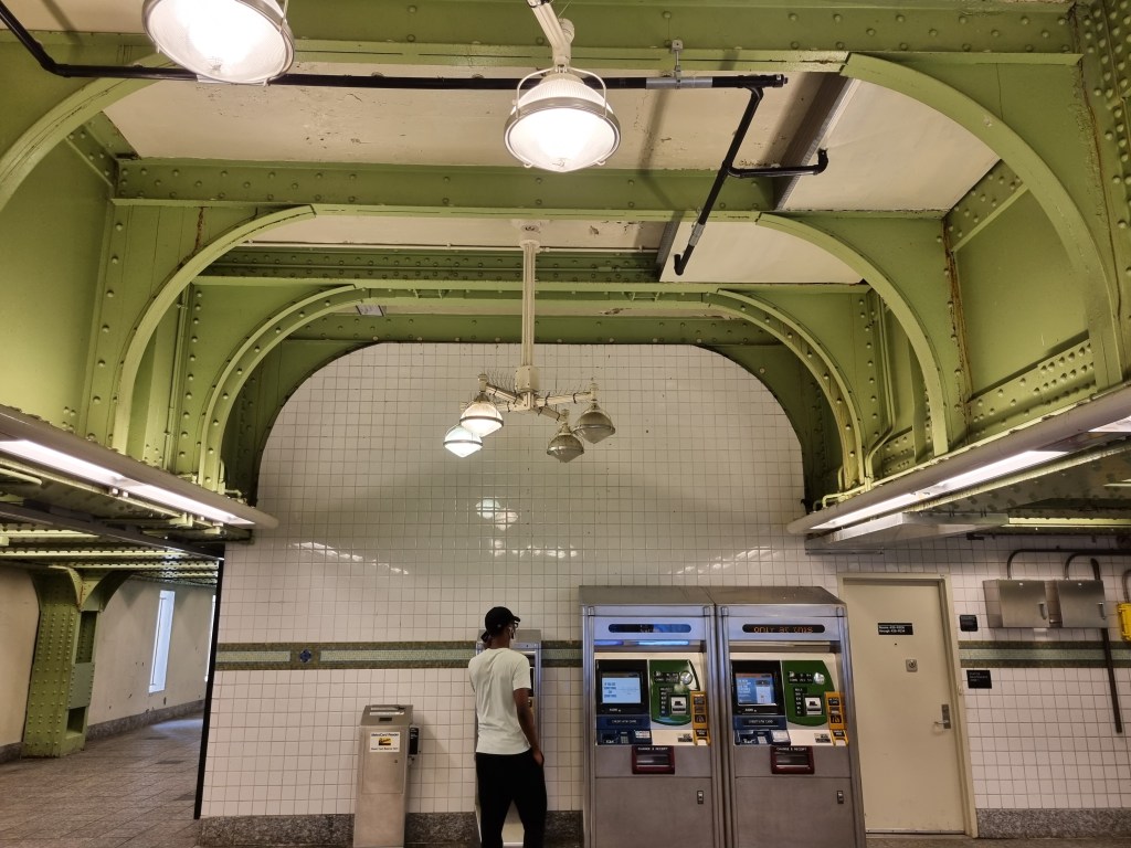
Passengers walk underneath the former NYW&B platforms and tracks to reach the subway. The ironwork to support the former station is quite impressive 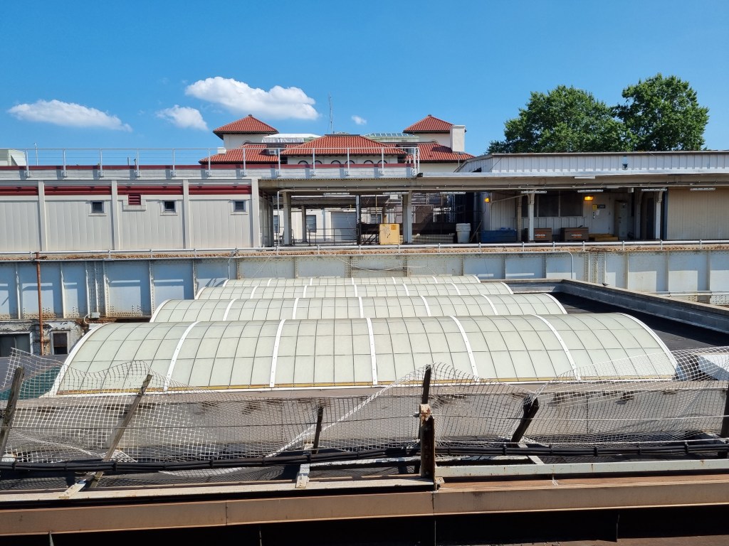
Looking east from the subway platforms at the former NYW&B station. The roof of the walkway between the two stations is visible 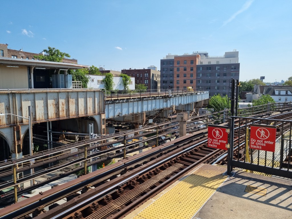
Looking southeast from the subway platforms at the NYW&B tracks. The apartment building is now built in the former NYW&B right-of-way.
Pelham Pkwy (5)
Pelham Pkwy was one of the only two express stops that the NYW&B operated in the Bronx. Pelham Pkwy was built fully underground, and therefore qualifies for a number of unique designations. It is the only underground station in the system not originally built for subway use, it is the northernmost four-track IRT station, and the only four-track IRT station in the Bronx.
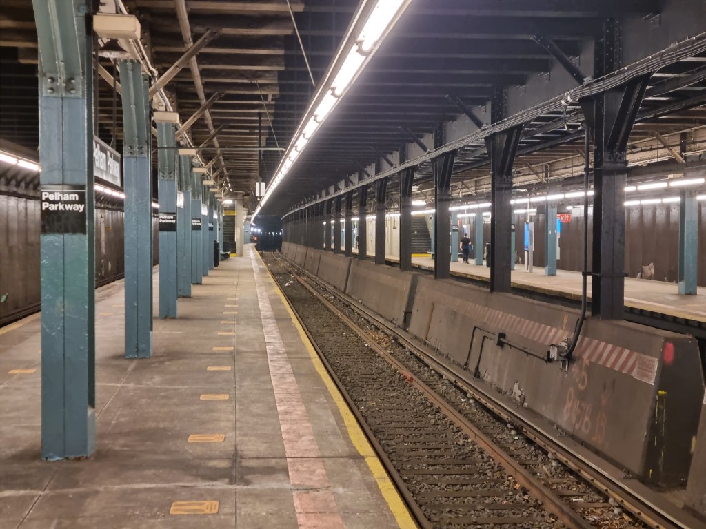
Pelham Pkwy doesn’t *feel* like a subway when you are in it. For one, it is enormous for the relatively empty state it usually is in. The high ceilings are a relic of the NYW&B days, as NYW&B trains drew power from overhead wires rather than a third rail. The tracks sit on ballast (basically big gravel) rather than being set into concrete which is typical on subway tracks. There is no decoration in the station, which makes it feel unfinished.
Eastchester-Dyre Ave (5)
When it opened, the Dyre Ave station was a two-side platform local station for the NYW&B, but when the city took it over it was converted to an island platform. The island platform sits over the original northbound express track, and the (current) southbound track is where the original southbound express track was. The northbound local track remains in place, and the southbound local track has been removed. The tracks continue for a few hundred feet north and are sometimes used for storage.
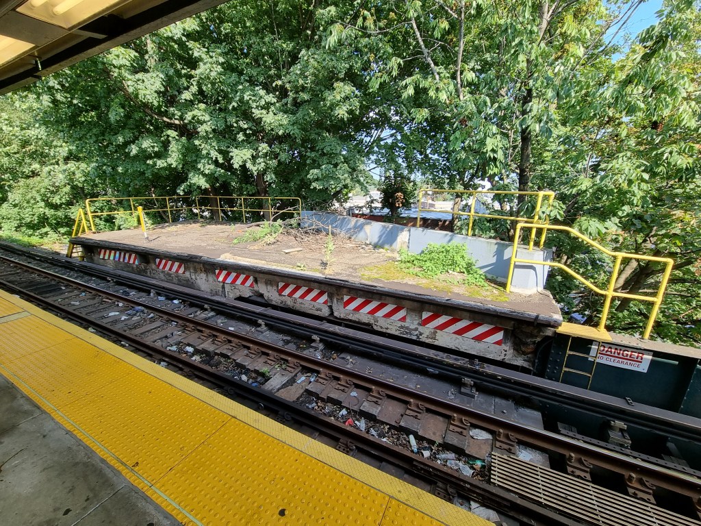
Remnant of the former northbound local platform 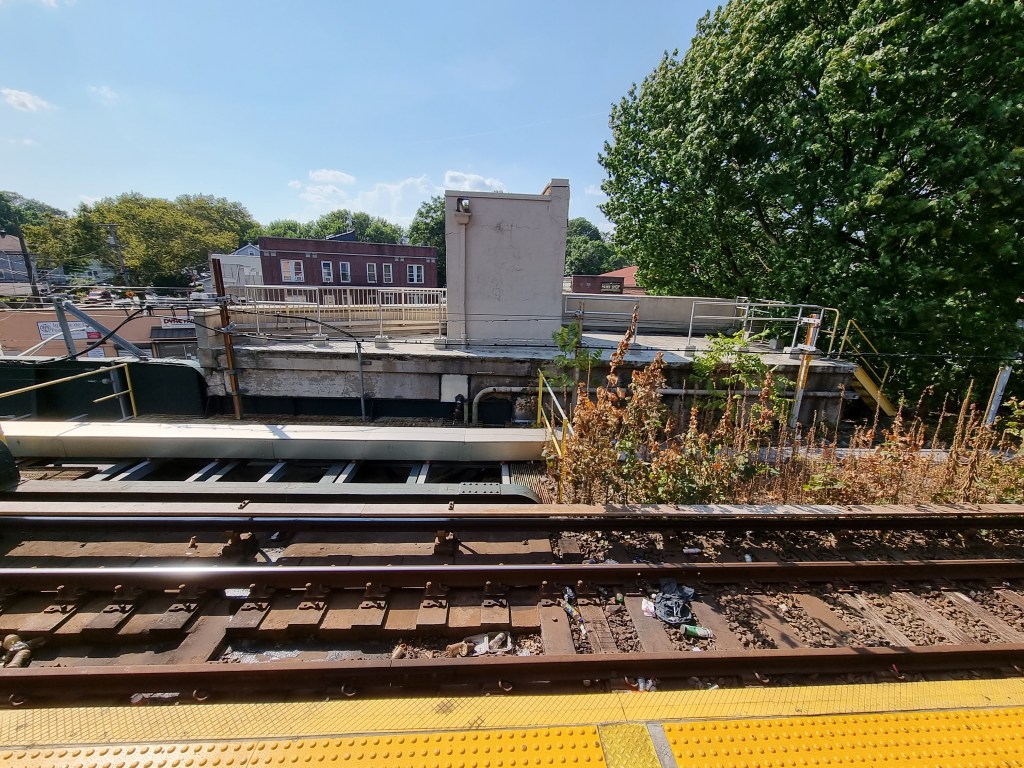
Remnant of the former southbound local platform
(6) IRT Pelham Line
Longwood Ave (6)
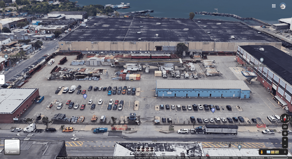
While not much is interesting about this station itself, this is the nearest stop to a very interesting elevated line. The MTA’s Tiffany Iron Shop is located at 1170 Oak Point Ave, and is where the MTA produces steel for it’s system. In it is a lonely stretch of elevated track, isolated from the rest of the system, used for training maintenance workers. The ‘Tiffany St El’ is barely long enough for the two Redbird cars perched on top.
Whitlock Ave (6)
Whitlock Ave is adjacent to the New Haven Railroad’s Harlem River and Port Chester Branch, currently used by Amtrak. The conversion of the NYW&B to a subway line was originally proposed to connect to this station rather than E 180th St (which honestly would probably have been a better idea than we ended up with).
Parkchester (6)
Parkchester is the third busiest station by passenger count in the Bronx after Yankee Stadium and 3rd Ave-139th St. Parkchester is located adjacent to a public housing complex of the same name, and above the Cross-Bronx Expwy. When the peak direction express <6> trains operate, local trains terminate here, using the middle track to relay back to Manhattan, while <6> trains continue on to Pelham Bay Park, making all stops.
Pelham Bay Park (6)
Pelham Bay Park is again laid out in the typical IRT terminal Spanish Solution layout. This station is the only terminal in the system not to use numbered tracks, but rather cardinal directions. There have been proposals to extend this line north to Co-op City, but nothing has come of them.
There is a superstition based on this station, coming from the novel and subsequent movie and TV adaptations, “The Taking of Pelham 123”. The premise of the story is that a southbound train from Pelham, leaving at 1:23 pm is hijacked. I won’t spoil the story, and I recommend watching the 1974 film adaptation, as it is, to my knowledge, a fairly accurate representation of the subway (in 1974, of course). Due to the superstition around this story, it was actually banned to schedule any train out of Pelham Bay Park at 1:23, and while the policy has since been revoked, dispatchers still avoid scheduling trains at that time.

Excellent commentary and great pictures. Thank you for your exhaustive study and presentation.
LikeLike