
Brooklyn
(2) IRT Nostrand Ave Line
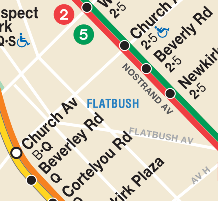
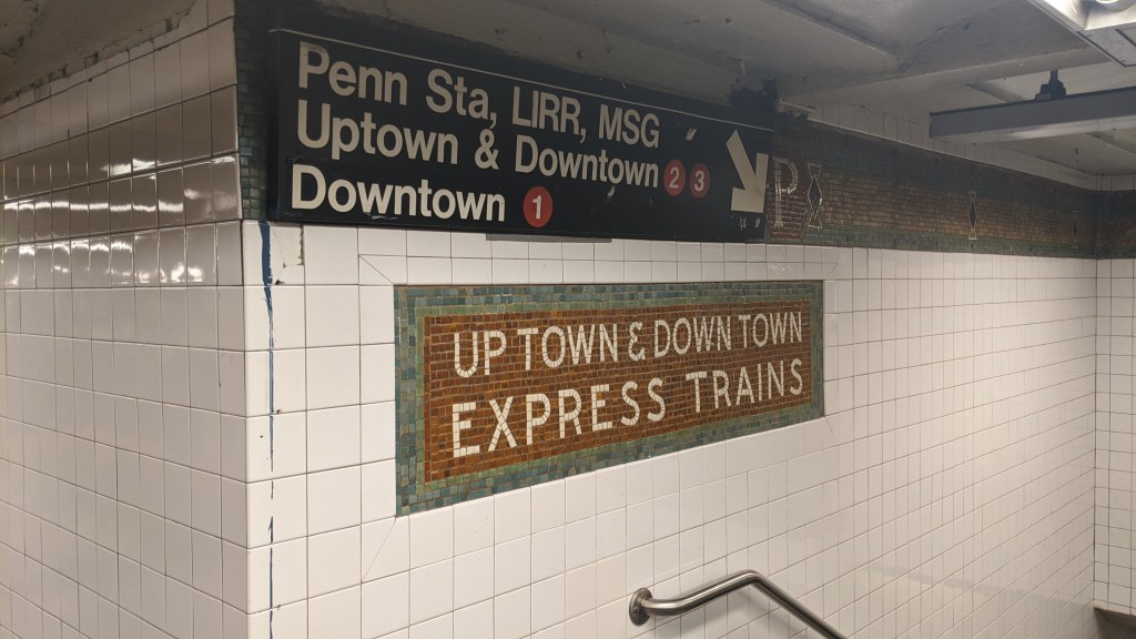
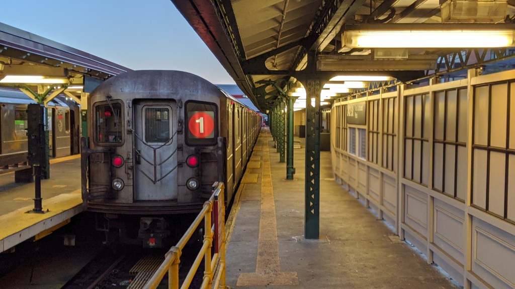
Flatbush Ave-Brooklyn College (2)(5)
The Nostrand Ave Line was built in 1920, but what exists today was never meant to be the whole line. It was built as part of the Dual Contracts, the period of most rapid expansion to the subway, when the city signed a number of contracts with the two private transit operators, the Brooklyn Rapid Transit Company (BRT) and the Interborough Rapid Transit Company (IRT). There have been a surprising number of proposed extensions to the line, dating all the way back to when the line was first planned as part of the Dual Contracts, and as recently as 2016. The proposed extensions usually follow one of two routes, either turning off Nostrand Avenue and onto Flatbush Avenue, and continuing to Avenue U and Kings Plaza, or continuing along Nostrand Avenue to Sheepshead Bay or Coney Island. One interesting proposal from 1919 would have had the IRT trains using the Manhattan Beach Branch, a now demolished branch of the Long Island Railroad that paralleled the BMT Brighton Line to Coney Island. The line would have had two tracks added to it, in order to allow both freight and subway trains to use the line.
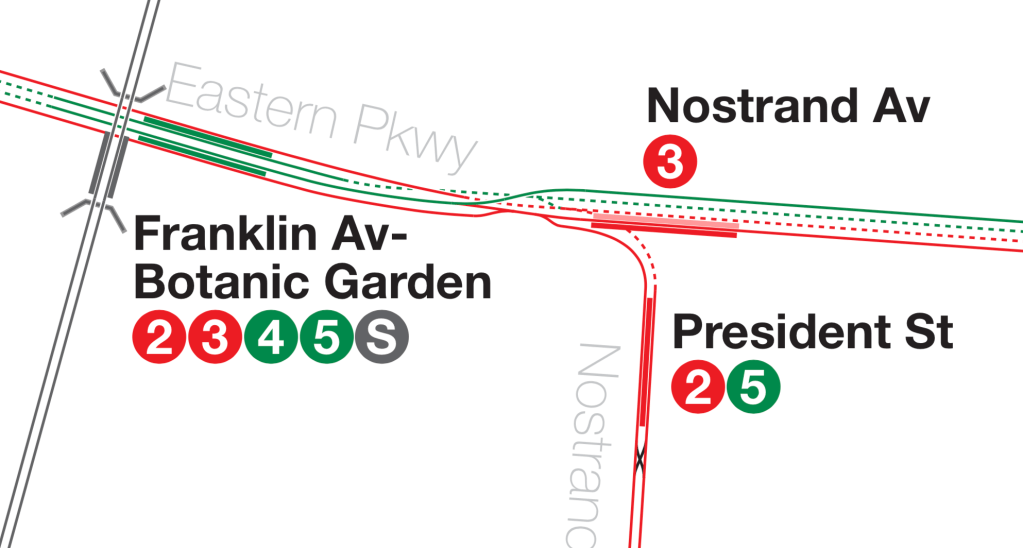
Extensions to this line never happened. It was restricted, like many other never-realized extensions, by fiscal crises in 1929 and 1974, the burgeoning car culture of post-war America, but also by more practical considerations. The Nostrand Ave Line merges with the Eastern Parkway Line at Franklin Ave-Medgar Evers College, at a point called Rogers Junction. This junction restricts how many trains can move through it at any given time, and is a major bottleneck to this day on the (2)(3)(4)(5) trains. Because of the increase in service that a Nostrand Ave extension would bring to the line, Rogers junction would have to be rebuilt as well, which adds huge cost and complexity to any possible extension.
Secondly, the line only has two tracks, and has no provisions to be widened to three or four tracks. This two-track set up goes against the IRT’s typical modus operandi with lines in the outer boroughs, which usually have a middle track that can carry express services into and out of Manhattan during rush hours. The lack of this third track on the Nostrand Ave line means trains either have to make every single stop along the line (which had it been extended to Kings Plaza or Coney Island would have been somewhere in the realm of 13 stations in a row with no express service) or trains would operate in a skip stop pattern (see the BMT Jamaica Line post for more details on how this works) which can be unpopular with riders and logistically difficult to schedule.
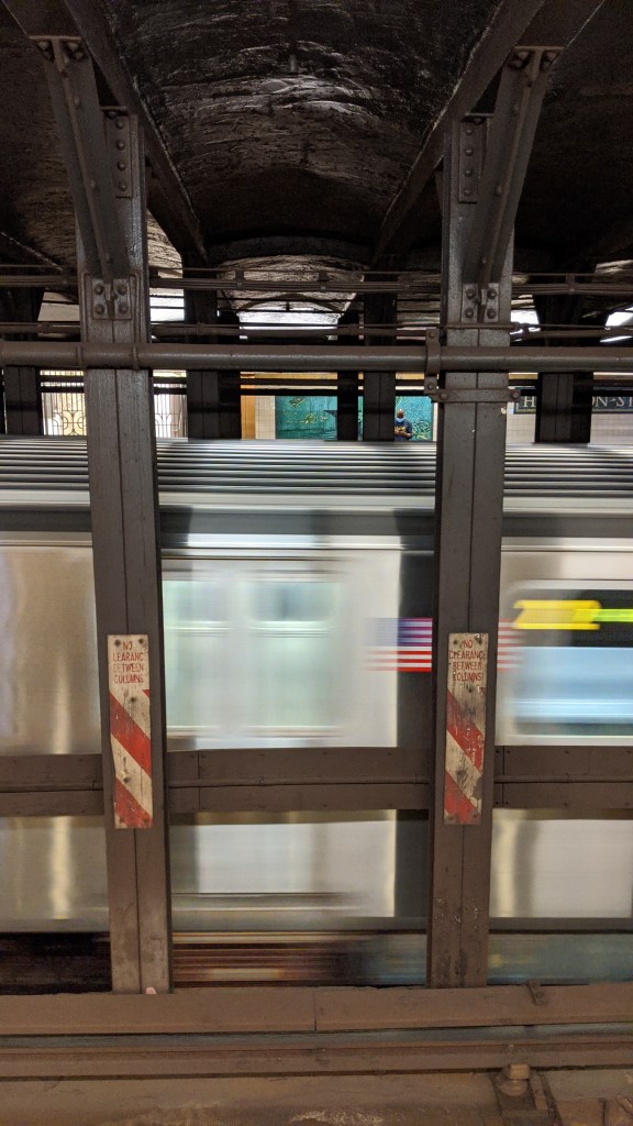
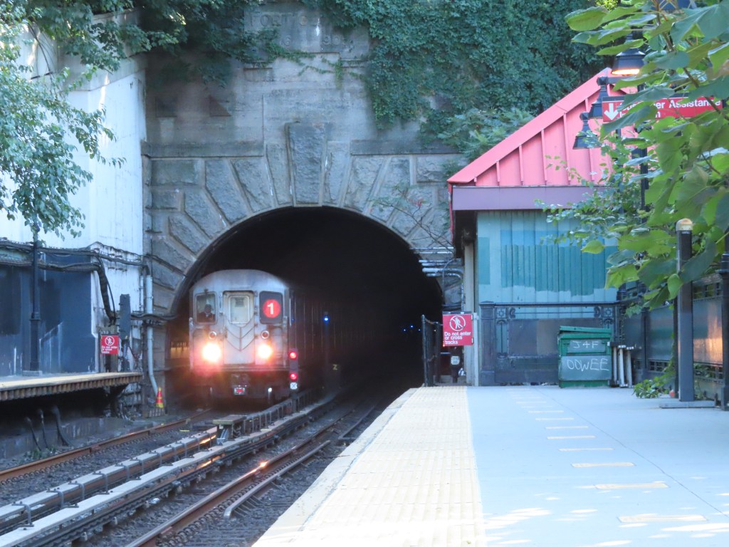
Another bottleneck on the Nostrand Ave Line, although this would have been negated had the line been extended, is the inefficient terminal design of Flatbush Ave-Brooklyn College. The station has two side platforms, although they are connected at the southern end, forming a U shape. This is the only station at the end of a physical line that doesn’t have an island platform, which means that riders entering the station have to pick which platform to wait on for the next train. This layout also doesn’t leave any room for storage tracks past the end of the station, so trains constantly have to be moved in and out. The tunnel does actually extend past the station for about 400 feet, until Avenue H, but opening this up for tail tracks would necessarily remove the U shaped platform and make the station more difficult for passengers to navigate.
(5) trains only serve this station on weekdays, and when they do, one of the platforms only serves (2) trains and the other serves (5) trains. At all other times (2) trains use both platforms. (2) and (5) train service is provided by the same fleet of physical trains, which can be identified by the LED strip maps inside of cars, which show both (2) and (5) stops. Because of this capability for interchange between the two services, often a train will enter Flatbush Ave-Brooklyn College station as one service and leave as the other.
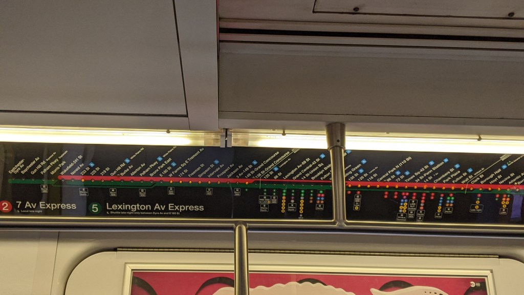
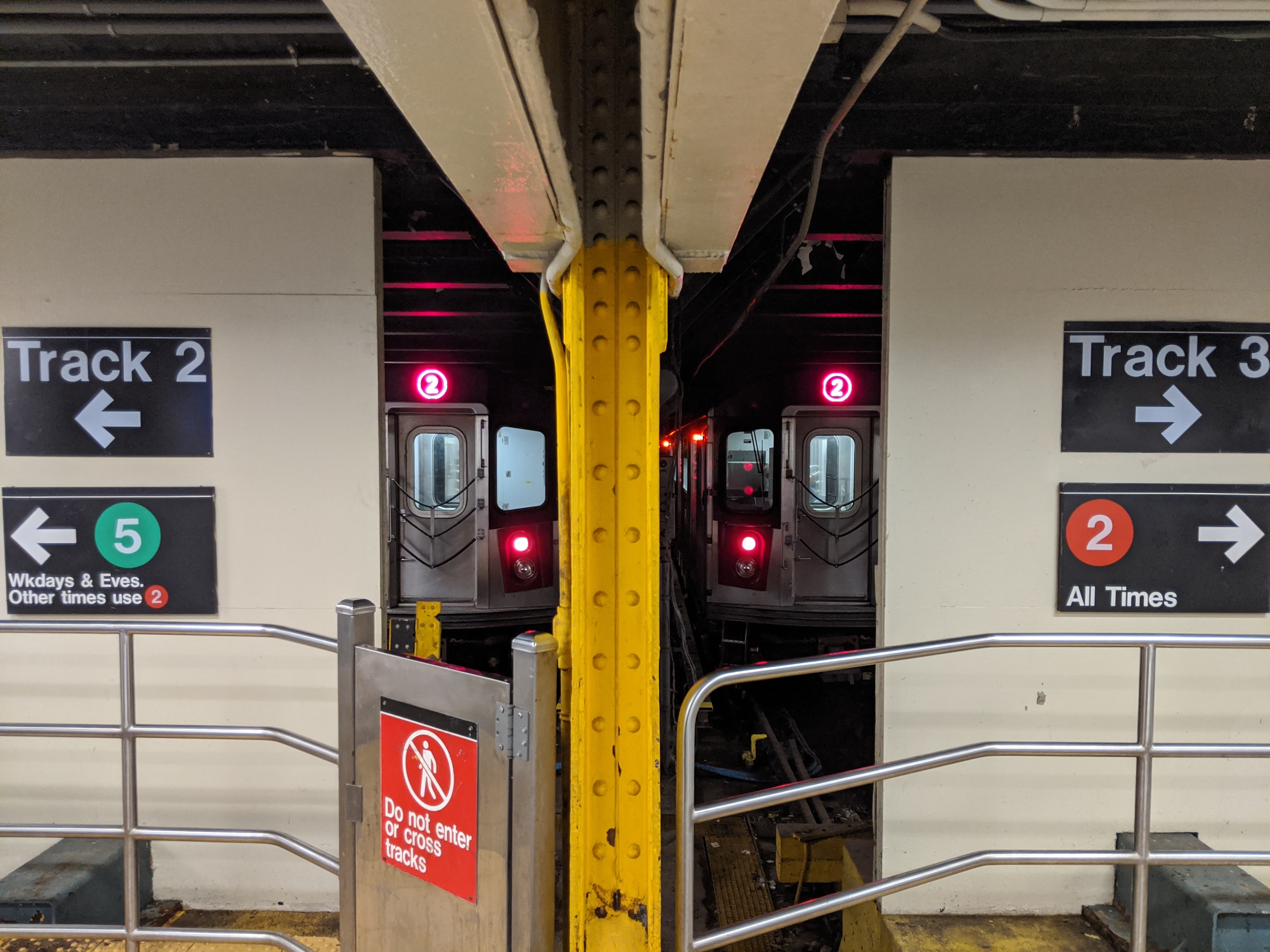
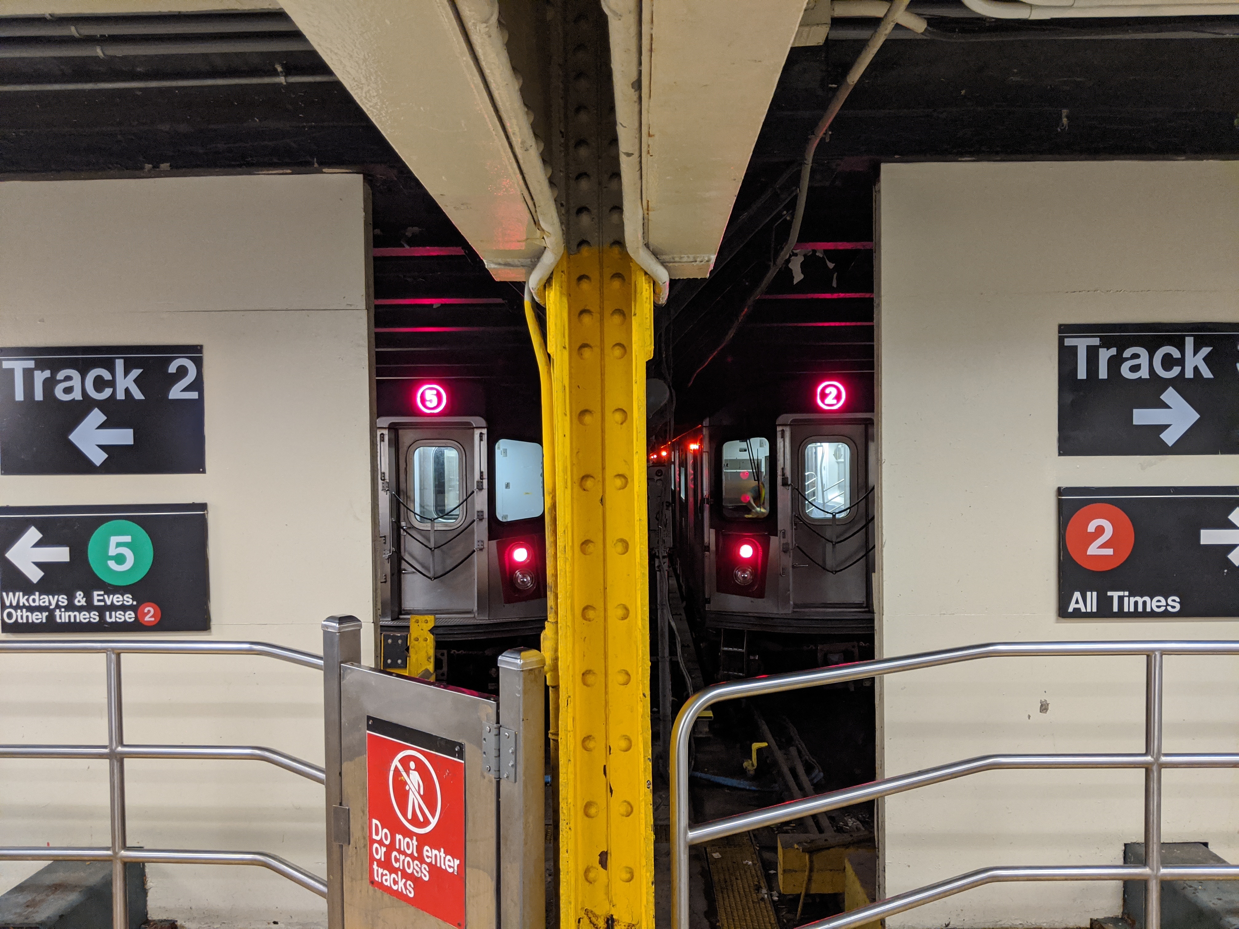
When the (5) serves this station, all (5) trains leave from Track 2 and all (2) trains leave from Track 3. Yes, despite only having two tracks, the tracks are labelled Track 2 and Track 3. The four-tracked IRT Eastern Pkwy Line, onto which the Nostrand Ave Line merges, is labelled Tracks 1-2-3-4 from left to right when looking north, with the middle express tracks being labelled Tracks 2 and 3. However, the Nostrand Ave Line tracks connect to the IRT Eastern Pkwy Line local tracks (Tracks 1 and 4), with another switch needed to reach the express tracks. I really don’t know why the IRT Nostrand Ave Line is labelled tracks 2 and 3 since the line is entirely local. The other solution might be to use Track 1 and Track 4 as those are the local track numbers.
The station is very close to the Bay Ridge Branch, a freight-only branch of the Long Island Railroad. If the Triboro RX line is ever built, it would use this right-of-way and a station would be located here to connect to the Nostrand Ave Line. The Bay Ridge Branch would have also been used for a short jog to the west had the IRT line been extended along the Manhattan Beach Branch to Coney Island.
To the left is a large parking garage and to the right is Nostrand Avenue. Had the line been extended south, it would have needed to dip underneath the LIRR tracks. Had the line been extended onto the Manhattan Beach Branch, the subway tracks would have merged with the LIRR tracks a few blocks east of this location.
Beverly Rd (2)(5)
This station, like many on the IRT Nostrand Ave Line, shares a name with a station on the BMT Brighton Line. This station, however, is misspelled. The BMT Beverley Rd station is spelled with three “e”s, while the IRT Beverly Rd is spelled with only two. This is because Beverley Rd dog-legs at Flatbush Ave and is split in two between east of Flatbush Avenue and west. To the west the road was spelled Beverley and to the east it was spelled Beverly, although now both sides are spelled Beverley, making this IRT station the only station name that is misspelled.
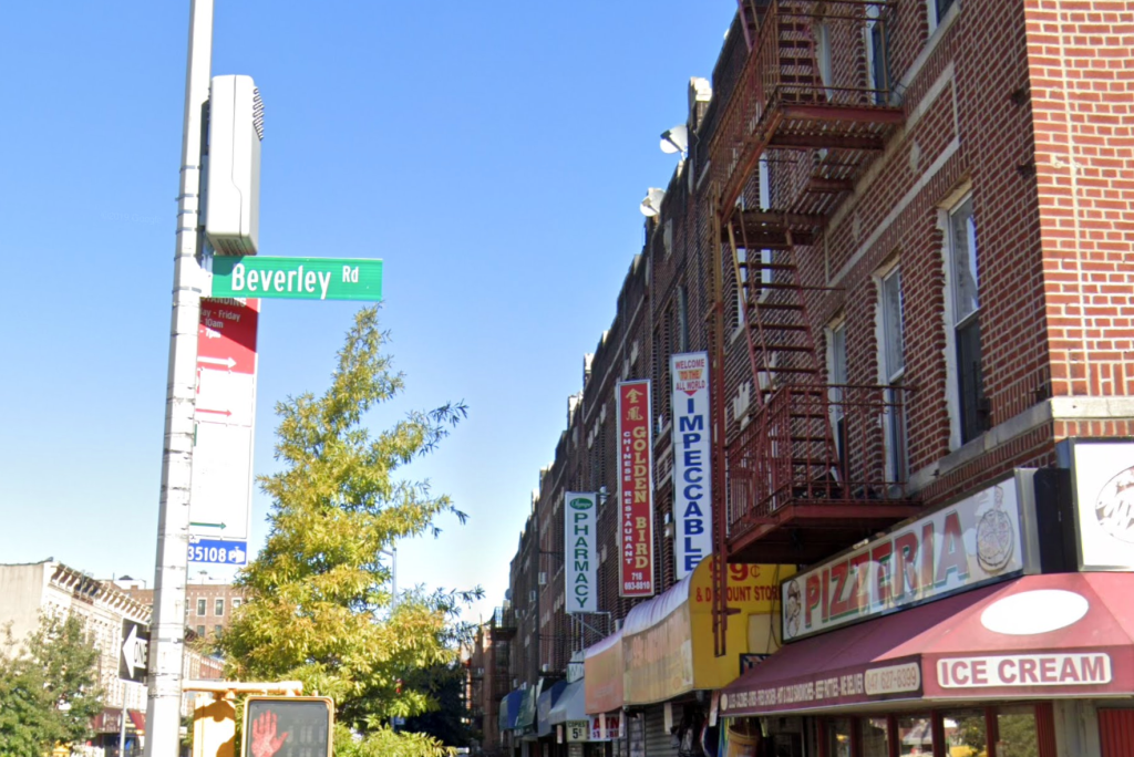
Beverley Road street sign 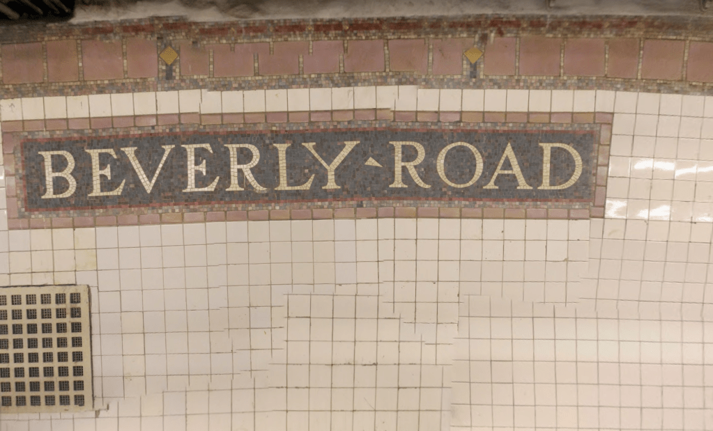
Beverly Rd station sign. Image by Sebastian Sinisterra
President St (2)(5)
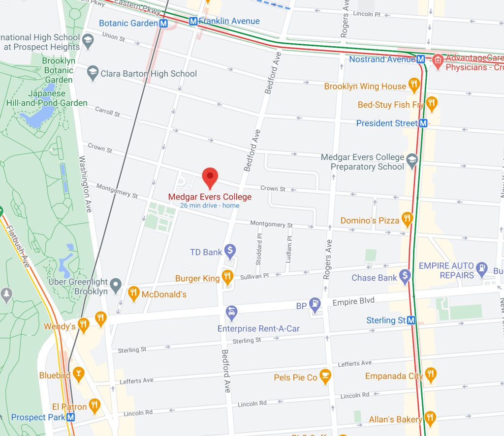
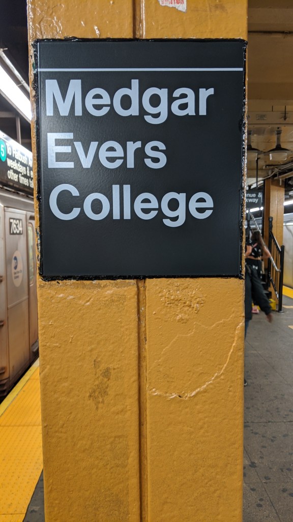
President St is the only station on the line with an island platform. It is the last station before the line joins the Eastern Pkwy Line. In June of 2020, NY Governor Cuomo announced that President St on the (2) and (5) trains, and Franklin Ave on the (2)(3)(4) and (5) trains would have “Medgar Evers College” added to their names in honor of the 50th anniversary of the historically black CUNY school nearby. Renaming both stations seems a little confusing, especially since (2) and (5) riders will have two stations in a row named for Medgar Evers College. This is not even mentioning that four other stations are equally as close to Medgar Evers College as Franklin Ave and President St are. To be fair, the Botanic Garden station is connected to the Franklin Ave station, although it wasn’t renamed.
(3) IRT New Lots Line
New Lots Ave (3)
New Lots Ave is the last stop on the (3) train in Brooklyn, and the only station on the IRT lines in Brooklyn with a storage yard. It is a relatively small yard, so many (3) trains are also stored at Lenox Yard in Manhattan. Because this is the only IRT Brooklyn yard, this line is also served by some (2)(4)(5) trains during rush hours, as they are stored here overnight. This is also the only elevated terminal in the city in which the tracks continue past the platforms. The yard is entirely elevated on concrete blocks, and takes up two full city blocks between Elton Street and Linwood Street to the east and west, and Hegeman Avenue and Stanley Avenue to the north and south. An extension to the Spring Creek neighborhood through the yard has been considered a number of times by the MTA, but has never been built. There is also a small provision for an extension east along New Lots Avenue.
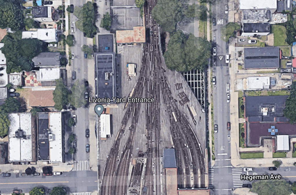
The northeast corner of the yard appears to have an unused trackway, although I’m not sure where this would have led. 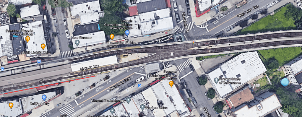
The curve of green-painted steel just above the tracks was placed in case an extension further east was ever needed.
Junius St (3)
This is the highest station on the IRT New Lots Line, as it passes over the BMT Canarsie Line here. The Junius St (3) train station and the Livonia Ave (L) train station are very close to each other, but no in-system free transfer exists yet between the two, although one was planned as part of the 202-2024 budget. This is also the only station on the line in which the middle trackbed actually has a track in it. There is a lead to the Linden Shops, where switches and other track components are manufactured. This track is non-electrified and can therefore only be used by diesel equipment. This track merges with a track from the BMT Canarsie Line, making this one of four places where the A division (number lines) and B division (letter lines) have a connection. This is also one of two places where the subway has a connection to mainline railroads, as the Linden Shops are also connected to the LIRR Bay Ridge Branch.
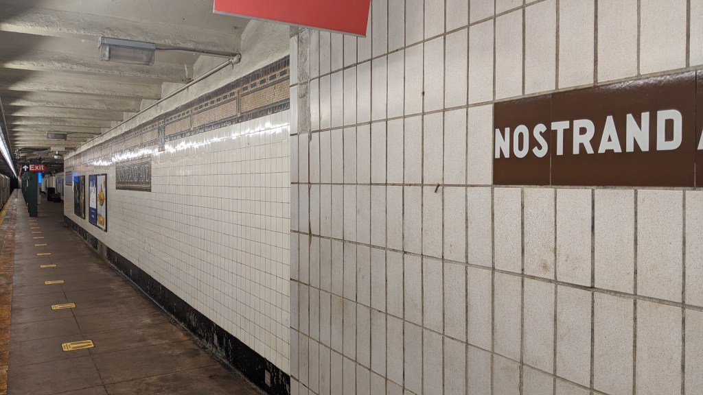
Sutter Ave-Rutland Rd (3)
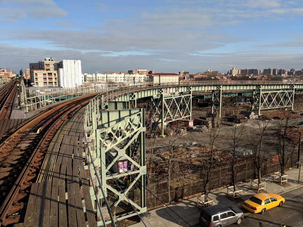
This station is entirely uninteresting in and of itself, but it is the first station on eastbound (3) trains that is elevated, and the last stop before the IRT Eastern Pkwy Line. The reason that the line east of Utica Ave has a different designation than west of Utica Ave is because of the different physical structures of the two lines. The New Lots Line is elevated, with space for three tracks, although there are predominately only two, while the Eastern Pkwy Line is underground, and has four tracks. The New Lots Line is elevated because southeastern Brooklyn has quite a high water table, meaning that subway construction in this region is prohibitively expensive, and the tunnels would be prone to flooding. The New Lots Line was elevated, and the Eastern Pkwy Line, built underneath higher elevation, is a subway.
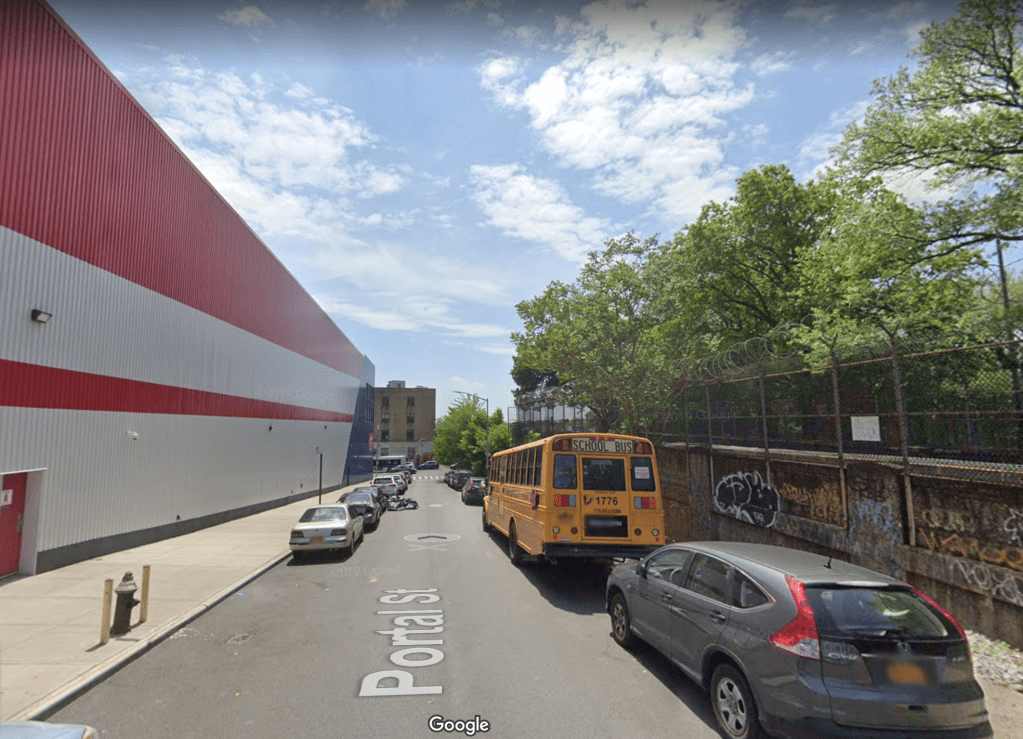
The end of a tunnel where the tracks go outside is called a portal. The street adjacent to the line here is called Portal Street for that reason. The portal that (3) trains use to move between the two lines is actually located directly along the western end of Long Island’s terminal moraine. A terminal moraine is a long hill or series of hills that forms at the furthest extent of a glacier. During the last glacial maximum 21,000 years ago, the Wisconsin Glaciation (the North American glacier system) extended as far south as Long Island. There are a series of hills that stretch from Bay Ridge, through Greenwood Cemetery, Prospect Park, Crown Heights (where do you think the name “Heights” came from?), Highland and Forest Parks, Jamaica Estates and continuing east all along the north shore of Long Island. Eastern Parkway runs along the top of this ridge line east of Prospect Park, so not much of a ramp is needed for the subway to move from underground (under Eastern Parkway) to an elevated structure, since the ground drops away significantly southeast of the Utica Ave station.
South of this ridge line was the glacial outwash plain, where meltwater ran off into the ocean, forming the low lying land of southern Long Island. This is where silt was deposited into the ocean, which built up enough to become land. Southeastern Brooklyn is unsuitable for subway construction because of its high water table and sandy dirt, which are all due to this Wisconsin Glaciation. Almost entirely unrelated, but still interesting, the big rocks in Central Park were formed when the glaciers retreated, and the grooves that were carved by the glaciers all point almost due north.
Crown Heights-Utica Ave (3)(4)
Crown Heights-Utica Ave is an unusual station for a number of reasons. For one, it is a terminal for express (4) trains that local (3) trains continue through, which is the opposite of the usual pattern of locals terminating and expresses continuing onward (think of the (A) and (C) at Euclid Ave and 168th St). Secondly, Utica Ave is, for reasons I’ll explain later, one of the few stations in the system without an exit onto the street for which it is named. In fact, the entire station is physically west of Utica Avenue.
Finally, Utica Ave is a bi-level station, which is unusual in and of itself, but it is a bi-level station not split with one service on top and the other on the bottom, but with eastbound trains on top and westbound trains the bottom. The express tracks are on the north side and the local tracks are on the south side of Utica Ave. You can see the tracks of the New Lots Line enter the portal at different heights just a few hundred feet east of the station in order to reach their respective levels. The unorthodox layout of the station means terminating (4) trains enter on the upper level, then have to relay through a series of tail tracks east of the station to reach the lower level from which they leave on the return trip to Manhattan. The tail tracks for the express tracks extend east to between Buffalo and Ralph Avenues. Some out of service (4) trains are stored in the middle track of the New Lots Line, which exists only for a few hundred feet east of the station before ending.
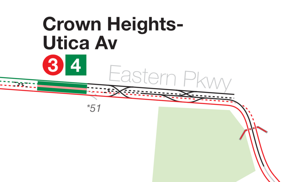
Just east of the platforms on the local tracks on both levels is a provision for a southern extension along Utica Avenue to Flatbush Avenue and Kings Plaza. This is why the Utica Ave station isn’t actually under Utica Avenue. It was built to the west in order to leave space for the tracks to curve under Utica Avenue. There have been a number of plans for a subway under or over Utica Avenue, including this IRT plan as well as plans from the IND’s infamous (in transit circles at least) Second System plan. Under the IRT plan, local Eastern Parkway Line trains would turn south onto Utica Ave and the express trains would take over the New Lots Line to New Lots Ave. No subway was ever built under Utica Ave, mostly because the high water table in the area makes subway construction incredibly difficult (we call that a callback in showbiz) and the residents along the route have consistently rejected the MTA’s proposals for an elevated line. As a result of this standoff, the line has never made it past proposal stage and the few provisions that exist for the line elsewhere in the system.
Nostrand Ave (3)
The Nostrand Ave station, and the Kingston Ave station to the east, both follow the two-over-two-under track layout of Utica Ave. Eastern Parkway, the street under which the line runs is more than wide enough for a line four tracks wide. The only other place this layout exists for any significant stretch is on the Central Park West Line. There are other places with this layout, but those are all just stations (like Lexington Ave-63rd St on the BMT/IND 63rd St Lines) rather than entire lines. In the IND Central Park West Line case, this layout is used in order to have the local platforms all be on the west side of the street, since the east side is Central Park. This keeps riders, who are mostly Upper West Side residents from having to cross the street every time they take the train.
This is not the case for Eastern Parkway, as both sides of the street are dense residential neighborhoods, yet at both Kingston and Nostrand Ave stations, the local platforms are on the southern side of the street. The only reason I can think of is that the Nostrand Ave station is incredibly close to Rogers Junction, where the Nostrand Ave Line merges into the Eastern Pkwy Line and, due to the bi-level nature of the junction, the Nostrand Ave station had to be a bi-level station. Then the designers of the line just made the whole thing bi-level from Rogers Junction to Utica Ave, since the provision for the Utica Ave Line would be easier to construct if that station was bi-level as well.
The IRT system underwent a number of platform lengthening programs throughout the 20th century, which I will explain in more depth at 96th St.
Franklin Ave-Medgar Evers College (2)(3)(4)(5)
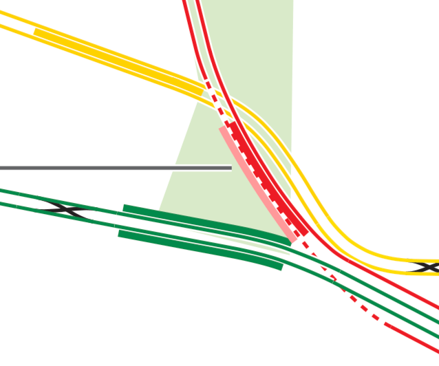
If you read the BMT Broadway Line post, you’ll be familiar with the concept of deinterlining. Rogers Junction, along with 149th St (which we’ll get to later in this post) are often discussed as another bottleneck that deinterlining could fix. Trains from the Eastern Pkwy Local (to the west of the Franklin Ave station) can reach the Nostrand Ave Line or continue along the Eastern Pkwy Local. Eastern Pkwy Express trains have the option to continue along the Eastern Pkwy Express, or merge onto the local track and then choose either the Eastern Pkwy Local or Nostrand Ave Line.
Original Vanshnookenraggen Track Map 
Corrected Vanshnookenraggen Track Map
Currently, because (5) trains serve the Nostrand Ave Line, eastbound (3) and (5) trains conflict with each other at the junction, as well as westbound (3) and (5) trains. If an eastbound (3) arrives on the Franklin Ave local track and an eastbound (5) arrives on the Franklin Ave express track, one of the two will have to be held in order to allow the other to proceed. The same is true for westbound trains, but since they stop at two different stations before the junction, it is much harder to visualize. Whichever train is held at the station will hold up either the (2) or the (4) behind it, which can cause extensive delays across all four lines. This may sound reminiscent of the issues plaguing the BMT Broadway Line at 34th St-Herald Sq and Times Sq-42nd St, and that’s because fundamentally, it is the same problem.
The MTA has considered rebuilding the junction into what is called a “flying junction” in which tracks pass over and under each other on different levels. The enormity of this project, which would include tearing up Eastern Parkway, and the more immediate needs of the rest of the system, have often prevented this fix from occurring. The other option is to simply add a switch east of the current junction on the Eastern Pkwy Line that allows express trains to access the local track after the Nostrand Ave Line has branched off. Under this fix, (4) and (5) trains would serve Eastern Pkwy, with one of the two becoming a local and continuing to the New Lots Line, and the (2) and (3) would serve Nostrand Ave and the Eastern Pkwy Local west of Franklin Ave.
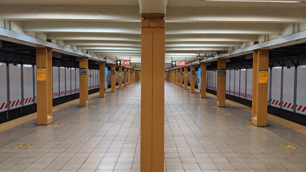
Grand Army Plaza (2)(3)
Grand Army Plaza, as well as Bergen St (next north) and Brooklyn Museum (next south), were opened after trains had already started serving the line. The extension from Atlantic Ave to Utica Ave opened in August of 1920, but the stations weren’t ready for passengers until October 9th. Grand Army Plaza has a wide island platform, and there are four tracks that pass underneath it. Directly below the platform are the BMT Brighton Line tunnels from Flatbush Avenue, and below the IRT local tracks are the IRT express tracks. For more information on the Flatbush Ave Tunnel, read the BMT Broadway Line post.
The Brooklyn Public Library Central Branch is located on the southern end of Grand Army plaza, and rumor has it there is a room in the sub-basement that was meant to be a subway station. Take what you read next with a grain of salt, as this is just a rumor, and the sources that do exist aren’t exactly what an academic would call credible. There is nothing about this station on the Wikipedia article for the Brooklyn Central Library, or any of the other places where I source reliable information from. The only two places I could find that mention this are a passing comment in a Brooklyn Based article about the library and a New York City Subway themed message board called SubChat, which has a thread that discusses the station.

continuing along Flatbush Ave and Eastern Pkwy.
Image via Wikipedia
If the room exists, the most plausible explanation I could piece together is this. When the library was under construction, which started in 1912, plans included the shell of a two track, two platform subway station. The IRT had expanded into Brooklyn by 1908 and made no secret of its wish to expand further. Perhaps the Library’s designers assumed they would be in the path of that expansion, since the IRT’s last stop in Brooklyn in 1912 was Atlantic Ave, and the tracks were pointing southeast along Flatbush Avenue, directly towards the library. It is uncommon but not unheard of for station shells to be built before construction has even started on the line. The IND system is full of these half built stations for lines that never materialized. It is slightly more unusual that a private institution constructed the station shell, but it is possible the library’s planners believed that having the station in place would encourage the IRT to expand and use it. The IRT had planned in 1910 an extension along Flatbush Avenue and Eastern Parkway and this plan was solidified in 1913 with the signing of the Dual Contracts, which included an Eastern Pkwy Line.
However, construction of the library was slowed by World War I, and only one wing of it was complete by 1929. This building was demolished in the 1930’s when the building was redesigned, and the library only opened in 1941. The IRT subway was built and opened by 1920, and it is possible that with 1) the library still incomplete during subway construction, 2) the nearby Brooklyn Museum getting a station on the new line, and 3) the IRT line continuing along Eastern Parkway after Grand Army Plaza rather than Flatbush Avenue meant that nothing subway-related came of the space. If it exists, it is now used for storage by the museum.
Hoyt St (2)(3)
Don’t worry, Nevins St and Atlantic Ave are both incredibly interesting stations, they will just be explored in the (4)(5)(6) IRT Lexington Ave Line post.
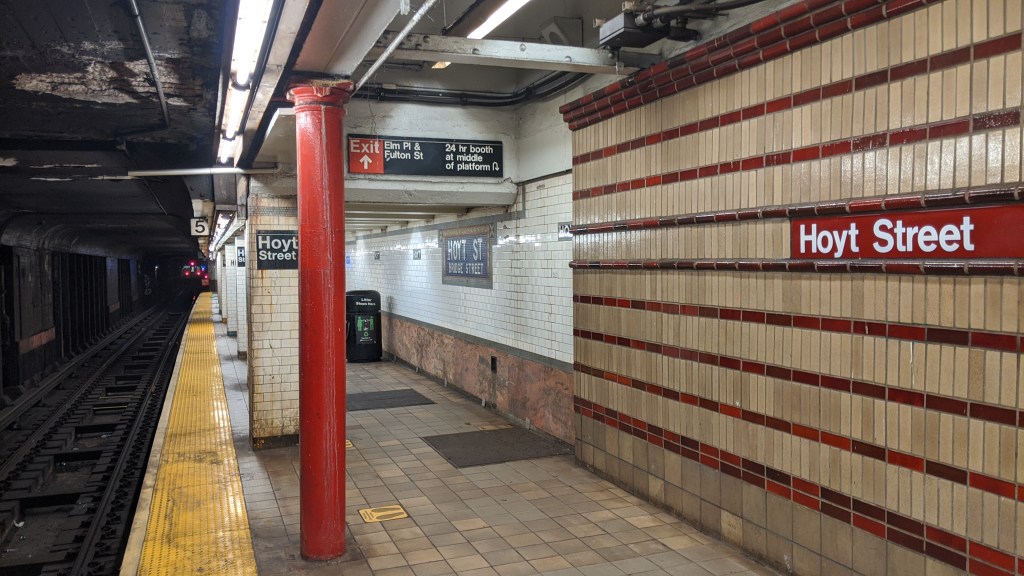
The old and “new” parts of Hoyt St. In fact the vast majority of the station is in the newer style seen on the right. The original station was quite short, and also called Hoyt St-Bridge St. The newer portion is quite unusual in the system, with various shades of red brick accentuating the walls. 
This used to be an underpass between platforms as well as an entrance to the Brooklyn branch of Macy’s. Both are obviously now closed.
Borough Hall (2)(3)
The (2)(3) platforms at Borough Hall are stacked one on top of the other, much like the Nostrand and Kingston Ave stations on the (3). This layout is necessary here because the (2)(3) tracks from Manhattan become the local tracks of the Eastern Pkwy Line, and so the Brooklyn-bound track is on the lower level of this station in order to pass under the (4)(5) tracks which become the Eastern Pkwy Express tracks. These platforms were opened in 1919, but the original Borough Hall station, now used by the (4) and (5) was opened in 1908.
Clark St (2)(3)
Clark St is quite a deep station, partially because it is the first station in Brooklyn past the East River, and partially because the Brooklyn Heights rise quite sharply out of the East River. The cross street of the station is Henry St rather than Clark St, and the subway runs along Clark St. This is one of three stations that are only accessible by elevators (incidentally the other two are also on the IRT Broadway-7th Ave Line, so we’ll get to them later). The station entrance is in the Hotel St. George, once the largest hotel in New York City.
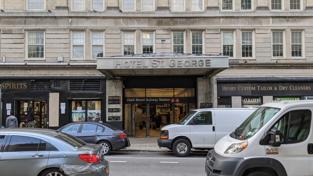
The Hotel St. George entrance to the Clark St subway station. 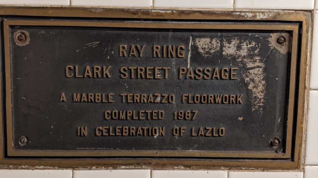
You may remember that the BMT Broadway Line 49th St station has a Terrazzo floor as part of a soundproofing experiment. The passageway to the elevators at Clark St also has Terrazzo flooring.
Manhattan
Wall St to Park Pl (2)(3)
Wall St, Fulton St, and Park Pl were all opened as part of the H system in 1918, in which the IRT Broadway-7th Ave and IRT Lexington Ave lines were completed south and north of 42nd St respectively. I will discuss this in more depth at 42nd St.
These three stations are all pretty similar, with a narrow island platform between the two tracks. The line has some tight curves through the narrow streets of lower Manhattan, meaning trains move through this area pretty slowly. One thing I always found interesting was that this area has a missed connection between the two main IRT lines. Missed connections are when subway lines cross each other in geographic space without a transfer point, and New York is full of them. Most of them are due to the IND system, which was built later than, and in direct competition with, the two private companies. As mentioned earlier in this post, there is a missed connection between the IRT and BMT at Junius St on the (3) and Livonia Ave on the (L), but other than that and the South Ferry area with Whitehall St (BMT Broadway) and Bowling Green (IRT Lexington) the two private companies don’t have any missed connections between them. However, here in lower Manhattan, the (2) and (3) trains (from the Broadway-7th Ave express tracks) cross underneath the (4) and (5) trains (from the Lexington Ave express tracks) without a transfer. Of course, a transfer exists now as part of the Fulton St mega-station, but the lines are too far apart for this transfer to have been built when the lines were originally constructed. Park Pl is also incredibly close to the next station north, Chambers St, with the two literally around the corner from each other.
(1)(2)(3) IRT Broadway-7th Ave Line
South Ferry (1)
South Ferry is the southernmost station in Manhattan, and has quite a storied history. First of all, the name. I always assumed that “South” referred to the geographic area the station was in, being at the southern tip of Manhattan and that “Ferry” referred to the Staten Island and Governors Island (in the summer) ferries. However, the name is actually a reference to a now long gone ferry route to Brooklyn. The original ferry connection between what was then New York City (Manhattan) and Brooklyn goes back all the way to 1642, and was called, rather appropriately, the “Old Ferry”. In 1814 Robert Fulton acquired the lease for this ferry route and began running a steamship service between two streets that would later bear his name (Fulton, not Robert).
The name “Old Ferry” came into usage in 1795 when the Catherine Street Ferry, more popularly called the “New Ferry” opened between Catherine Street in Manhattan and Main Street in Brooklyn. (I bet you didn’t even know that Brooklyn had a Main Street. It is a two-block long street between the Brooklyn and Manhattan Bridges). In 1836, in order to better serve the needs of South Brooklyn (which at this point meant south of Atlantic Avenue), the South Ferry Company was organized in order to provide ferry service to residents, and to the Long Island Railroad which had a terminal at the foot of Atlantic Avenue and the East River. The Manhattan end of the South Ferry route was the very southern tip of Manhattan Island. The Manhattan Elevated Lines all had a terminal station here, opened in 1877, called South Ferry for the connection to the Brooklyn Ferry. The subway came in 1905, and named its station after the El station. Essentially, this means that the South Ferry subway station is named after a neighborhood in Brooklyn.
The South Ferry station opened as one of the first ever extensions to the subway system. The station was opened as a loop of track that connected to the Bowling Green station of the IRT Lexington Ave Line, and was used to terminate Lexington Ave express trains. The station opened with two tracks, but only the outer one had a platform, and the inner one was used for storage. In 1918 the H system opened and the local IRT Broadway-7th Ave line was extended to the South Ferry station, with Broadway-7th Ave Line trains using the outer platform, and a new inner platform being constructed for Lexington Ave trains. There was no free transfer available between the two platforms. Due to the sharp curve of the outer platform, only the two doors on the ends of the cars could open, as the gap in the middle was too big, although the 1959 installation of moveable gap fillers like those at Union Square solved this problem. The inner platform curve was even sharper than the outer, and only the middle door could open. The platforms were only long enough for a 5-car train, meaning the last 5 cars would not open and would sit in the tunnel when the train was in the station. The inner platform stopped serving passengers in 1977, and the outer platform stopped in 2017.
The MTA constructed a new South Ferry station for Broadway-7th Ave local trains, which opened in 2009. It was the first new station since 1989 in New York City. The new station is an island platform rather than a loop, and can accommodate a full 10-car train instead of just 5. It also has the ability to handle 24 trains an hour, as opposed to just 16 that the loop station could handle. Now the old South Ferry station is only used to turn some Broadway-7th Ave and Lexington Ave trains around without stopping. When (5) trains terminate at Bowling Green, they use the South Ferry inner track to get from the downtown track back to the uptown track. The new station was flooded in 2012 by Hurricane Sandy, and put out of operation. While repair work was being done, the old South Ferry Loop station was put back into service to serve as a temporary terminal until 2017, when the new station reopened.
The new station opened with its tracks labelled Track 1 and Track 4. This is at odds with the Flatbush Ave-Brooklyn College labelling, since both of these lines are local lines that become the local tracks of a four tracked line.
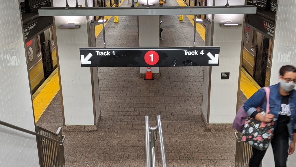
South Ferry has Tracks 1 and 4. 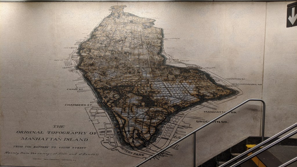
A mosaic showing Manhattan’s original topography compared to its modern extent.
Cortlandt St (1)
Cortlandt St opened in 1918 as just another local station on the IRT Broadway-7th Ave Line. The station was destroyed on September 11, 2001 when the two World Trade Center towers above the station were hit by planes. A subway operator reported an explosion shortly after the first plane hit, and luckily service was halted after this report so no one in the subway was killed. The line reopened a year and four days later with service to South Ferry, but the Cortlandt St station was removed. It was rebuilt and reopened on September 8, 2018. Due to the station’s location in the Fulton St-World Trade Center mega-station, pedestrians can actually walk underneath the tracks and station in the atrium of the Oculus.
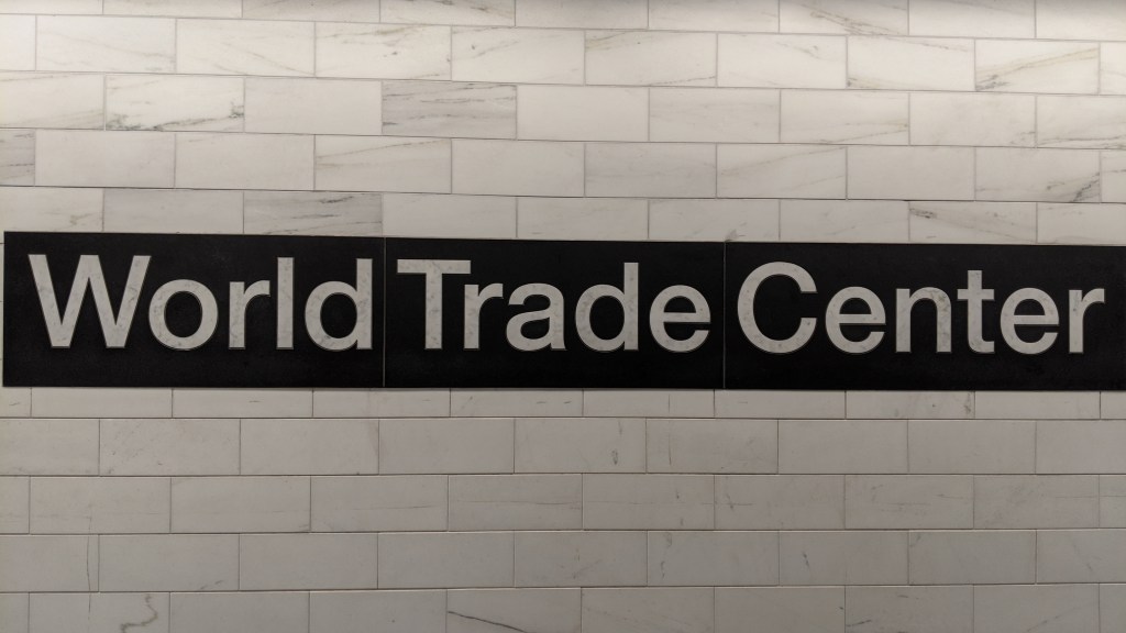
The new marble World Trade Center signage. 
The artwork on the wall is called “Chorus”. 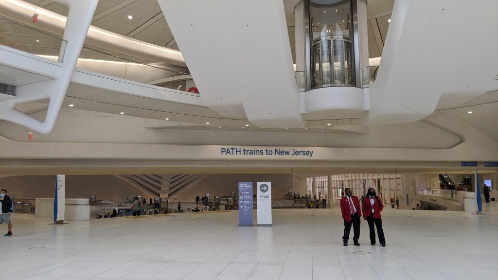
The (1) train is suspended above the Oculus atrium within the box that says “PATH trains to New Jersey”.
Franklin St (1)
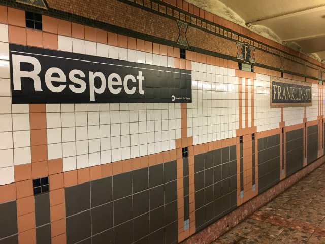
We have now reached the part of the line served by the (1)(2) and (3) trains, although the (2) and (3) are express here. Franklin St is largely unremarkable, but after the death of Aretha Franklin in 2018 guerrilla artist Adrian Wilson put stickers mimicking subway signage reading “Respect” in the station in tribute. Also, the Ghostbusters firehouse is located near this station.
Houston St (1)
Houston St is another largely unremarkable local station, except that the express tracks descend slightly within the station and the local tracks remain slightly above them. By my count, this happens two other times in the system, on the original IRT line at 33rd St (Lexington Ave) and Carroll St on the IND Culver Line, although this happens because the express tracks are descending entirely below the local tracks rather than just slightly changing height. This height difference is caused by the line changing its own elevation, and giving the fast moving express trains a smoother slope to traverse while keeping the platform and therefore the local tracks level. Houston St used to be called North Street, which seems crazy to us now, but it was the northern boundary of New York at the start of the 1800s.
You can see clear over the express trains as they pass through Houston St. 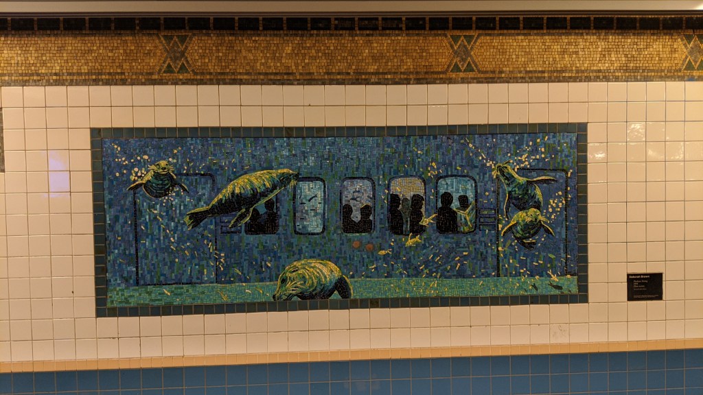
The mosaics in Houston St all depict the subway being flooded and populated with marine life.
Christopher St-Sheriden Sq (1)
Once again, this station is unremarkable, except it sits underneath what is now called 7th Avenue South. The Commissioners’ Plan of 1811 laid out the system of avenues and streets that now exists north of Houston St, and in that plan, 7th Avenue was to end at Greenwich Ave and 11th St. The problem for the IRT was that they wanted to use 7th Avenue and Varick Street (under which Franklin, Canal, and Houston St stations are located) for their West Side Line, and these two streets didn’t connect. 7th Ave South was constructed in 1914, bulldozing through the historic West Village and wreaking havoc on the grid of streets that had already existed. The famously wonky intersections of the area is at least partially due to the subway.

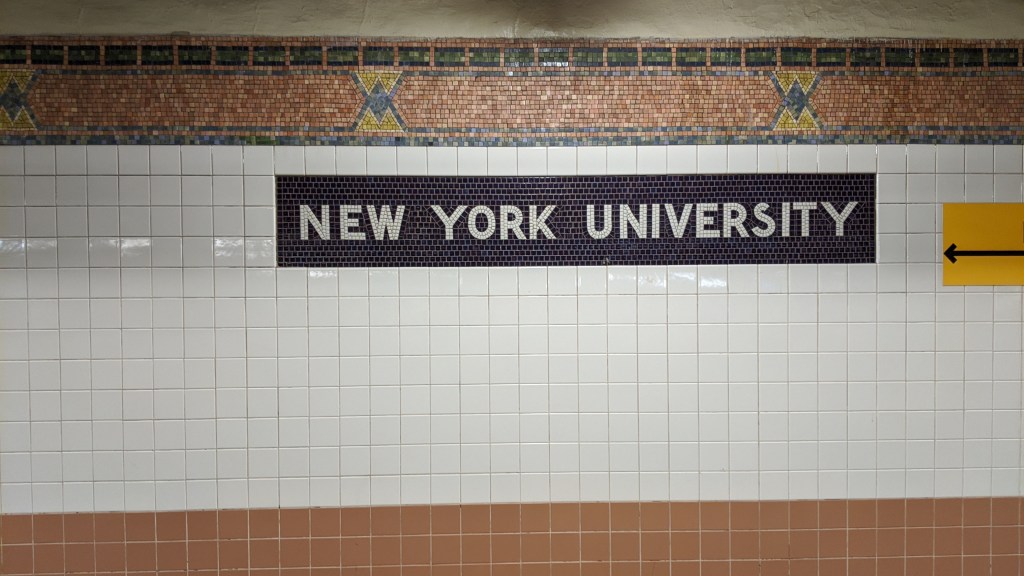
Christopher St has NYU signage, although unlike 8th St on the BMT Broadway Line, it is not renamed as such.
18th St (1)
The IRT Broadway-7th Ave Line is the only north/south Manhattan trunk line with a stop at 18th St. There used to be one on the IRT Lexington Ave Line, but throughout the 1940s and ’50s IRT platforms were extended all over the system which caused the abandonment of some original stations, Lexington 18th St being one of them.
23rd St (1)
During construction of the station in 1915, a dynamite explosion killed seven people and injured 85 after the temporary road surface in place over the tunnel collapsed, and a crowded streetcar fell in.
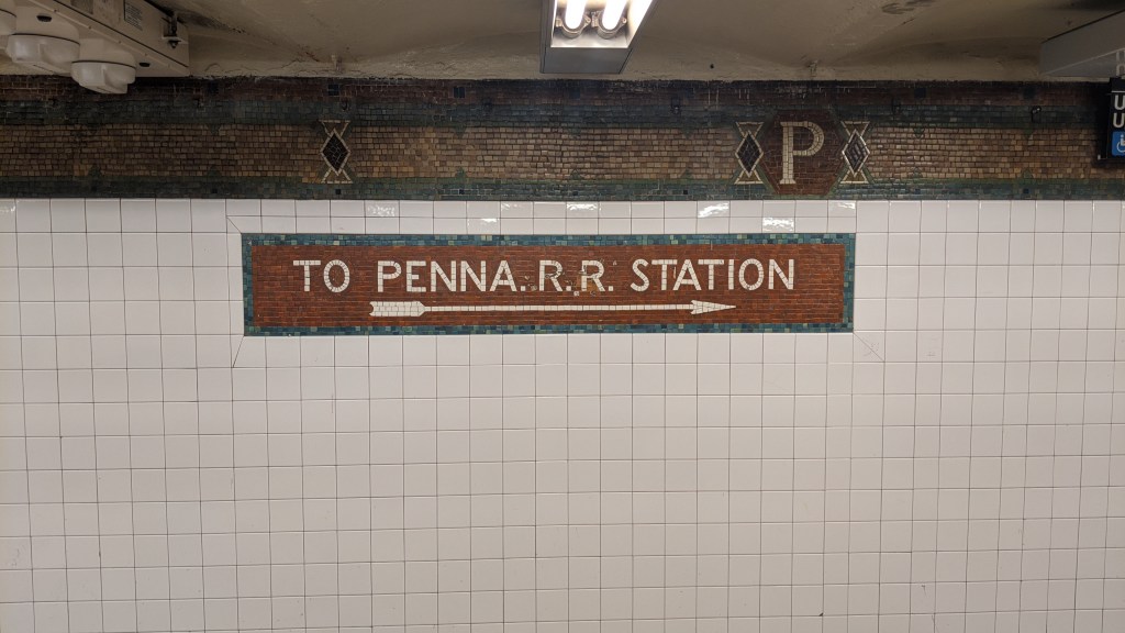
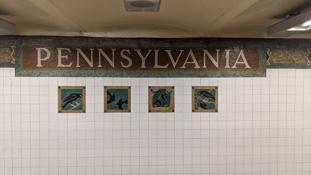
34th St-Penn Station (1)(2)(3)
I always found it weird that a train station in New York was named for Pennsylvania, but this is of course named after the Pennsylvania Railroad, which built Penn Station. This explains the mosaics on the wall that say “PENNSYLVANIA”.
34th St-Penn Station has an unusual layout for an express station, with an island platform for express trains and two side platforms for local trains rather than two island platforms in between the express and local tracks in the same direction. This layout is repeated on the IND 8th Ave Line station at Penn Station, as well as at Atlantic Ave-Barclays Center on the IRT Eastern Pkwy Line. The IND copied the layout from the IRT, as the IRT came first.
The reason behind the unusual layout is that the IRT expected high ridership at the station from Passengers from Penn Station; they were right, as the two Penn Station subway stops rank 5th and 6th busiest in the system. 34th St comes after a stretch of three local stations from the south, and if it weren’t for 42nd St being express, there would be four local stations to the north. Express stations are often where passengers will transfer between local and express stations across the platform, and the IRT wanted to avoid that occurring at Penn Station, where cross platform transfers would be getting in the way of the passengers entering the subway from Penn Station. The IRT would rather that passengers wanting to transfer between express and locals did it one stop north, at 42nd St.
Times Square-42nd St (1)(2)(3)
You may have read that last paragraph and wondered why in the world the IRT would make the station intended for cross platforms transfers 42nd St, since the whole justification for the unusual platform layout at 34th St was to segregate cross-platform transfers from people entering the system. Why do that at the 5th busiest station but not at the 1st busiest? Well, if you’ll allow me to wax poetical here for a moment, it is usually the subway that conforms to the shape of the city, but sometimes the city conforms to the shape of the subway.
The first station in Times Square was what is now the 42nd St Shuttle platforms, as part of the original subway. It was, you may be surprised to learn, a local stop. However, in 1917 when the first portion of the IRT’s new H system was being constructed and the new Times Square station had to be built, it was made an express station, in order to facilitate the unusual platform layout at 34th St. The BMT Broadway Line station opened the next year as an express stop, but if you read that post, you might remember that it wasn’t originally supposed to be an express stop, until Brooklynites said they wanted faster rides to the theater district. Having an express stop on both of New York City’s two subway systems made Times Square an easily accessible area from almost anywhere in the city, turning a formerly somewhat understated area of the city into the center for culture and arts that it is today (with a dash of urban decline post-WWII and revitalization in the ’90s for good measure).
The H system that I have mentioned so many times is the popular name for the third contract signed between the city and the IRT, and the first signed as part of the Dual Contracts between the two. The first two contracts were for the original subway line, which ran from Atlantic and Flatbush Avenues in Brooklyn, under Fulton and Joralemon Streets to the East River, under Broadway and Park Row where it became a four-track line, then under Lafayette Street (originally called Elm St), and under Park Avenue (originally called 4th Avenue). This route is now served by the (4)(5) and (6) trains. The line then turned west under 42nd St to Times Square, and turned north under Broadway, going as far as 145th St and Broadway, with the express tracks turning east after 96th St, going under Central Park, and north under Lenox Ave to 145th St. Another branch turned off of Lenox Ave between 135th and 145th Streets, going under the Harlem River to the Bronx, under 149th St, and then onto the elevated line along Westchester Avenue and Southern Boulevard to the now demolished Bronx Park Terminal.
Contract 3 called for two new lines to built in Manhattan, one north and one south of 42nd St on the east and west sides respectively. The new west side line followed what we have looked at so far, from South Ferry and Wall St in lower Manhattan up to 7th Avenue and 43rd Street where the new line merges with the original subway. This became the IRT Broadway-7th Ave Line. The east side line split from the original subway at 41st St and Park Ave, and continued north under Lexington Avenue to 125th St. No points for guessing which IRT line that became. The four track section under 42nd St became the 42nd St Shuttle, with the southbound express track being entirely removed from service and the remaining three tracks used by trains to shuttle back and forth between the original Grand Central and Times Square stations. It was called the H system because the lines now looked like the letter H. I hope that was clear.
Interestingly, due to the confusion that this change was going to cause riders when it debuted, the IRT implemented a system of red and green lights in Times Square and Grand Central stations in order to help riders navigate the new system. Those colors today denote to the IRT Broadway-7th Ave and IRT Lexington Ave Lines.
Many a rider has often wondered why some subway services have numbers and some have letters. The system is split up into two separate systems, called the A (numbers) Division and B (letters) Division. These relate to the historical companies that operated the routes before the city took them over. The IRT operated what is now the A division, and the BMT and IND operated what is now the B division.
The reason why they have to remain separate is because of something called the loading gauge. The size of trains is limited by a number of factors called gauges. The width of the track is called the track gauge, but this is the same for both divisions. Anything else that limits train size falls under loading gauge. These include the width of tunnels, the radius of the turns, the height of bridges over the tracks, the width of platforms, etc. The original subway was built by the Rapid Transit Construction Company, formed by August Belmont Jr. who also headed the Interborough Rapid Transit Company which was chartered to operate the lines. Because Belmont basically had a monopoly on the subway, he purposefully built the tunnels narrower than what was standard for railroads at the time to use, in order to prevent them from being taken over by a larger railroad company looking for access to the city.
Since the era of the Dual Contracts, construction and ownership of the lines has been carried out by the city, with private companies franchised to operate the system and therefore all of the subway and elevated infrastructure has been built to a wider width than the original subway. This is why the IND and BMT were able to interoperate as the B division, since the loading gauge for those two system is the same wider gauge. However, on every A division line there is at least some part of the line that has the narrower loading gauge, restricting the size of trains on the entire line, making interoperation between the A division and B division nearly impossible. (Yes, even the (7) train which does not pass through any part of the original subway has a limited loading gauge, but you’ll just have to wait for the IRT Flushing Line post to find out what that is).
59th St-Columbus Circle (1)
Despite now being a major interchange point, 59th St is a local station on the IRT line. When the New York Coliseum was being built in the 1950s the MTA planned to convert 59th St into an express station. The downtown local and express tracks would be moved slightly to the west allowing for a center express platform where the current downtown express track is. The downtown local track would be in place of the current downtown local platform, and the new platform would be converted from the large waiting area that exists now. The station layout would resemble the two Penn Station stops and Atlantic Ave-Barclays Center. This would have also involved walling off the express tracks at 72nd St, turning that into a local only station. This plan obviously never came to fruition, probably because 59th to 96th St is quite a long trip even for an express train, and it would put three express stations within a four station stretch between 34th and 59th streets.
No points for guessing who the ship is referencing. 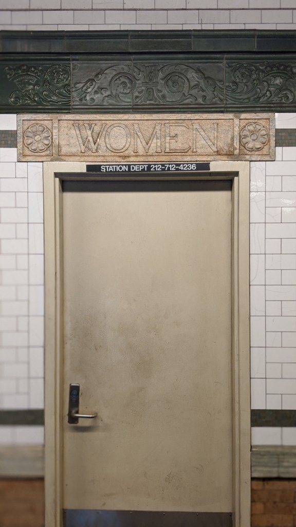
According to the New York Times, only 51 of the city’s 472 stations have working bathrooms. This is not one of them.
66th St-Lincoln Center (1)
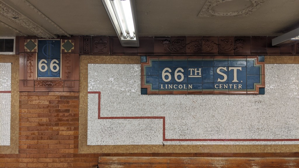
The emblazoned “LC” behind 66th St was added when Lincoln Center was built in the 1960s. 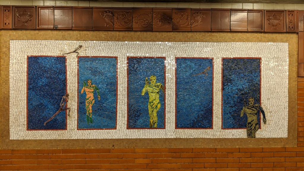
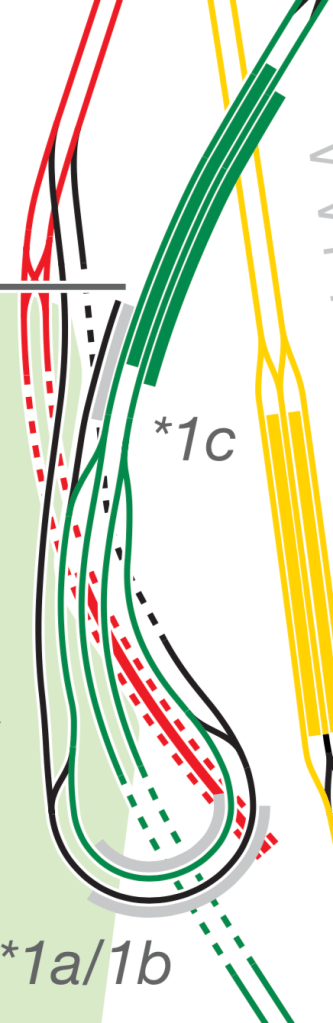
72nd St (1)(2)(3)
The original station house for 72nd St is listed on the National Register of Historic Places (it still exists despite a new station house being built in 2002). All of the sources I have looked at have called 72nd St inadequate as an express station, with narrow platforms and staircases, and originally no free transfer between directions. The new station house does have a free transfer between directions. 72nd St is also notable for the presence of “pocket tracks” (the black lines in the diagram). Pocket tracks in general are tracks used for the very short term storage of trains away from the active tracks. The IRT constructed pocket tracks in between the local and express tracks before the platforms at 14th St-Union Square on the IRT Lexington Ave Line and here at 72nd St. The purpose of these pocket tracks specifically was 1) if service was delayed it allowed trains to bunch up, freeing up space behind them and 2) it allowed trains switching between the local and express tracks to do so without getting in the way of trains not switching. I’m not sure how often they were used in regular service, but they became out of date as soon as platforms were lengthened on the IRT system, as the pockets could only hold a 5-car train.
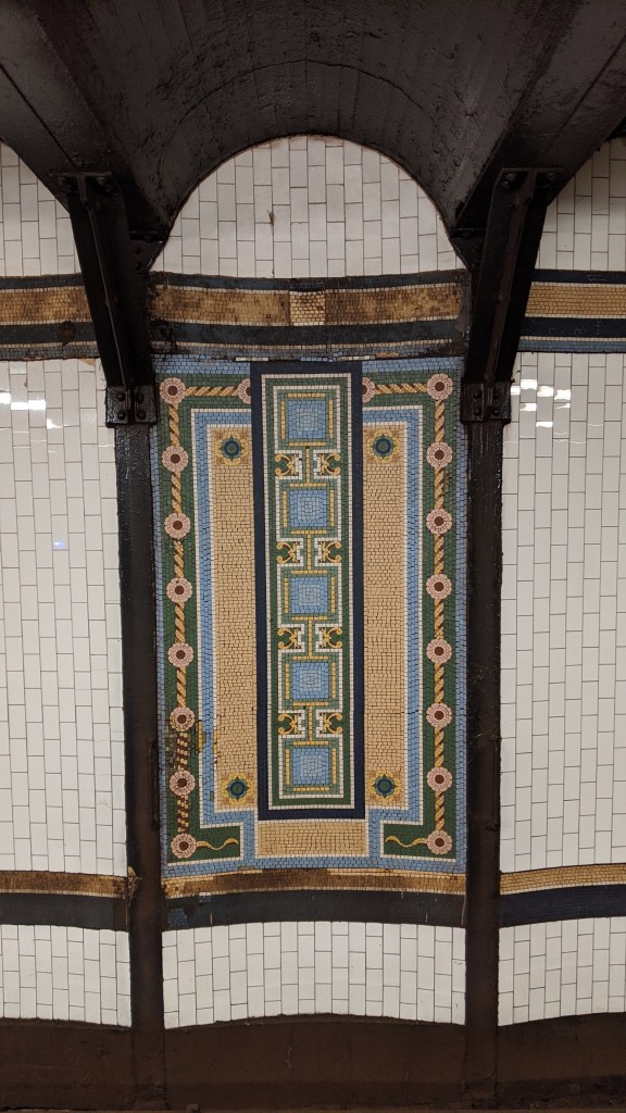
Some gorgeous trackside mosaics. 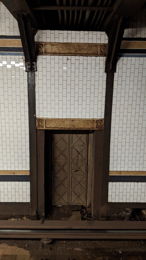
A tiny, mysterious, golden, trackside door in the station. It looks like the entrance to a magical fantasy land. 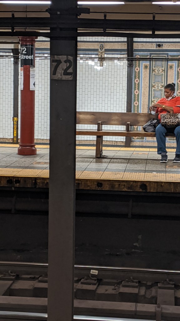
There are funny little “72”s emblazoned on the support pillars. 
The narrow staircases leading to the platforms in 72nd St. 
The old station house (1904). 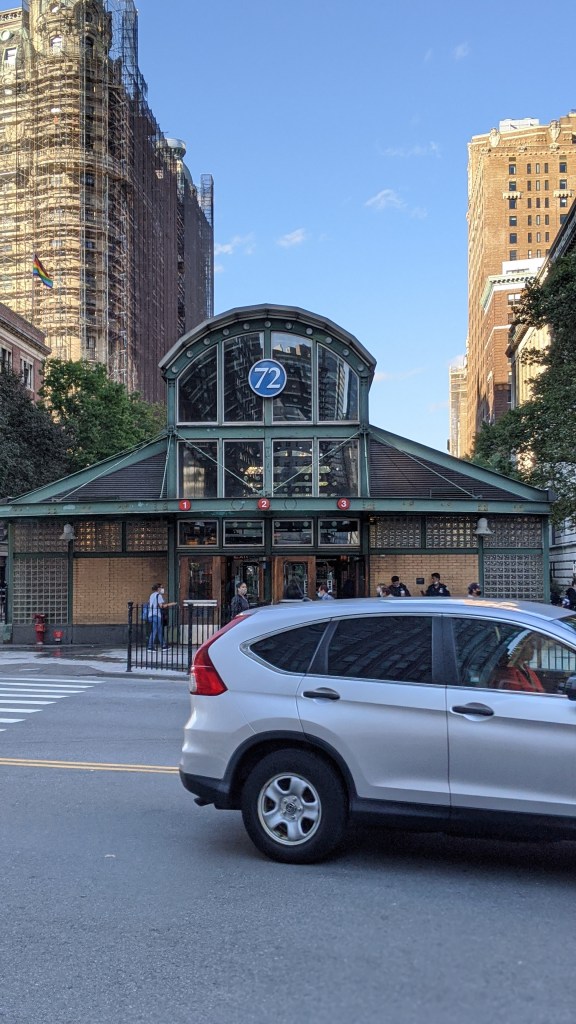
The new station house (2002).
If you look closely, you might be able to see the outline of where the (1)(2)(3) circles used to be on the new station house. They have been rearranged because there used to be another IRT Broadway-7th Ave service that has since been discontinued. The (9) was a rush hour variant of the (1), with the two services operating a skip-stop pattern north of 137th St. The (9) operated between 1989 and 2005, and was discontinued because the few minutes saved by running this service pattern was outweighed by the longer wait times at skipped stations. Now all (1) trains operate as locals, increasing frequency at each station at the expense of a few extra minutes of travel time.
79th St (1)
I must confess, I withheld some of the truth from you at Houston St. 79th St station is the other place where the express tracks are lower than the local tracks within a station, besides 33rd St and Carroll St. If you were typing away at the comments, getting ready to point out my mistake, do not fear, I have corrected myself.
The track height difference is subtle but it’s there. 79th St is also comically underwhelming in terms of decoration compared to the other stations on this line.
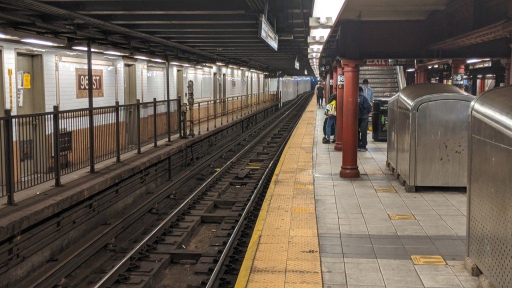
96th St (1)(2)(3)
96th St is basically a museum of the changes in the IRT subway. It opened as part of the original subway and is the last stop before the Lenox Line starts. Its original layout had two island platforms, like most express stations, as well as two side platforms for local trains. This layout was also used at Union Square and Brooklyn Bridge on the IRT Lexington Ave Line. The local trains would open their doors on both sides, allowing for transfers with the express train across the island platform, as well as local-only boarding on the side platforms. When the IRT first opened, express trains operated with 6 cars and local trains operated with 5. In 1910 and 1911 the length of express trains was increased from 6 to 8 and then to 10 cars long, and local trains were increased form 5 to 6 cars. In the 1950s and 1960s the IRT system had it’s local platforms extended to fit 10-car trains.
Until 2010, passengers would enter the station from the sidewalks down onto the outer local platforms, and reach the express platforms via an underpass. The local side platforms were not lengthened, and are now used for storage and an active switching tower. The additions to the station are quite obvious, as they were done in a completely different style. In fact, most platforms outside of the IND system were widened or extended at some point in their history, and changes in tiling pattern, column shape, ceiling height, and platform width at the ends of platforms are obvious signs of where that extension starts.
In the image above the short local platforms can be seen across the tracks from the active island platform. The wall was added when the platform was closed, and the space is now used for storage. The lengthening of IRT local trains to 10 cars lead to the closure of the 91st St station, which was one stop south of 96th St. 96th had an entrance added at 94th St, and spending the money to extend the 91st St platforms to 10 cars long would have been pointless given how close it would be to 96th St. Not to mention that keeping the 91st St station would slow local trains down. I must confess, I withheld some of the truth from you at 79th St. The abandoned 91st St station is yet another place where the express tracks are lower than the local tracks. You can see 91st St by looking out of the windows of (1) trains just before or just after 96th St.
The entrance to the new 96th St head house. 
The staircases to the platforms take up one lane of Broadway, due to the platforms being under the road surface. 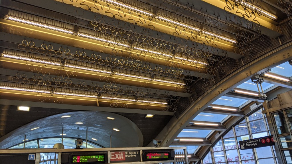
The interior of the new head house.
I mentioned above that passengers used the local platforms as entrances to 96th St until 2010. That was when the MTA opened a new entrance in the middle of Broadway with direct access to both express platforms.
North of the station, the express tracks descend to the lower level before turning east under 104th St towards Central Park. The upper level tracks continue under Broadway. Both levels had provisions for a third track to be added, but only the upper level had it added. When the subway first opened, trains from both the Broadway (local) and the Lenox (express) Lines could become either local or express trains south of 96th St, leading to congestion around the switches just north of 96th St. This was changed in 1959 with all Lenox Line trains running express south of 96th St.
(1) IRT Broadway-7th Ave Line (West Side Branch)
110th St-Cathedral Pkwy (1)
The Cathedral of Cathedral Parkway, the alternate name for 110th Street, is the Cathedral of St. John the Divine. The cathedral is incomplete from its original design, having started construction in 1892 and undergoing multiple stylistic changes. Despite being incomplete, it is the sixth largest church in the world by area. Part of the cathedral was design by the architects Heins & LaFarge, who were also responsible for the architecture and tiling on the original IRT subway line.
125th St (1)
125th St is one of the only elevated subway stations in Manhattan. El lines were once common, but have all been demolished. There are only four elevated stations in Manhattan total (or six depending on what you consider Manhattan and what you consider elevated, but we’ll get to that later). The reason for 125th St’s elevation is the Manhattan Valley, which is a break in the hilly terrain of northern Manhattan. The name “Manhattan” comes from Munsee, a Lenape language, and most likely means “the place where we gather bows,” but a more popular folk etymology claims that Mannahatta means “island of many of hills”. To downtowners this name may seem strange given the relatively flat nature of the city south of 110th St (with a major exception being Central Park), but to residents of West Harlem, Fort George, and Inwood, that name rings true. The hills of the island were flattened as part of the city’s relentless and grid based expansion north, but many were preserved in the far northern reaches of the island.
Western 125th Street runs at a diagonal to the grid, from just west of Morningside Avenue (which is geographically in line with Columbus (9th) Avenue but is physically unconnected) to the Hudson River. This valley runs in between the neighborhoods of Morningside Heights and Manhattanville, and is formed by a fault line that runs across the island. This fault line is suspected to have caused a magnitude 5.2 earthquake in 1737. On either side of the valley, the subway tracks were built between 10 and 20 feet below the street level using the cut and cover technique. Due to the steepness of the valley, the subway tracks span it on a 54-foot high steel viaduct as the street drops away. This viaduct keeps the subway tracks relatively level across the valley, rather than having two very steep slopes in quick succession. In fact, trains descend slightly from the 116th St station before reaching the viaduct, which is surprisingly not the only place in the system where trains descend into daylight.
The 125th St viaduct. 
Looking north along the viaduct. 
Looking north along the viaduct. The slope of Broadway compared to the level viaduct is quite apparent. 
The masonry along the viaduct has the profile of subway cars carved into the stone.
137th St-City College (1)
Unlike the other two lines this far north in Manhattan, the IRT Broadway-7th Ave Line doesn’t have a station at 135th St, the major east-west cross street in the area. That’s because 135th St is busy serving as the northern portal where the subway re-enters a tunnel from the Manhattan Valley Viaduct. 137th St is also where one Barack Obama got his first taste of community organizing. Working for the New York Public Interest Research Group, he organized a local campaign on May Day (my birthday!) 1985 (not my birth year) to get the MTA to address the poor condition of the station.
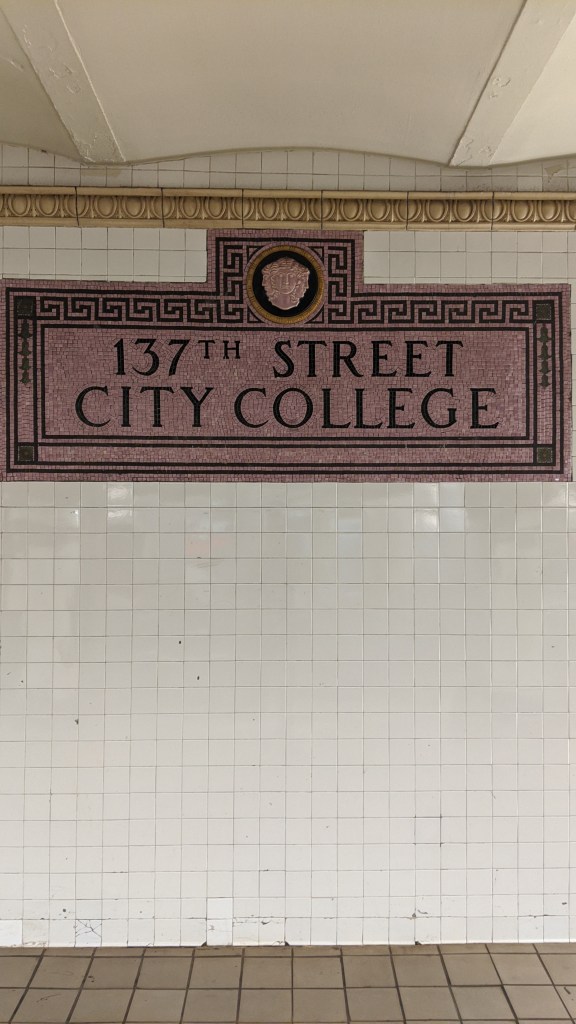
137th St has this lovely pink stone in its station mosaics. 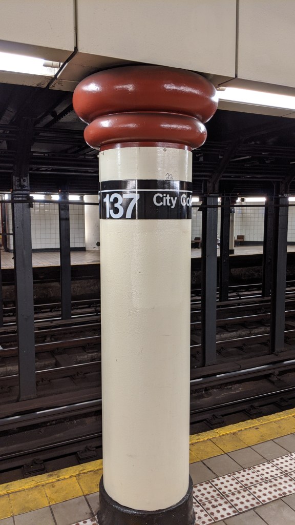
The skinny columns at the northern end of 137th St. 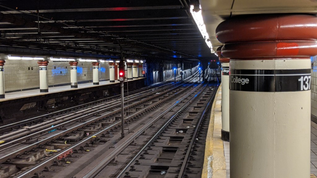
The fat columns of 137th St. The southern end of the station has no support columns between tracks, necessitating these much fatter trackside columns. I assume this gap was the site of a series of switches removed when the station was extended.
Between this station and the next (145th St) is the 137th St Yard, a five-track storage yard occasionally used to terminate trains before 242nd St. The yard layout is unusual, with two tracks merging out from the northbound local track just north of 137th St and merging back in just before 145th St. This is mirrored on the southbound side with three tracks. 145th St was the original northern terminus when the line was first opened, and this would have served as a storage yard for Broadway trains.
157th St (1)
Again, unlike both other lines in Manhattan at this point, the IRT Broadway-7th Ave Line doesn’t have a stop at 155th Street, the major crosstown street here. Instead it is at 157th St, due to the fact that the next station north, 168th St, is at the intersection of Broadway and St. Nicholas Ave. 157th Street is more centrally located between there and 145th St. 157th St also has the distinction of being the first station added to the subway system after the original 28 stations, from City Hall to 145th St (on the Broadway Line, not Lenox), which were opened on October 27, 1904. 157th St opened temporarily on October 29th, and fully opened on November 12th. The Lenox Line stations opened on November 23rd.
This station also has only two tracks, without a center express track, unlike all of the stations between 103rd and 145th Sts. The third track in those stations was not part of the original plan, but was added during construction. It has no platform for its entire length, and as far as I know has never been used in regular service. Even when the (9) operated as a partial express it did not use this track.
168th St (1)
The Washington Heights Mine Tunnel is a deep-bored tunnel blasted through bedrock between 157th St and Dyckman St stations. The stations along it are some of the deepest in the system, ranging between 80 and 180 feet below ground level. It should not surprise you then that 168th St is the second of the three stations in the system accessible only by elevators. 168th St is quite an ornate station, looking a bit like something out of a Soviet metro system. The station features high arched ceiling and two pedestrian crossovers. Because the station is so deep and has an arched ceiling, most of it doesn’t require support pillars, making it feel far more open than most other stations. In 1950 the New York Board of Transportation included this station in a report detailing how it could convert subway stations for use as bomb shelters. The project was never completed, but would have included water supply, extra bathrooms, and first-aid rooms.
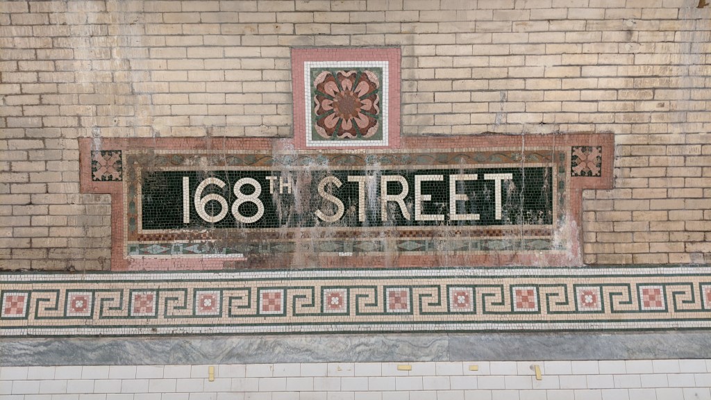
Some more pink mosaics. 168th St has a flower theme. 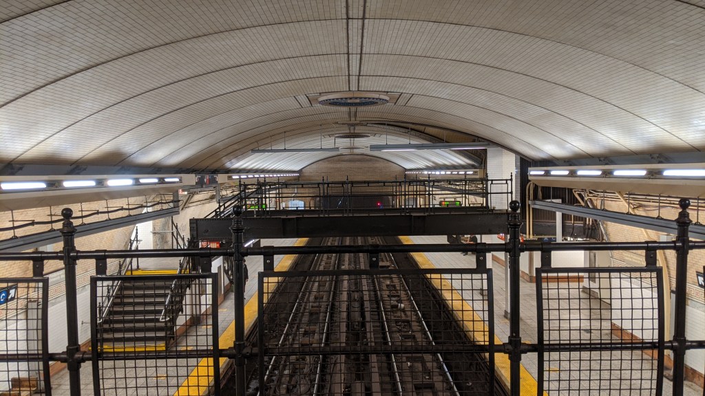
A view from one of the pedestrian overpasses. 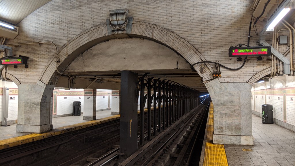
What used to be the southern end of the station, which was extended in 1948. 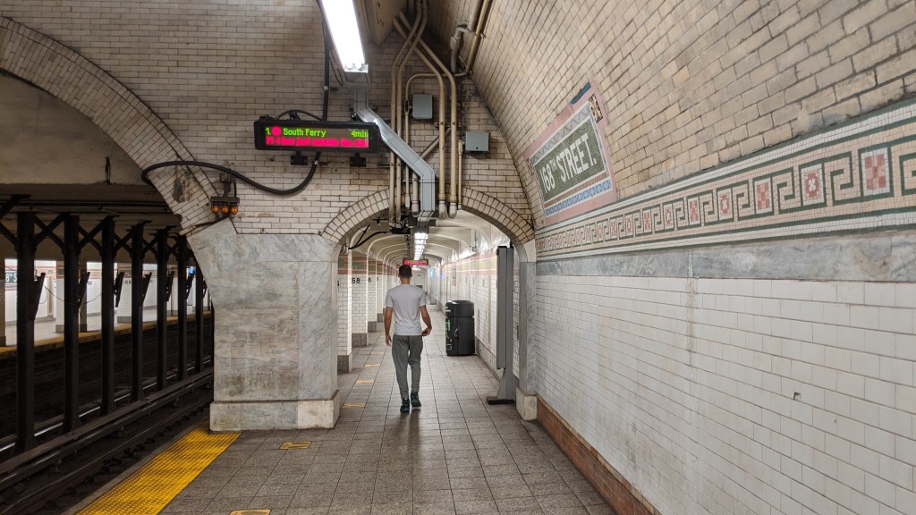
The southern platform extensions. These extensions look much more natural than the extensions at Hoyt St.
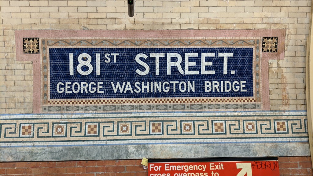
181st St (1)
This is the third of three station accessible only by elevators. It is similar to 168th St, with high arched ceilings (which have an unfortunate history of collapsing) and ornate decorations. There are two footbridges between platforms, but only is in use. Ten miners died during tunnel boring when a 300-ton boulder weakened by the explosives fell, killing six instantly and fatally wounding another four. The ceiling also partially collapsed in 2007 and 2009, although no one was killed or injured in those events.
The flowers at 181st St are beige rather than pink. 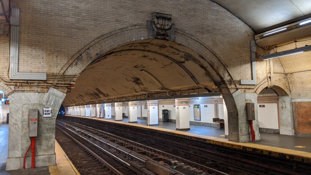
The 181st St platform extensions are to the north of the station. 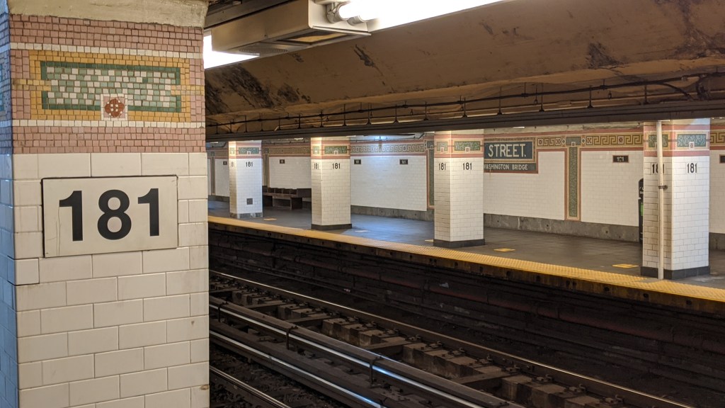
Pillars support the roof of the northern part of the platform, which was extended in 1948. 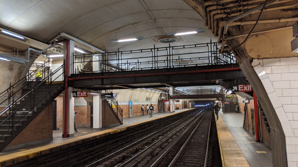
181st St also has two pedestrian overpasses, but only one is in use. 
Looking south from the in-use pedestrian overpass.
191st St (1)
This is the deepest station in the entire system, sitting between 173 and 180 feet below ground level. The station also sits almost exactly at street level. This is due to a quirk of Manhattan geography that gives this station one of the coolest subway entrances in the city. Manhattan is less than a mile wide measured from the Hudson to the Harlem River at 191st Street, yet in that space there are two of the highest points on the island, as well as a deep valley between them. Bennet Park, located at 184th Street and Fort Washington Avenue on the western hill is the highest natural point in Manhattan, at 265 feet above sea level.
The Washington Heights Mine Tunnel, through which the (1) train runs, passes underneath the Fort George Hill, the eastern of the two peaks here. The Washington Heights Mine Tunnel is slightly above sea level, but 180 feet below Fort George Hill. Broadway passes through the valley in between the two peaks, and the platforms of 191st St are at about the same elevation as Broadway. Because of this, shortly after the station opened, a 1,000-foot (3 block) long tunnel opened between the station and Broadway. This tunnel is almost entirely straight and level, allowing residents from the valley reach the subway without having to trek uphill. The tunnel is not technically part of the station. It is owned by the Parks Department and is officially called “Tunnel Street”. The tunnel has been painted in a mural for its entire length and makes for a fascinating walk. Residents can also access the station from elevators directly above the station. Despite one entrance containing elevators and the other being one long flat tunnel, the station is not handicap accessible, because the platforms can only be reached by stairs. There is even a ramp at the Broadway entrance of the tunnel which is incredibly steep and seems to serve no real purpose.
The original stations in the tunnel (168th and 181st Sts) opened after the trains began using the tunnel, as their ornate station design required more time to complete. These two stations opened in 1906, without a station at 191st St. The area around what would become the 191st St station was less developed than the area around the other two, and so no station was built. This left an almost mile-long gap between 181st St and Dyckman St. At the behest of landowners in the area of 191st St, the IRT added an infill station (a station added to an already operating piece of track) in 1911. This is why the station is somewhat less ornate than its Mine Tunnel brethren.
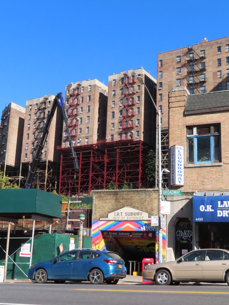
The 191st St station Broadway entrance. Note the “IRT Subway” sign. The apartments in the background supported on red stilts show the ground level of the Fort George Hill, under which the subway runs. 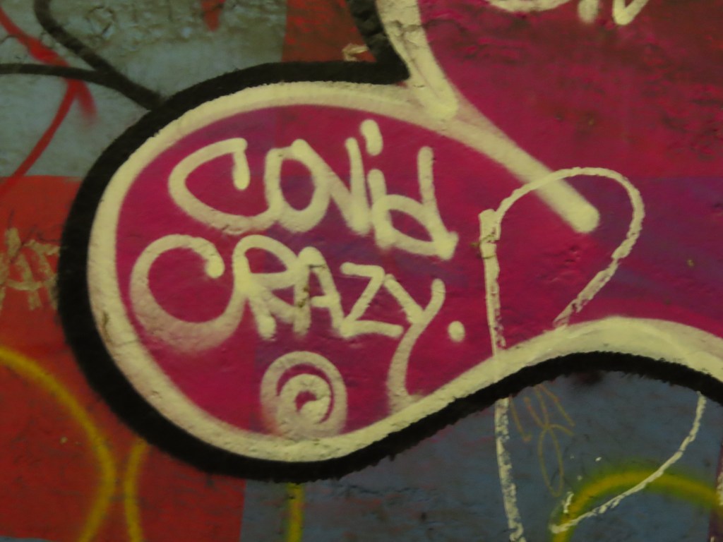
Some graffiti on top of the mural in the tunnel. 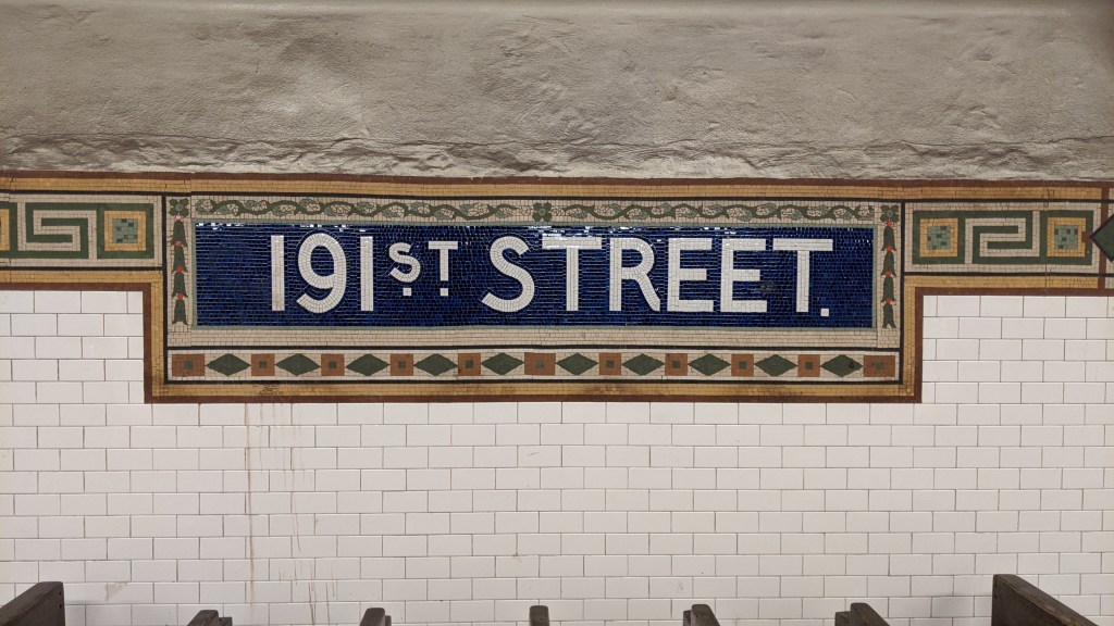
191st St station sign. 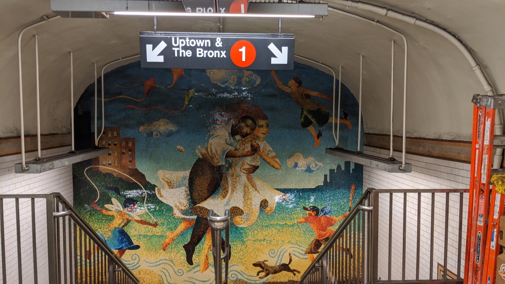
A mural above the staircase to the northbound platform.
Dyckman St (1)
Dyckman St is yet another fascinating station in upper Manhattan. If you want an example of just how extreme northern Manhattan topography is, come here. The station starts immediately after the Washington Heights Mine Tunnel ends. The rather ornate portal is at the northern end of the Fort George Hill, which appears nearly vertical at the end of the tunnel. The station remains level for its entire length, and by the time you reach the northern end, the tracks are elevated above street level, which at this point is basically sea level. An unused third track appears again north of the station.
Dyckman St would be 200th St in the grid plan, although the grid in Inwood is offset from the Manhattan grid pretty significantly due to Inwood Hill taking up the western half of the peninsula. There is another fault line here, called the Dyckman Street Fault which is active but not responsible for any major damage. Substation 17, which is adjacent to the station, was one of eight substations built by the IRT to power its system between 1904 and 1905 and is on the National Register of Historic Places.
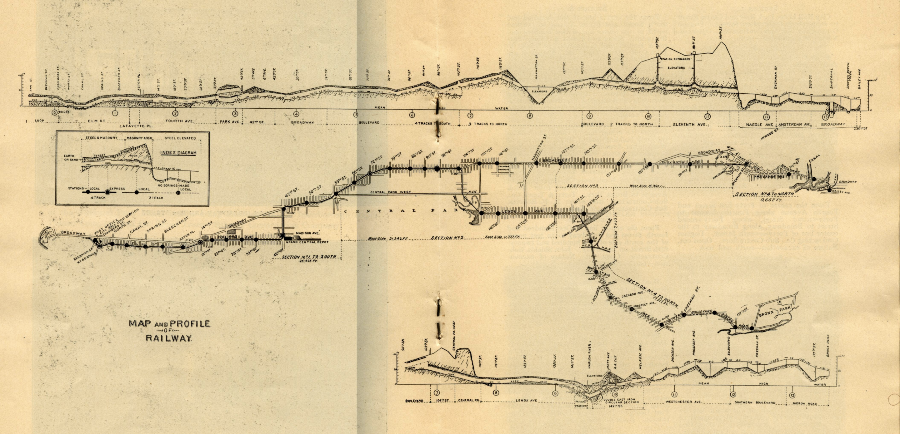
The image above is one of the most interesting maps of the subway. It shows the full route of Contract 1 of the subway, from City Hall to 242nd St and Bronx Park. A few key things to note: The map is oriented with west at the top, not north; north is to the right. The slopes on this map are greatly exaggerated. The actual numerical value of each slope on the track is included in the image. While the profile diagrams (the top and bottom features of the map) are straight lines, the actual route curves quite a bit. The middle feature shows a top down more traditional, geographically accurate map of the subway route. The two types of diagram are to scale, meaning any point on the top-down map maps onto the profile maps above and below it exactly. We are only interested in this map north of the section along 42nd St, which is where the top-down map shows two sharp curves about a third of the way along the map from the left.
The first interesting feature is the 125th St viaduct on the West Side Branch. If you find 125th St on the top-down map, notice the diagonal street labelled “Manhattan St”. This is now the western portion of 125th St, and passes through the Manhattan Valley we discussed at 125th St. If you look above that, at the profile map, you will see the ground drop away significantly, while the tracks emerge onto a viaduct, and then plunge back underground on the other side when the ground rises back up. You will also notice that the track, while still in a tunnel on the left, is descending to emerge onto the viaduct.
If you follow the route to the right (north) you will see the Fort George Hill start at 157th St. Once again the track stays relatively level, ignoring the contours of the ground above it. In fact the entire Fort George Mine Tunnel is on a slight downward slope. You can see the 168th and 181st St stations deep below ground level, with their respective elevator shafts. There is no station at 191st St (remember this didn’t come until 1911) but the location of 190th St is pointed out on the map. The sharp descent of the Fort George Hill is visible immediately south of Dyckman St. In fact the terrain change is so abrupt that on the smaller scale of this map, the track appears to immediately emerge onto a viaduct. In fact some of the Dyckman St station is at ground level, and the northern end is elevated.
We will come back to this map later, so I highly recommend that you open the image in a new tab for later. Also, feel free to take a break here and just look at everything on it. It is a magnificent image and absolutely full of fascinating features. You might even uncover some of the secrets that I’ll discuss in the IRT Lexington Ave Line post.
207th St (1)
A track north of the station provides access to the 207th St yard, one of just four places where the two divisions of the subway are connected.
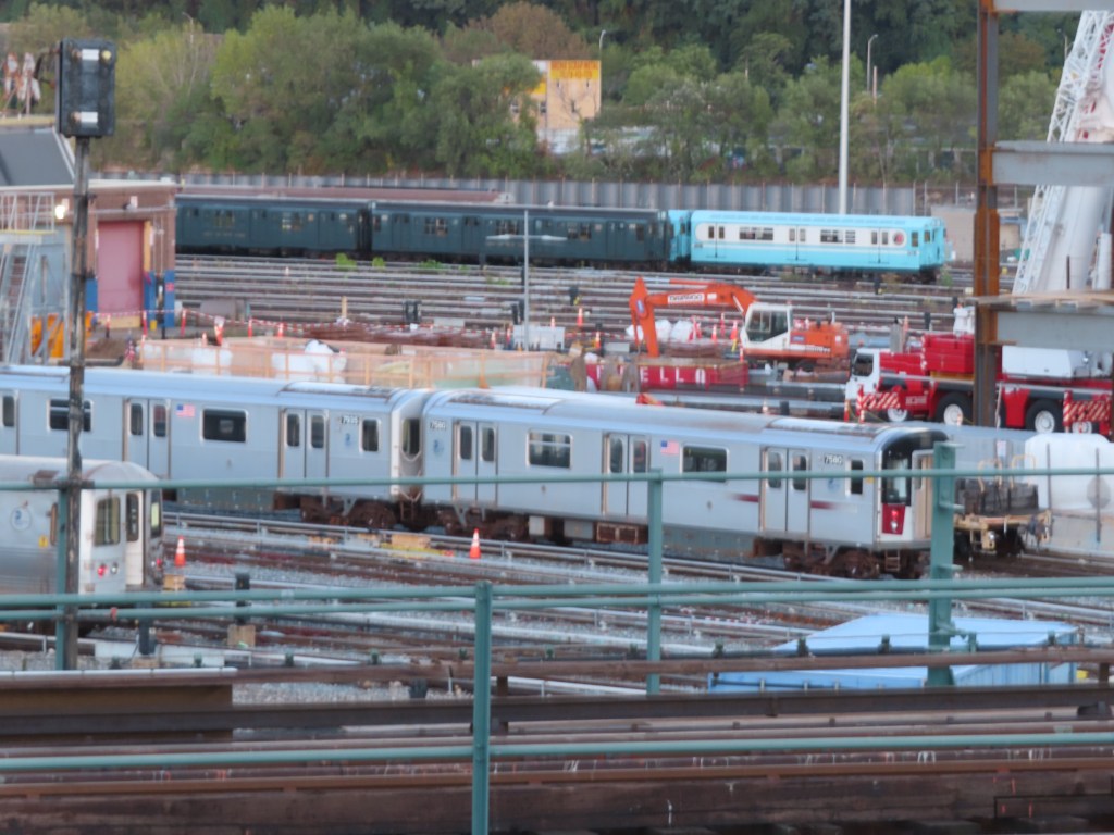
In the left foreground is a B division R46 train. In the middle ground is a train of A division R142A cars. In the background are two historical train sets. I believe the dark green one is a set of R9 cars, which were standard IND stock when that system opened. The blue and white train is the classic R33S, used on the IRT Flushing Line for the 1964 World’s Fair.
The 207th St yard is the primary storage yard for the C service, as well as a major overhaul and repair shop for both A and B division trains. It is also where New York Transit Museum trains are stored and maintained, hence the old units.
215th St (1)
This is the northernmost station on Manhattan Island, but not the northernmost station in Manhattan. The extension north from 157th St opened in 1906 with shuttle trains operating between 157th St and a temporary terminal at 221st St. This terminal was at the northernmost point of the island, just before the Broadway bridge. When the line was extended across the Harlem River in 1907, the station was removed.
Marble Hill-225th St (1)
The temporary 221st St terminal station was moved to 230th St where it served as another temporary terminal after Marble Hill-225th St opened in 1907.
Marble Hill is politically and administratively part of Manhattan, although it has a Bronx zip code, Bronx area codes, and is served by a Bronx police precinct. The reason for this Manhattan exclave on the mainland is the Spuyten Duyvil Creek. The Spuyten Duyvil Creek was a tidal estuary that formed an S-shaped connection between the Hudson River and the Harlem River at the northern end of Manhattan island. The creek was difficult to navigate, and in 1895 and again in 1938 the Harlem River Ship Canal cut through the S-shape, making the waterway easier to navigate for large craft. The result of this was two islands stuck in between the newly created oxbow lakes, one of which was Marble Hill. The other was basically marshland and unsuitable for development. The cut in 1895 separated Marble Hill from Manhattan Island, and the path of the original creek was filled in by 1914, connecting Marble Hill to the mainland. This makes 225th St one of two stations in Manhattan’s boundaries but not on the physical island. The other is Roosevelt Island on the (F).
To this day the path of the original creek can be seen from satellite views, as the original Marble Hill neighborhood is quite dense and low-rise, whereas the newly created land is taken up by much less dense development. This includes multiple schools, a U-Haul storage lot, and a NYCHA housing development. The King’s Bridge (which gave its name to Kingsbridge, a nearby neighborhood) was built in 1693 and spanned the original Spuyten Duyvil Creek. It was a part of the Boston Post Road, but was buried when the creek was filled in. Spuyten Duyvil is a transliteration from Dutch, which likely meant “spouting devil” given the rough currents located around the creeks entrance at the Hudson.
The Broadway Bridge that crosses the Harlem River Ship Canal is actually its third incarnation. When the subway was extended over the Canal in 1907 the original bridge was moved to become the University Heights bridge further south. The new bridge had two subway tracks on the upper level and was a swing bridge to let ships through. This bridge was removed on December 23rd of 1960 and a new pre-assembled lift bridge was floated into place and connected by Boxing Day. This new bridge doubled the channels width, added a third subway track, and could lift to allow ships to pass under. I don’t think the bridge lifts particularly often, as this would be a huge inconvenience to subway riders.

A 1777 military map of Spuyten Duyvil Creek. Image via Wikimedia 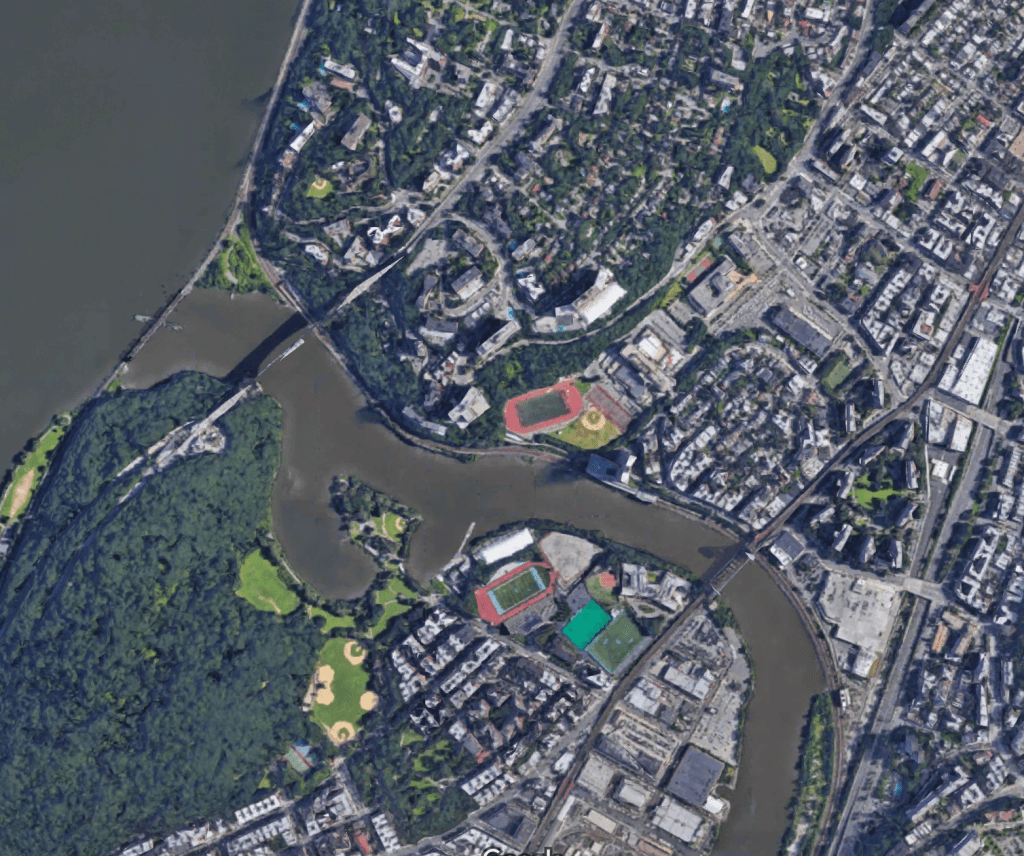
A 2020 Google Maps screenshot of the same area of Spuytren Duyvil Creek and Marble Hill.
The Bronx
Van Cortlandt Park-242nd St (1)
While not the northernmost station in the system, this is the highest number street in a station name. This station, like most elevated IRT terminals is arranged with two tracks, two side platforms, and a central island platform. This is called a Spanish Solution, and involves embarking passengers and disembarking passengers using different sides of the train. Now however, like most elevated IRT terminals, the two side platforms are closed. The station sits over only the western half of the street. The station is located near the 240th St yard where (1) trains are stored and maintained.
The station is very decorative, and takes inspiration from the City Beautiful movement. A number of elevated stations were designed by Heins & LaFarge (remember them from 110th St?) but this is the only one remaining in that style.
The unused side platforms, typical of IRT elevated terminals. 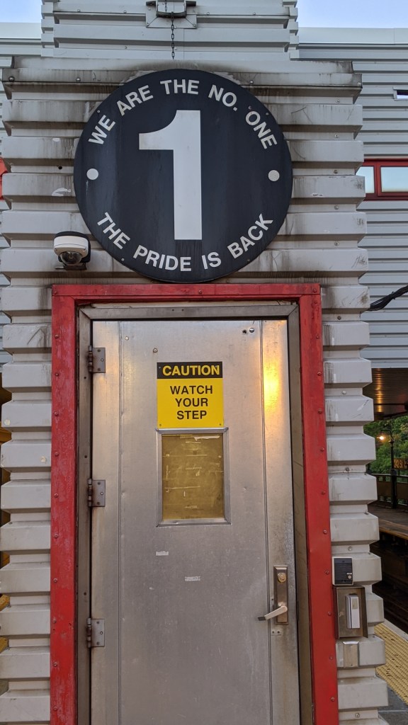
A sign above the entrance to the crew quarters. 
The ornate control house.
I have to say, I was surprised when I read the Wikipedia article for this station. Citing the entry on the National Register of Historic Places, the author of the article goes about as in-depth as I have ever seen when describing the control house. I highly recommend that you go read it for yourself to see just how detailed it gets.
Manhattan
(2)(3) IRT Lenox Ave Line
We’re back in Manhattan now, just north of 96th St following the (2) and (3) on their Lenox Ave branch.
110th St (2)(3)
The tunnel under Central Park slopes downward for its entire length. Built as a deep bore under the hills of northern Central Park, the tunnel has two sharp corners restricting train speed. Upper West Side residents asked for a station at 104th St and Central Park West, but the IRT declined to build one. This would have been useful as a transfer station between the Lenox Line and the later IND 8th Ave Line.
110th St was the site of a fire on March 27, 2020 which killed Garret Goble, the train operator of a (2) train and injured 16 others. The fire was suspected arson as a number of other smaller fires in nearby stations had been reported around the same time. The station reopened on April 6th.
135th St (2)(3)
135th St has a center track unused in regular service. This track was used by (3) trains when they operated as a late night shuttle between Harlem-148th St and 135th St until 1995. The middle track only connects with the southbound track to the south of the station, and the northbound track to the north of the station.
145th St (3)
145th St was the original northern terminus of the East Side Branch (IRT Lenox Ave Line) of the original subway, and opened November 23rd, 1904 along with the rest of the east side branch. The station is the only station in the system that is unable to accommodate a full length train (besides the shuttles). Only six IRT cars can fit in the station, so only the front five open their doors (IRT trains operate in two five car sets each controlled by the conductor individually). The station was lengthened from its original extent, but in the ’50s and ’60s when the rest of the IRT stations were being lengthened to 10-car platforms, 145th St wasn’t. Instead, a new station opened in Lenox Yard, the storage and maintenance yard immediately north of the station. This new station, Harlem-148th St, was meant to replace 145th St, and was built 10 cars long. After community opposition however, 145th St remained open but still short. Due to the short distance between 145th St and 148th St, the northbound platform is exit only. South of the station, (2) trains branch off to the IRT White Plains Line at a level junction (meaning all the tracks are on the same level). This can cause some congestion, as southbound (2) trains block northbound (3) trains. The junction is far enough to the south that 145th St could be lengthened to 10 cars, but the MTA doesn’t consider the cost justified.
Harlem-148th St (3)
Sometimes called Lenox Terminal, this station was added to the line in 1968. There have been proposals to extend this northern section of the IRT Lenox Ave Line to the IRT Jerome Ave Line (the (4)), but these never came to fruition. The platform was added to two of the southernmost tracks in the yard, and you can see the other yard tracks from the platform. The station is at ground level and immediately adjacent to the Harlem River, making it quite prone to flooding. The station is actually at 149th St, but to avoid confusion with the 149th St stations in the Bronx it was named 148th St. The Lenox Yard in which the station sits used to be the main repair and inspection facility for the IRT. When it opened in 1904 it stretched from 147th to 150th Street. It has been confined to between 149th and 150th Streets since the Transit Authority moved all repair work to the 207th St Yard. The yard was reduced from 26 acres to just 7, and the land was sold to developers.
This station is at ground level. If you caught how iffy I sounded at 125th St (West Side branch) when discussing how many stations in Manhattan are above ground, this is part of the reason why. Is this station above ground? Technically yes, but it is under another building, so daylight isn’t entirely visible, and it is below the street level of 7th Ave, where the exit is. To further complicate things, would you consider Marble Hill-225th St part of Manhattan? Politically yes, but physically no. Therefore, there are between four and six above ground stations in Manhattan.
The Bronx
(2) IRT White Plains Rd Line
Grand Concourse-149th St (2)(5)
This was the first subway station in the Bronx, and indeed the first subway station opened outside of Manhattan. The station opened as Mott Ave in 1905, served by trains from the Lenox Ave Line. The station has undergone a number of changes since its original incarnation. The high round ceilings similar to the Mine Tunnel Stations on the Broadway-7th Ave Line once ran the length of the station. After the H system under the Dual Contracts opened, an upper level was opened for trains from the Lexington Ave Line. In addition to this, a sharp S-curve connection was added west of the original lower level for direct access to the Lexington Ave Line. This is used by (5) trains today, and the sharp curve causes an almighty screech as trains move around it at an excruciatingly slow 10mph.
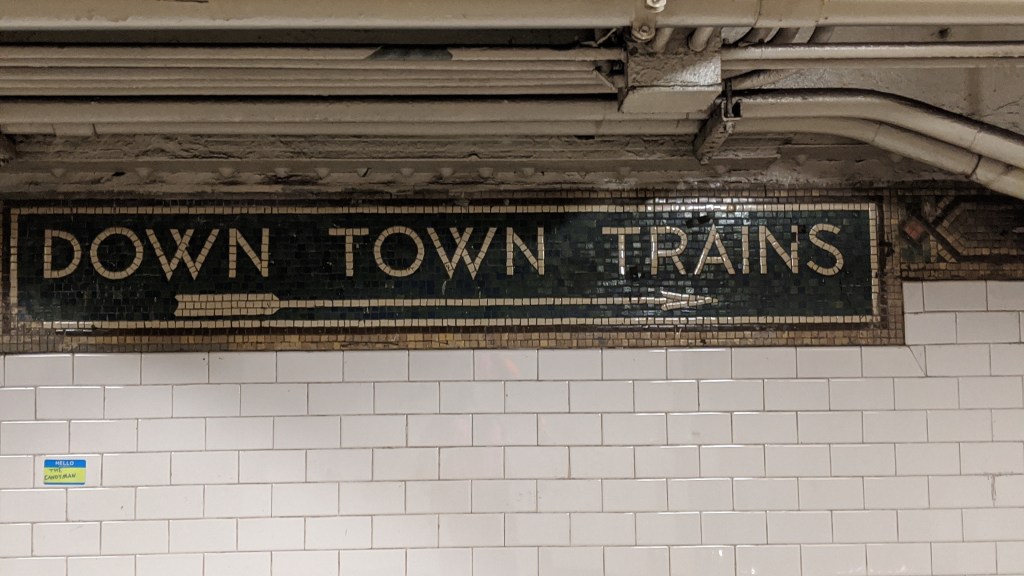
Original “Down Town Trains” sign at Grand Concourse. 
This crossover between platforms used to be open, allowing you to look at the tracks below. I would prefer that to the ads that are there now. 
A closed off staircase to a closed crossover at the western end of the platforms. 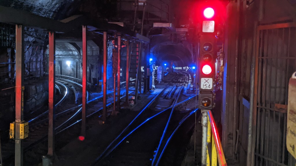
Looking into the tunnels to the west of the station. The (2) continues straight through, and the (5) branches off on both sides.
3rd Ave-149th St (2)(5)
Because of the subway and former elevated and trolley lines here, this area is known as the Hub. The IRT 3rd Ave El opened in the area in 1887 and wasn’t demolished until 1973. The Bx55 bus replaced the 3rd Ave El, and a paper transfer was available at this station. Because of this existing transfer this station was one of the first to receive MetroCards in the early 1990s. Daylight can be seen at the eastern end of the platform as the tracks rise to an elevated structure almost immediately after leaving the station. An express tracks starts after this station and doesn’t have a stop until E 180th St, seven stations and 3.4 miles later, making it the second longest express run in the system.
Jackson Ave (2)(5)
This station wasn’t served by subway trains until 1905, but actually opened for service in 1904. In fact the entire elevated line, from Jackson Ave to Bronx Park (the longest elevated section in Contract 1), opened in 1904 and was originally served by trains from the 3rd Ave El. This section was first called the West Farms Line, and it was the new extension to 241st St that gave the whole line its “White Plains Rd” Line name.
As trains rise out of the ground onto the elevated structure, the remnants of the connection to the 3rd Ave El are visible. The El tracks joined from the middle of the subway tracks and rose above the tracks to continue west along Westchester Avenue to 3rd Avenue. In 1917 a new connection to the 3rd Ave El called the Bergen Avenue Cutoff was added. This path followed the S-curve that the subway tracks make between 149th St and Westchester Ave, but the new El track stayed elevated. This was abandoned in 1946.
Note the much greater extent of the elevated lines in 1924. These are the IRT 3rd Ave El and its connections. The mainline continues up 3rd Ave, while the original connection to the IRT West Farms Line (now the IRT White Plains Rd Line) branched off at Westchester and 3rd Avenues. You can see the location of where the tracks would have gone from the image above. The last piece of track is the squiggly line that branches off of the 3rd Ave El in the bottom of the 1924 picture and merges with the IRT West Farms Line. This was the Bergen Ave Cutoff, and it was built to allow 3rd Ave El trains to bypass the busy Hub area. It merges off of the IRT White Plains Rd line directly above where the subway tracks descend underground, as you can see in the Google Maps image. The stilts that supported this line are still visible as you ride a (2) or (5) train between 3rd Ave and Jackson Ave stations.
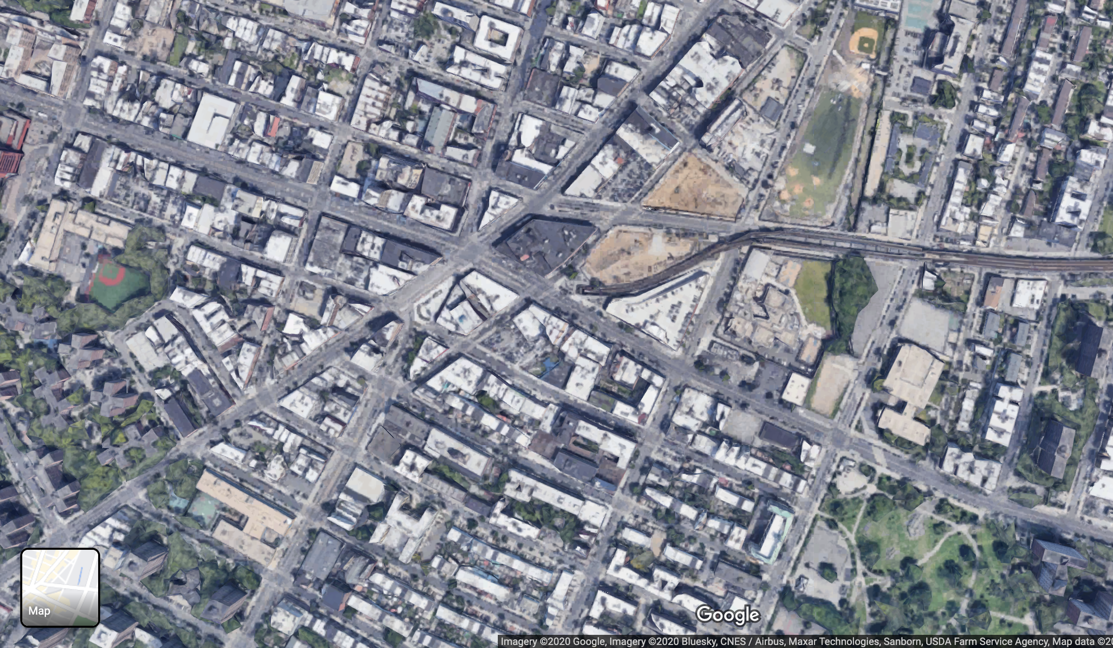
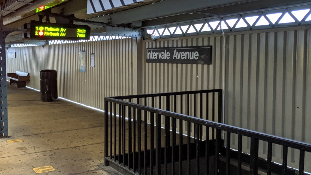
Intervale Ave (2)(5)
This station was added to the line as an infill in 1910. The original station fell victim to arson after a failed robbery of the token booth, and was completely rebuilt.
Simpson St (2)(5)
This is where the line turns off of Westchester Ave and onto Southern Blvd. The IRT Pelham Line (6) turns onto Westchester Ave just a few blocks northeast of here, which can be seen from the station.
This station along with Substation 18 were placed on the National Register of Historic Places in 2004. The stations along this line all (except for Intervale Ave) have beautiful stained glass decorations.
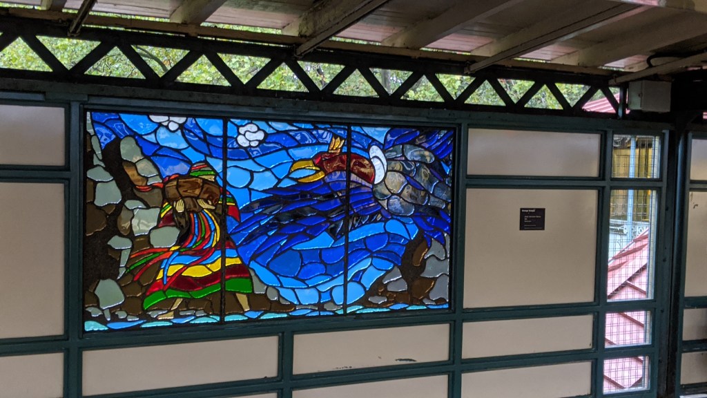
Jackson Ave stained glass. 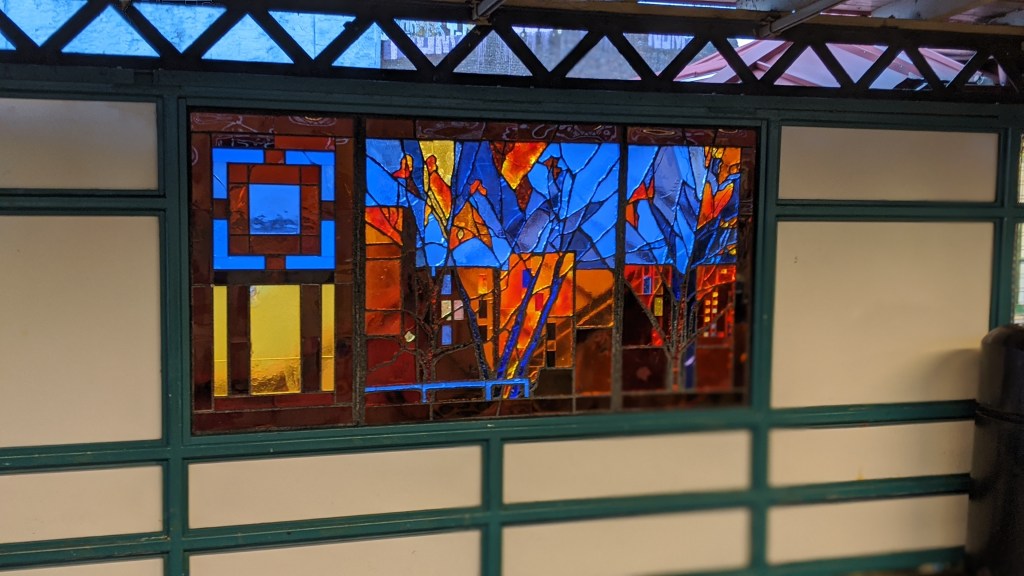
Prospect Ave stained glass. 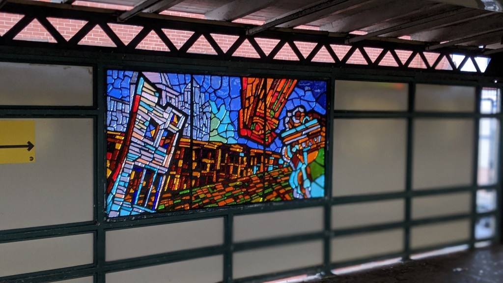
Simpson Ave stained glass. 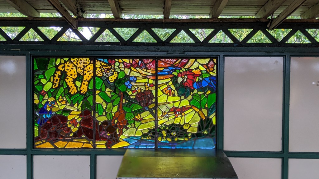
West Farms Sq-East Tremont Ave stained glass.
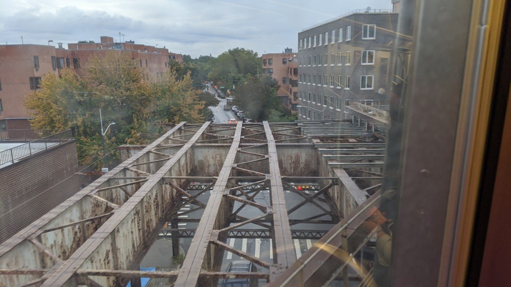
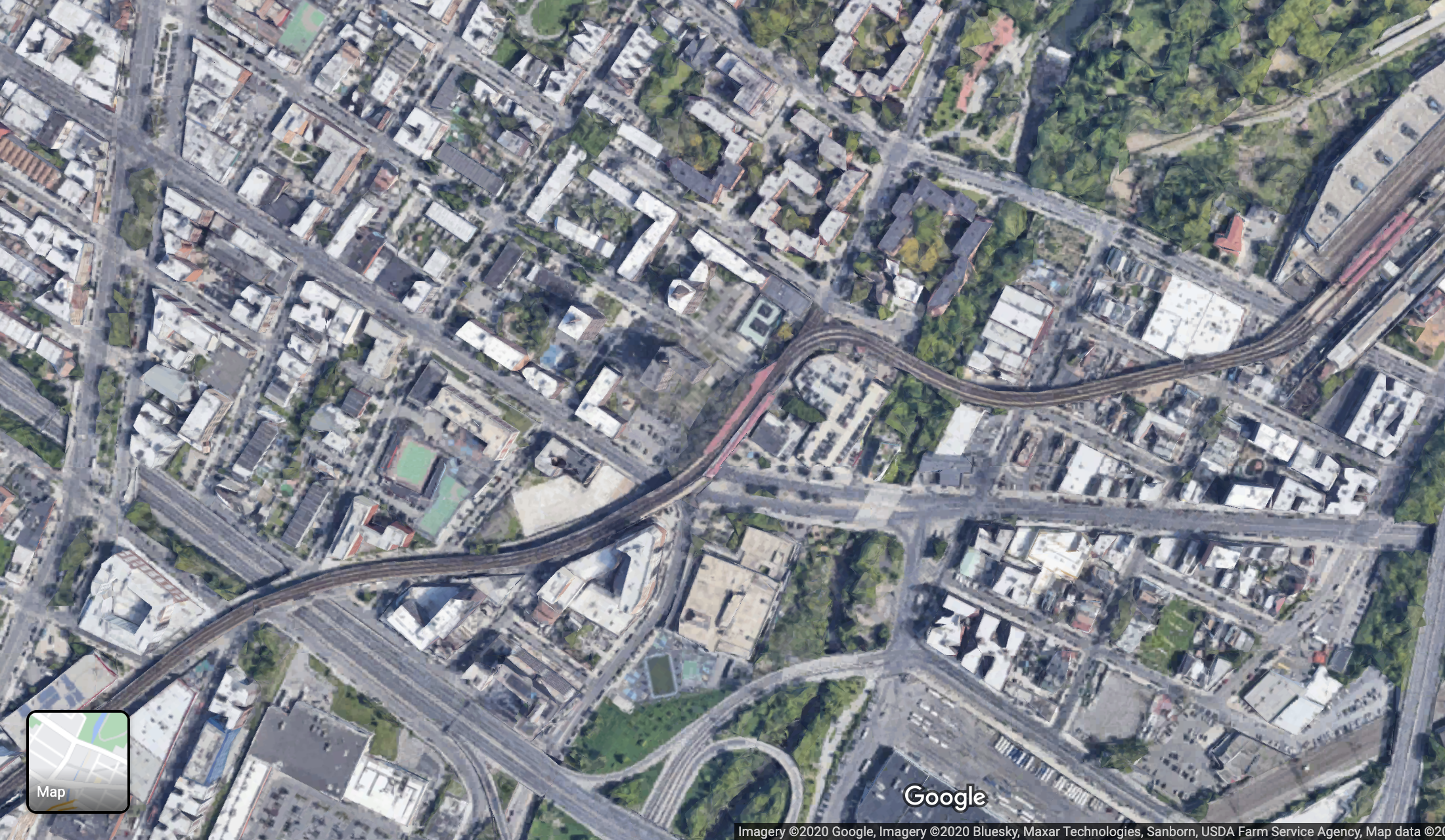
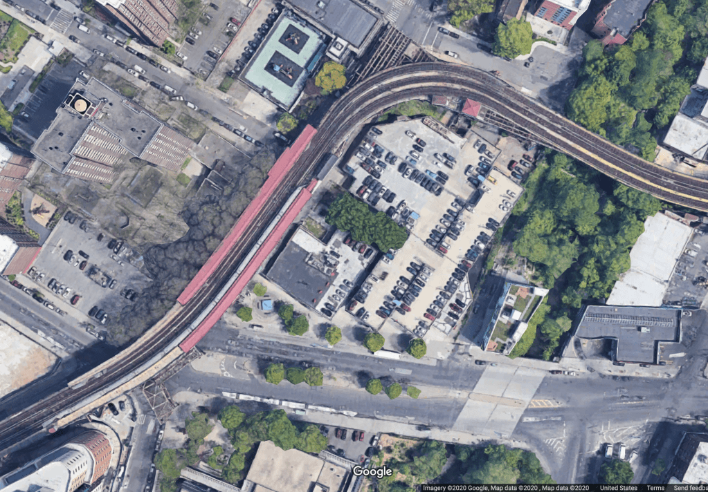
West Farms Sq-East Tremont Ave (2)(5)
This station sits on a high curve, just before a sharp S-curve. The original route continued north of this station to a terminal called 180th St-Bronx Park. The trackways for this line are visible to the north of the station before they end. This terminal station was accompanied by the West Farms Yard, a now demolished elevated yard that sat to the east of the current station, and south of where the tracks now continue. The original plan was for this line to extend north from the 180th St-Bronx Park station, but this was changed due to concern that trains continuing through Bronx Park would disturb the animals in the Bronx Zoo. The 180th St-Bronx Park terminal station was demolished in 1952.
In 1917, as part of the Dual Contracts, the IRT White Plains Rd Line was opened from a junction just north of this station to 219th St, and later 241st St. It was originally just this line that was called the White Plains Rd Line, and the original Contract 1 line was called the West Farms Line, although both sections are now referred to by White Plains Rd.
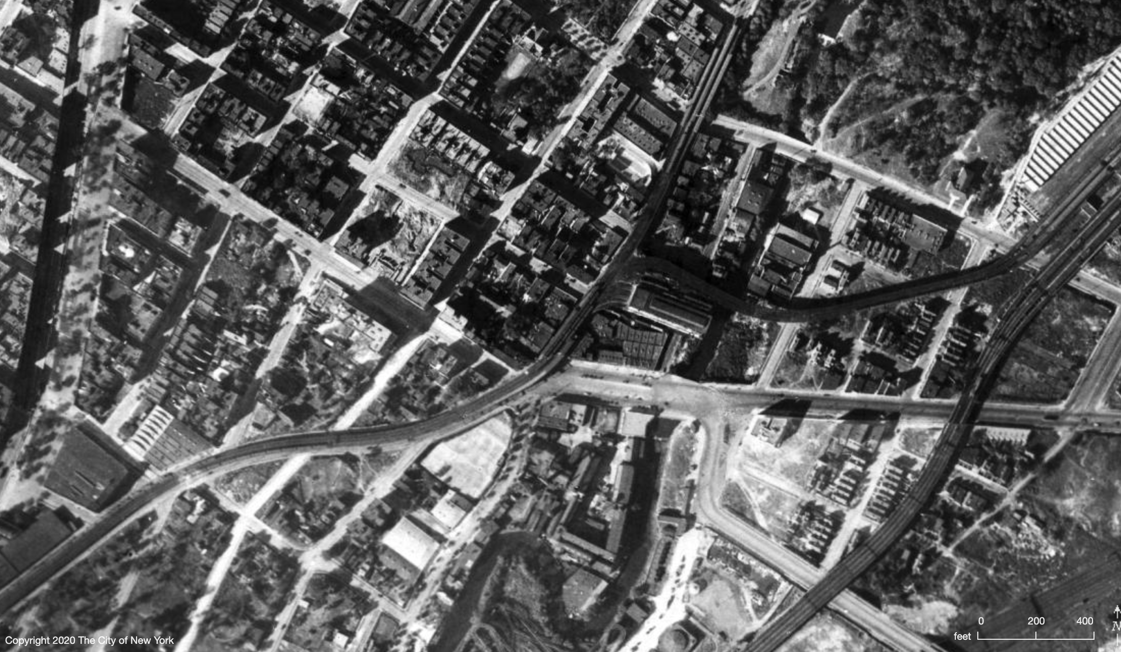
In the 1924 image, the original Bronx Park Terminal and the Dual Contracts extension are visible. The station complex in the top right is the newer E 180th St station, and the line that continued straight north is the original Bronx Park spur. A now demolished elevated yard existed just south of where the Dual Contracts extension turned east, and if you look at this area on the Google Maps image below you can still see one of the original trackways that led to the yard. The yard has also been demolished and was replaced by the E 180th St and Unionport facilities. If you look at this long enough you might notice another fascinating piece of this area’s history. That will be discussed in the IRT Lexington Ave Line post.
East 180th St (2)(5)
This is a fascinating station, but much of its history has more to do with the IRT Dyre Ave Line which I will cover in the next post on the IRT Lexington Ave Line.
This station is connected to two yards, the East 180th St Yard and the Unionport Yard. As far as I can tell, E 180th St is used as a maintenance facility whereas Unionport is just for storage. The connection between this station and West Farms Sq is a private right of way and doesn’t run along any roads. This station and the next, Bronx Park East, both contain the word “East” in their station names in order to distinguish them from the original 180th St-Bronx Park terminal station.
Bronx Park East-Burke Ave (2)(5)
These four stations all also have quite beautiful stained glass.
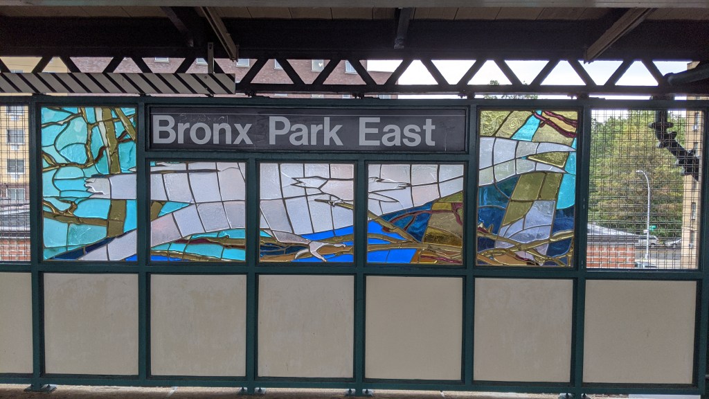
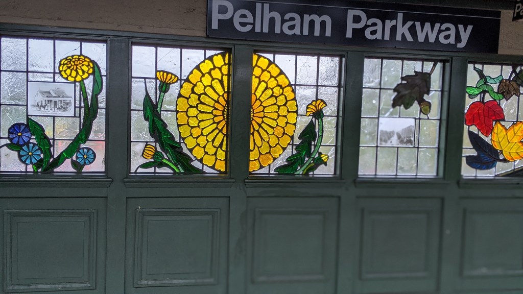
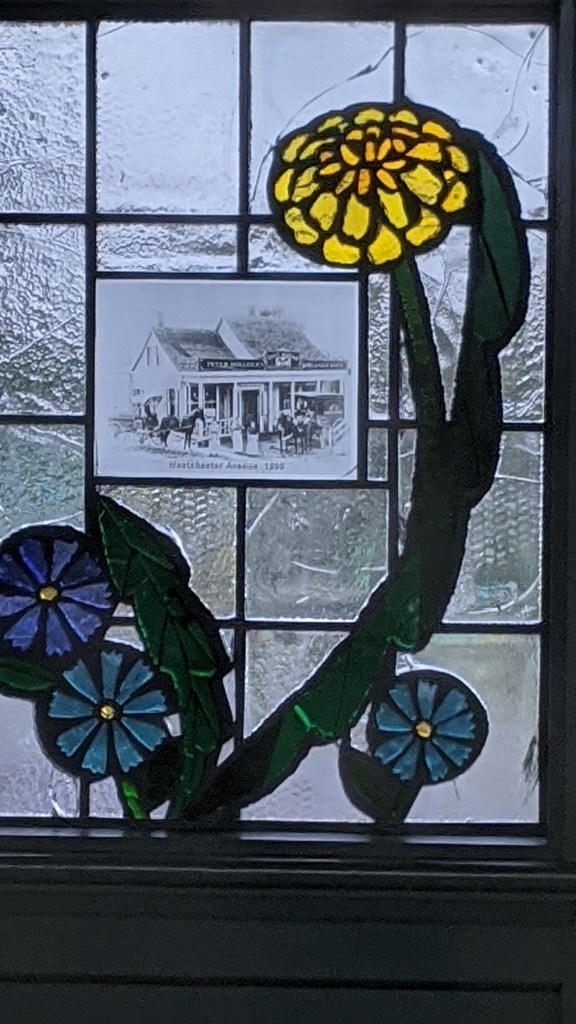
Pelham Pkwy contains historical photos of the surrounding area 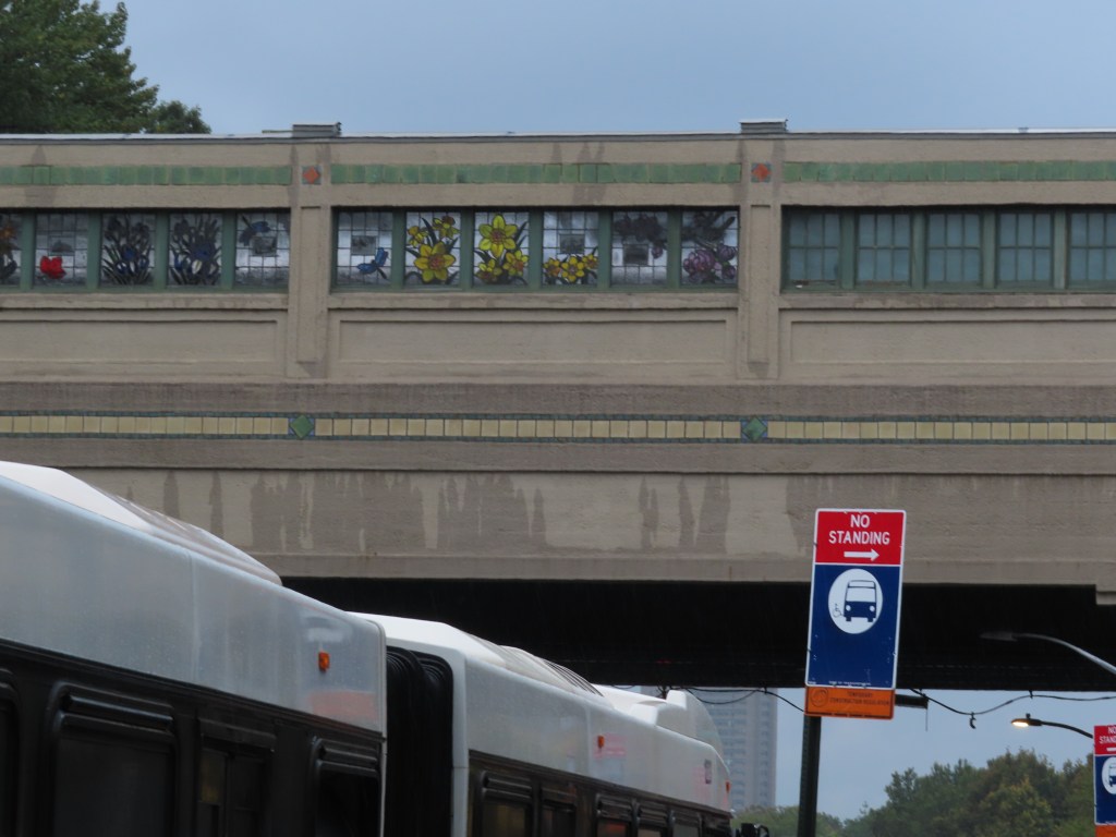
Pelham Pkwy is also clad entirely in structurally unnecessary concrete 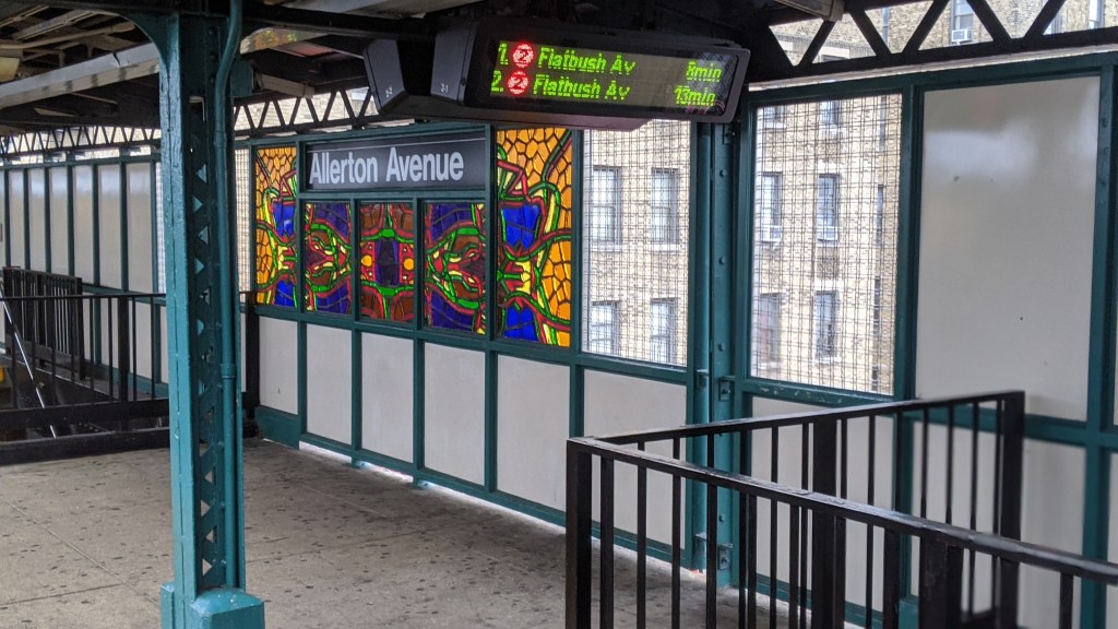
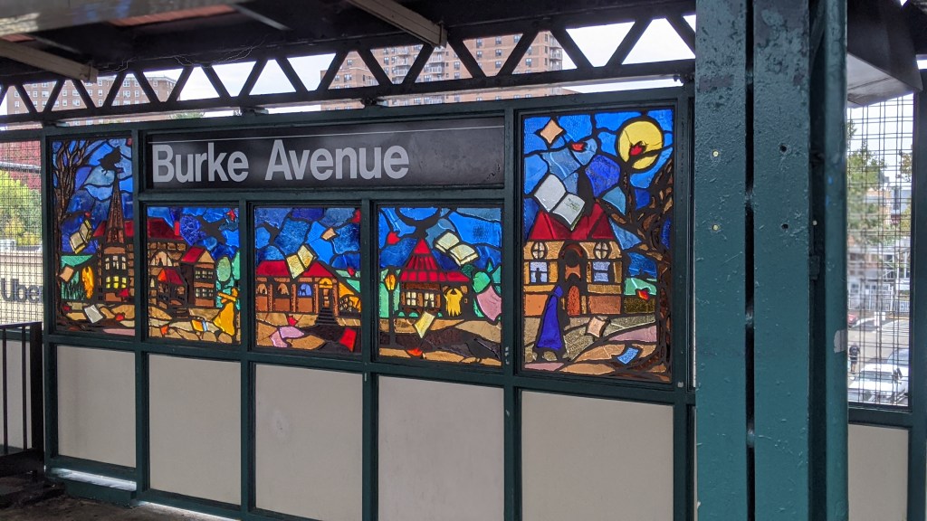
Gun Hill Rd (2)(5)
This was built as a bi-level station, with the lower level being served by the IRT 3rd Ave El. The lower level tracks continued north rising up to the upper level and merging, allowing 3rd Ave El trains to run to the end of the White Plains Rd Line. The lower level has been abandoned since 1973. The subway tracks are above the El tracks at this station, which is kind of funny, since subway means below and Elevated means above. To the north, the subway tracks descend to the El track level and merge together. Just before the merge, the tracks are five wide. From west to east they are: southbound local subway, southbound El, bidirectional express subway, northbound El, northbound local subway. The abandoned El trackways are visible to the north of the station.
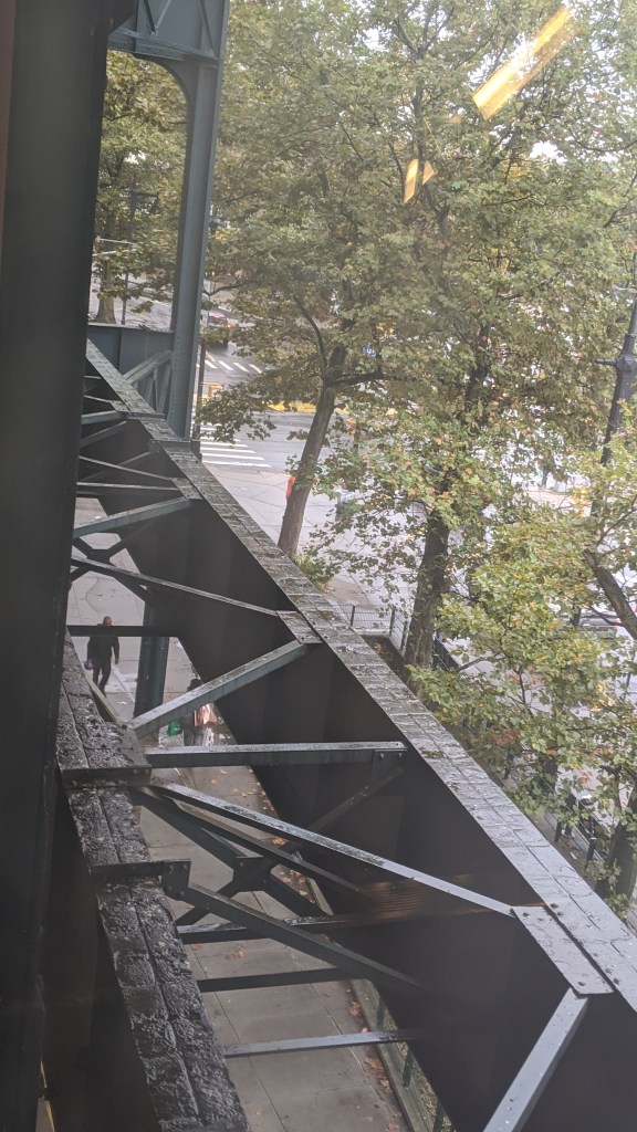
The mezzanine level of Gun Hill Rd used to be the island platform for the 3rd Ave El. Now the trackways are visible out of the windows. 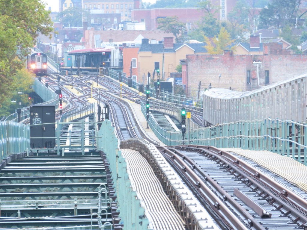
The subway tracks slope down and once merged with the El tracks before the next stop.
The name Gun Hill comes from the American Revolution, when colonists brought a cannon to the top of a hill now in Woodlawn Cemetery and fired on the British. The road was originally called Kingsbridge Road and was a part of the Boston Post Road, so it was an incredibly important transit artery. After the battle, the hill locally became known as Gun Hill, and the road soon followed.
Nereid Ave (2)(5)
This is the northern terminal for rush hour (5) trains which then head into the 239th St Yard, while (2) trains continue on. The track connection to the yard requires that the northbound local track rise up a level to allow the yard leads to pass underneath.
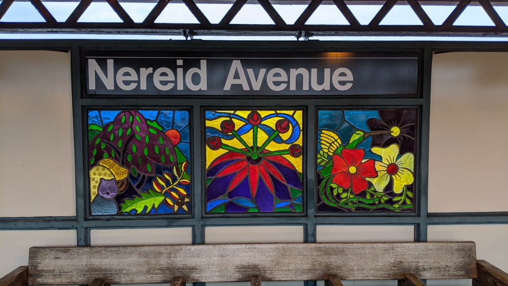
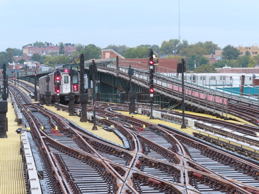
When rush hour (5) trains serve the IRT White Plains Rd Line, they start and end their trips at Neried Ave, rather than 241st St. This is because the 239th St Yard is connected to the tracks at Neried Ave, so as you can see in the photo above, (5) trains will stop here and then enter the yard immediately. The reverse is true in the morning, when (5) trains leave the yard and start their trips at Nereid Ave. All (2) trains continue on to and originate from the next and last stop. The northbound local track rises above the yard leads just north of Neried Ave.
This track layout follows the typical IRT layout on its elevated lines, where the yard is connected to the second to last station, and the last station has the Spanish Solution style layout that we saw at 242nd St on the (1).
Wakefield-241st St (2)
Welcome to the northernmost station in the system. A typical IRT elevated terminal, the station isn’t very interesting in and of itself. The station was called Becker Ave during construction, but opened as East 241st St.
The street grid in the Bronx largely follows the one in Manhattan, starting in the south at 132nd St, at the equivalent level of 132nd St in Manhattan. However, the blocks in the Bronx are longer than the blocks in Manhattan, so by the time you reach the northernmost street on Manhattan island, 220th St, nearly 4.5 miles north of 132nd St, the equivalent street in the Bronx is only 194th St, putting the Bronx grid almost thirty streets off. North of Marble Hill, in the part of the Bronx west of I-87 (and west of the Harlem River, had it continued north instead of turning west between 220th St and 225th St), the gird follows on from the northernmost point of Manhattan. The incongruity of the two grids in the Bronx is such that if you walk 440 feet north along Sedgwick Avenue from 197th St, the next street you encounter is 229th St. All this adds up to the fact that the (1) terminal at Van Cortlandt Park, despite being nearly a mile further south than the (2) terminal at Wakefield, is signed as one street further north.

On the Saratoga 3 stop New Lots bound platform I’ve always if there was an engineering mistake. The staircase down to the booth makes it so there’s only about…2 feet of platform. So if you get off of the first car you basically have to wait until the car pulls out of the station before you continue to the stairs. Its that or be an inch or less from a moving train as it pulls out. Seems pretty unsafe. Does this happen anywhere else?
LikeLike
I also posted this on the page with the Beverley Road station.
Re: Beverley vs Beverly
The IRT station spelling IS correct.
It was done on purpose in 1897 when Brooklyn was still a separate city.
The area west of Nostrand Av uses the English spelling with the extra ‘e’. The area from Nostrand Av eastward uses the Americanized spelling, which is why the IRT Co. used it when they built the station
Now officially the street has the extra ‘e’. There is no reason to have to have new station tablets made for the IRT station. People know where they live.
What’s Your Name, Bev?
Q. In Brooklyn, Beverl(e)y Road is spelled two ways, either Beverley or Beverly. The subway station on the Brighton (Q) Line, near East 16th Street, is labeled the Beverley Road Station. The station on the Nostrand Avenue (2 and 5) line is named the Beverly Road Station. What gives?
A. Herbert Schonhaut, an authority on station signs for New York City Transit, said the two spellings date to the development of the Prospect Park South area. The street was originally called Avenue B.
At the request of the developers, in 1897 the City of Brooklyn renamed a stretch, from Coney Island Avenue to Flatbush Avenue, Beverley Road, using the English spelling.
Later, after Brooklyn was annexed into the City of New York, three of the remaining four of the street’s sections Church to Coney Island Avenue; Flatbush to Brooklyn Avenue; and Schenectady to Ralph Avenue were renamed Beverly Road, using the Americanized spelling.
The fourth section, from Ralph Avenue to East 98th Street in Remsen Village, was never renamed and is still Avenue B. (This could be because it complements Avenue A, a block north.)
The Brighton Line station fell in the area with the third “e,” and the Nostrand Avenue station is in the area that was renamed without the “e.”
The correct name for the entire stretch from Church to Ralph Avenue is now Beverley Road, according to the Brooklyn borough president’s office.
LikeLike