(N) Sea Beach Line
New Utrecht Ave (N)
The (N) follows the route of the historic New York & Sea Beach Railroad, a Brooklyn excursion railroad. For much of it’s history as a destination, Coney Island was well outside of the New York and Brooklyn city limits (two different cities until 1898) and was primarily a day trip or weekend vacation spot. The four subway lines that reach Coney Island today (The (D)(F)(N)(Q)) all follow the routes of railroads that were chartered to bring New Yorkers and Brooklynites to the hotels that dotted Coney Island.
The New York & Sea Beach Railroad opened in 1877, between the site of the current New Utrecht Ave station (then called Bath Junction) and Coney Island. Its Coney Island terminal was not the same one that exists today. It was called Sea Beach Depot, and was located between W 8th and W 11th Streets, a spot currently occupied by the Luna Park Houses. In 1878 the Sea Beach Palace opened as a hotel for the Sea Beach Railroad to serve. It was a building originally built for the Philadelphia Centennial Fair, but moved to Coney Island and converted to a combined hotel and restaurant.


At the same time, the New York, Bay Ridge and Jamaica Railroad (part of the New York and Manhattan Beach Railroad, later the LIRR Bay Ridge Branch) opened between Bay Ridge, at 65th Street, and Manhattan Beach, on the eastern end of Coney Island. The New York and Sea Beach used the New York and Manhattan Beach’s tracks west from Bath Junction to the ferry terminal at 65th St. In 1879, the New York and Sea Beach built its own route directly south of the New York and Manhattan Beach Railroad until 8th Avenue, where it crossed to the northern side and continued west to the ferry terminal. This is the same route that the (N) BMT Sea Beach Line follows today, except for the last few blocks to the ferry terminal. In 1885, a second track was added. The line was at street level for most of its route.

In 1896, the New York and Sea Beach Railway went bankrupt, and was bought by the Brooklyn Rapid Transit Company in 1897, and leased to the Brooklyn Heights Railroad, the streetcar division of the BRT. In 1898 the line had been electrified with trolley wire and El trains from the BRT 5th Ave Line (5th Avenue in Brooklyn, not Manhattan) were operating over it from the El terminal at 3rd Avenue and 65th Street to Coney Island, under trolley wire.
In 1908, the BRT began operating El trains from Park Row in Manhattan, over the Brooklyn Bridge, along the 5th Ave El, the West End Line (todays (D) train) to Bath Junction and from Bath Junction to Coney Island via the Sea Beach Line. Bath Junction is now the New Utrecht Ave station on the BMT Sea Beach Line, where a connection between the West End and Sea Beach Lines was built (both lines were at ground level at the time). Trolleys provided service from Bath Junction to the 65th St ferry along the west half of the route. Also in 1908, the BRT connected the Sea Beach Line to the West End Terminal (the site of the current Coney Island Terminal).

8th Ave (N)
In 1915, as part of the Dual Contracts, the Sea Beach Line was expanded from two to four tracks, and sunk into the open cut that the line uses today. The track connection to the West End Line was severed at this time and the tracks were connected to the new 4th Ave Subway. The two express tracks don’t have any platforms from 4th Ave-59th St all the way to Coney Island, and were used by seasonal express trips, offering the fastest route to Coney Island from Manhattan. Both the 4th Ave Line and the Sea Beach Line have 4 tracks, but the Sea Beach express tracks merge with the Sea Beach local tracks before they reach the 4th Ave Line, where they become the 4th Ave express tracks. Today, one of the Sea Beach express trackways doesn’t have any track laid on it, and the other isn’t used in revenue service.


A northbound Sea Beach train entering the tunnel between 8th Ave and 59th St. Taken from 65th St, which didn’t exist in the above image. The foreground shows where the express tracks used to be. 
Looking east as a Coney Island bound (N) train heads towards 8th Ave. To the right is the Bay Ridge Branch, and to the left is the trackways for the express tracks, which can be seen in the background.

(Q) BMT Brighton Line
Ocean Pkwy (Q)
Ocean Pkwy is built like an express station, but only the local tracks are in service. West of the station, the local tracks merge into the express tracks, but the structure that holds the track continues west to the lower level of the W 8th St-New York Aquarium station. In 1954, the tracks to the lower level were removed and Brighton Local service (the (Q)) began to use the upper level platforms.

Brighton Beach (B)(Q)
Brighton Beach station is the last stop for (B) service in Brooklyn. Just west of the station is the widest elevated structure in the city, holding six tracks, four of which are used to store (B) trains and two of which carry (Q) trains to and from Coney Island.

The current Brighton Beach Station was opened as part of the BRT modernization under the Dual Contracts, in 1917, but train service to the area goes back much further. In 1878, the Brooklyn, Flatbush, & Coney Island Railroad opened from Prospect Park to Brighton Beach as an excursion railroad for beach going New Yorkers. It was connected to the Brighton Beach Hotel, and enormous building located just south of the current station. The hotel and railroad were were owned and operated by the Brooklyn, Flatbush, and Coney Island Railroad. Soon after, it was connected to the LIRR at Atlantic Avenue and Franklin Avenue, and Brooklyn, Flatbush, and Coney Island trains operated to Brighton Beach from Downtown Brooklyn.

A map to Coney Island via the LIRR and BF&CI RR 
A postcard showing the Brighton Beach Hotel with a train in the background 
In 1883, the connection to the LIRR was removed because the LIRR bought the New York and Manhattan Beach Railroad, a line that largely paralleled the Brooklyn, Flatbush, and Coney Island line. The LIRR didn’t want the BF&CI to compete with its new line, and so denied the BF&CI access to Downtown Brooklyn, and therefore passengers. The Brooklyn, Flatbush, and Coney Island Railroad was reorganized as the Brooklyn and Brighton Beach Railroad, and, in 1896, built a new connection to the Fulton St El, two blocks north of the former Atlantic Avenue connection to the LIRR. In 1899, the Brooklyn Rapid Transit Company acquired both the Brooklyn and Brighton Beach railroad and the Kings County Elevated Railroad, which operated the Fulton St El. During this time both El trains and streetcars were operated over the line, which had been electrified with overhead trolley wire. In 1903 the line was extended west from Brighton Beach to the now demolished Culver Terminal, near today’s W 8th St station. The Culver Terminal was the Coney Island Terminal for the Prospect Park and Coney Island Railroad, which became the BMT and later IND Culver Line, the (F) train.
The original Brighton Line was a two track railroad line that operated mostly at ground level and partially in an open cut. By 1908, as part of a wide scheme to eliminate grade crossings in Brooklyn, the entire line from Church Avenue, where the original open cut ended, to Sheepshead Bay was grade separated, meaning roads no longer crossed the railroad at the same level. Between Church Avenue and Avenue H, the line was lowered into an open cut. South of Avenue H it was placed onto an embankment (basically an inverted open cut) and the whole line south of Church Ave was widened to four tracks.
Because the tracks no longer crossed roads at any point, the lines electrification was upgraded from trolley wire to third rail. Between 1917 and 1920, a number of construction projects were started on the Brighton Beach Line, as it was now called, in compliance with the Dual Contracts. The connection to the Culver Terminal was removed, and the elevated structure from Brighton Beach to the Coney Island terminal was completed. The line between Church Ave and Prospect Park was widened from two to four tracks, and the tunnel under Flatbush Avenue connecting Prospect Park station to DeKalb Ave was opened.
Neck Rd (Q)
The New York and Manhattan Beach Railroad, which was bought by the LIRR and renamed the Manhattan Beach Branch, ran very close to the route of the Brighton Line. On the east side of the Brighton Line station at Neck Rd are the remains of a Manhattan Beach Branch station, with stairs leading up to the long abandoned platforms.

Staircase to the Manhattan Beach Branch Neck Rd station in 1910. Image via Forgotten New York 
The embankment on which the Manhattan Beach Branch once ran at Neck Road. Image by Leo Shirky 
The staircase up to the abandoned Manhattan Beach Branch Station, now blocked off. Image by Leo Shirky
Neck Rd is also the former of the Sheepshead Bay Racetrack Spur. Betting on horse racing was a common pastime in old New York, and the racetrack was opened in 1879, and was a big draw for passengers on the Brooklyn, Flatbush, & Coney Island Railroad and the Manhattan Beach Branch. The compounding of making betting on horse races illegal in New York State in 1908, and losing out on patronage to the Belmont Racetrack, the Sheepshead Bay facility was eventually sold and demolished in 1919. Luckily for us, the site was still visible in 1924, when the first aerial map of New York was photographed, showing the site of the racetrack, as well as the LIRR Manhattan Beach Branch and the Racetrack Spur. The junction where the spur left the Brighton Beach Line is still visible today from Google Maps.


Avenue H (Q)
Avenue H is the last Manhattan-bound station to be rebuilt above street level in 1908. It sits directly over the LIRRs Bay Ridge Branch, and is near the site of a long gone junction between the LIRR Bay Ridge Branch, the LIRR Manhattan Beach Branch, and the BRT Brighton Line. This junction, called the Manhattan Beach Junction, was opened in 1877, and LIRR trains ran from Manhattan Beach, on the east end of Coney Island, to either Bay Ridge or East New York, and later Greenpoint. (See the (L) BMT Canarsie Line post for more detail about this portion of the route).


The Manhattan Beach branch was abandoned in 1937, and very little of it remains, but the Bay Ridge Branch is still active and used exclusively by freight trains of the New York & Atlantic Railway, which is the freight division of the LIRR. The Avenue H station now passes over the Bay Ridge Branch, but when the Brighton Line was first built, it actually passed underneath. If the Triboro RX plan is ever realized, converting the Bay Ridge Branch into passenger use, a station would likely appear at this location to transfer to the Brighton Line.

The Bay Ridge Branch track visible through the gap between platform and track of Avenue H 
Avenue H station elevated over the Bay Ridge Branch


The northbound station house at Avenue H really goes all in on the “house” aspect. It looks like a regular suburban home, complete with a porch, a chimney, and wooden rocking chairs.

Newkirk Ave (B)(Q)
Newkirk Ave is an express station, and the first open cut station we arrive at. Open cut means that the tracks are depressed below street level, but open to the air. Looking south along the tracks shows the slope that (B)(Q) trains traverse in order to move from below ground to above ground. All of the streets between Foster Avenue (just south of Newkirk Avenue) and Avenue H dead end into the Brighton Line. This makes for interesting spots to watch subway trains pass through a low-density suburban neighborhood.


Newkirk Ave station house has a plaque on the eastern side dedicated to the 1903-1908 grade crossing elimination project along this line.

Beverley Rd (Q)
Beverley Rd is, in a word, quaint. The station house sits suspended above the tracks, wreathed in vines and leaves. The station is notable because it shares its name with a station on the IRT Nostrand Ave Line to the east, yet the two names are spelled differently. The BMT station is spelled Beverley, and the IRT station is spelled Beverly. The IRT station is the misspelled one, according to street signs. Beverley Rd is also very close to the next station south, Cortelyou Rd. Technically the two are only a block apart, although it is a long block.
I believe the close spacing of the two stations is due to the fact that real estate developers bought huge plots of land when the railroad was constructed, hoping to make money turning it into residential land, and then petitioned the railroad for each of their developments to get their own station, to make the developments as enticing as possible.


Images by Leo Shirky
Prospect Park (B)(Q)(S)
Prospect Park station was the original northern terminus of the line. When the Flatbush Ave tunnel was built in 1920 and the station was widened from two to four tracks, the middle two, which were connected to the tunnel, were sunk at the northern end of the station in order to pass underneath what became the south-bound local track. The two local tracks were connected to what was the original route of the line north between Franklin Avenue and Classon Ave, now the Franklin Ave Shuttle. At the northern end of the station, the express platforms are a full 6 feet lower than the local ones, and stairs are required to get from one side to the other.
Due to the nature of the tracks, being outside and adjacent to residential neighborhoods, a common problem on the Brighton Line is leaves on the tracks. This is actually a serious issue for trains, and leaves, especially wet leaves, in between the trains wheels and the rails can cause wheel slip, and reduce the friction and therefore the grip that the train has on the tracks. Branches falling on the tracks is also not uncommon.

The express tracks sink below the local tracks at the north end of Prospect Park station 
A sign warning train operators of the risk of leaves on the tracks
7th Ave (B)(Q)
The 7th Ave station is a fascinating one, not because it is interesting in and of itself, but because of the Flatbush Tunnel of which it is a part. The Flatbush Tunnel contains six tracks, across both divisions of the subway. It was built as part of the Dual Contracts between the City and the IRT and BRT companies. Part of that construction was upgrading BRT lines in Brooklyn, and expanding the existing IRT lines further into Brooklyn. Both of these goals were achieved by constructing the Flatbush Tunnel, which brought the IRT subway from Atlantic Ave east along Flatbush Avenue to Eastern Parkway where it continued into Brooklyn. The tunnel also connected the BRT’s Brighton Line from Prospect Park to the DeKalb Ave station in Downtown Brooklyn. The tunnel was built all at once, with four of the tracks being used by the IRT and two being used by the BRT. Despite being built as one whole, there is no transfer between the two competing companies’ lines in the tunnel, only at the western end at Atlantic Ave.

The tunnel is six tracks wide, with the inner two belonging to the (B)(Q) BMT Brighton Line, the middle two belonging to the (4)(5) IRT Eastern Pkwy Line Express and the outer two belonging to the (2)(3) IRT Eastern Pkwy Line Local. 7th Ave station has two side platforms, directly below which the IRT express tracks pass. The IRT local tracks pass behind the station walls. The tracks are rarely all at the same level underground.
7th Ave station on the (B)(Q) BMT Brighton Line is situated about halfway along the tunnel. Trains travel uphill to reach the station from both directions, then descend as they leave, with the middle of the station being the peak of the hill. To the east, the downward slope is necessary to pass underneath both sets of IRT tracks and under Prospect Park itself to reach the Prospect Park station. To the west of the station, the downward slope is necessary because of the slope of Flatbush Avenue itself. Just before the station to the west, the BMT and IRT local tracks are on the same level, as shown by the diagram above.

There is a hole in the wall just west of the station on the Coney Island bound side of the BMT tracks. Standing at the western end of the Manhattan-bound platform allows you to see across both BMT tracks into the IRT tunnels. You can quite clearly see eastbound IRT local trains pass by the station through this hole. As the diagram shows, the IRT express tracks are lower than both the IRT local and BMT tracks at this point, but through this same hole in the wall, you can see the tops of the IRT express trains pass by. Because of the close proximity of all six tracks, you can often hear the IRT trains rumbling behind and underneath the station.
East of the station, the IRT local tracks continue rising with the slope of Flatbush Ave, and shortly past the station, the IRT express tracks do as well, while the BMT tracks plunge further underground. All along the station walls, there is a rising level of paint which I believe roughly delineates the height of the IRT local tracks behind the wall.

DeKalb (B)(Q)(R)
As Manhattan-bound (B)(Q) trains approach DeKalb Ave, the tracks turn sharply under Fulton St. There is a provision for a connection to the now-demolished Fulton St El at this point in the tunnel. The connection was never built, as DeKalb Ave and the surrounding junctions were already quite congested, and there is no provision on the Brooklyn-bound side of the tunnel. Watch this YouTube video of a Manhattan-bound (B) train leaving Atlantic Ave-Barclays Center. The provision is on the right hand side and looks like a gap in the wall. It appears just after the tracks split to the left, at 1:11.
When DeKalb Ave was built in 1915, it was the largest subway station in the world.
As trains leave DeKalb Ave towards Manhattan, they pass by the abandoned Myrtle Ave station. This was a local station with two side platforms, and offered a connection to the former BMT Myrtle Ave El. The station was demolished in 1956 when the interlocking (a series of switches) north of DeKalb Ave was rebuilt. The southbound platform was completely destroyed, but the northbound platform remained intact. In 1980, Bill Brand installed the Masstransiscope, a series of 228 hand painted panels along the northbound platform. A wall with slits was placed at the platform edge, so as trains move past it, the images appear to be moving. I lived in Shanghai, China, for a few years, and in the metro tunnels there, advertisements would be put along the tunnel wall in a similar fashion, with hundreds of static images that look like a short video as trains pass by.
(R) BMT 4th Avenue Line
Bay Ridge-95th St (R)
Bay Ridge-95th St is, surprisingly, the westernmost station in the subway system. The subway map is oriented to Manhattan North (the line formed by the Manhattan Avenues) rather than true north. The two are about 29° off from each other. (Read this fantastic article to see how to figure that out).
95th St was not part of the original 4th Ave Line, but was opened in 1925, nine years after the rest of the line to 86th St. 95th St station was in fact supposed to be the start of a subway tunnel to Staten Island, through the Narrows, and adjacent to the Verrazzano Narrows Bridge, although the bridge wasn’t built until 1964. The line would have connected with the Staten Island Railway’s Grasmere station, and with the now abandoned South Beach Branch of the Staten Island Railway at its Fort Wadsworth Station, located at Tompkins Avenue and Lyman Street. This tunnel wasn’t built, and neither was the other planned tunnel connection from the 4th Ave Line to Staten Island, but that planned tunnel and the failures of both will be discussed at 59th St.
86th St (R)
86th St was the original southern terminal of the line, and opened with the rest of the extension south from 59th St in 1916. The line was planned to be four-tracked with express trains, but this never came to pass. Only what would be the western island platform of the express station was built, which is the platform in service today. The current southbound track was to be the southbound local, and the northbound track was going to be the southbound express. The two northbound tracks would have been built to the east of the current station. In fact, the whole line south of 59th St is built on the western side of 4th Avenue, allowing for the two new tracks to be put under the eastern side. The express tracks only really made sense if the Narrows Tunnel would have been built, which never happened.

Geographically accurate subway + Select Bus map 
1972-style subway diagram 
Isometric Station Diagram 
Bus Connections in the neighborhood
The MTA recently renovated the station, and when it was reopened, the MTA added some new experimental maps to see how riders responded to them. The poll on the MTA website can be found here.
59th St (N)(R)
59th St has signs for uptown and downtown trains, despite not being in Manhattan. In Manhattan, uptown and downtown correlate with Manhattan North and Manhattan South, but at 59th St, uptown is south and downtown is north (roughly), because Downtown Brooklyn is north of the station. I have never heard anyone use downtown and uptown regularly in Brooklyn, but it’s possible that the usage has slipped under my radar.
From Bay Ridge Ave to 59th St, 4th Avenue crosses over the LIRR Bay Ridge Branch, which is in a deep open cut. The 4th Ave Line was built cut and cover, meaning directly below the street level. This means that at the bridge where 4th Avenue passes over the Bay Ridge Branch, the subway, which is still under 4th Ave, is also above the Bay Ridge Branch. For a few brief seconds, daylight can be seen on the (R) train as it passes through this weird underground bridge. The two trackways on the east side of 4th Avenue are visible as well.


As the northbound train leaves the underground bridge, the tracks swings to the right and then left, ending up on the furthest east trackway, or what would be the northbound local in a four track set up. It then proceeds for a bit, and after a junction with the northbound express tracks that ascend from the Sea Beach Line, the tracks swings quite sharply right then left again, and gap in the wall to the right that looks suspiciously like a provision for another track is visible. Watch this YouTube video, from 3:50-5:15, to see the front view of the (R) train as it passes through this section of track.
This provision was for another plan for a Staten Island Tunnel that was supposed to leave the 4th Ave Line local tracks just south of 59th St and turn west under 67th Street and Owls Head Park. This tunnel would have had links to the Staten Island Railway Main Line to Tottenville and the now demolished North Shore Branch. This tunnel was also supposed to carry freight from the Baltimore and Ohio Railroad, which owned the Staten Island Railway, and the Long Island Railroad that owned the Bay Ridge Branch which ended just north of where the tunnel would emerge on the Brooklyn side.

Northbound provision for the Staten Island Tunnel 
Southbound provision for the Staten Island Tunnel
The plans began to fall apart, because the Pennsylvania Railroad, which owned the LIRR and was a direct competitor of the Baltimore and Ohio Railroad, proposed a new plan to cross New York Harbor bypassing Staten Island entirely, and therefore cutting off the Baltimore and Ohio from accessing New York City more directly. In 1923, Mayor Hylan (for whom Hylan Boulevard in Staten Island is named, in order to get him interested in building this tunnel) held a groundbreaking ceremony in Owls Head Park, and construction was supposed to start in the next few years. In 1925 the plans were halted, because Mayor Hylan wanted to secure freight usage as well as passenger usage for the tunnel, whereas the New York State Transit Commission wanted mostly or entirely passenger service to use the tunnel. New York State Governor Al Smith led an investigation, and eliminated freight service from the tunnel. Mayor Hylan, disappointed by the lack of freight service through the tunnel, then stalled the project. To this day, only 150 feet of tunnel exist under Owls Head Park. It was after the Bay Ridge tunnel was cancelled that the 1925 extension to 95th St opened, with the BRT hoping that opening the station would reignite interest in the route under the Narrows.
The Baltimore and Ohio Railroad would have been the biggest benefactor of the freight service through the tunnel, giving it more direct access to New York City. Governor Smith had a financial stake in the Pennsylvania Railroad, which opposed the freight service because it competed with the Baltimore and Ohio Railroad, so Smith cancelled freight service through the tunnel. Mayor Hylan had a known distaste for private transit operators, having once been employed and fired by the BRT. It was Hylan who later proposed the Independent Subway, which directly competed with the privately operated BRT (later BMT) and IRT in order to bankrupt them for city takeover (which worked). Pure passenger service through the tunnel and into the BRT subway was not ideal for Hylan, as it would give the BRT a financial boost, so Hylan blocked the tunnel once it was apparent that only privately-operated passenger service could use it.
53rd St (R)
This station was recently renovated and looks quite fancy compared to most other subway stations. According to this blog post and this article, this section of track is also where the MTA trains workers and contractors who need to be certified to perform work on live tracks.
36th St (D)(N)(R)
36th St is where the (D) train, from the West End Line, joins the 4th Ave Line. It has two tracks which come over the top of the 4th Ave subway tracks and descend in between the express and local tracks, before splitting, with West End trains able to join either the 4th Ave express or the 4th Ave local. Currently, (D) trains use the 4th Ave express, bu the before 2010, rush hour (M) trains (when the (M) was brown) would use the 4th Ave local tracks to reach the West End Line.
The connection to the West End Line that exists today was not the one that was planned, however. In fact, a four track subway was planned to turn east from 4th Ave and travel underground along 39th St in order to reach the West End Line. The West End, like all lines to Coney Island, was originally a surface level railroad, and when the 4th Ave subway was built the West End had not yet been elevated, and one of the plans was for a subway along New Utrecht Ave rather than an elevated line.
Traveling north on an (R) local train from 45th St (the next stop south of 36th St), you first reach a gap in the left hand wall, where a switch between the local and express tracks was planned but never installed. Then, the local tracks swing out to the right and then back again. This is because the original subway connection that was planned to the West End was going to go under the existing 4th Ave subway. The northbound West End express track would have risen in between the existing northbound 4th Ave local and northbound 4th Ave express tracks, so the local track swings out to make room. Immediately after this sharp curve, another provision can be seen in the right hand wall. This was the space left for the northbound local West End track to join the northbound 4th Ave local track. This can all be seen here, 9:00 to 10:30.
On the southbound side, the local tracks swing out to the right, making space for two trackways to descend, one local and one express. These two, plus the northbound express track would have all passed underneath the existing subway, but since having gone unused, they are now apparently swamped with water. The existing connection to the West End line actually happens further north, with just two tracks. The change was made as construction was happening, and so 36th St station itself had to be moved further north to accommodate the new connection. This is apparent in how the ceiling changes about halfway through the 36th St station, as the north half was meant to be tunnel.

Track map of the 36th St area from Vanshnookenraggen 
A Southbound (R) train swings out where a junction to the 39th St tunnel would have existed. Immediately left of the train is where the track would have gone. To the left of the photo is the existing connection to the West End Line as it ramps up and over the 4th Ave Line. Image by Leo Shirky
This is also one of two stations on the (R) called 36th St. The other is on the Queens Blvd Line.
Jay St-MetroTech (R)
Jay St-MetroTech, originally Lawrence St, before a connection with the IND station was built, is a station with a very narrow island platform. The Montague St Tunnel was planned in 1917 without Lawrence St station, but was revised to include the station. WWI led to a shortage of men and materials, and so construction was halted on the station. When the line opened in 1920, the station hadn’t been completed, and construction resumed while trains were running. The station opened 4 years after the rest of the line, in 1924.
(N)(Q)(R)(W) BMT Broadway Line
Whitehall St (R)(W)
As you travel north through the Montague tunnel approaching Manhattan, the tunnel splits in two. To the right, the now unused connection to the Nassau St Subway (J)(Z) at Broad St. The connection was built in 1931, along with the Nassau St subway itself. This allowed the Nassau Loop service to start, in which trains came over the southern tracks of the Manhattan Bridge, through Chambers St and the Nassau St subway, and back into Brooklyn through the Montague Tunnel. Just south of Whitehall St are two provisions for another tunnel connection to Brooklyn, via Atlantic Ave. This might have used the old LIRR Cobble Hill Tunnel (which is fascinating in and of itself), but I don’t think it was ever seriously considered. I can find no plans for where the line would go once it reached Brooklyn. Watch this video, where the Nassau St Connection appears at 2:11 and the Atlantic Tunnel provisions appear at 2:35.
Whitehall St has three tracks and two island platforms. The center track is used to terminate ![]() trains during weekdays and (R) trains that shuttle between Bay Ridge and Whitehall St at nights. The
trains during weekdays and (R) trains that shuttle between Bay Ridge and Whitehall St at nights. The ![]() first entered service in 2001, when the Manhattan Bridge’s north pair of tracks were closed for maintenance, shutting off service to 6th Ave. The
first entered service in 2001, when the Manhattan Bridge’s north pair of tracks were closed for maintenance, shutting off service to 6th Ave. The ![]() served the West End Line in Brooklyn, (served by the (B) before 2001 but now the (D)), 4th Ave Express, Broadway Express and the Astoria Line. In 2004, with the reopening of the northern tracks on the Manhattan Bridge, the
served the West End Line in Brooklyn, (served by the (B) before 2001 but now the (D)), 4th Ave Express, Broadway Express and the Astoria Line. In 2004, with the reopening of the northern tracks on the Manhattan Bridge, the ![]() was cut back to Whitehall St and the Broadway Local. It was cut from service in 2010 due the MTA budget cuts, and the Astoria portion was replaced by an extended (Q) train from 57th St. The
was cut back to Whitehall St and the Broadway Local. It was cut from service in 2010 due the MTA budget cuts, and the Astoria portion was replaced by an extended (Q) train from 57th St. The ![]() was revived in 2016 in preparation for phase one of the Second Avenue Subway opening on January 1, 2017, which would be served by the (Q) and thus leaving Astoria residents underserved.
was revived in 2016 in preparation for phase one of the Second Avenue Subway opening on January 1, 2017, which would be served by the (Q) and thus leaving Astoria residents underserved.
City Hall (R)(W)
When people think of the abandoned City Hall station they think of the IRT loop that was the southern terminal for the first subway. But, there is another abandoned City Hall station, and it’s on the BMT Broadway Line. As originally planned, the BMT Broadway Line would operate as a four track subway south from 57th St to City Hall, where local trains would terminate and the express trains would continue south through the Montague St tunnel into Brooklyn (the service pattern almost all Manhattan trunks follow). Thus, a lower level to the City Hall station was built, with three tracks and two island platforms which would serve the express trains, and the in-use upper level with its wide island platform would be the terminus for the local trains. For photos of the lower level, look here and here.
Plans were changed before service ever started and so no train has ever served the City Hall lower level, although it is now sometimes used for train storage. Evidence of the change in plans can be seen in the station, like at the southern end of the northbound side of the platform, where the station wall is straight, but the tracks curve inward, leaving a significant gap between the train and the far wall. Furthermore, the sharp reverse curve tunnel under Vesey St that trains use to travel between Cortlandt St and City Hall is at the level of the lower level express platforms, because those were the tracks it was supposed to connect with. When plans were changed, a steep ramp had to be built from the upper level down to the level of the tunnel.

An out-of-service train stored on one of the lower level tracks 
The closed staircase to the lower level 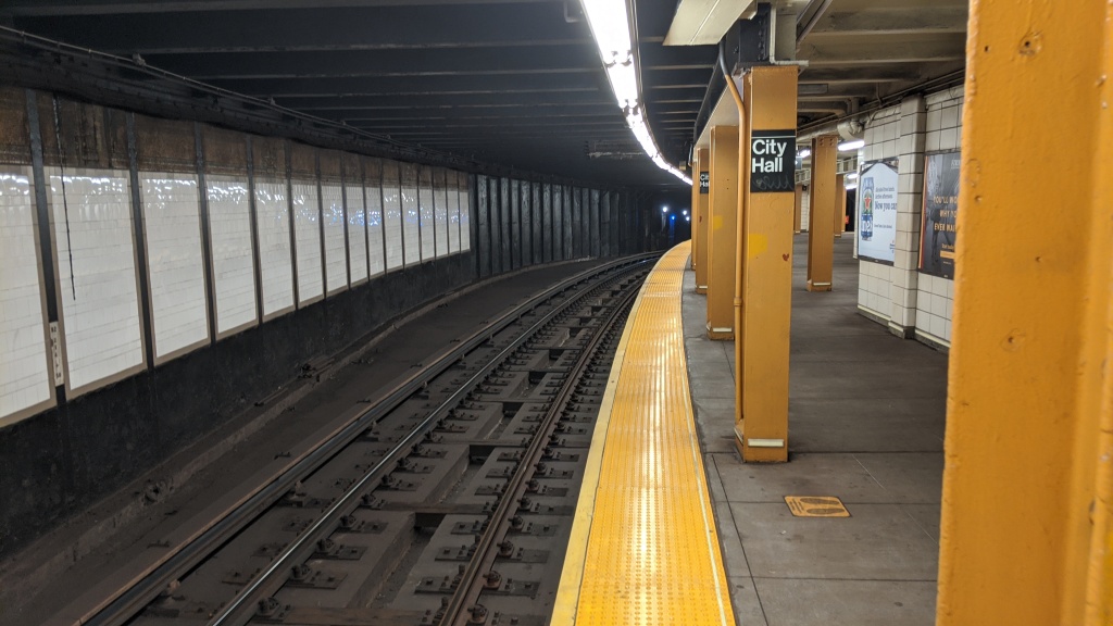
The southern end of the northbound platform shows 1) where the platform used to end, 2) where the track was meant to go, and 3) the slope trains climb to reach the upper level
City Hall station also encompasses the place where the first method of underground transport was showcased in New York City. The Beach Pneumatic Transit was Alfred Ely Beach’s attempt at a subway. In order to showcase his idea, in 1870 he built a 300 foot long tunnel underneath Broadway from Murray Street to Warren Street, a distance which is now entirely within the City Hall station. The subway would have run on air pressure, not tracks as we know today, and was planned to extend all the way to Central Park. Subways faced opposition from streetcar and El companies and in order for the subway to even be built, Beach had to lie about what he was constructing. He obtained permission to build pneumatic postal tubes, but instead built one large pneumatic tube and put a subway in it. The stock market crash of 1873 put a stop to any further expansion. Although no subway ever came of the project, the New York pneumatic tube mail system can credit its existence to Alfred Beach.

In 1912, when the BMT Broadway Line was being excavated, workers uncovered the pneumatic subway, as well as the tunneling shield used to build it, the remains of the single subway car, and the piano that was in the main station of the pneumatic subway. The tunneling shield was donated to Cornell University, which has since lost it. It is alleged that a plaque honoring the Beach Pneumatic Transit was commissioned to be put in the City Hall station, although according to nycsubway.org, this plaque has never been placed.
Canal St (N)(Q)(R)(W)
The BMT Broadway Line Canal St station is actually two stations that are connected by a passageway. The upper level, or Mainline station, is a (mostly) standard four track local station with two side platforms. These tracks connect to the City Hall station, with the local tracks connecting to the City Hall upper level, and the express tracks connecting to the lower level. The express tracks are unused however, and dead end about two thirds of the way north into the station, and have never had a train run on them. As mentioned in the City Hall post, plans for the BMT Broadway Line were changed during construction, making the lower level useless. That change of plans was the Manhattan Bridge.

Canal St tiling 
Unused express trackways at Canal St
The bridge opened in 1909 with two sets of tracks, one on the north side and one on the south side, but unconnected to anything. The City was entering the Dual Contracts negotiations, and was willing to connect the bridge to either the BRT or the IRT system. The tracks were first operated by streetcar companies from 1910 to 1915, at which point the BRT was awarded use of the bridge. At first, only the southern pair of tracks were in use, connecting Chambers St on the BMT Centre St Subway with DeKalb Ave station, and the BMT 4th Ave Line and the BMT Sea Beach Line. The northern pair of tracks was originally meant to connect to a Canal St crosstown line.

The BMT Broadway Line was under construction during the mid 1910’s, and it was at this point, after 1915, that plans for the line changed, calling for the north side tracks of the Manhattan Bridge to connect to the BMT Broadway Line express tracks, instead of the Canal St Crosstown. In 1917, the northern pair of tracks were connected to the Broadway Line, allowing Broadway Line trains to access Brooklyn three years earlier than the original plan would have allowed. However, because of this change, the express tracks on Broadway south of Canal St were never used, and the City Hall lower level wasn’t even finished.
Riders of the subway today know that no trains over the Manhattan Bridge connect to Chambers St anymore. This is because the Chrystie Street Connection opened in 1967, connecting the northern bridge tracks to the IND 6th Ave express tracks, and the southern pair of tracks was connected to Canal St and the Broadway Express. The connection between the bridge and Chambers St was severed, ending the Nassau Loop service. As trains pass between Canal St and the bridge, riders of the (N) and (Q) trains can feel the curve of track that was installed in 1967.

Switching off of the northern set of tracks (Connected to Manhattan Bridge North) 
Switching on to the southern set of tracks (Connected to Centre St Subway)

Vanshnookenraggen track map of the area 
A combination map created by layering this Joseph Brennan map over Google Maps, and drawing in the tracks. Image by Leo Shirky
For some reason, the tracks in the lower level Canal St station wiggle a little bit inside the station. To the west of Canal St, the provision for the crosstown line can still be seen as trains take the sharp curve north under Broadway.

Looking west along the Brooklyn-bound platform. The track wiggle in the middle of the station is visible. 
Looking west from the Brooklyn-bound platform into the tunnel. Provision for Canal St Crosstown line is visible to the left as two trains make the turn from Canal St onto Broadway.
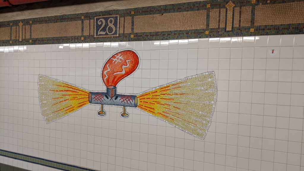
Prince St-28th St
These five stations are somewhat uninteresting, save for their mosaics. Each local station has a theme and the walls are decorated with dozens of colorful mosaics in that theme.
Prince St (R)(W)

I call this one: Why Everyone Should Care About the Americans with Disabilities Act
8th St-NYU (R)(W)


14th St (N)(Q)(R)(W)

23rd St (R)(W)

28th St (R)(W)
34th St-Herald Sq (N)(Q)(R)(W)
For some reason, one that I have never been able to find out, the southbound platform is slightly raised above the northbound one at the southern end of the station. 34th St-Herald Sq is an incredibly complex station, but the BMT platforms were one of the first to be built. There is an art installation on the platform, where you can make sounds by waving your hand in front of openings in a metal tube.

1935 cross section of Herald Square. “City Line” refers to the IND 6th Ave Line. Image via Arthur Weidnorf 
The slight heigh difference between downtown and uptown platforms. Image by Leo Shirky 
Christopher Jeanny’s “REACH New York” musical installation. Image by Leo Shirky 
A hole in the wall. I’m not sure where this leads or what it is for. Image by Leo Shirky
I would like to discuss a concept in transit planning that has become somewhat of a hot topic in New York City Transit discourse: deinterlining. Interlining is the process of running multiple services over the same physical tracks. This is very common in New York, and you will see the platform signage that denotes the destinations for the different services that call at each platform. Reverse branching is a higher level version of interlining in which services from different Manhattan trunk lines (different colors) use the same track in the outer boroughs. For example, on the 4th Ave express track in Brooklyn, the orange IND 6th Ave Line (D) and yellow BMT Broadway Line (N) trains share the same tracks. Deinterlining is the process by which reverse branching and interlining are phased out of subway operations, in order to improve the travel times, frequency, and overall efficiency of the subway, at the expense of one seat rides. A number of other blogs from people smarter than me have discussed this more at length.
Deinterlining is often touted as the cheap way to improve transit, because instead of relying on constructing new lines or buying new rolling stock or completely rewiring the signaling infrastructure, it makes use of the existing infrastructure and consists almost entirely of operational changes. I don’t want to discuss my personal beliefs on deinterlining, but I would like to use 34th St-Herald Sq on the BMT Broadway Line as an example of what deinterlining is trying to fix.
There are a pair of diamond crossover switches north of 34th St, and (N) trains use them to switch from the express tracks to the local tracks (and vice-versa going southbound). This is done for two reasons. Firstly, three of the four Broadway Line services terminate in Queens, and only the Broadway Line local tracks can reach the 60th St tunnel into Queens. However, there is a switch north of 57th St that allows express trains to reach this tunnel, which brings us to the second reason: 49th St. For a local station, 49th St has comparatively high ridership, being located at the northern end of Times Square, and so adding a third service to the station helps deal with the crowds, and there is no crossover between the express and local tracks closer to 49th St than 34th St.
The standard signaling that most lines have is called fixed block signaling. This works by having set distances of track controlled by a signal. When a train enters the block, the signal turns red, not allowing any other trains to enter the block, until the first train leaves, and a sufficient amount of time has passed, for safety. This type of signaling has an upper limit to how many trains per hour are allowed through a given section of track (the frequency). In New York City, this upper limit is around 30 trains per hour (tph), but since you never want to run a line at maximum capacity, to allow for flexibility in case of delays, most lines have a functional upper limit of closer to 20tph. This is a train every 3 minutes (the headway), which is an excellent headway when compared to most New York City subway services. the (1) and (6) both hit this level of service during rush hours, since neither service shares track (interlines) with any other, and so all 20 slots can go to the single service.
Interlining with fixed block signaling means each service can only get about half as many trains as the maximum allowable tph of the line, since the track has to be shared with another service. For example, the (2) and (3) trains each only get 10tph, since the two services share track for most of their respective routes. Passengers along the shared section effectively get 20tph, but passengers on lines served only by the (2) or (3) only get 10tph. The issue that arises with the BMT Broadway Line is that since three of the services go to Queens, that is three services that share one section of track, reducing each individual services’ maximum tph to only a third of the maximum allowable frequency.
During rush hour through the 60th St tunnel the (N) gets 8tph, the (R) gets 8tph, and the ![]() gets 7tph during rush hour. The (N) actually gets 10tph along the rest of the route, but two (N) trains terminate at 96th St on the 2nd Ave Line rather than Astoria, since the Astoria terminal can only handle 15tph (8 (N) trains and 7
gets 7tph during rush hour. The (N) actually gets 10tph along the rest of the route, but two (N) trains terminate at 96th St on the 2nd Ave Line rather than Astoria, since the Astoria terminal can only handle 15tph (8 (N) trains and 7 ![]() trains). Therefore, at rush hour, the 60th St tunnel is handling 23tph, slightly higher than recommended, although three tph more than usual isn’t a huge problem. The serious problems that arise from this interlining are felt outside of this portion of the line. The BMT Broadway local, served by the (R) and (W), only gets 15tph, when it can handle closer 20tph. The IND Queens Blvd local, served by the (M) and (R), only gets 16 tph (since the (M) is also restricted by another part of its route) which again can handle at least 20tph. The BMT 4th Ave local, served only by the (R), only gets 8tph, a loss of a full 12tph from what it could easily handle. Therefore, riders all throughout the rest of the system are impacted with less frequent service by the choice to interline three services on one two-track line. The other place this happens is the Williamsburg Bridge, which as mentioned above, restricts the (M) to 8tph.
trains). Therefore, at rush hour, the 60th St tunnel is handling 23tph, slightly higher than recommended, although three tph more than usual isn’t a huge problem. The serious problems that arise from this interlining are felt outside of this portion of the line. The BMT Broadway local, served by the (R) and (W), only gets 15tph, when it can handle closer 20tph. The IND Queens Blvd local, served by the (M) and (R), only gets 16 tph (since the (M) is also restricted by another part of its route) which again can handle at least 20tph. The BMT 4th Ave local, served only by the (R), only gets 8tph, a loss of a full 12tph from what it could easily handle. Therefore, riders all throughout the rest of the system are impacted with less frequent service by the choice to interline three services on one two-track line. The other place this happens is the Williamsburg Bridge, which as mentioned above, restricts the (M) to 8tph.
The other negative effect of the switch at 34th St can be seen most clearly in this YouTube video. Train speed is limited to just 13mph over the switch, meaning that (N) trains that make the crossover have to move much slower than normal, slowing down travel times along the route. Not only is the (N) slowed down, but this simple maneuver has the potential to delay all three of the other BMT Broadway Line services. When a northbound (N) (on the express track) and (R) or ![]() (on the local track) arrive at 34th St together, one will be delayed as the other gets priority. When a southbound (N) and (Q) arrive at 42nd St together (one stop north), one will be delayed as the other gets priority. This in-station delay will ripple down the line as other trains behind the delayed one get held a few seconds longer to preserve safe spacing along the line.
(on the local track) arrive at 34th St together, one will be delayed as the other gets priority. When a southbound (N) and (Q) arrive at 42nd St together (one stop north), one will be delayed as the other gets priority. This in-station delay will ripple down the line as other trains behind the delayed one get held a few seconds longer to preserve safe spacing along the line.
This affects one of the most important metrics in transit planning: dwell time. Dwell time is the amount of time a train spends in a station, and it can have a big impact on overall on-time performance. A few seconds delay at every station along a line can add up to minutes worth of lost time by the end. Subway trains should spend around 30 seconds stopped at each station, but as the video above shows, when the (N) train crossover causes other trains to be delayed, these trains can spend upwards of 90 seconds at the station. The MTA has to factor this delay into the schedules, which reduces the total number of trains per hour each service is able to run. Passengers at 34th St also have to guess which train will leave first, in order to save themselves those 90 seconds otherwise spent sitting at the station. This video from the New York Times terms this guessing game “The Subway Shuffle”.
42nd St-Times Sq (N)(Q)(R)(W)
42nd St was planned to be a local station originally, which seems crazy to us now, and the express station would be located at 47th St. Brooklyn residents insisted that the express station be at 42nd St, to give them fast access to the theater district of Manhattan. It was also at this station that the handover ceremony when the City bought the BMT in 1940 took place. At the north end of the station, a number of places exist where you can look into the tunnels north of the station. There is also a staircase that was cut into the wall of the southbound platform when the BMT and IRT stations were connected underground.

The staircase cut into the wall. 
Looking along the southbound local track, from the staircase.
49th St (N)(R)(W)
49th St has red brick walls and a unique floor material. In 1973, a sound-proofing experiment took place, adding the brick walls and terrazzo flooring on top of the original BMT construction. The southbound local tracks dips below the level of the other three tracks between 42nd St and 49th St. This is because Broadway crosses 7th Avenue at 45th Street, and the IRT Broadway-7th Ave Line turns from 7th Avenue to Broadway, and the BMT Broadway Line turns off of Broadway onto 7th Avenue. Each line is four tracks wide, making for a grand total of eight tracks passing underneath this one intersection. The southbound BMT local track dips below the level of the other seven tracks and passes underneath the northbound IRT local track.

The red brick wall and terrazzo flooring of 49th St. 
A southbound local train dips below the other three tracks south of 49th St
57th St (N)(Q)(R)(W)
57th St is the point from where much of the BMT system is chained. Chaining is a way of measuring precise distances along tracks, in 100ft long “chains”. This station is the zero point for the BMT Broadway, Brighton, Montague Tunnel, Manhattan Bridge South, 4th Ave, Sea Beach, West End, Astoria, and 63rd St lines. The tunnel continues north of the station with six trackways, although only four have ever had tracks. The express tracks continue north and ascend to the BMT 63rd St Line, which connects with the IND 2nd Ave Line (currently only served by the BMT (Q)). The connection to the 60th St tunnel into Queens are in the middle of the express and local tracks, and have a connection to both the express and local tracks, although are only served by local trains. These tracks descend north of the station. The outer most trackways have never had tracks laid in them, and continue straight from the local tracks of the station, ascending along with the express tracks.

When the station opened, only the 60th St tunnel tracks were built, and the express tracks and outer local trackways continued north and slightly west for 400 feet above the 60th St tunnel before ending. These four tracks were supposed to be provisions for the Washington Heights Line, planned in 1923 to connect to the BMT Broadway Line, and continue up Central Park West from 64th Street to 193rd Street. The plans also called for a two track extension south of 64th Street to 30th Street and 8th Avenue. In 1924 it was decided to give the Washington Heights Line to the new IND system rather than the BMT, leaving the four trackways north of 57th St without purpose.
5th Ave (N)(R)(W)
The 5th Ave station sits at an angle to the street grid, with the western end underneath 59th St and the eastern end underneath 60th St. The original plan for the eastbound track to be under 59th St and the westbound to be under 60th St, and for both to go over the Queensboro Bridge. It was decided that the bridge could not handle the weight of the all-steel subway cars, and instead both tracks were routed underneath 60th St. Trains did eventually run over the Queensboro bridge, but they were El trains, so shorter and lighter than subway cars.
Lexington Ave (N)(R)(W)
A walkway in this station between the IRT local platforms is supposedly the remnant of the 59th St tunnel that would have connected the BMT tracks to the Queensboro Bridge. This station is interesting as well, beacuase the BMT tracks cross the IRT line at a 90 degree angle below the IRT local tracks, but above the IRT express tracks.

The 60th St tunnel connection, or 11th St Cut, is the name of the piece of track that allows (R) trains to reach the IND Queens Blvd Line. This was opened in 1955, 35 years after the tunnel originally opened. The eastbound switch is located just before the track goes above ground on the Queens side. This, along with the underground bridge at 4th Ave over the Bay Ridge Branch in Brooklyn, is the closest the (R) train ever gets to daylight. This is a video of an eastbound (R) merging off of the 60th St tunnel into the 11th St cut.
(N)(W) BMT Astoria Line
Queensboro Plaza (N)(W)(7)
Queensboro Plaza is a shadow of its original self. It was double the size of the current station, and hosted both El and Subway service, as well as both BMT and IRT service, in one of the rare moments of cooperation between the two companies. The full station layout was basically a copy of what exists today to the north of the current station. It had eight tracks across two levels and a massive spaghetti junction to the east of the platforms. IRT trains used both sides of the current platform, and BMT trains used the north half of the station.


Tracks from the west fed into the station from the Steinway Tunnel (to 42nd St now the (7)), the Queensboro Bridge (the El tracks mentioned at Lexington Ave), and the 60th St tunnel (now the (N) and (W)). To the east, tracks went to a short terminating track on the south side of the IRT Flushing Line, the IRT Flushing Line itself, and the BMT Astoria Line.


The BMT Astoria Line and the IRT Flushing Line were constructed at the same time and operated by both the BMT and the IRT. Both lines were built with platforms that fit IRT cars, which were narrower than BMT cars. IRT trains ran through Queensboro Plaza into Manhattan, via either the Steinway Tunnel for subways, or the Queensboro Bridge to the 2nd Ave El for El trains. BMT Subway trains were too wide for the Astoria and Flsuhing lines, and had to terminate and turn around at Queensboro Plaza, using the short terminating track adjacent to the Flushing Line. BMT El cars, which fit the IRT platform size, were operated on both the Astoria and Flushing Lines and would turn around at Queensboro Plaza, requiring a cross-platform transfer to the subway trains into Manhattan.
On the upper level going south to north the tracks were used by: IRT Subway trains to Flushing from 42nd St, IRT El trains to Astoria from the 2nd Ave El, BMT Subway trains from the 60th St tunnel (terminating at Queensboro Plaza), and BMT El Trains to Astoria from Flushing, that reversed at Queensboro Plaza. The upper level is also host to one of just four connections between what are now the A (numbered) and B (lettered) divisions of the subway, in the form of a diamond crossover.
On the lower level going south to north the tracks were used by: IRT Subway trains to 42nd St from Flushing, IRT El Trains to the 2nd Ave El from Astoria, BMT Subway trains to the 60th St tunnel after reversing at Queensboro Plaza, and BMT El trains from Astoria to Flushing that reversed at Queensboro Plaza.
The IRT 2nd Ave El was demolished in 1942, leading to the upper level of the north side of the station to be abandoned. In 1949, Astoria service was granted entirely to BMT trains and Flushing service entirely to IRT trains (although the system was unified at this point). The Astoria line platforms were shaved back a few inches to allow for the wider subway trains. This was when the northern half of the station was entirely abandoned and demolished, and the 60th St tunnel tracks were connected to what used to be the IRT 2nd Ave El tracks.

At the western end of the station, the tracks that connected to the Queensboro Bridge are still visible (the green structures amidst the mass of rust red iron). The two trackways that led from the 60th St tunnel to the northern BMT half of the station are also visible. The bottom of these two was where BMT subway trains entered the station (on the upper level), and the top was a connection between the 60th St tunnel and the BMT El platform. This connection rarely had any trains on it since El trains were not allowed in tunnels. BMT El trains from Flushing to Astoria would use the upper level to turn around, and BMT El trains from Astoria to Flushing would use the lower level. Today the BMT tracks from the 60th St tunnel connect to what used to the be the IRT El platforms. The IRT 2nd Ave El trains served Astoria exclusively.

Looking east from a Manhattan-bound (N) train leaving Queensboro Plaza 
Looking west from the upper level of Queensboro Plaza as an Astoria-bound (N) train enters the station

At the eastern end of the station, a number of trackways are still visible. To the top left of the photo are the tracks that carried BMT El trains from Flushing into and out of Queensboro Plaza. The bottom of the photo shows the track that connected to both the upper and lower levels of the BMT subway platforms. This track, at the bottom of the Flushing line to the right of the image was a single track. BMT subway trains would enter the Queensboro Plaza upper level from the 60th St tunnel, then continue past the station onto this single track, at which point the crew would move to the other end of the train and drive it into the lower level of Queensboro Plaza, then onward into Manhattan.


Note in the image above the extra set of tracks coming from the southeast (foreground). These might be the tracks of the proposed elevated crosstown line which was never built.

Queensboro Plaza is also an incredibly photogenic station, with almost every corner on both levels playing host to a great view of subway infrastructure.

A Manhattan-bound (N) train crosses over the Queensboro Bridge pedestrian path. Note the unused trackway above the train, which once led to the BMT half of the station 
Two (N) trains pass each other east of the station. The one on the left is descending into the lower level 
A Manhattan-bound (N) train leaves the Queensboro Plaza lower level. Note the unused trackway on the right that once led to the BMT half of the station
As the BMT Astoria Line turns north onto Northern Boulevard, it rises quite high above the street level. This was done to allow the BMT El tracks to pass underneath what was then the IRT El tracks, which became the BMT subway tracks. While the BMT Astoria Line is elevated above Northern Boulevard, the IND Queens Blvd Line is underground. This is, I believe, the only point in the system where an elevated line and an underground line run along the same street.
39th Ave-Dutch Kills (N)(W)
The station formerly known as 39th Ave-Beebe Ave reopened in 2019 as part of the Enhanced Station Initiative with a new name: Dutch Kills. This is in reference to a tributary of the Newtown Creek and a hamlet that used to exist in the area. Dutch Kills has been a loosely used name for the neighborhood for decades, and the Dutch Kills Civic Association requested that the MTA change the name when it was doing renovations. 39th Ave is unusual by having “Dutch Kills” also in its name, since most stations that have neighborhood names are either terminals (think Astoria-Ditmars Blvd) or major interchange points (think Times Square-42nd St).

Astoria Blvd (N)(W)
Astoria Blvd is a three track, two platform station, set up like a typical three track express station. Currently the middle track on the BMT Astoria Line is not in service, although it has occasionally been used in the past for rush hour service, although this was unpopular with riders. On May 1, 1998, a backhoe doing non-transit related work under the station struck some of the supports for the station, causing one of the platforms to cave in. No one was injured or killed, and less than 8 hours after, the station was back in full service with a temporary floor, which was made permanent that night.
Astoria-Ditmars Blvd (N)(W)
The last stop of the BMT Astoria Line sits directly below Amtrak’s Hell Gate Viaduct. The viaduct and subway line opened in the same year (1917), and it provides for some quite spectacular views of the station, especially from Astoria Blvd, one stop south. The Astoria Line has no yard attached to it, which has restricted which services are able to use it. The (R), for example, can’t, because there is also no yard associated with the BMT 4th Ave Line, so instead the (R) uses the IND Queens Blvd Line and its Jamaica Yard. Another restriction is that the Ditmars Blvd station can only handle 15 trains per hour, while the line itself can handle 30.

(Q) IND 2nd Ave Line
Lexington Ave-63rd St (F)(Q)
In 1963, the plan for the 63rd St Line became public, but the line wasn’t open until 1989. It included connections to both the BMT Broadway Line, finally putting to use the express tracks that ended north of the 57th St station, as well as a connection to the IND 6th Ave Line. The BMT Line was almost never used, except by a shuttle to 57th St and later 34th St from 1998 and 1999. The BMT platform at Lexington Ave-63rd St was walled off and passengers could only access the IND 63rd St Line side of the platform. In 2017, the BMT side of the platform opened in conjunction with phase one of the IND 2nd Ave Line. (Q) trains were extended from 57th St along the BMT 63rd St Line which was connected to the IND 2nd Ave Line.

An out-of-service  train stored at the BMT side of Lexington Asve-63rd St, before renovation
The IND side of the 63rd St station before renovation
72nd St (Q)
As trains travel from 63rd St to 72nd St, the provisions for the southern extension of the IND 2nd Ave Line are visible from the train windows. Northbound (Q) trains pass underneath the trackways, and rise up on the far eastern side before joining what will become phase three of the IND 2nd Ave Line.

96th St (Q)
The IND 2nd Ave Line is the newest line in the system, and its three stations are all similar deep level caverns. They are not particularly interesting in and of themselves, but the history behind the 2nd Ave Line is fascinating. Even though it is only serve by the BMT (Q) service, the line itself is labeled as IND.
A subway under Second Avenue was first proposed in 1919, as part of a plan title Proposed Comprehensive Rapid Transit System. That proposed system called for a massive system across all five boroughs. In 1929, the 2nd Ave Line was approved by the Board of Transportation as part of the IND system. The Great Depression hit NYC transit hard, and with the first part of the IND system not yet open, plans were scaled down from what was a 6 track subway with multiple branches in the Bronx to a much more humble line. By 1939 the plan had been reduced to two tracks, two branches in the Bronx, a connection to the BMT Broadway Line, and a connection to the IND Fulton St Line in Brooklyn through the Court St station, which is now the Transit Museum. The US entry into World War II halted all subway construction as men and material were needed for the war effort.
After subway unification in 1940, the El lines were being torn down and replaced by subway lines. In fact, many of the IND lines today either directly replaced or incorporated El lines. Manhattans East Side had two El lines, one on Third Ave and another on Second Ave. The Second Ave El closed in two phases, in 1940 and 1942. This increased crowding on the Third Ave El, and hastened the need for a subway under Second Avenue. Planning for the Second Ave subway continued through the ’40s and ’50s, but the city was unable to raise enough money for the project. The Korean War increased construction costs, and the city used what money it had on platform lengthening and other improvements around the rest of the system. The Third Ave El’s Manhattan portion was demolished in 1955 without a suitable replacement, leaving the IRT Lexington Ave Line as the only line serving the Upper East Side.
The 1968 Program for Action included a Second Ave subway to link up with some of the services created by the Chrystie St Connection, mostly the IND 6th Ave Lines. Construction started in avarious places along the line in the early 1970s. The 1973 fiscal crisis decimated the citys economy, and the subway barely had enough money to keep its exsting lines in a state of good repair, let alone finance a new line. The 1989 63rd St Line was built with provisions for a Second Ave Line, but no construction under Second Ave took place. The 2000s saw the MTA begin to study the line more seriously, with a plan for a line from Hanover Sq in Lower Manhattan to 125th St in Harlem being approved in 2004. The plan called for a connection to the BMT Broadway Line, and a new service called the (T) to serve the entire line. It would be the only non-shuttle line to exist entirely in one borough.
Phase one opened on January 1, 2017, with three new stations and one rebuilt station (Lexington Ave-63rd St). The line is only served by (Q), with (T) service not due to start until phase three is completed, from 72nd St, south to Houston St. Phase two is an extension of the (Q) north to 125th St. The Second Ave Subway has been called the most expensive subway in the world, as its per-mile cost is higher than other similar projects in cities like London and Paris, and far higher than other underground rail projects around the world. Phase One cost $4.5 billion, or $2.5 billion a mile.
A New York Times article on the high cost of subway construction in New York blames the problem on labor costs, and the fact that unions often require many more people on site than are actually needed for the job. Requirements from the Buy America Act also drove up costs on materials that could have been cheaper had they been bought from foreign markets. The high cost, coupled with the decimation of the MTA’s revenue from the Covid-19 pandemic and the recession that is likely to follow, mean that phases three and four may not be completed for years and years.

Re: the taller southbound platform at Herald Square, is it possible that the H&M platform and associated space is why? I always remember the height being much more pronounced on the southern end of the platforms.
LikeLike
Helluva blog here! Lots of intriguing info – including that Manhattan Beach branch off of Neck Rd station. Nice shots too!
LikeLike
https://www.brownstoner.com/architecture/building-of-the-54/ explains that the Beverley & Cortelyou Rd. stations are so close together because one developer wanted a station for the commercial area of his development and a separate station for the residential part.
LikeLike
Re: Beverley vs Beverly
The IRT station spelling IS correct.
It was done on purpose in 1897 when Brooklyn was still a separate city.
The area west of Nostrand Av uses the English spelling with the extra ‘e’. The area from Nostrand Av eastward uses the Americanized spelling, which is why the IRT Co. used it when they built the station
Now officially the street has the extra ‘e’. There is no reason to have to have new station tablets made for the IRT station. People know where they live.
What’s Your Name, Bev?
Q. In Brooklyn, Beverl(e)y Road is spelled two ways, either Beverley or Beverly. The subway station on the Brighton (Q) Line, near East 16th Street, is labeled the Beverley Road Station. The station on the Nostrand Avenue (2 and 5) line is named the Beverly Road Station. What gives?
A. Herbert Schonhaut, an authority on station signs for New York City Transit, said the two spellings date to the development of the Prospect Park South area. The street was originally called Avenue B.
At the request of the developers, in 1897 the City of Brooklyn renamed a stretch, from Coney Island Avenue to Flatbush Avenue, Beverley Road, using the English spelling.
Later, after Brooklyn was annexed into the City of New York, three of the remaining four of the street’s sections Church to Coney Island Avenue; Flatbush to Brooklyn Avenue; and Schenectady to Ralph Avenue were renamed Beverly Road, using the Americanized spelling.
The fourth section, from Ralph Avenue to East 98th Street in Remsen Village, was never renamed and is still Avenue B. (This could be because it complements Avenue A, a block north.)
The Brighton Line station fell in the area with the third “e,” and the Nostrand Avenue station is in the area that was renamed without the “e.”
The correct name for the entire stretch from Church to Ralph Avenue is now Beverley Road, according to the Brooklyn borough president’s office.
LikeLike
Re: Canal Street lower level station
This station was originally called Broadway while the upper level is called Canal St. This is because the lower level platform while on Canal St is actually under Broadway. The upper level platform os on Broadway but crosses Canal St.
Subway maps thru 1966 showed 2 stations – Canal St. and Broadway. In 1967 with the maps showing the new Chystie St connections the entire complex was called Canal St and any reference to the Broadway name was dropped.
When the lower level platform was renovated in the 1980s (or was it 1990s) you could see the ‘B’ station mosaic plaque revealed when the tiles were removed.
LikeLike
Fascinating! NYC’s Subway!
LikeLike
I use the B/Q almost on a daily basis and this is some amazing info. Great documentation!
LikeLike